

Mynydd Ferddin
Good walks are even better shared.
Overview
Mynydd Ferddin: A Hidden Gem in the Brecon Beacons
Nestled within the awe-inspiring Brecon Beacons National Park, Mynydd Ferddin stands tall at an elevation of 406 meters. Though less well-known than some of its higher neighbours, this mountain is a delight for hikers seeking beautiful vistas without the throngs often found on the more popular peaks.
Geology
The mountain showcases a variety of sedimentary rock formations, primarily sandstone and shale from the Devonian period. This geological history contributes to the striking angles and textures seen throughout the terrain.
Routes
One of the best routes begins from the village of Bwlch. The Mynydd Ferddin from the East route stretches approximately 8 km and can be tackled in about 3.5 hours. This moderate trek is both invigorating and rewarding, leading you through stunning landscapes and rich flora.
Summit Features
At the summit, you'll find a trig point that has witnessed countless sunrises and sunsets. The surrounding grassy knoll is an ideal resting spot, giving you the chance to gather your thoughts (or your breath) while soaking in the magnificent views.
Terrain
The terrain is predominantly grassy interspersed with rocky outcrops and patches of vibrant heather. It's like hiking through a picturesque painting – just watch your step on those rocky bits!
Views
The summit vista is nothing short of spectacular. From this vantage point, enjoy sweeping views that stretch over the Brecon Beacons and the Black Mountains. If visibility is good, you might even catch a glimpse of Cardiff’s skyline in the distance. For the best views, consider visiting during spring or autumn when nature flaunts her colours.
Hazards
While Mynydd Ferddin is a lovely walk, be prepared for the fickle Welsh weather. Sudden mists are not uncommon, so bring a map and compass – GPS doesn’t always have the best signal in these hills. Also, tread carefully on the rocky patches when wet; your feet may take on a life of their own!
Nearby Summits
For those looking to conquer more peaks, Mynydd Llangattock (595 m) and Graig Fan Ddu (739 m) are excellent options nearby.
Access
The journey to Mynydd Ferddin is quite straightforward. The nearest parking can be found at the Bwlch car park, with public transport options available from Merthyr Tydfil. Plus, the village of Bwlch has a quaint café to fuel up before your hike.
Facilities
Keep in mind that facilities are limited on the mountain itself. It’s best to bring your own provisions, though the café in Bwlch offers a welcome break. Don’t forget to indulge in a cake or two – they’re designed for hikers, right?
History
The name 'Mynydd Ferddin' translates intriguingly as 'Mountain of the Ferddin', with roots that suggest a historical journey. This peak has served as a significant waypoint in the landscape for generations.
Mynydd Ferddin may not be the highest peak, but it surely is a treasure in the Brecon Beacons, promising a delightful adventure for all who tread its slopes. Remember to pack your sense of wonder and an extra sandwich – you’ll need it!
Happy Hiking!
Explore routes near Mynydd Ferddin
Public walks starting within 80 km of this hill. Nearby does not mean a route reaches the summit; check its map and access before setting out.
Capturing the Landscape: Art & Walking at Llanthony Priory
View route
Clytha Estate: River Usk, Chapel Ruins and Castle Woods
View route
Hereford Walk with Men Walking & Talking
View route
A Very Merry Winter Walk ending with Cake & a Hot Drink!
View route
Route planning notes
These notes describe possible approaches, not verified navigable routes or permission to cross land. Check current paths, local access rules and conditions before setting out.
Mynydd Ferddin from the East
A scenic route starting from the village of Bwlch, offering impressive views along the way.
Make a day of it, together
Find someone to share the walk with, or organise a day out along a route you like.
Photo Gallery
View all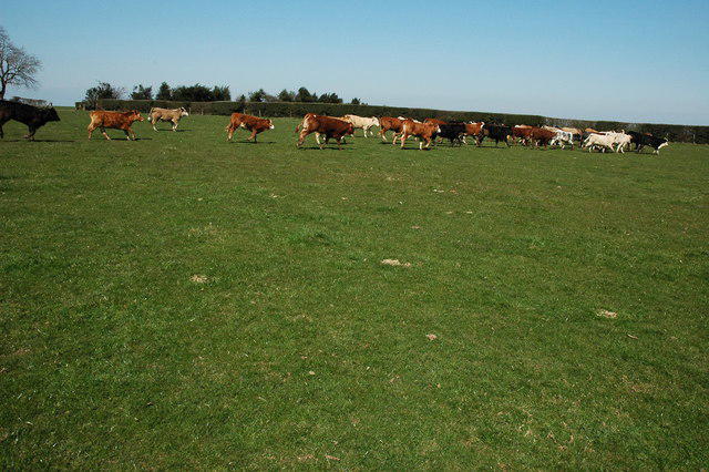 Photo could not load
SO3428 : Cattle on Mynydd Merddin
Philip Halling
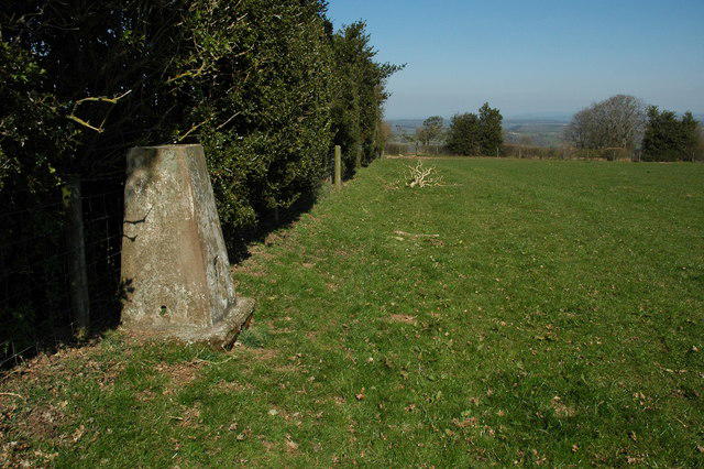 Photo could not load
SO3428 : Trig Point, Mynydd Merddin
Philip Halling
Hill facts and local notes
Classifications
Elevation
323m
1,060 ft
Prominence
123m
Coordinates
51.9511, -2.9555
SO344284
OS Map
149 161
Explorer: OL13N
At the Summit
The summit features a prominent trig point, surrounded by a grassy knoll, perfect for resting and taking in the views. It's a great spot for a group selfie before descending.
Terrain & Geology
Mynydd Ferddin is predominantly composed of sedimentary rocks, specifically sandstone and shale, which were formed during the Devonian period. The terrain gives a unique visual texture to the hills, characterized by steep slopes and rocky outcrops.
Views & Scenery
From the summit, hikers can enjoy sweeping vistas of the Brecon Beacons, the Black Mountains, and even glimpses of the distant Cardiff skyline on clear days.
History & Heritage
Name Origin
The name 'Mynydd Ferddin' translates to 'Mountain of the Ferddin', with 'ferddin' possibly relating to an old-term meaning 'journey'.
Historical Significance
Mynydd Ferddin has served as a historical landmark for both locals and travelers, providing a place of significance within the landscape of the Brecon Beacons.
Getting There & Facilities
Check current local access restrictions, parking rules and transport timetables before travelling. These notes do not confirm public access to the summit.
Parking
Parking is available at the Bwlch car park, with ample space for several vehicles. This location is marked on most walking maps.
Public Transport
Regular bus services run from Merthyr Tydfil to Bwlch, with the bus stop located conveniently near the car park.
Nearby Facilities
The village of Bwlch has a small café that provides refreshments. Bring your own snacks and water, as facilities are limited on the mountain.
Safety Information
Known Hazards
- Beware of sudden changes in weather. Mynydd Ferddin can be shrouded in mist, so keep an eye on your map and compass. Slippery paths after rain, especially on rocky sections.
General Safety Tips
- Check weather conditions before setting out
- Carry appropriate clothing and equipment
- Let someone know your planned route
- Take a map, compass, and GPS device
- Carry emergency supplies: food, water, first aid kit, torch
Hills
Some common questions about the hills answered
Are there group walks up Mynydd Ferddin?
Many walkers use Walkmates to join or organise walks with others. You can check for group walks around Mynydd Ferddin through the maps
Are there other walkers around Mynydd Ferddin?
Activity varies by location and time, but Walkmates lets you see whether others have shared walks or shown interest in this area. Find other people through the walking friends search walking friends for Mynydd Ferddin search or of course create your own walk for Mynydd Ferddin
Can I organise a walk to Mynydd Ferddin?
Yes. If there aren’t any walks listed already, you can create a walk and make it available for others to join.
If you're signed up to Walkmates, you can create a walk to Mynydd Ferddin.
How do I find a walk up this hill?
There are often multiple ways to walk this hill, depending on experience and route preference. Walkmates helps you explore walks and routes that others have shared.
Can I suggest a new route up Mynydd Ferddin?
Yes. You can suggest or create routes to share with others. Walkmates focuses on the social side of walking, so routes are used to help people organise walks and explore areas together, rather than as detailed navigation tools or route libraries.
Other uses really appreciate knowledgeable walkers sharing their routes. Share your favourite route to Mynydd Ferddin here
The is an error or something incorrect about this hill. How do I let you know?
We always strive to keep the information on Walkmates as accurate as possible. If you find an error, please let us know through the contact form and we'll aim to correct it as quickly as possible
Community Discussion
Comments
Location
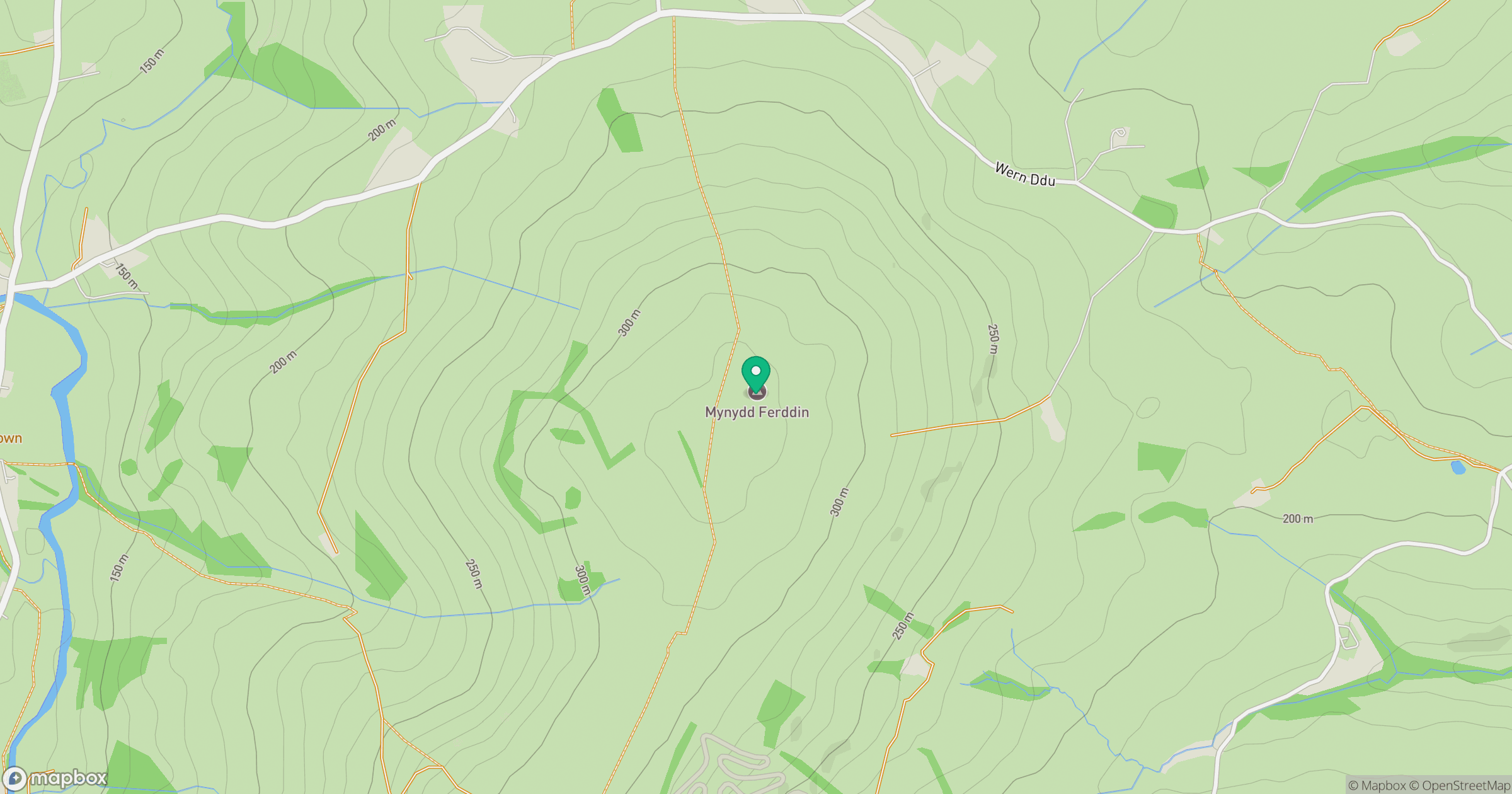
Grid reference: SO344284
View on OpenStreetMapOpens a map in a new tab, centred on the hill.
Hills within 30 km
Straight-line distance, not a walking route or confirmation of access.
No comments yet. Be the first.