

Hergest Ridge
Good walks are even better shared.
SO2556 : Lonely fingerpost, Hergest Ridge
Chris Heaton Photo source
Overview
Hergest Ridge is a broad, grassy border hill west of Kington. Its 426.9 m natural summit lies in Herefordshire, England, at boulders west of the trig; Offa’s Dyke Path crosses the wider ridge toward Gladestry in Wales.
Hergest Ridge
Hergest Ridge is a broad border hill west of Kington, with open grassland, grazing sheep and ponies, and long views across Herefordshire and the Welsh hills. The ridge crosses into Wales, but its 426.9 m natural summit lies in Herefordshire, England.
Summit and landmarks
The highest ground is the group of boulders at SO 25438 56264, about 230 m west of the trig point at SO 25663 56282. The trig, the Whetstone, the old racecourse and the monkey-puzzle trees are separate landmarks. Reaching the trig or circling the racecourse does not by itself reach the surveyed summit.
Routes
Kington to the surveyed summit and back
Walk from Kington via Church Street, St Mary’s and Ridgebourne Road to the common gate. Follow Offa’s Dyke Path west past the racecourse and monkey-puzzle area, then leave the main path for the summit area. Identify the high boulders west of the trig. Return along the same eastern ridge and Ridgebourne Road to the original town start. This approach stays outside Park Wood.
Kington ridge and southern-contour circuit
From the Mill Street/Crabtree Road car park, take the eastern approach to the ridge and include the surveyed summit boulders. Continue west along the ridge toward the small final top at SO240553, then double back on the southern contour path. Follow it until it rejoins the outward route, then descend Ridgebourne Road and return through Kington to the car park. This is the longer circuit described by Walking Britain; do not confuse it with a Park Wood loop.
Gladestry and Rabber Dingle circuit
From Gladestry use the lane signed toward Huntington, then the uphill no-through lane at SO234551 to reach Offa’s Dyke Path. Follow the ridge east and make the summit-area detour to the high boulders west of the trig. Continue to the fence at SO273568, turn sharply right, and use the southern flank path above Bage Farm and through Rabber Dingle. It rejoins the outward trail; descend by the same lanes to Gladestry. The published route’s optional trig visit is distinct from the natural summit.
Terrain and navigation
The ridge has broad grassy tracks, bracken and gorse, with uneven ground and locally wet patches. The southern circuits add slopes, field paths and short lane sections. Wind and mist can make the open ridge less comfortable and its many branching paths harder to distinguish; use a map to locate the boulders and the correct return. Wet grass and muddy paths can be slippery. Keep clear of grazing animals and keep dogs controlled.
Access and current restrictions
Use public rights of way and mapped access land; garden paths and permissive links have separate conditions. Hergest Croft Gardens lists Park Wood closed from 12 October 2026 to 1 March 2027 for conservation and tree work. The notice does not explain whether the public right of way used by the National Trails circular is affected. Use an eastern ridge route instead of relying on that woodland leg while its status is unclear. This restriction does not establish a closure of Hergest Ridge itself.
Kington footpath ZE29, between SO29155696 and SO29345689, is separately listed closed until 30 April 2027 because of unstable ground. Do not use it as a shortcut through the town’s western outskirts. On access land, dogs must be on a lead no longer than two metres around livestock and between 1 March and 31 July.
Parking, transport and facilities
Mill Street car park in Kington is long stay, with charges Monday–Saturday during the daytime and free Sunday parking. High Street car park is currently free Monday–Sunday. Hergest Croft’s car park is advertised for garden visitors; use the town car parks for a hill-walking start. Mill Street public toilets are listed open from 7 am to 5:30 pm, and Kington has shops and cafés. Maples Tearoom at the gardens is seasonal. There are no facilities identified on the summit.
Sargeants service 461 connects Kington with Hereford and Llandrindod Wells. Use the operator’s timetable for the intended travel day, including the return journey and school-day differences. Kington has no railway station.
Geology and history
The council’s archaeological survey describes Wenlock and Ludlow strata: mudstone, siltstone and grey-brown sandstone. The broad grassy skyline carries traces of past land use, including the nineteenth-century racecourse, field systems and possible prehistoric cairns. Twentieth-century military remains and cultivation are also recorded. The monkey-puzzle trees were planted in the 1990s. The ridge also gave its name to Mike Oldfield’s 1974 album.
Views and nearby hills
In clear weather the outlook takes in Herefordshire, the Welsh hills, the Black Mountains and distant Malverns. Nearby distinct hills include Hanter Hill (414.2 m), Bradnor Hill (391.5 m) and Herrock Hill (371 m). An extra summit needs its own mapped route; none is an automatic continuation of the walks above.
Explore routes near Hergest Ridge
Walks starting near this hill. Open a route to check its map, distance and full itinerary.
Croft Castle: Fishpool Valley and the Gothic pumphouse
View route
Berrington Hall: woodland, lake and Windmill Hill
View route
Hereford Walk with Men Walking & Talking
View route
Mortimer Forest Lower Evens Circuit
View route
Route planning notes
These notes describe possible approaches. Check a route's map and access information when planning your walk.
Kington to the surveyed summit and back
Start in Kington and walk via Church Street, St Mary’s and Ridgebourne Road to the common gate. Follow Offa’s Dyke Path west past the racecourse and monkey-puzzle area, then leave the main ridge path for the summit area. The natural high point is the boulders at SO 25438 56264, about 230 m west of the trig at SO 25663 56282. Return by the same eastern ridge, Ridgebourne Road and town approach to your original start. This route avoids Park Wood. Use the named roads rather than the closed ZE29 footpath.
Kington ridge and southern-contour circuit
From Mill Street/Crabtree Road car park, go via Church Street, St Mary’s and Ridgebourne Road onto Offa’s Dyke Path. Follow the ridge and visit the surveyed boulders 230 m west of the trig. Continue west toward the small final top at SO240553, then double back along the southern contour bridlepath. Continue as it becomes a footpath, rejoin the outward route and descend Ridgebourne Road to the original Kington start. This longer ridge circuit follows Walking Britain’s route outline and avoids Park Wood.
Gladestry and Rabber Dingle circuit
Start in Gladestry, follow the lane signed toward Huntington and turn up the no-through lane at SO234551 to the common gate. Follow Offa’s Dyke Path east and make the summit-area detour to the high boulders 230 m west of the trig. Continue to the fence at SO273568, turn sharply right and follow the southern flank above Bage Farm. Continue past SO254553 and through Rabber Dingle to rejoin the outward trail. Descend by the original lanes to Gladestry. Arrange a lawful start in the village without blocking the school, gates or traffic.
Make a day of it, together
Find someone to share the walk with, or organise a day out along a route you like.
Photo Gallery
View all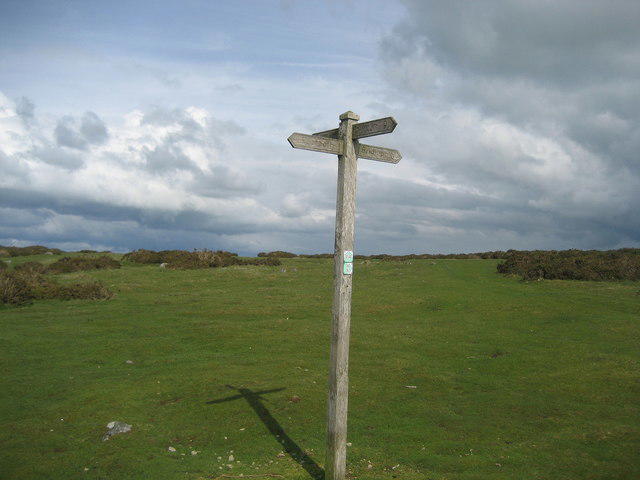 Photo could not load
SO2556 : Lonely fingerpost, Hergest Ridge
Chris Heaton
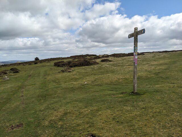 Photo could not load
SO2556 : Fingerposts on Hergest Ridge
Fabian Musto
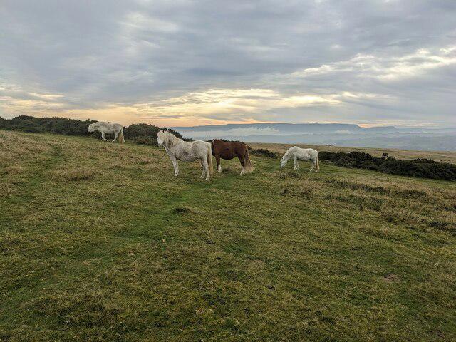 Photo could not load
SO2556 : Ponies on Hergest Ridge
Fabian Musto
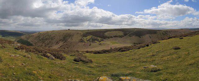 Photo could not load
SO2556 : Hergest Ridge
Fabian Musto
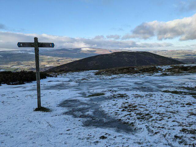 Photo could not load
SO2556 : Offa's Dyke Path on Hergest Ridge
Fabian Musto
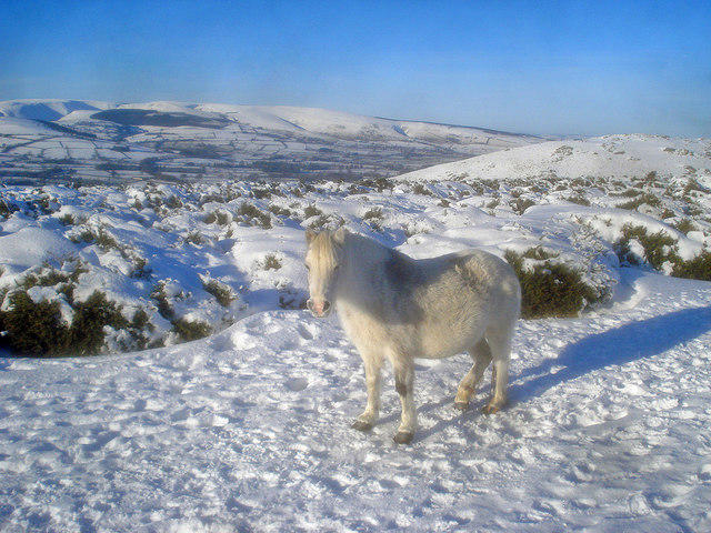 Photo could not load
SO2556 : Pony on Hergest Ridge
Trevor Rickard
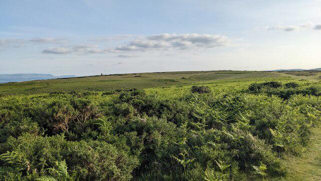 Photo could not load
SO2556 : Hergest Ridge
Fabian Musto
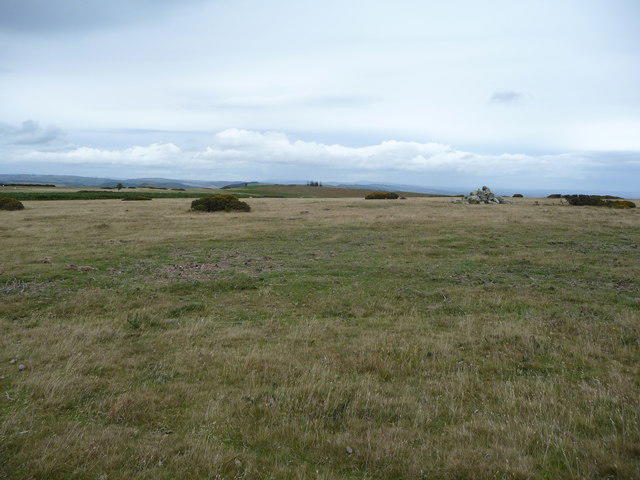 Photo could not load
SO2556 : On Hergest Ridge
Jeremy Bolwell
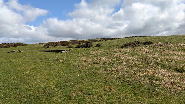 Photo could not load
SO2556 : Hergest Ridge
Fabian Musto
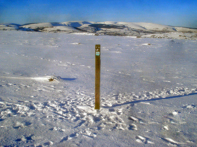
SO2556 : Way marker post on the Hergest Ridge
Trevor Rickard
Hill facts and local notes
Classifications
Elevation
427m
1,401 ft
Prominence
158m
Coordinates
52.1995, -3.0924
SO254562
OS Map
148
Explorer: 201S
At the Summit
The natural summit is the boulders at SO 25438 56264, 230 m west of the trig point at SO 25663 56282. The Whetstone, racecourse and monkey-puzzle clump are separate features. A trig-point visit alone does not reach the surveyed high point.
Terrain & Geology
The Herefordshire Archaeology survey describes Wenlock and Ludlow strata comprising mudstone, siltstone and grey-brown sandstone. This sedimentary ridge should not be described as predominantly Old Red Sandstone or confused with the different geology of nearby Hanter Hill.
Views & Scenery
In clear weather, views extend across Herefordshire and the Welsh hills, including the Black Mountains and distant Malvern Hills.
History & Heritage
Historical Significance
The surviving oval racecourse is a nineteenth-century landscape feature. Herefordshire Archaeology also records field-system remains, possible prehistoric cairns, quarries and twentieth-century military activity and cultivation. The monkey-puzzle trees were planted in the 1990s; Hergest Ridge is also the title of Mike Oldfield’s 1974 album.
Getting There & Facilities
Parking
For a Kington start, use council long-stay parking at Mill Street (HR5 3DP) or High Street (HR5 3AX). Mill Street is pay-and-display Monday–Saturday 8 am–6 pm, excluding bank holidays: over three hours up to 24 hours is £3; Sundays are free. High Street is currently free Monday–Sunday. Hergest Croft Gardens advertises its car park for garden visitors, so use town parking for a hill-only visit.
Public Transport
Sargeants service 461 connects Kington’s Mill Street stop with Hereford and Llandrindod Wells. Consult the operator’s timetable for the intended travel day and return journey, as school-day and weekend services differ. Kington has no railway station; rail connections require a bus leg.
Nearby Facilities
Kington has shops and cafés. The council lists Mill Street public toilets open 7 am–5:30 pm, with additional toilets at Kington Library during library hours. Maples Tearoom at Hergest Croft Gardens is seasonal, from late March to November. These are town and garden facilities; none is identified at the summit.
Safety Information
Known Hazards
- Exposed high ground and branching grassy paths can make route-finding difficult in wind or mist, especially when locating the true summit away from the trig.
- Wet grass, muddy paths and uneven ground can be slippery; southern circuits include slopes and field/lane sections.
- Sheep and ponies graze the common. Keep clear of animals and keep dogs controlled; on access land use a short lead around livestock.
Seasonal Hazards
Hergest Croft Gardens lists Park Wood closed from 12 October 2026 to 1 March 2027 for conservation and tree work. Its notice does not say whether the public right of way used by the National Trails circular is included; choose an eastern ridge route while that woodland leg is unclear. The notice does not close the whole ridge. Kington footpath ZE29, SO29155696–SO29345689, is separately listed closed until 30 April 2027 for unstable ground. On access land, dogs must be on a lead no longer than two metres from 1 March to 31 July and whenever livestock are nearby.
General Safety Tips
- Check weather conditions before setting out
- Carry appropriate clothing and equipment
- Let someone know your planned route
- Take a map, compass, and GPS device
- Carry emergency supplies: food, water, first aid kit, torch
Hills
Some common questions about the hills answered
Are there group walks up Hergest Ridge?
Many walkers use Walkmates to join or organise walks with others. You can check for group walks around Hergest Ridge through the maps
Are there other walkers around Hergest Ridge?
Activity varies by location and time, but Walkmates lets you see whether others have shared walks or shown interest in this area. Find other people through the walking friends search walking friends for Hergest Ridge search or of course create your own walk for Hergest Ridge
Can I organise a walk to Hergest Ridge?
Yes. If there aren’t any walks listed already, you can create a walk and make it available for others to join.
If you're signed up to Walkmates, you can create a walk to Hergest Ridge.
How do I find a walk up this hill?
There are often multiple ways to walk this hill, depending on experience and route preference. Walkmates helps you explore walks and routes that others have shared.
Can I suggest a new route up Hergest Ridge?
Yes. You can suggest or create routes to share with others. Walkmates focuses on the social side of walking, so routes are used to help people organise walks and explore areas together, rather than as detailed navigation tools or route libraries.
Other uses really appreciate knowledgeable walkers sharing their routes. Share your favourite route to Hergest Ridge here
The is an error or something incorrect about this hill. How do I let you know?
We always strive to keep the information on Walkmates as accurate as possible. If you find an error, please let us know through the contact form and we'll aim to correct it as quickly as possible
Community Discussion
Comments
Location
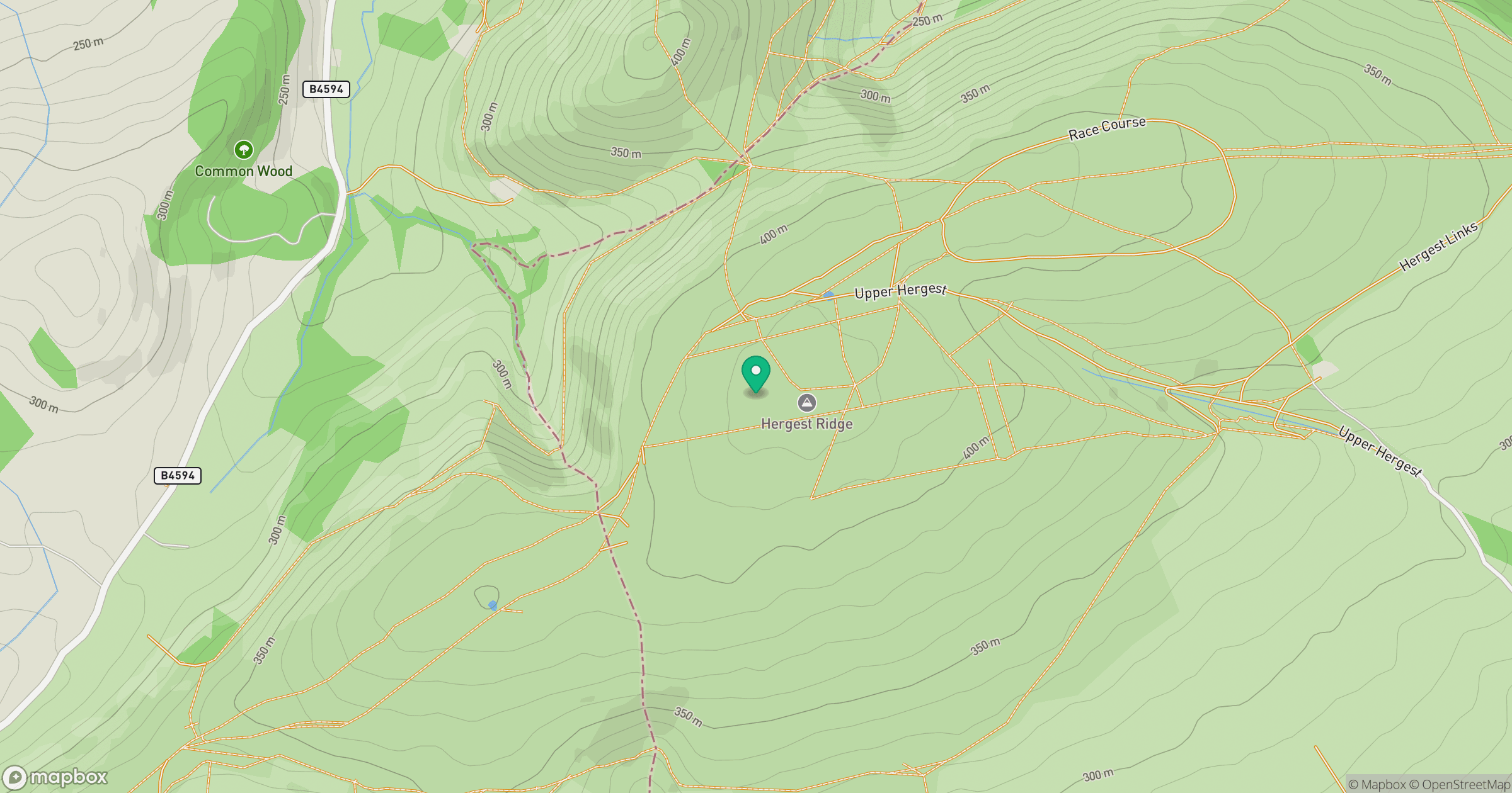
Grid reference: SO254562
View on OpenStreetMapOpens a map in a new tab, centred on the hill.

No comments yet. Be the first.