

Stanner Hill
Good walks are even better shared.
Overview
Stanner Hill: A Hidden Gem in the Wye Valley
If you find yourself wandering in the Wye Valley, Stanner Hill is a splendid choice for a day hike. Rising to 421 meters, it may not be the tallest, but its charm lies in its rolling grassy slopes and panoramic views that make the effort worthwhile.
Geology
Stanner Hill is a testament to millions of years of geological history, primarily formed from Old Red Sandstone. This rock type offers a spectacular display of sedimentary washouts, which you can observe as you ascend. The ancient landscape it tells offers hikers a decent excuse to pause and ponder the earth's timeline, even if it doesn't have a coffee shop.
Routes
For those eager to explore, the Stanner Hill Circular Walk provides a delightful route through the surrounding countryside. It spans 6.5 kilometers and takes about 2.5 hours. Although moderately challenging, it's suitable for those with a fair fitness level. The way up winds through woodlands that could charm even the grumpiest of walkers.
Terrain
Expect a mix of grassy paths with occasional rocky outcrops. The terrain is relatively easy on the feet but watch out in wet areas, as they can become quite boggy. Remember, it's all part of the adventure!
Views
Once you reach the summit, prepare to be wowed by the sweeping views of the Wye Valley. The stunning landscapes include the River Wye and the distant Welsh hills. If it’s a clear day, you might even spot the peaks of the Brecon Beacons, reminding you of just how small you are in this vast world. Best enjoyed in spring or autumn for splendid colours and temperate weather!
Hazards
Keep an eye out for local livestock - sheep can be rather brazen when they want to be! Also, a slip in a muddy patch can turn your proud climb into a comical misadventure.
Access
Getting to Stanner is straightforward; the nearest parking is in the charming village of Stanner, though don’t expect too many spaces! Buses from towns like Hay-on-Wye make public transport a breeze, and the proximity to this literary haven ensures you have a charming pit stop before or after your hike.
Facilities
Speaking of Hay-on-Wye, it’s littered with cafes and shops that could easily distract you post-hike. Pop in for a hot drink and a slice of cake - you’ve earned it! Restrooms can also be found in town, making it a practical stop.
History
As for the name 'Stanner', it hints at the hill’s stony character and historical significance. This area has seen human presence for eons, with remnants dating back to prehistory. You can literally walk where ancient peoples tread, contemplating their existence while enjoying the fresh air.
So, lace up those hiking boots and head out to Stanner Hill, where the views are simply stunning and the sheep won’t judge you for taking too many photos!
Last Updated
2023-10-01
Source
Ordnance Survey
Explore routes near Stanner Hill
Public walks starting within 80 km of this hill. Nearby does not mean a route reaches the summit; check its map and access before setting out.
Croft Castle: Fishpool Valley and the Gothic pumphouse
View route
Berrington Hall: woodland, lake and Windmill Hill
View route
Mortimer Forest Lower Evens Circuit
View route
Ludlow Town Walls and Castle Walk
View route
Route planning notes
These notes describe possible approaches, not verified navigable routes or permission to cross land. Check current paths, local access rules and conditions before setting out.
Stanner Hill Circular Walk
A delightful circular route that starts from the village of Stanner and takes you through scenic woodlands and pasture before ascending the hill.
Make a day of it, together
Find someone to share the walk with, or organise a day out along a route you like.
Photo Gallery
View all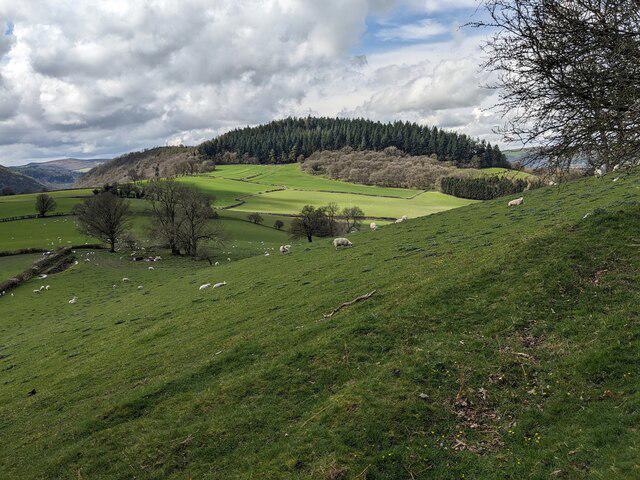 Photo could not load
SO2659 : Stanner Rocks and Navages Wood
Fabian Musto
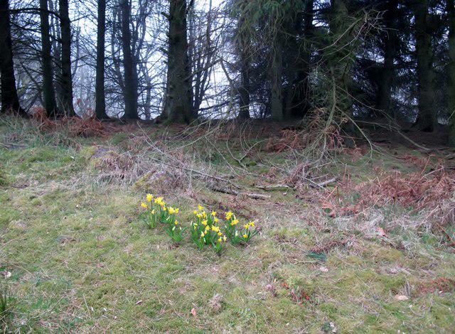 Photo could not load
SO2659 : Stanner Hill
Rude Health
Hill facts and local notes
Classifications
Elevation
349m
1,145 ft
Prominence
114m
Coordinates
52.2247, -3.0752
SO266590
OS Map
148
Explorer: 201S
At the Summit
The summit of Stanner Hill features a small stone cairn and a prominent trig point, offering a perfect spot for your post-hike selfie.
Terrain & Geology
Stanner Hill is primarily composed of Old Red Sandstone, which dates back to the Devonian period. The hill's geology offers a glimpse into ancient landscapes, with striking sedimentary formations visible along its slopes.
Views & Scenery
From the summit, you can see the picturesque Wye Valley, the River Wye below, and, on a clear day, the Welsh hills in the distance, competing for your attention.
History & Heritage
Name Origin
The name 'Stanner' is thought to derive from Old English, meaning 'stony place'.
Historical Significance
The hill has historical significance, with evidence of human activity dating back to prehistoric times, including ancient burial mounds.
Getting There & Facilities
Check current local access restrictions, parking rules and transport timetables before travelling. These notes do not confirm public access to the summit.
Parking
There is a small parking area in the village of Stanner, which can accommodate a handful of vehicles.
Public Transport
Buses run from nearby towns like Hay-on-Wye. Check local timetables for the best options.
Nearby Facilities
In Hay-on-Wye, you'll find plenty of cafes and public toilets, making it an ideal stop before or after your hike.
Safety Information
Known Hazards
- Watch out for sheep on the paths and the occasional muddy stretch after rain!
General Safety Tips
- Check weather conditions before setting out
- Carry appropriate clothing and equipment
- Let someone know your planned route
- Take a map, compass, and GPS device
- Carry emergency supplies: food, water, first aid kit, torch
Hills
Some common questions about the hills answered
Are there group walks up Stanner Hill?
Many walkers use Walkmates to join or organise walks with others. You can check for group walks around Stanner Hill through the maps
Are there other walkers around Stanner Hill?
Activity varies by location and time, but Walkmates lets you see whether others have shared walks or shown interest in this area. Find other people through the walking friends search walking friends for Stanner Hill search or of course create your own walk for Stanner Hill
Can I organise a walk to Stanner Hill?
Yes. If there aren’t any walks listed already, you can create a walk and make it available for others to join.
If you're signed up to Walkmates, you can create a walk to Stanner Hill.
How do I find a walk up this hill?
There are often multiple ways to walk this hill, depending on experience and route preference. Walkmates helps you explore walks and routes that others have shared.
Can I suggest a new route up Stanner Hill?
Yes. You can suggest or create routes to share with others. Walkmates focuses on the social side of walking, so routes are used to help people organise walks and explore areas together, rather than as detailed navigation tools or route libraries.
Other uses really appreciate knowledgeable walkers sharing their routes. Share your favourite route to Stanner Hill here
The is an error or something incorrect about this hill. How do I let you know?
We always strive to keep the information on Walkmates as accurate as possible. If you find an error, please let us know through the contact form and we'll aim to correct it as quickly as possible
Community Discussion
Comments
Location
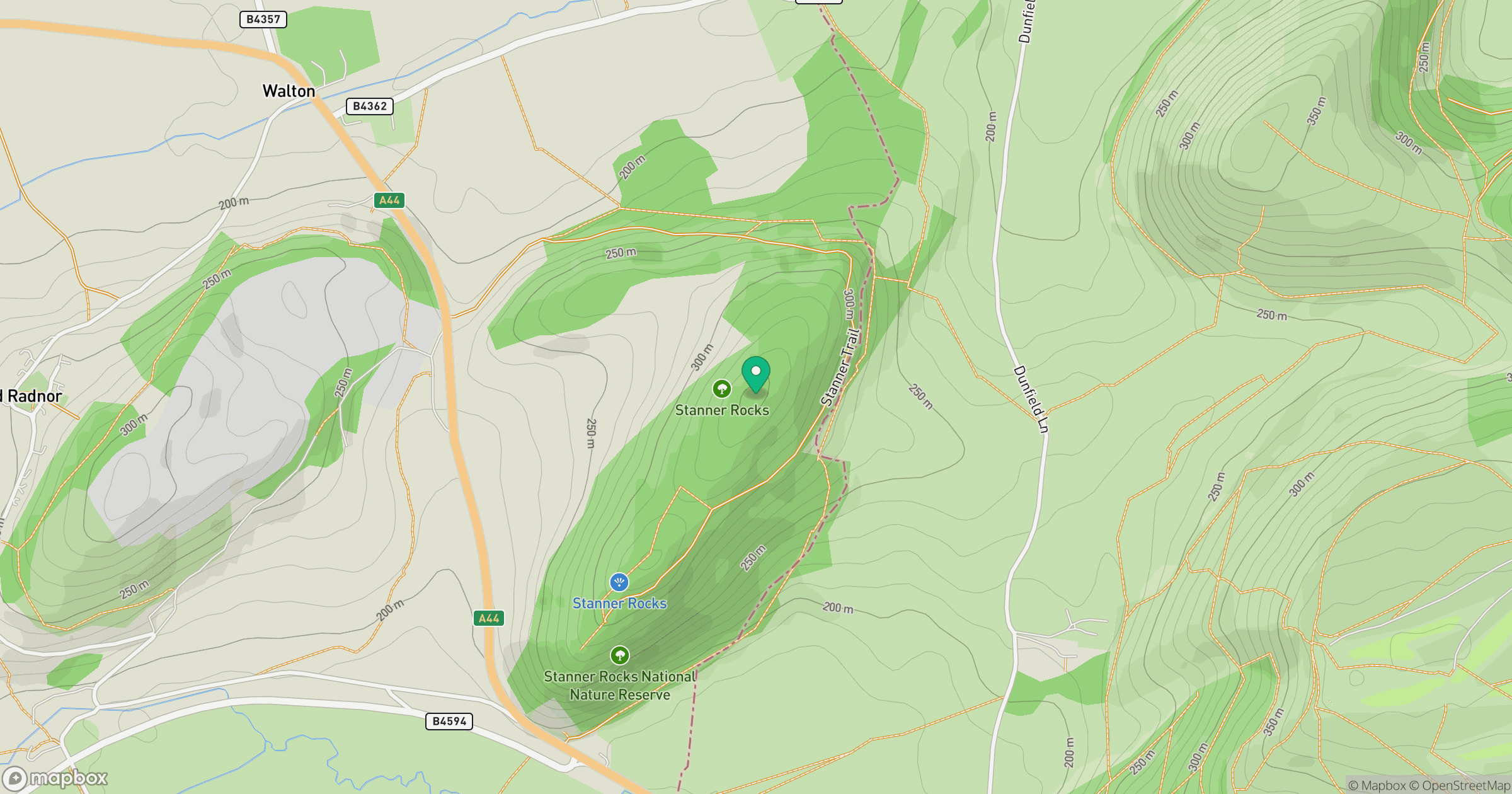
Grid reference: SO266590
View on OpenStreetMapOpens a map in a new tab, centred on the hill.
Hills within 30 km
Straight-line distance, not a walking route or confirmation of access.
Carneddau
445m
Bradnor Hill
392m
Burfa Bank
313m
Hergest Ridge
427m
Llanfihangel Hill [Colva Hill]
532m
No comments yet. Be the first.