
Meallan Odhar
Good walks are even better shared.
Overview
Meallan Odhar
Nestled in the heart of the Scottish Highlands, Meallan Odhar stands as a Munro with plenty of character and a fantastic vantage point for those looking to soak in the beauty of Scotland's great outdoors.
Geology
The mountain is made of ancient schists, gneiss and quartzite, giving it a rugged texture and complex structure that provides a glimpse into the geological history of the region. These rocks have been shaped by intense pressure and heat over eons, and they are a testament to the dynamic forces of nature.
Routes
For those keen to reach the summit, there are two main routes worth considering:
- Ballachulish to Meallan Odhar: A well-trodden path that meanders through enchanting forests and open moorland before the final ascent to the peak. This 12 km trek can be completed in approximately 4.5 hours and is classified as moderate.
- Kinlochleven Route: For the more adventurous, this route offers a good challenge with a mix of stunning scenery and scrambly sections. Covering 10 km, expect to spend about 5 hours on this route.
Summit Features
At the top of Meallan Odhar, you will find a cairn that has been assembled by many visitors before you. It’s the perfect spot to pause, take photos, and enjoy a well-deserved snack. The sweeping views across the surrounding peaks and Loch Leven are nothing short of spectacular – ideal for those Instagram moments!
Terrain
The terrain can be varied, transitioning from rocky outcrops to grassy slopes. Just be wary of the occasional boggy patch which could catch you off guard, so sturdy boots are recommended.
Views
The summit offers an uninterrupted panorama that takes in Loch Leven, Ben Nevis, and many of the surrounding hills. The best times to witness this breathtaking sight are during the spring and early autumn when the air is crisp and the scenery is vibrant.
Hazards
Like any highland trek, be cautious of loose rocks and the unpredictability of the weather – the Scottish climate is known for keeping you on your toes! Prepare for anything from sunbathing temperatures to torrential downpours. And watch your step in those boggy areas!
Access
Conveniently located near the village of Ballachulish, the nearest parking can be found at the village car park – and it’s free (a true Scottish treasure!). Public transport is also available, with buses running regularly from nearby towns. The closest little town to find amenities is Ballachulish itself, which has charming cafes and public toilets for your convenience.
Facilities
After your trek, you can find a lovely cafe or two in Ballachulish where you can savour a tasty bite to eat and quench your thirst.
History
The name “Meallan Odhar,” translating to ‘the brown hill,’ hints at its earthy, rugged appearance. This mountain has been an informative feature in local history with various tales linked to its surroundings, enhancing its cultural significance.
So, lace up those hiking boots, grab your walking stick, and get ready for an adventure like no other! There’s nothing quite like the heart-pounding thrill of reaching a Munro summit. Just remember, keep your wits about you and don’t forget your camera!
Happy hiking!
Explore routes near Meallan Odhar
Public walks starting within 80 km of this hill. Nearby does not mean a route reaches the summit; check its map and access before setting out.
Loch Affric full circuit from River Affric
View route
Glen Affric: Coire Loch Woodland Trail
View route
Fort Augustus to Kytra Lock: Caledonian Canal Towpath
View route
Great Glen Way low route: Fort Augustus to Invermoriston Old Bridge
View route
Route planning notes
These notes describe possible approaches, not verified navigable routes or permission to cross land. Check current paths, local access rules and conditions before setting out.
Ballachulish to Meallan Odhar
A popular route starting from the village of Ballachulish, leading walkers through enchanting forests before ascending the moorland.
Kinlochleven Route
Starting in Kinlochleven, this route offers a more challenging climb with stunning scenery and occasional scrambling sections.
Make a day of it, together
Find someone to share the walk with, or organise a day out along a route you like.
Hill facts and local notes
Classifications
Elevation
612m
2,008 ft
Prominence
129m
Coordinates
57.2115, -4.9630
NH211173
OS Map
34
Explorer: 415
At the Summit
At the summit, you’ll find a stone cairn that has likely seen more selfies than adventurous souls. The views stretch out for miles, making it a perfect spot for a well-earned snack.
Terrain & Geology
Meallan Odhar is primarily composed of ancient schists, which are known for their metamorphic origin. The mountain's exposed rock face showcases fascinating geology, including a mix of gneiss and quartzite that tells a story of tectonic forces at work over millions of years.
Views & Scenery
From the summit, enjoy panoramic views of Loch Leven, Ben Nevis, and the surrounding peaks. On a clear day, the scenery is simply breathtaking.
History & Heritage
Name Origin
The name Meallan Odhar translates roughly to 'the brown hill', likely referencing its rugged, earthy appearance surrounded by lush greenery.
Historical Significance
Meallan Odhar has been a prominent feature for local people for centuries, serving as a backdrop for various tales and legends in the region.
Getting There & Facilities
Check current local access restrictions, parking rules and transport timetables before travelling. These notes do not confirm public access to the summit.
Parking
Parking is available at the Ballachulish village car park, which is free but fills up quickly on weekends.
Public Transport
Regular bus services run to Ballachulish from nearby towns, with the nearest station at Fort William. Check local schedules for the most up-to-date times.
Nearby Facilities
Facilities in the nearby village of Ballachulish include cafes serving hearty meals and refreshments, as well as public toilets.
Safety Information
Known Hazards
- Be cautious of loose rocks, especially on the ascent. Weather conditions can change rapidly, so prepare for anything from sunshine to showers. Boggy areas may surprise unwary hikers.
General Safety Tips
- Check weather conditions before setting out
- Carry appropriate clothing and equipment
- Let someone know your planned route
- Take a map, compass, and GPS device
- Carry emergency supplies: food, water, first aid kit, torch
Hills
Some common questions about the hills answered
Are there group walks up Meallan Odhar?
Many walkers use Walkmates to join or organise walks with others. You can check for group walks around Meallan Odhar through the maps
Are there other walkers around Meallan Odhar?
Activity varies by location and time, but Walkmates lets you see whether others have shared walks or shown interest in this area. Find other people through the walking friends search walking friends for Meallan Odhar search or of course create your own walk for Meallan Odhar
Can I organise a walk to Meallan Odhar?
Yes. If there aren’t any walks listed already, you can create a walk and make it available for others to join.
If you're signed up to Walkmates, you can create a walk to Meallan Odhar.
How do I find a walk up this hill?
There are often multiple ways to walk this hill, depending on experience and route preference. Walkmates helps you explore walks and routes that others have shared.
Can I suggest a new route up Meallan Odhar?
Yes. You can suggest or create routes to share with others. Walkmates focuses on the social side of walking, so routes are used to help people organise walks and explore areas together, rather than as detailed navigation tools or route libraries.
Other uses really appreciate knowledgeable walkers sharing their routes. Share your favourite route to Meallan Odhar here
The is an error or something incorrect about this hill. How do I let you know?
We always strive to keep the information on Walkmates as accurate as possible. If you find an error, please let us know through the contact form and we'll aim to correct it as quickly as possible
Community Discussion
Comments
Location
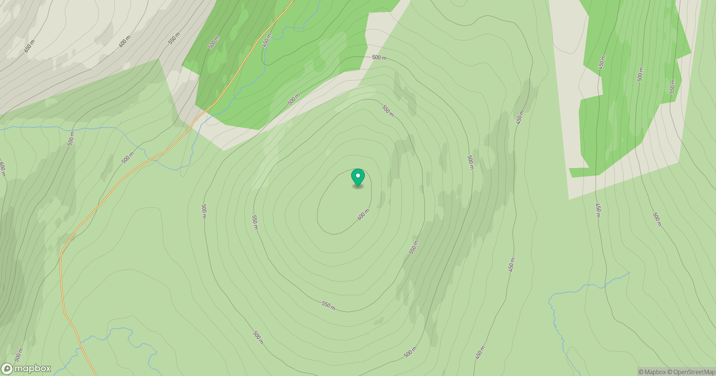
Grid reference: NH211173
View on OpenStreetMapOpens a map in a new tab, centred on the hill.
Hills within 30 km
Straight-line distance, not a walking route or confirmation of access.
Carn Eighe
1,183m
Mam Sodhail
1,179m
Sgurr a' Choire Ghlais
1,084m
Gleouraich
1,035m
Sgurr a' Mhaoraich
1,027m
No comments yet. Be the first.