

Meall Garbh
Good walks are even better shared.
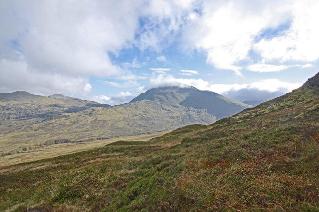
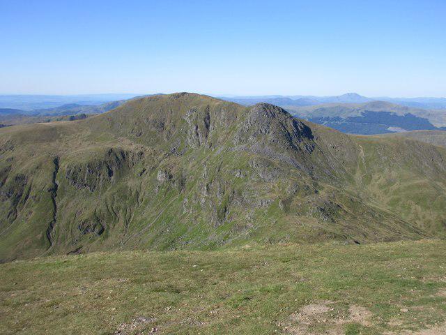
NN6451 : Looking towards Carn Gorm over An Sgorr from Meall Garbh
Alan O'Dowd Photo source
Overview
Meall Garbh: A Hiker's Delight
Introduction
Nestled in the heart of the Scottish Highlands, Meall Garbh is not only a Munro but also a delight for avid hikers and those looking to reconnect with nature. With its impressive elevation of 922 meters, it stands tall among its peers, offering stunning views and a rugged landscape that draws adventurers from far and wide.
Geology
As you make your way up Meall Garbh, take a moment to marvel at the fascinating geology. Composed mainly of schist and gneiss, the rocks that make up the mountain have a story to tell, shaped by intense metamorphic processes over millennia. Don’t worry, though; they won’t bite – but they might take your breath away!
Routes
There are several routes to choose from, each offering a unique experience:
- Balquidder via Loch Doine: This route is perfect for those looking for a moderate challenge. Spanning approximately 15 km with a time commitment of around 5 hours, it is a delightful trek along the shores of Loch Doine.
- Strathfillan: For the more adventurous, the Strathfillan route is a steep climb that covers about 12 km, taking around 4.5 hours. Be prepared for some puffing and panting, but the views are well worth it!
Summit Features
Upon reaching the summit, hikers are greeted by a magnificent caiman. This isn’t your average pile of stones but a substantial monument. It's not just a mark of your achievement; it’s also a fabulous spot for selfies! Don’t forget to snap a pic for the ‘gram!
Terrain
The terrain varies from rocky outcrops to grassy patches, although some lower areas can be a bit boggy. Make sure to wear sturdy shoes – unless you fancy a free mud pack!
Views
The views from Meall Garbh are nothing short of spectacular! You’ll be treated to sweeping vistas of the surrounding peaks, including Ben More and Loch Voil. For the best photographic opportunities, aim for spring or early summer when the heather blooms and the light is just right.
Hazards
While there’s plenty to enjoy on Meall Garbh, hikers should be aware of potential hazards. The weather can change faster than you can say 'Scottish summer', so ensure you pack appropriate gear, including waterproofs and warm layers.
Nearby Summits
If you’re feeling ambitious, why not tackle some nearby summits? Ben More, the highest peak in the area, stands at 1174 meters, and the formidable Stobinian towers over at 1118 meters. They make great additions to your hiking repertoire!
Access
Accessing Meall Garbh is straightforward. The nearest parking area is located at the start of the Balquidder trail, accommodating around 10 vehicles. Alternatively, if you prefer public transport, there are regular buses from Callander to Balquidder. Callander itself is a charming town with lots of amenities to help set you up for your adventure.
Facilities
Before you embark on your journey, make sure to fuel up! The village of Balquidder offers a delightful cafe and public toilets, perfect for last-minute pitstops.
History
The name Meall Garbh, meaning 'rough hill' in Gaelic, fittingly describes its rugged nature. Historically significant, this mountain has served as a part of ancient routes used by early Scots, making it not just a natural wonder, but a historical one as well.
Conclusion
In conclusion, Meall Garbh stands as a testament to the natural beauty and rich history which the Scottish Highlands are famed for. Don’t forget your camera, your sense of adventure, and perhaps a wee snack for the journey!
Happy hiking!
Explore routes near Meall Garbh
Walks starting near this hill. Open a route to check its map, distance and full itinerary.
Kenmore: Drummond Hill Black Rock Trail above Loch Tay
View route
Killin: Falls of Dochart, Finlarig and Moirlanich Longhouse
View route
Aberfeldy: Glassie Woodland and River Tay Circular
View route
Monachyle Glen pack-pony short walk
View route
Route planning notes
These notes describe possible approaches. Check a route's map and access information when planning your walk.
Balquidder via Loch Doine
A scenic route that starts from the village of Balquidder, leading alongside Loch Doine before ascending towards the summit.
Strathfillan
Beginning from the Strathfillan area, this route offers a steep climb that rewards hikers with stunning views of the surrounding valleys.
Make a day of it, together
Find someone to share the walk with, or organise a day out along a route you like.
Photo Gallery
View all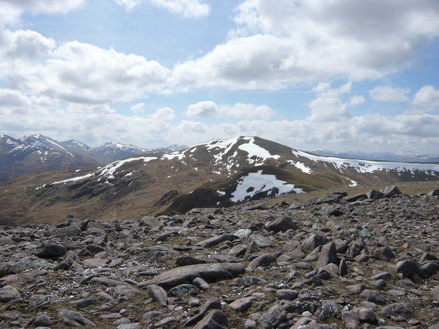 Photo could not load
NN6451 : Looking towards Carn Gorm over An Sgorr from Meall Garbh
Alan O'Dowd
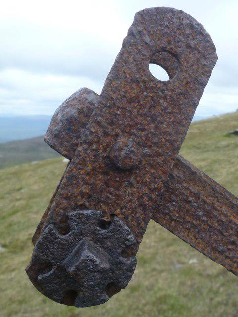 Photo could not load
NN6451 : Rusting Fence Post, Meall Garbh
Michael Graham
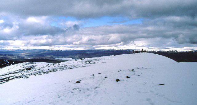 Photo could not load
NN6451 : Meall Garbh [Carn Mairg group]
Gordon Hatton
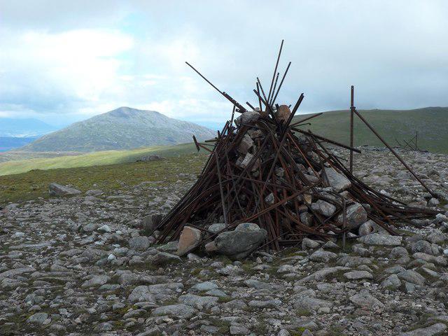 Photo could not load
NN6451 : Summit cairn, Meall Garbh
Stephen Sweeney
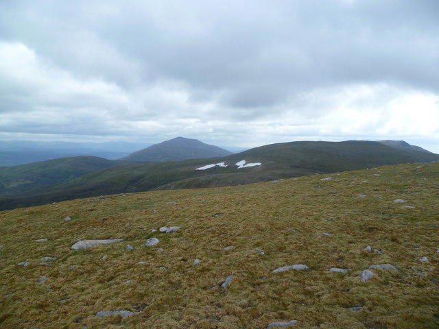 Photo could not load
NN6451 : On Meall Garbh
Michael Graham
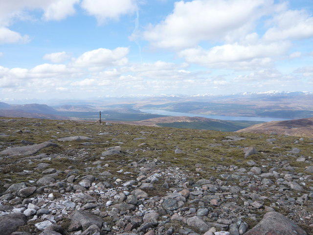 Photo could not load
NN6451 : Old fencepost near summit of Meall Garbh
Alan O'Dowd
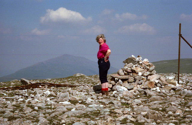 Photo could not load
NN6451 : Summit cairn on Meall Garbh
Russel Wills
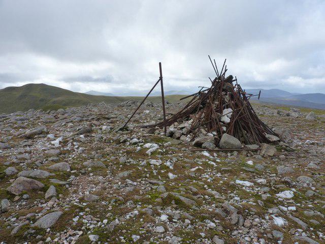 Photo could not load
NN6451 : Not so much a summit cairn now
Richard Law
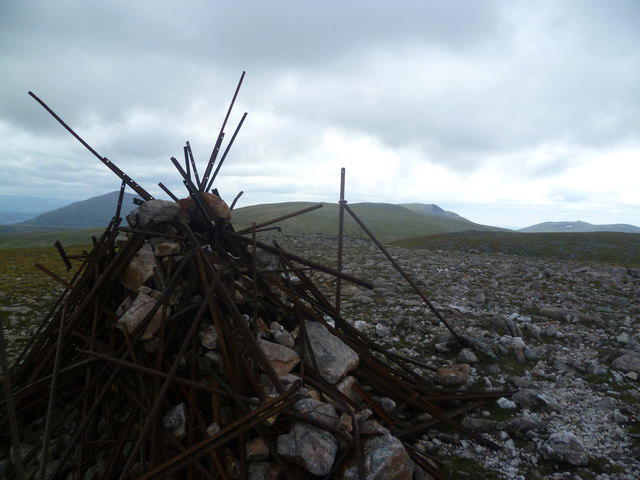 Photo could not load
NN6451 : On Meall Garbh
Michael Graham
NN6451 : Summit of Meall Garbh (Glen Lyon)
Iain Russell
Hill facts and local notes
Classifications
Elevation
968m
3,174 ft
Prominence
102m
Coordinates
56.6374, -4.2075
NN647516
OS Map
42 51
Explorer: OL48E OL49W 378E 386W
At the Summit
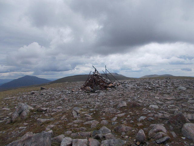
The summit is marked by a sizeable stone cairn, which not only serves as a windbreak but is also great for an Instagram photo op!
Terrain & Geology
Meall Garbh is primarily composed of schist and gneiss, typical of the rugged terrain found in the Highlands. The unique strata result from intense metamorphic processes, making it a geological wonder.
Views & Scenery
From the summit, hikers can enjoy breathtaking views of the surrounding peaks, including Ben More and the picturesque Loch Voil.
History & Heritage
Name Origin
The name Meall Garbh translates from Gaelic to 'rough hill', fitting for its rugged landscape.
Historical Significance
This mountain has historical significance as part of the ancient routes used by the early Scots.
Getting There & Facilities
Parking
There is a small parking area at the start of the Balquidder trail, accommodating around 10 vehicles.
Public Transport
Regular buses operate from Callander to the village of Balquidder, with connections from nearby towns.
Nearby Facilities
The nearest facilities can be found in the village of Balquidder, where you'll find a charming cafe and a public toilet.
Safety Information
Known Hazards
- Beware of changing weather conditions; the Highlands are notorious for their quick shifts. Always carry appropriate gear.
General Safety Tips
- Check weather conditions before setting out
- Carry appropriate clothing and equipment
- Let someone know your planned route
- Take a map, compass, and GPS device
- Carry emergency supplies: food, water, first aid kit, torch
Hills
Some common questions about the hills answered
Are there group walks up Meall Garbh?
Many walkers use Walkmates to join or organise walks with others. You can check for group walks around Meall Garbh through the maps
Are there other walkers around Meall Garbh?
Activity varies by location and time, but Walkmates lets you see whether others have shared walks or shown interest in this area. Find other people through the walking friends search walking friends for Meall Garbh search or of course create your own walk for Meall Garbh
Can I organise a walk to Meall Garbh?
Yes. If there aren’t any walks listed already, you can create a walk and make it available for others to join.
If you're signed up to Walkmates, you can create a walk to Meall Garbh.
How do I find a walk up this hill?
There are often multiple ways to walk this hill, depending on experience and route preference. Walkmates helps you explore walks and routes that others have shared.
Can I suggest a new route up Meall Garbh?
Yes. You can suggest or create routes to share with others. Walkmates focuses on the social side of walking, so routes are used to help people organise walks and explore areas together, rather than as detailed navigation tools or route libraries.
Other uses really appreciate knowledgeable walkers sharing their routes. Share your favourite route to Meall Garbh here
The is an error or something incorrect about this hill. How do I let you know?
We always strive to keep the information on Walkmates as accurate as possible. If you find an error, please let us know through the contact form and we'll aim to correct it as quickly as possible
Community Discussion
Comments
Location
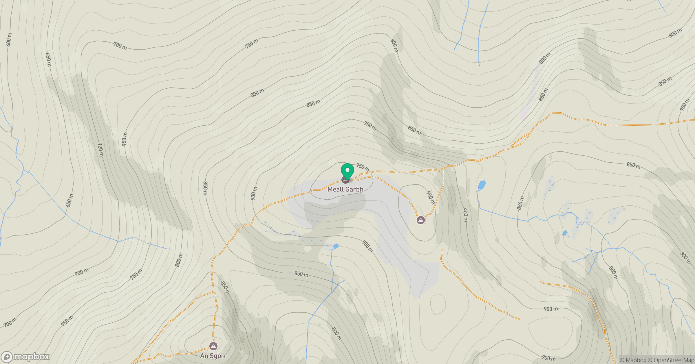
Grid reference: NN647516
View on OpenStreetMapOpens a map in a new tab, centred on the hill.
No comments yet. Be the first.