

Meall an Daimh
Good walks are even better shared.
NN2018 : Meall an Daimh
Richard Webb Photo source
Overview
Meall an Daimh: A Hiker's Delight
Introduction
Meall an Daimh, standing proudly at 600 meters, is a dazzling Munro nestled in the heart of the Scottish Highlands. Whether you’re a seasoned mountaineer or a casual walker, this hill offers something for everyone.
Geology
The mountain's geological features, dominated by schist and granite remnants, tell a story of ancient earth movements. Perfect for geology enthusiasts!
Routes
Two popular routes lead you up to the summit:
- From Strathryan: A moderate trek of about 8 km, approximately 3.5 hours, provides a beautiful introduction to the hills.
- Circuit via Meall a'Bhúiridh: For those wanting a serious challenge, this circuit stretches 12 km and takes around 5 hours. It combines the beauty of both peaks, rewarding you with stunning vistas.
Summit Features
At the summit, you’ll find a simple stone cairn and, of course, breathtaking views that make the hike utterly worthwhile. Don’t forget to snap a few pictures!
Terrain
Expect a mix of grassy slopes interspersed with rocky outcrops, while a bit of mud keeps things exciting under foot.
Views
From the top, the scenery is a feast for the eyes. Rannoch Moor spread out below, the majestic peaks of Glencoe, and on a good day, you can see all the way to Loch Awe. Autumn provides the breath-taking dance of colours, while spring showcases the area's revival.
Hazards
Watch out for loose rocks and ever-changing weather. Bring your sense of humour and prepare for a bit of mud!
Access
- Nearest Parking: Available at Strathryan, about 2 km from the entry point.
- Public Transport: Best accessed by car, with infrequent bus routes nearby.
- Nearest Town: Crianlarich is close by and offers basic amenities.
Facilities
Post-hike, treat yourself at a café in Crianlarich. Toilets are also available nearby.
History
The name means ‘Hill of the Stag’. This picturesque hill has seen many a pair of hiking boots traverse its trails, representing the spirit of outdoor adventure.
Conclusion
With its stunning views, serene atmosphere, and rich history, Meall an Daimh is an ideal destination for hikers and nature lovers alike. So lace up those boots, grab your walking stick, and enjoy the great outdoors!
Remember
Laughing along the way makes any hike more enjoyable, but do keep your wits about you. Happy hiking!
Explore routes near Meall an Daimh
Walks starting near this hill. Open a route to check its map, distance and full itinerary.
Beinn Ime from Succoth
View route
The Cobbler from Succoth Carpark
View route
Ben Lomond in the trossachs
View route
Loch Katrine: Brenachoile Point Shore Walk from Trossachs Pier
View route
Route planning notes
These notes describe possible approaches. Check a route's map and access information when planning your walk.
From Strathryan
This route begins at Strathryan, leading you through lush glens and up to the summit via a well-defined path.
Circuit via Meall a'Bhúiridh
A scenic route that combines the ascent of Meall an Daimh with Meall a'Bhúiridh, perfect for avid hikers looking for a challenge.
Make a day of it, together
Find someone to share the walk with, or organise a day out along a route you like.
Photo Gallery
View all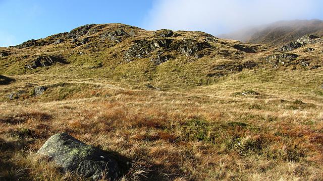 Photo could not load
NN2018 : Meall an Daimh
Richard Webb
Hill facts and local notes
Classifications
Elevation
762m
2,500 ft
Prominence
24m
Coordinates
56.3229, -4.9019
NN206182
OS Map
50 56
Explorer: OL39N 364N
At the Summit
The summit is adorned with a rocky outcrop and a modest cairn, perfect for a quick photo op. Don’t forget to take a selfie to show your mates that you indeed made it!
Terrain & Geology
Meall an Daimh is primarily composed of schist, with remnants of granite, making it a great study for those intrigued by Scottish geology. The rock formations offer insights into the ancient tectonic processes that shaped this stunning landscape.
Views & Scenery
From the summit, you can see the vast expanse of Rannoch Moor, the impressive peaks of Glencoe, and on a clear day, even Loch Awe.
History & Heritage
Name Origin
The name 'Meall an Daimh' translates to 'Hill of the Stag', a nod to the wildlife that roams these hills. Keep your eyes peeled for the occasional deer!
Historical Significance
It has been a popular walking destination for locals and tourists alike, adding to the rich outdoor culture of the Scottish Highlands.
Getting There & Facilities
Parking
There is parking available at the base in Strathryan, roughly 2 km from the starting point of the route. Be sure to arrive early as spaces can fill up quickly.
Public Transport
Limited bus services run to nearby villages, but it's advisable to drive. The closest train station is in Crianlarich, with public transport links from there.
Nearby Facilities
Facilities are quite limited in the immediate vicinity; however, you can find a café and public toilets in Crianlarich. Perfect for a post-hike cake!
Safety Information
Known Hazards
- Loose rocks, changing weather conditions, and the possibility of encountering boggy patches, especially in the early spring. As the Scots say, it's a 'crazy' climate up here, so always be prepared!
General Safety Tips
- Check weather conditions before setting out
- Carry appropriate clothing and equipment
- Let someone know your planned route
- Take a map, compass, and GPS device
- Carry emergency supplies: food, water, first aid kit, torch
Hills
Some common questions about the hills answered
Are there group walks up Meall an Daimh?
Many walkers use Walkmates to join or organise walks with others. You can check for group walks around Meall an Daimh through the maps
Are there other walkers around Meall an Daimh?
Activity varies by location and time, but Walkmates lets you see whether others have shared walks or shown interest in this area. Find other people through the walking friends search walking friends for Meall an Daimh search or of course create your own walk for Meall an Daimh
Can I organise a walk to Meall an Daimh?
Yes. If there aren’t any walks listed already, you can create a walk and make it available for others to join.
If you're signed up to Walkmates, you can create a walk to Meall an Daimh.
How do I find a walk up this hill?
There are often multiple ways to walk this hill, depending on experience and route preference. Walkmates helps you explore walks and routes that others have shared.
Can I suggest a new route up Meall an Daimh?
Yes. You can suggest or create routes to share with others. Walkmates focuses on the social side of walking, so routes are used to help people organise walks and explore areas together, rather than as detailed navigation tools or route libraries.
Other uses really appreciate knowledgeable walkers sharing their routes. Share your favourite route to Meall an Daimh here
The is an error or something incorrect about this hill. How do I let you know?
We always strive to keep the information on Walkmates as accurate as possible. If you find an error, please let us know through the contact form and we'll aim to correct it as quickly as possible
Community Discussion
Comments
Location
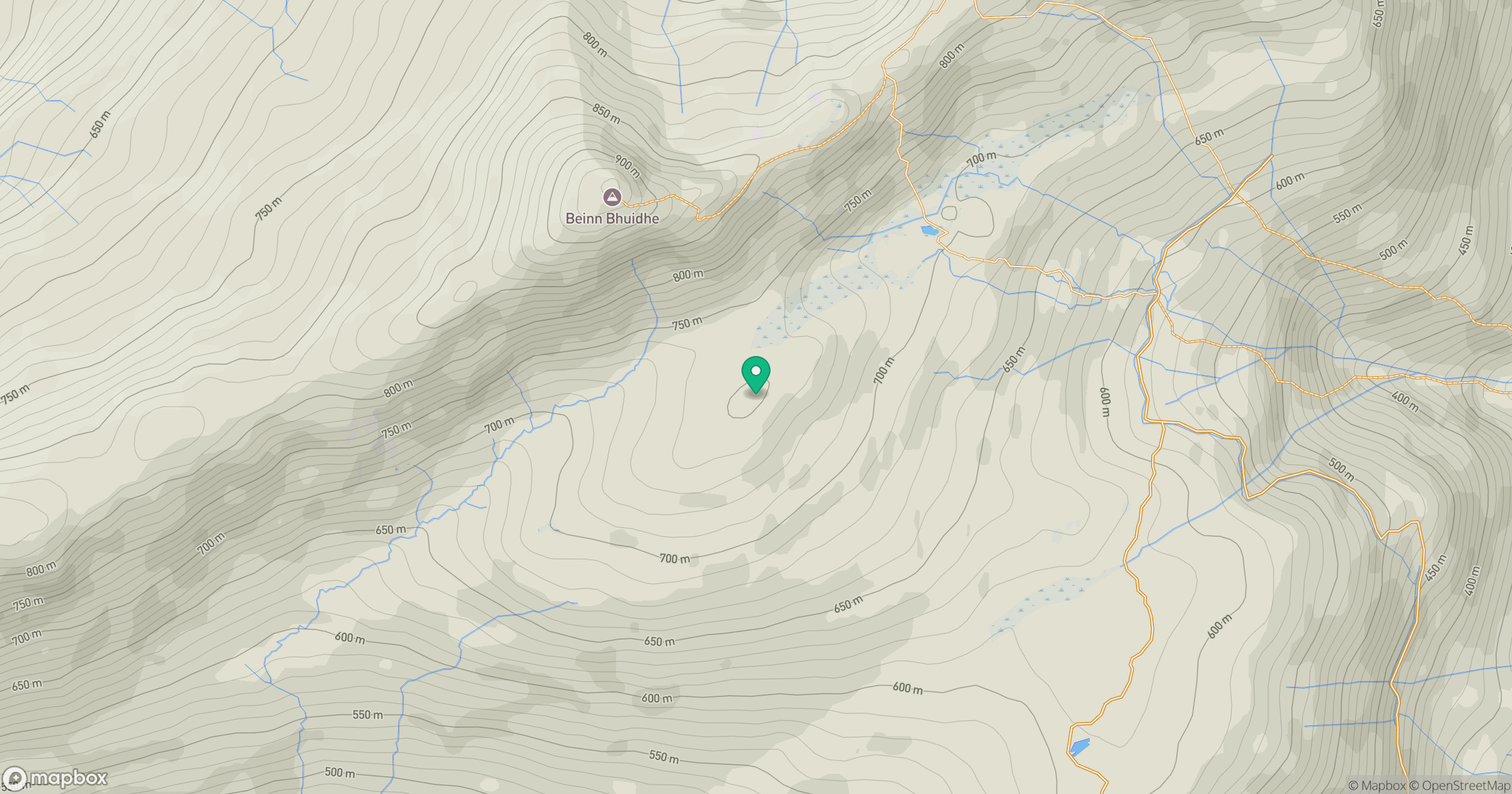
Grid reference: NN206182
View on OpenStreetMapOpens a map in a new tab, centred on the hill.
Nearby Hills
![Ben Lui [Beinn Laoigh]](https://cdn.walkmates.com/gallery-images/20d4da67f4984b329a102d7c3aba012b.jpg)
Ben Lui [Beinn Laoigh]
1,131m
Beinn Ime
1,012m
![The Cobbler [Ben Arthur]](https://cdn.walkmates.com/gallery-images/a1b697040769474a8338b3fb586ebc7a.jpg)
The Cobbler [Ben Arthur]
887m
Beinn Narnain
927m
Ben Vorlich
943m
No comments yet. Be the first.