

Meall a' Bhuiridh
Good walks are even better shared.
NN2550 : Rime icing
L Cowieson Photo source
Overview
Meall a' Bhuiridh
Nestled in the heart of the Scottish Highlands, Meall a' Bhuiridh stands proudly as a Munro, attracting adventurers and nature lovers alike. At an elevation of 1108 meters, it provides both challenge and reward in equal measure.
Geology
The mountain's landscape is shaped by ancient geological forces, composed primarily of schist and granite. The rugged cliffs and rolling hills showcase a stunning example of the Highland terrain, creating a visually striking backdrop for any hike.
Access
Accessing Meall a' Bhuiridh is straightforward. The nearest parking can be found at the Glencoe Ski Centre, which serves as the starting point for the most popular route. It’s also easily reachable by public transport, with regular bus services linking it to Fort William and Glasgow. The quaint village of Ballachulish is just 11 km away, offering various amenities for weary hikers.
Routes
One of the favored routes is the Glencoe Ski Centre Route, a moderately challenging path that winds its way along the beautiful slopes, providing both stunning vistas and a friendly gradient. The 8 km round trip usually takes around 3.5 hours, making it suitable for a half-day adventure.
Summit Features
Upon reaching the summit, hikers are greeted with a substantial cairn and a trig point, perfect for some photographic moments. The cairn itself is often adorned with small stones, a lovely custom started by previous hikers.
Terrain Type
Expect to encounter a delightful blend of rocky outcrops, lush grassy slopes, and the occasional boggy patch—perfect for those who enjoy the full Scottish experience!
Views
From its lofty heights, views are nothing short of breathtaking. The summits of Buachaille Etive Mòr and the expansive Rannoch Moor can be seen in the distance. On particularly clear days, Locher Etive shines like a jewel amidst the mountains, offering a picturesque Mediterranean vibe in the heart of the Highlands.
Hazards
A word of caution: the weather can change quicker than you can say 'there's a midgie!' Be prepared for sudden shifts and loose rocks on the trail. Always check local conditions before venturing out.
Conclusion
Whether you're looking to tick off a Munro or simply seeking a slice of Scotland's majestic scenery, Meall a' Bhuiridh delivers. With friendly routes, stunning views, and a variety of terrain, it's a mountain that promises adventure for all.
Happy hiking!
Explore routes near Meall a' Bhuiridh
Walks starting near this hill. Open a route to check its map, distance and full itinerary.
Ben Nevis via Mountain Path
View route
Banavie to Glen Loy Aqueduct: Neptune’s Staircase Canal Towpath
View route
Killin: Falls of Dochart, Finlarig and Moirlanich Longhouse
View route
Coire Ardair lochan from Aberarder and back
View route
Route planning notes
These notes describe possible approaches. Check a route's map and access information when planning your walk.
Glencoe Ski Centre Route
A well-trodden path starting from the Glencoe Ski Centre, offering a gradual ascent with stunning views along the way.
Make a day of it, together
Find someone to share the walk with, or organise a day out along a route you like.
Photo Gallery
View all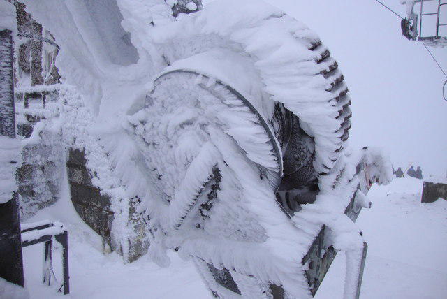 Photo could not load
NN2550 : Rime icing
L Cowieson
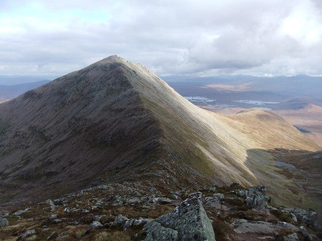 Photo could not load
NN2450 : Meall a'Bhuiridh
David Brown
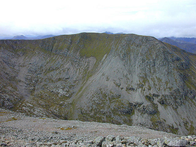 Photo could not load
NN2450 : Creise seen from Meall a' Bhuiridh
Nigel Brown
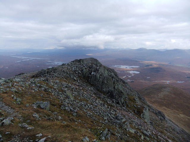 Photo could not load
NN2550 : On Meall a' Bhuiridh
David Brown
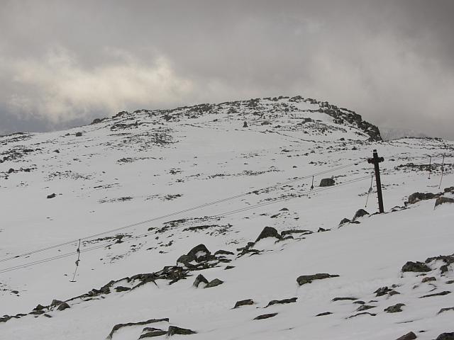 Photo could not load
NN2550 : Meall a' Bhùiridh
Richard Webb
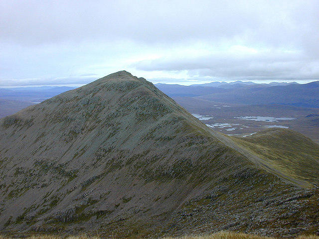 Photo could not load
NN2450 : Meall a' Bhuiridh seen from Creise
Nigel Brown
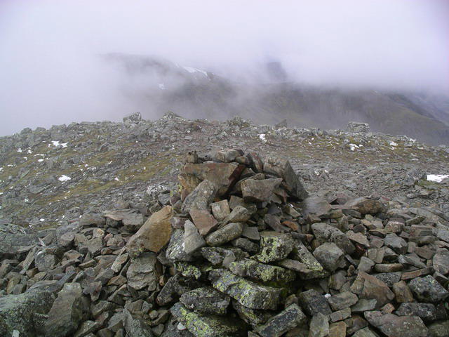 Photo could not load
NN2550 : Meall a' Bhuiridh : Munro No 45
Graham Ellis
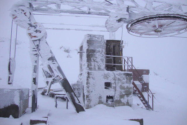 Photo could not load
NN2550 : Frozen Ski Lift
L Cowieson
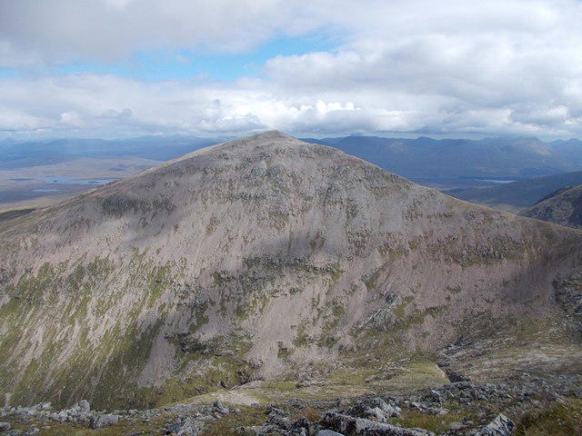 Photo could not load
NN2550 : Meall a' Bhuiridh from Creise
Iain Russell
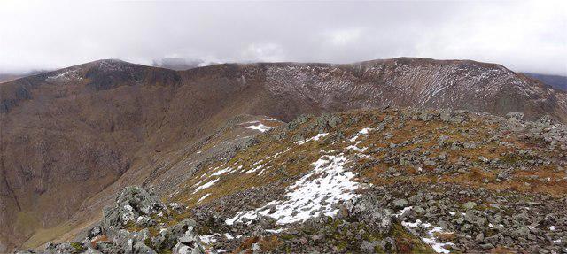
NN2550 : Clach Leathad - Creise
Adam Ward
Hill facts and local notes
Classifications
Elevation
1,108m
3,635 ft
Prominence
795m
Coordinates
56.6122, -4.8522
NN250503
OS Map
41
Explorer: 384
At the Summit
The summit features a large cairn and a trig point, making it a perfect spot for a photo op. Notably, the cairn is adorned with small stones added by visitors, a lovely tradition.
Terrain & Geology
Meall a' Bhuiridh is primarily composed of schist and granite, formed during the Caledonian Orogeny. Its rugged cliffs and rolling hills provide a stunning example of the Highland landscape.
Views & Scenery
From the summit, you can see majestic peaks like Buachaille Etive Mòr and the expansive expanse of the Rannoch Moor. On a clear day, keep an eye out for Loch Etive glinting in the sun.
History & Heritage
Name Origin
The name 'Meall a' Bhuiridh' translates to 'Hill of the Sedge', reflecting the vegetation found around its slopes.
Historical Significance
This mountain has long been a popular spot for hikers and climbers, and it holds a special place in local folklore and outdoor culture.
Getting There & Facilities
Parking
The nearest parking is at the Glencoe Ski Centre, which has ample space for vehicles and facilities for visitors.
Public Transport
Regular bus services operate from nearby towns such as Fort William and Glasgow, making it relatively easy to reach Glencoe.
Nearby Facilities
There are facilities at Glencoe Ski Centre and local cafes in nearby Ballachulish for a well-deserved treat after your hike.
Safety Information
Known Hazards
- Be mindful of changing weather conditions, as the Highlands can be notoriously fickle. Watch out for loose rocks on steep sections and prepare for sudden squalls.
General Safety Tips
- Check weather conditions before setting out
- Carry appropriate clothing and equipment
- Let someone know your planned route
- Take a map, compass, and GPS device
- Carry emergency supplies: food, water, first aid kit, torch
Hills
Some common questions about the hills answered
Are there group walks up Meall a' Bhuiridh?
Many walkers use Walkmates to join or organise walks with others. You can check for group walks around Meall a' Bhuiridh through the maps
Are there other walkers around Meall a' Bhuiridh?
Activity varies by location and time, but Walkmates lets you see whether others have shared walks or shown interest in this area. Find other people through the walking friends search walking friends for Meall a' Bhuiridh search or of course create your own walk for Meall a' Bhuiridh
Can I organise a walk to Meall a' Bhuiridh?
Yes. If there aren’t any walks listed already, you can create a walk and make it available for others to join.
If you're signed up to Walkmates, you can create a walk to Meall a' Bhuiridh.
How do I find a walk up this hill?
There are often multiple ways to walk this hill, depending on experience and route preference. Walkmates helps you explore walks and routes that others have shared.
Can I suggest a new route up Meall a' Bhuiridh?
Yes. You can suggest or create routes to share with others. Walkmates focuses on the social side of walking, so routes are used to help people organise walks and explore areas together, rather than as detailed navigation tools or route libraries.
Other uses really appreciate knowledgeable walkers sharing their routes. Share your favourite route to Meall a' Bhuiridh here
The is an error or something incorrect about this hill. How do I let you know?
We always strive to keep the information on Walkmates as accurate as possible. If you find an error, please let us know through the contact form and we'll aim to correct it as quickly as possible
Community Discussion
Comments
Location
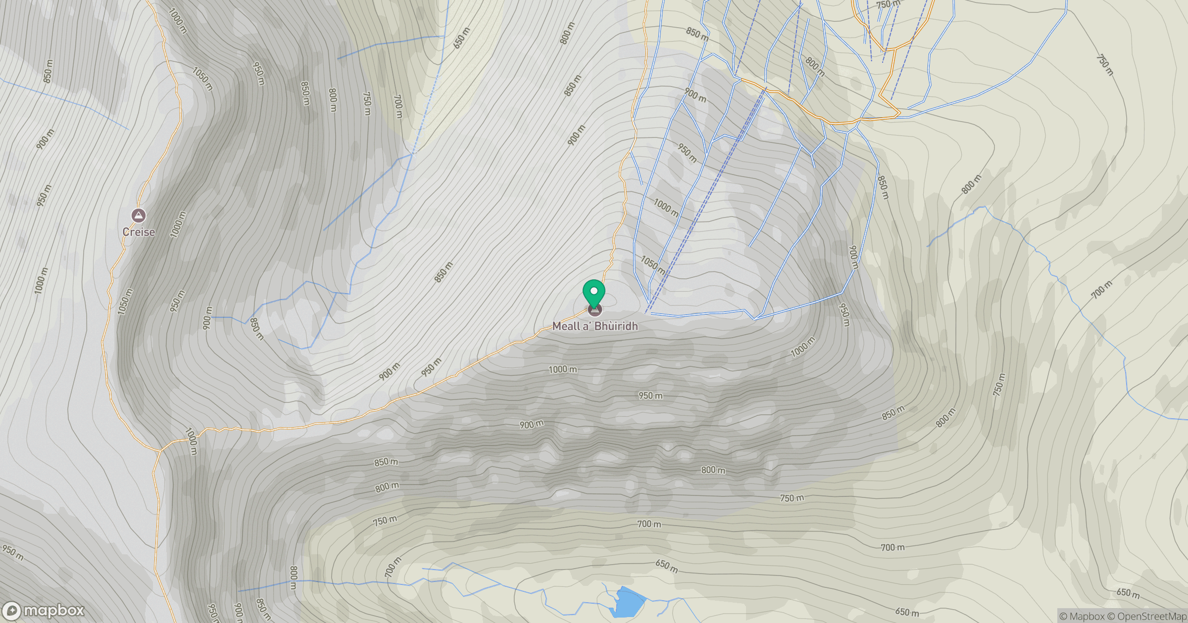
Grid reference: NN250503
View on OpenStreetMapOpens a map in a new tab, centred on the hill.
No comments yet. Be the first.