
Lumsdon Law
Good walks are even better shared.
Overview
Lumsdon Law: A Hidden Gem
Nestled in the Southern Uplands of Scotland, Lumsdon Law is a delightful Marilyn that commands beautiful vistas and invites hikers of all abilities to explore its rolling landscape. Elevating to 307 meters, this hill may not be the highest, but it offers a charm that's hard to resist.
Geology
The underlying geology features sedimentary sandstone, giving Lumsdon Law its steep crags and gentle slopes. The surrounding terrain is not only a sight for sore eyes but home to varied flora and fauna, making it popular for both seasoned hikers and casual walkers.
Routes
Two primary routes cater to hikers aiming to summit this gentle giant:
- From Glenholm: A moderate 5.2 km trail that meanders through lush fields to the hill's peak. Expect a journey of about 2.5 hours filled with scenic views and the occasional frolicking sheep.
- Via Lumsdon Farm: If time isn’t on your side, this 3.8 km easy route is perfect for a quick jaunt to the top, taking about 1.5 hours.
Summit Features
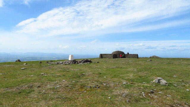
Reaching the summit, adventurers will encounter a sturdy trig point and a well-constructed cairn. Take a moment to appreciate the panoramic views — it's a prime spot for celebrating your uphill battle with a well-deserved snack (or two).
Terrain Type
The hill's terrain consists of a mix of grassy fields interspersed with rocky outcrops and boggy sections, particularly in wetter weather. Sturdy footwear is recommended, especially if you fancy returning with dry socks.
Views
A summit view will reward you with a glimpse of the Southern Uplands' rolling hills and potentially the Eildon Hills in the east, and the Cheviots if visibility permits. The best time to experience these views is during spring and autumn, when the landscapes are at their most vibrant.
Hazards
Though not particularly dangerous, hikers should be aware of the unpredictable Scottish weather. Conditions can turn before you know it — so pack an extra layer. The terrain may be a bit boggy, so stick to paths when possible to protect the environment.
Access
Parking is available at Glenholm, with room for a handful of cars. For those relying on public transport, be prepared for a trek from Peebles — a bus ride might cut costs, but you'll need to enjoy a bit of a walk first. The nearest residential base is the quaint village of Broughton, just a short drive away.
Facilities
While Lumsdon Law keeps it rustic, the village of Broughton has a charming café and village shop, an excellent pitstop for refreshments post-hike.
History
The name 'Lumsdon' speaks of its storied past, signifying 'the hill with the light.' Historically, Lumsdon Law served as a lookout during the clan battles of yore, steeped with tales of courage and camaraderie.
In summary, Lumsdon Law may not be the tallest peak, but its access, views, and surrounding history make it a worthy destination for both seasoned hikers and those just taking their first steps into the glorious world of the hills. Get yourself out there, and enjoy all that this hidden gem has to offer!
Happy hiking!
Explore routes near Lumsdon Law
Walks starting near this hill. Open a route to check its map, distance and full itinerary.
Byrness to Echo Crags
View route
Byrness Woodlands Circular
View route
Byrness Hill from St Francis Church
View route
Chew Green to Pennymuir: Dere Street across the border
View route
Route planning notes
These notes describe possible approaches. Check a route's map and access information when planning your walk.
From Glenholm
A scenic route starting at Glenholm that winds through lush countryside before ascending to the summit.
Via Lumsdon Farm
A shorter route that approaches from the west, offering views of the farmland and a steady climb to the top.
Make a day of it, together
Find someone to share the walk with, or organise a day out along a route you like.
Hill facts and local notes
Classifications
Elevation
475m
1,558 ft
Prominence
59m
Coordinates
55.3424, -2.4324
NT726054
OS Map
80
Explorer: OL16W
At the Summit
The summit features a large cairn and a trig point, providing excellent spots for photos and a great place to catch your breath after the climb.
Terrain & Geology
The hill is primarily composed of sedimentary rocks with a predominance of sandstone, which contributes to its unique topography and drainage features. The surrounding area is a mix of broadleaved woodland and heathland, offering rich flora.
Views & Scenery
From the summit, you can see the rolling hills of the Southern Uplands, and on a clear day, landmarks like the Eildon Hills and the distant Cheviots are visible.
History & Heritage
Name Origin
The name 'Lumsdon' is believed to derive from Old Norse, meaning 'the hill with the light' — perhaps referencing the breathtaking views or the sun that shines quite nicely when it decides to show up.
Historical Significance
Historically, the hill has served as a lookout point and has witnessed local battles during the turbulent times of the Scottish clan wars.
Getting There & Facilities
Parking
There is a small parking area at Glenholm, where you'll find enough space for a few cars. Be mindful of local residents.
Public Transport
Public transport options are limited; the nearest bus route functions from Peebles, approximately 12 miles away.
Nearby Facilities
There are no facilities directly on the hill, but Broughton offers a café and a village shop for post-hike refreshments.
Safety Information
Known Hazards
- Beware of sudden weather changes; conditions can become blustery, so pack additional layers. The terrain may be uneven and boggy in parts, especially after rain.
General Safety Tips
- Check weather conditions before setting out
- Carry appropriate clothing and equipment
- Let someone know your planned route
- Take a map, compass, and GPS device
- Carry emergency supplies: food, water, first aid kit, torch
Hills
Some common questions about the hills answered
Are there group walks up Lumsdon Law?
Many walkers use Walkmates to join or organise walks with others. You can check for group walks around Lumsdon Law through the maps
Are there other walkers around Lumsdon Law?
Activity varies by location and time, but Walkmates lets you see whether others have shared walks or shown interest in this area. Find other people through the walking friends search walking friends for Lumsdon Law search or of course create your own walk for Lumsdon Law
Can I organise a walk to Lumsdon Law?
Yes. If there aren’t any walks listed already, you can create a walk and make it available for others to join.
If you're signed up to Walkmates, you can create a walk to Lumsdon Law.
How do I find a walk up this hill?
There are often multiple ways to walk this hill, depending on experience and route preference. Walkmates helps you explore walks and routes that others have shared.
Can I suggest a new route up Lumsdon Law?
Yes. You can suggest or create routes to share with others. Walkmates focuses on the social side of walking, so routes are used to help people organise walks and explore areas together, rather than as detailed navigation tools or route libraries.
Other uses really appreciate knowledgeable walkers sharing their routes. Share your favourite route to Lumsdon Law here
The is an error or something incorrect about this hill. How do I let you know?
We always strive to keep the information on Walkmates as accurate as possible. If you find an error, please let us know through the contact form and we'll aim to correct it as quickly as possible
Community Discussion
Comments
Location
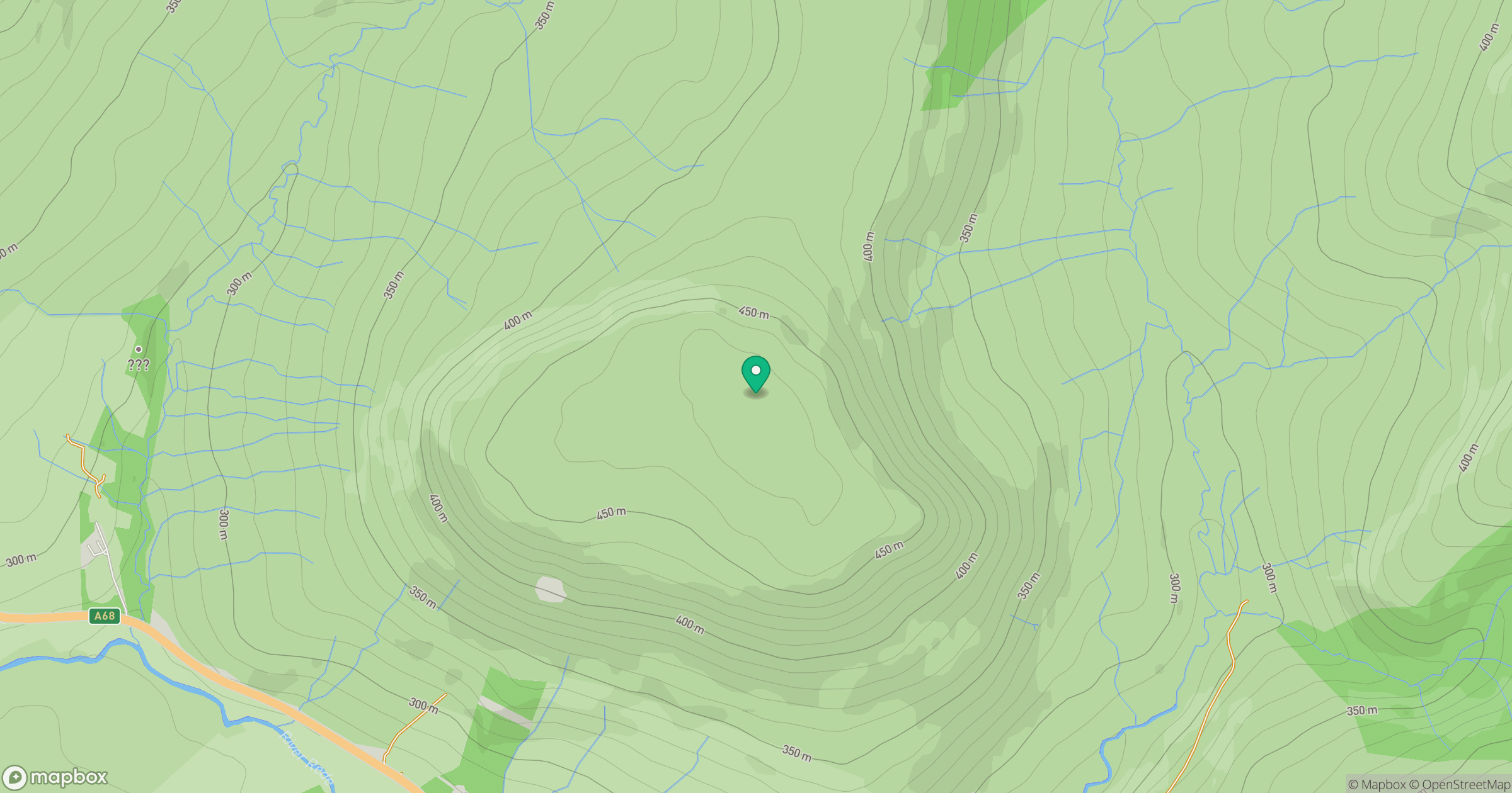
Grid reference: NT726054
View on OpenStreetMapOpens a map in a new tab, centred on the hill.
No comments yet. Be the first.