

Wharncliffe Chase
Good walks are even better shared.
SK3196 : Wharncliffe Chase
Dave Pickersgill Photo source
Overview
Wharncliffe Chase
Introduction
Wharncliffe Chase, standing at a modest 144 meters, is more than just a hill; it's a treasure trove for history lovers and outdoor enthusiasts alike. Nestled in the picturesque South Yorkshire region, it offers a quick escape from city life into the embrace of nature.
Geology
This area boasts unique geology, primarily sandstone that dates back to the Carboniferous period. Looking for fossils? Wharncliffe Chase might just have a few to offer! The layers tell tales of an ancient world, forming a landscape both rugged and beautiful.
Routes and Trails
Hikers are spoiled for choice with routes that suit all skill levels.
- Wharncliffe Woods Trail: A delightful 4.5 km circular path that meanders through verdant woods and leads directly to the summit. Perfect for families and casual walkers!
- Crags Trail: For those who fancy a challenge, this 3.0 km route ascends the crags with a rewarding view at the top. Definitely not for the faint-hearted, but the vistas are worth it!
Summit Features
At the top, you'll discover a trig point that acts as a perfect vantage spot. It's the ideal throne for nature lovers and photographers seeking to make their friends green with envy!
Terrain and Views
The varied terrain is a mix of rocky outcrops, grassy slopes, and delightful woodland paths. As you climb, be on the lookout for the breathtaking views that stretch over the Rother Valley and into the Peak District. Spring and autumn are prime times to visit for spectacular colours and clearer skies without losing your breath from the heat!
Hazards
A quick note of caution: The paths can be slippery when wet, so keep your wits about you. And while deer are picturesque, they can be quite unpredictable!
Nearby Summits
A few peaks that might pique your interest include Black Hill (177 m) and Hunshelf Bank (307 m), offering further adventures for the keen peak bagger.
Access and Facilities
For car drivers, Wharncliffe Woods car park is conveniently located off the A6101, with room for plenty. Alternatively, express buses bring you within striking distance from towns like Sheffield. If you're feeling a tad peckish post-hike, The Old Bramall Lane Café awaits with treats and loo facilities!
History and Significance
The name 'Wharncliffe' hints at enchanting stories of yore, with rich history intertwined in the very bones of this place. Historically a hunting ground, tales of hermits and treasures add an exciting edge to your hiking experience.
In a nutshell, Wharncliffe Chase wraps history, geology, and vibrant views in a rather delightful package, making it an essential outing for anyone looking to enjoy the great outdoors. So lace up those hiking boots and let the adventure begin!
Enjoy the trails, and don’t forget to stop and smell the wildflowers!
Explore routes near Wharncliffe Chase
Walks starting near this hill. Open a route to check its map, distance and full itinerary.
Wharncliffe Woods Plank Gate Return
View route
Wortley and Thurgoland Tunnel Return
View route
Worsbrough Mill and Reservoir Circuit
View route
Elsecar Greenway and the Old Canal
View route
Route planning notes
These notes describe possible approaches. Check a route's map and access information when planning your walk.
Wharncliffe Woods Trail
A circular route winding through lush woodlands and up to the summit, offering a blend of nature and views.
Crags Trail
Starting from the craggy edges, this route leads to panoramic views from the summit, perfect for those who enjoy a bit of a climb.
Make a day of it, together
Find someone to share the walk with, or organise a day out along a route you like.
Photo Gallery
View all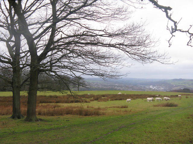 Photo could not load
SK3196 : Wharncliffe Chase
Dave Pickersgill
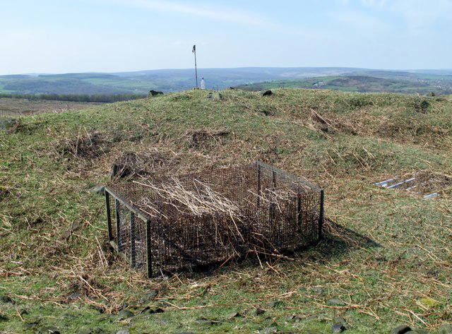 Photo could not load
SK3196 : Wharncliffe Chase
Rude Health
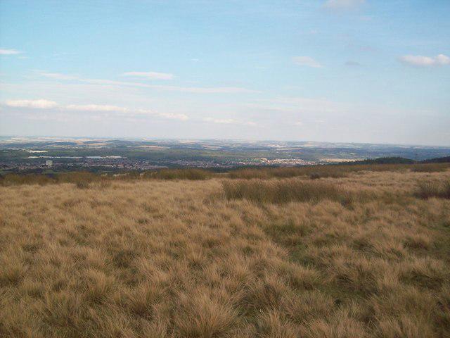 Photo could not load
SK3196 : A Commanding View from Wharncliffe Chase
Jonathan Clitheroe
Hill facts and local notes
Classifications
Elevation
319m
1,046 ft
Prominence
103m
Coordinates
53.4631, -1.5288
SK313963
OS Map
110 111
Explorer: OL1E 278S
At the Summit
The summit features a prominent trig point, surrounded by a stunning array of heathland and grass giving hikers a natural carpet beneath their feet.
Terrain & Geology
Wharncliffe Chase is predominantly composed of sandstone, which dates back to the Carboniferous period. The exposed rock formations reveal interesting strata and fossils.
Views & Scenery
On a clear day, you can see across the Rother Valley, with striking views of the Peak District to the west and the skyline of Sheffield to the south.
History & Heritage
Name Origin
The name 'Wharncliffe' is derived from Old English 'hwern', meaning 'swirl', and 'clif', meaning 'cliff', reflecting its rugged terrain.
Historical Significance
Historically, Wharncliffe Chase was part of a hunting ground and is steeped in folklore, including tales of local hermits and hidden treasures.
Getting There & Facilities
Parking
Parking is available at the Wharncliffe Woods car park, located off the A6101, with ample space for vehicles.
Public Transport
Accessible by bus routes connecting to nearby towns such as Sheffield and Barnsley, with stops at convenient points near trailheads.
Nearby Facilities
Nearby facilities include The Old Bramall Lane Café, providing refreshments and restrooms, as well as picnic areas within Wharncliffe Woods.
Safety Information
Known Hazards
- Slippery paths in wet weather, wildlife such as deer crossing paths unexpectedly, and steep drops along certain trails.
General Safety Tips
- Check weather conditions before setting out
- Carry appropriate clothing and equipment
- Let someone know your planned route
- Take a map, compass, and GPS device
- Carry emergency supplies: food, water, first aid kit, torch
Hills
Some common questions about the hills answered
Are there group walks up Wharncliffe Chase?
Many walkers use Walkmates to join or organise walks with others. You can check for group walks around Wharncliffe Chase through the maps
Are there other walkers around Wharncliffe Chase?
Activity varies by location and time, but Walkmates lets you see whether others have shared walks or shown interest in this area. Find other people through the walking friends search walking friends for Wharncliffe Chase search or of course create your own walk for Wharncliffe Chase
Can I organise a walk to Wharncliffe Chase?
Yes. If there aren’t any walks listed already, you can create a walk and make it available for others to join.
If you're signed up to Walkmates, you can create a walk to Wharncliffe Chase.
How do I find a walk up this hill?
There are often multiple ways to walk this hill, depending on experience and route preference. Walkmates helps you explore walks and routes that others have shared.
Can I suggest a new route up Wharncliffe Chase?
Yes. You can suggest or create routes to share with others. Walkmates focuses on the social side of walking, so routes are used to help people organise walks and explore areas together, rather than as detailed navigation tools or route libraries.
Other uses really appreciate knowledgeable walkers sharing their routes. Share your favourite route to Wharncliffe Chase here
The is an error or something incorrect about this hill. How do I let you know?
We always strive to keep the information on Walkmates as accurate as possible. If you find an error, please let us know through the contact form and we'll aim to correct it as quickly as possible
Community Discussion
Comments
Location
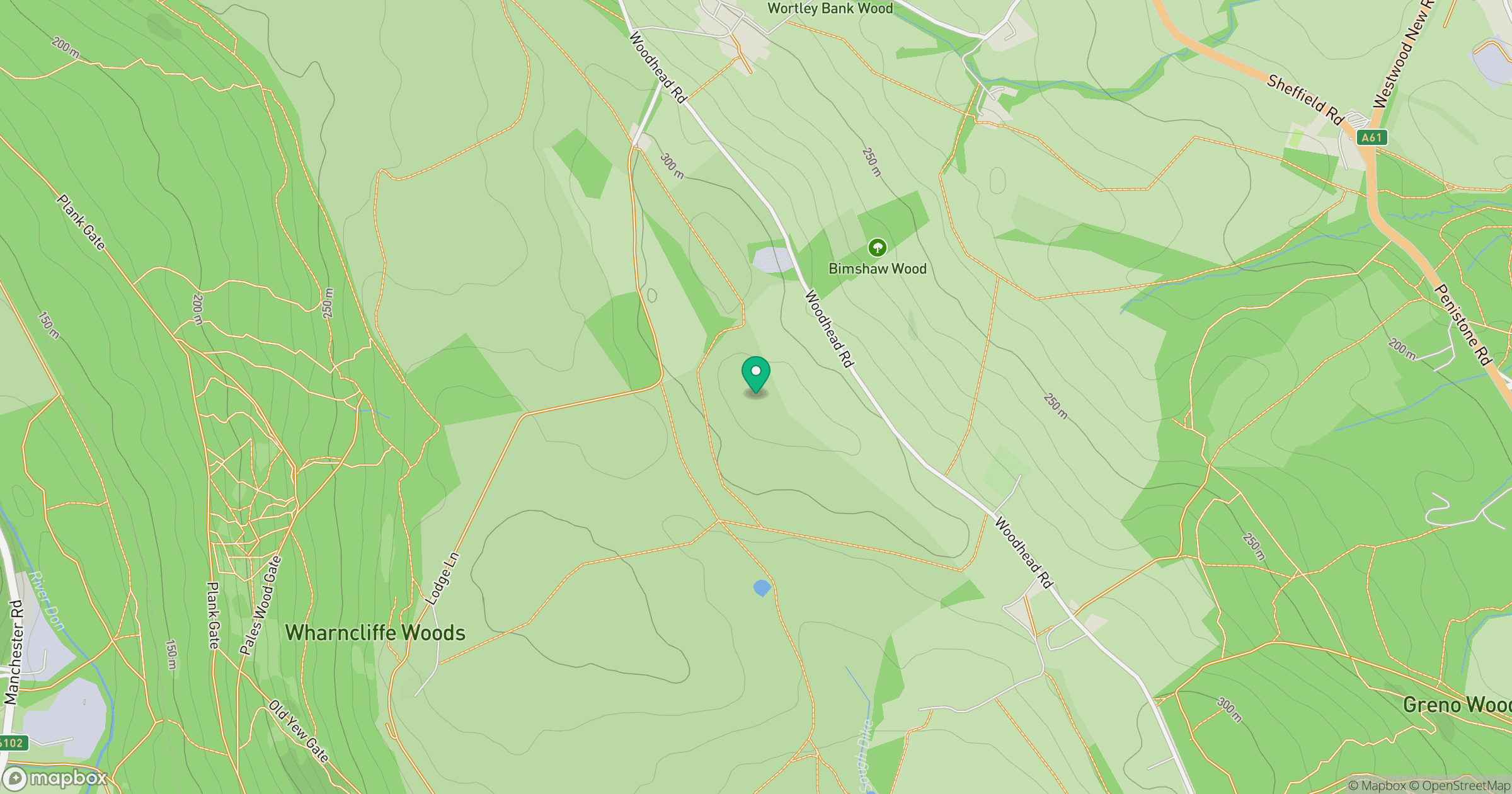
Grid reference: SK313963
View on OpenStreetMapOpens a map in a new tab, centred on the hill.
Nearby Hills

Kinder Scout
636m
Rombalds Moor [Ilkley Moor]
402m
The Roaches
505m

Pendle Hill
557m
Buckden Pike
702m
No comments yet. Be the first.