

Holmbury Hill
Good walks are even better shared.
TQ1043 : Give Us Your Money!
Colin Smith Photo source
Overview
Holmbury Hill is a 261 m sandstone hill in the Surrey Hills. Woodland paths lead to views over the Weald and the earthworks of Holmbury Camp, an Iron Age hillfort. The precise high ground is northwest of the stone structure, rather than the viewpoint itself.
Holmbury Hill
Holmbury Hill is a 261 m sandstone hill in the Surrey Hills. Woodland paths lead to views over the Weald and the earthworks of Holmbury Camp, an Iron Age hillfort. The precise high ground is northwest of the stone structure, rather than the viewpoint itself.
Summit
DoBIH records the high ground 10 m northwest of a stone structure at TQ 10386 42959. A grassy path junction 110 m northwest is almost as high. The toposcope and memorial are landmarks, not a surveyed trig-point summit.
Routes
Holmbury Hill and Holmbury St Mary from Hurtwood car park 1 (circuit)
Start and finish at Hurtwood car park 1 on Radnor Road, TQ098431. Take woodland tracks past the pond, descend steeply to The Glade and Holmbury St Mary, then climb via Holmbury Hill Road, the cricket ground and the Greensand Way to the fort and toposcope. From the memorial seat take the left-hand path over the earthworks, follow the escarpment, pass the pond and shallow gully, and return to car park 1. Friends of the Hurtwood gives 3 miles (about 4.83 km) and 1¾ hours for this complete circuit; no ascent total is supplied. It reaches the hilltop viewpoint but does not explicitly identify the precise natural high point 10 m northwest of the stone structure. Check forestry notices and car-park gates.
Terrain and safety
Unsurfaced woodland tracks, heathland and steep slopes. The described village circuit has a steep wooded descent and a sustained climb; paths can become muddy and slippery.
Rough paths, roots, steep slopes and mud can make footing difficult, especially in wet weather. Trails are shared with cyclists and horse riders. Follow forestry notices, keep clear of machinery and keep dogs under control. Follow the Hurtwood Code: no fires, barbecues or camping. Check local notices; this page does not certify current access or gate status.
Access and facilities
The described circuit uses Hurtwood car park 1 on Radnor Road near Peaslake, TQ098431. Check the gate and local notices before travelling; a parking space or an open gate is not guaranteed.
The hilltop area has a toposcope, memorial seat and interpretation boards. Village refreshments require a separate opening check. No on-hill café or toilet service has been established by this review.
Geology and history
BGS 1:50,000 mapping places the summit in Early Cretaceous Hythe Formation sandstone. This is generalized bedrock mapping, not an identification of every exposed rock. The earlier Triassic attribution was incorrect.
Holmbury Camp is a scheduled Iron Age hillfort, National Heritage List entry 1013183. Multiple earthworks survive above the Weald. Published accounts disagree about its precise chronology and first excavation date, so those dates are not asserted here.
Views
The hilltop and escarpment overlook the Weald. Distant views depend on visibility.
Explore routes near Holmbury Hill
Walks starting near this hill. Open a route to check its map, distance and full itinerary.
Leith Hill: woodland circuit from Starveall Corner
View route
Prospects of Polesden from Denbies Hillside
View route
Box Hill - Stepping Stones Circuit
View route
Winkworth Arboretum: woodland and Rowe’s Flashe lake
View route
Route planning notes
These notes describe possible approaches. Check a route's map and access information when planning your walk.
Holmbury Hill and Holmbury St Mary from Hurtwood car park 1 (circuit)
Start and finish at Hurtwood car park 1 on Radnor Road, TQ098431. Take woodland tracks past the pond, descend steeply to The Glade and Holmbury St Mary, then climb via Holmbury Hill Road, the cricket ground and the Greensand Way to the fort and toposcope. From the memorial seat take the left-hand path over the earthworks, follow the escarpment, pass the pond and shallow gully, and return to car park 1. Friends of the Hurtwood gives 3 miles (about 4.83 km) and 1¾ hours for this complete circuit; no ascent total is supplied. It reaches the hilltop viewpoint but does not explicitly identify the precise natural high point 10 m northwest of the stone structure. Check forestry notices and car-park gates.
Make a day of it, together
Find someone to share the walk with, or organise a day out along a route you like.
Photo Gallery
View all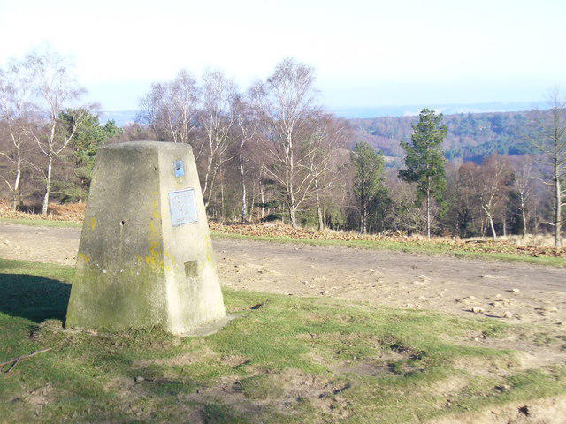 Photo could not load
TQ1043 : Give Us Your Money!
Colin Smith
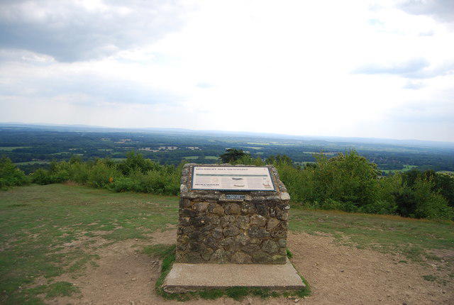 Photo could not load
TQ1042 : Viewing point, Holmbury Hill
N Chadwick
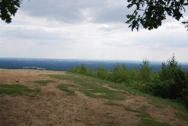 Photo could not load
TQ1042 : View from Holmbury Hill
N Chadwick
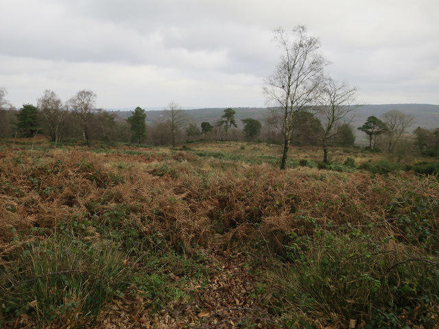 Photo could not load
TQ1042 : Inside the fort, Holmbury Hill
Hugh Venables
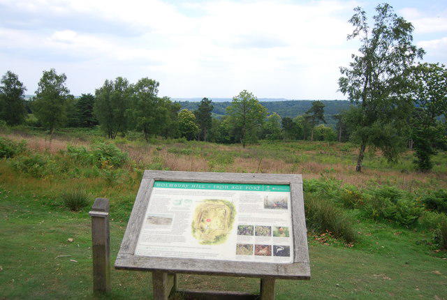 Photo could not load
TQ1042 : Information board, Holmbury Hill
N Chadwick
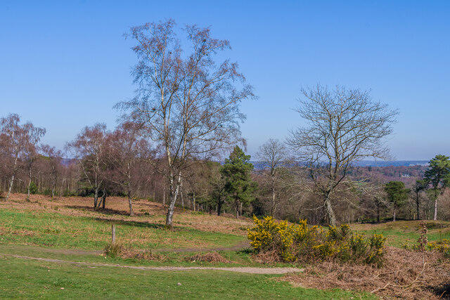 Photo could not load
TQ1042 : Holmbury Hill
Ian Capper
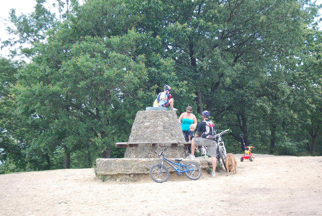 Photo could not load
TQ1042 : Cairn, Holmbury Hill
N Chadwick
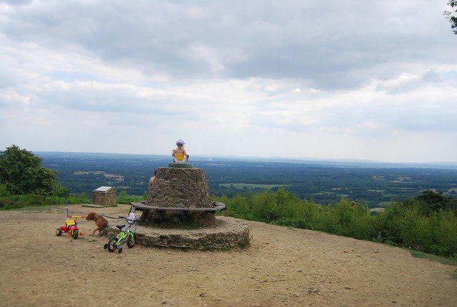 Photo could not load
TQ1042 : Cairn, Holmbury Hill
N Chadwick
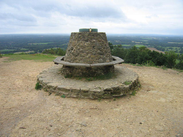 Photo could not load
TQ1042 : Holmbury Hill
Rude Health
TQ1043 : Hurt Wood
N Chadwick
Hill facts and local notes
Classifications
Elevation
261m
856 ft
Prominence
107m
Coordinates
51.1752, -0.4223
TQ103429
OS Map
187
Explorer: 146
At the Summit
DoBIH records the high ground 10 m northwest of a stone structure at TQ 10386 42959. A grassy path junction 110 m northwest is almost as high. The toposcope and memorial are landmarks, not a surveyed trig-point summit.
Terrain & Geology
BGS 1:50,000 mapping places the summit in Early Cretaceous Hythe Formation sandstone. This is generalized bedrock mapping, not an identification of every exposed rock. The earlier Triassic attribution was incorrect.
Views & Scenery
The hilltop and escarpment overlook the Weald. Distant views depend on visibility.
History & Heritage
Historical Significance
Holmbury Camp is a scheduled Iron Age hillfort, National Heritage List entry 1013183. Multiple earthworks survive above the Weald. Published accounts disagree about its precise chronology and first excavation date, so those dates are not asserted here.
Getting There & Facilities
Parking
The described circuit uses Hurtwood car park 1 on Radnor Road near Peaslake, TQ098431. Check the gate and local notices before travelling; a parking space or an open gate is not guaranteed.
Nearby Facilities
The hilltop area has a toposcope, memorial seat and interpretation boards. Village refreshments require a separate opening check. No on-hill café or toilet service has been established by this review.
Safety Information
Known Hazards
- Rough paths, roots, steep slopes and mud can make footing difficult, especially in wet weather.
- Trails are shared with cyclists and horse riders. Follow forestry notices, keep clear of machinery and keep dogs under control.
- Follow the Hurtwood Code: no fires, barbecues or camping. Check local notices; this page does not certify current access or gate status.
General Safety Tips
- Check weather conditions before setting out
- Carry appropriate clothing and equipment
- Let someone know your planned route
- Take a map, compass, and GPS device
- Carry emergency supplies: food, water, first aid kit, torch
Hills
Some common questions about the hills answered
Are there group walks up Holmbury Hill?
Many walkers use Walkmates to join or organise walks with others. You can check for group walks around Holmbury Hill through the maps
Are there other walkers around Holmbury Hill?
Activity varies by location and time, but Walkmates lets you see whether others have shared walks or shown interest in this area. Find other people through the walking friends search walking friends for Holmbury Hill search or of course create your own walk for Holmbury Hill
Can I organise a walk to Holmbury Hill?
Yes. If there aren’t any walks listed already, you can create a walk and make it available for others to join.
If you're signed up to Walkmates, you can create a walk to Holmbury Hill.
How do I find a walk up this hill?
There are often multiple ways to walk this hill, depending on experience and route preference. Walkmates helps you explore walks and routes that others have shared.
Can I suggest a new route up Holmbury Hill?
Yes. You can suggest or create routes to share with others. Walkmates focuses on the social side of walking, so routes are used to help people organise walks and explore areas together, rather than as detailed navigation tools or route libraries.
Other uses really appreciate knowledgeable walkers sharing their routes. Share your favourite route to Holmbury Hill here
The is an error or something incorrect about this hill. How do I let you know?
We always strive to keep the information on Walkmates as accurate as possible. If you find an error, please let us know through the contact form and we'll aim to correct it as quickly as possible
Community Discussion
Comments
Location
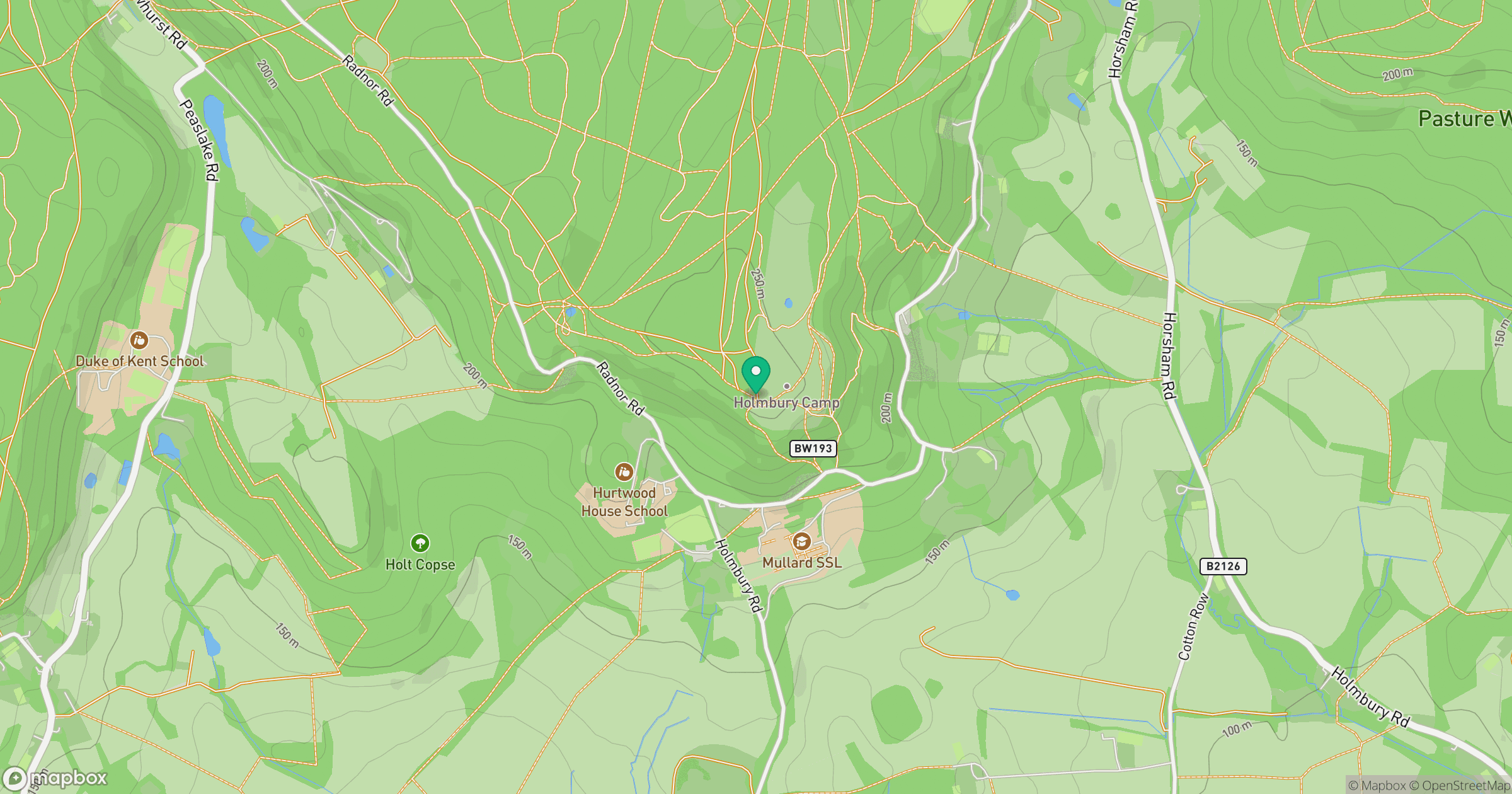
Grid reference: TQ103429
View on OpenStreetMapOpens a map in a new tab, centred on the hill.
Nearby Hills
Leith Hill
294m
Ditchling Beacon
248m
Worcestershire Beacon
425m
Glastonbury Tor
158m
Titterstone Clee Hill
533m
No comments yet. Be the first.