

Reigate Hill
Good walks are even better shared.
TQ2552 : Masts, Reigate Hill
Ian Capper Photo source
Overview
Reigate Hill
Reigate Hill rises to 234.7 m on Surrey’s North Downs. DoBIH records 100.1 m prominence and HuMP status, rather than Marilyn status.
Locating the summit
The recorded high point is unmarked ground on the track near the west end of Reigate Fort, TQ 25548 52097. DoBIH notes potentially higher natural ground 25 m west at TQ 25522 52100. The ground 30 m ESE at TQ 25576 52080 is 0.4 m higher but artificial. Preserve this uncertainty; the fort, viewpoints and masts are not substitutes for the recorded high point.
Complete return walks
The route cards describe two National Trust circuits through the fort corridor. The Wray Lane walk is 5.28 km with a stated 2–2¼ hours. The Margery Wood circuit is 5.92 km with 1½ hours stated. Neither source gives total ascent. Both return to their own car park, but their descriptions and published mapping do not certify precise high-point completion.
These are moderate countryside walks with steep slopes, uneven chalk and road sections. The full circuits are not wheelchair or pushchair routes. A relatively level approach to the fort does not establish accessibility for the whole circuit.
Landscape and history
The hill belongs to the chalk escarpment. BGS describes the region’s chalk as marine limestone; no specific summit formation is assigned here. Reigate Fort was built in 1898 as part of London’s defences and later reused during the Second World War. The place-name has a possible roe-deer and gate interpretation, rather than an established “road gate” meaning.
Planning a visit
Use the correct Wray Lane or Margery Wood starting point. Check parking arrangements, facilities and current transport before travelling. Follow local signs, keep dogs controlled around livestock and remain outside private or closed areas. Surrey’s Colley Hill is a local route landmark; no unrelated hill record is associated with it.
Explore routes near Reigate Hill
Walks starting near this hill. Open a route to check its map, distance and full itinerary.
Reigate Hill B-17 Crash Site and Colley Hill
View route
Box Hill - Stepping Stones Circuit
View route
Coulsdon Walk with Men Walking & Talking
View route
Prospects of Polesden from Denbies Hillside
View route
Route planning notes
These notes describe possible approaches. Check a route's map and access information when planning your walk.
Reigate Hill and fort corridor circuit from Wray Lane
From Wray Lane car park (TQ262523), cross the footbridge and walk west along the North Downs Way past Reigate Fort, the crash glade and Inglis Memorial. At the T-junction take the tarmac track past the Coal Tax post and descend steeply. Turn left at the lower crossroads through yew woodland; follow the marked steps and paths to Underhill Park Road. At its bend climb left, then sharp left onto the Millennium-trail chalk ascent past the Simpson Memorial. Pass the gate, turn right up steps to Inglis Memorial, then return east on the North Downs Way and footbridge to Wray Lane. National Trust gives 5.28 km and 2–2¼ hours; no ascent figure. This full circuit passes the fort corridor but does not certify the precise unmarked summit. It includes steep slopes, steps and a road section and is not wholly waymarked.
Margery Wood circuit via Reigate Fort and Pilgrims Way
From Margery Wood car park (TQ245527), walk south through the wood and cross the M25 footbridge. Turn east along the North Downs Way past Inglis Memorial and the crash glade to Reigate Fort. Beyond the fort cottages turn right downhill, take the right fork, then turn left at the lower fence to the road. Go right, then right after Pilgrim’s Cottage; continue west on Pilgrims Way. At the major crossing turn hard right to climb Juniper Hill. Turn right twice onto the eastbound North Downs Way, cross Colley Hill and return via the original water-tower landmark, motorway bridge and woodland to Margery Wood. National Trust gives 5.92 km and 1½ hours; no ascent figure. The fort corridor is included, but precise unmarked-summit completion is unverified. Expect steep slopes, road sections and a narrow footbridge.
Make a day of it, together
Find someone to share the walk with, or organise a day out along a route you like.
Photo Gallery
View all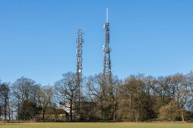 Photo could not load
TQ2552 : Masts, Reigate Hill
Ian Capper
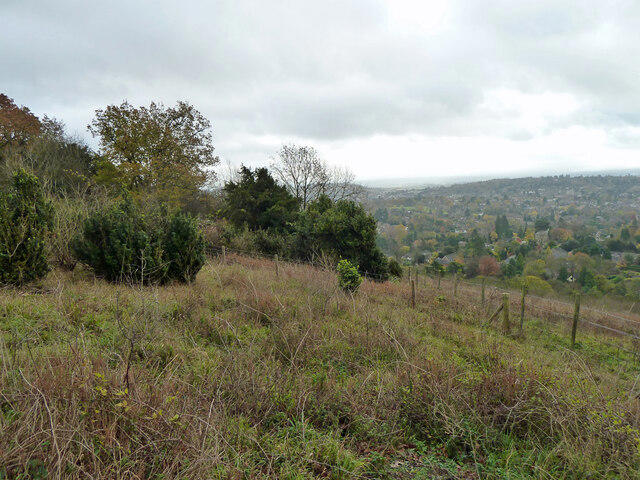 Photo could not load
TQ2551 : Slopes below Reigate Fort
Robin Webster
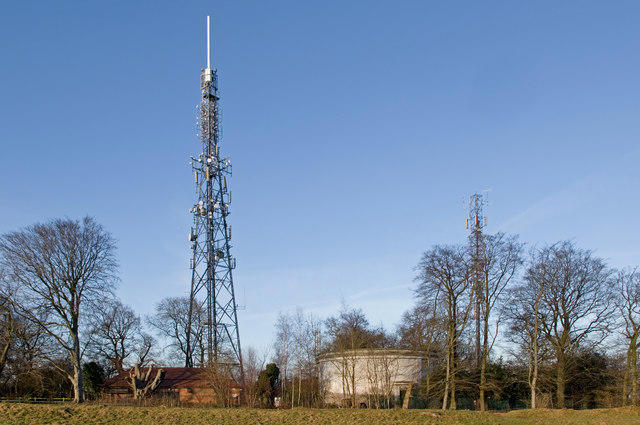 Photo could not load
TQ2552 : Reigate Hill masts and water tower
Ian Capper
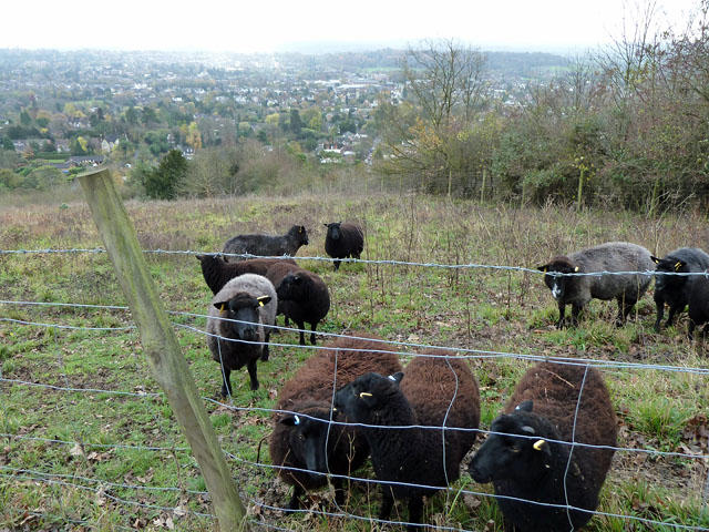 Photo could not load
TQ2551 : Black sheep on Reigate Hill
Robin Webster
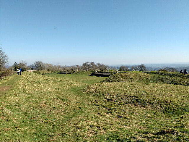 Photo could not load
TQ2552 : Reigate Fort
Robin Webster
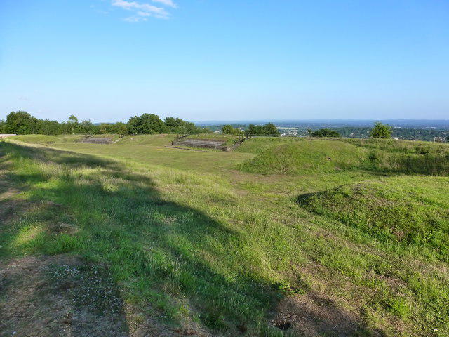 Photo could not load
TQ2552 : Reigate Fort
Ian Paterson
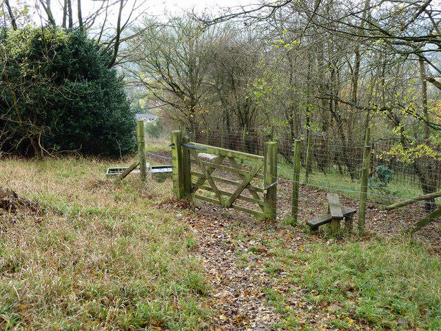 Photo could not load
TQ2551 : Gate and stile on Reigate Hill
Robin Webster
 Photo could not load
TQ2552 : B17 crash memorial, Reigate Hill
Ian Capper
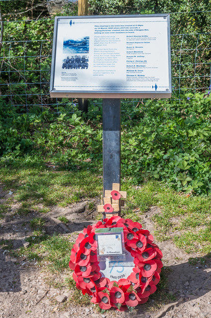 Photo could not load
TQ2552 : B17 crash memorial, Reigate Hill
Ian Capper
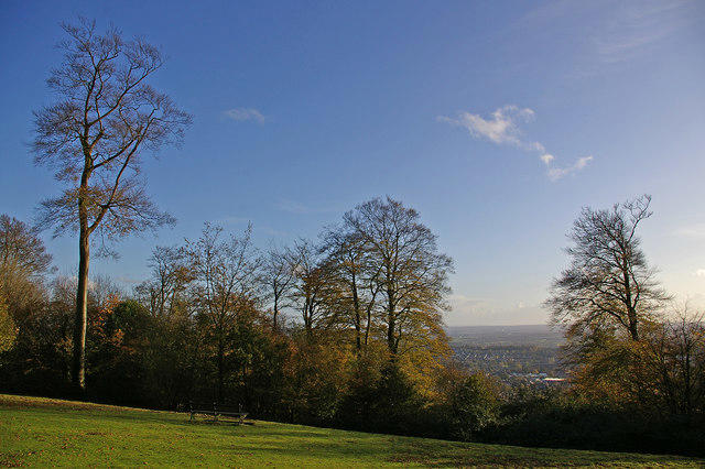
TQ2552 : Memorial Seat, Reigate Hill
Ian Capper
Hill facts and local notes
Classifications
Elevation
235m
770 ft
Prominence
100m
Coordinates
51.2542, -0.2023
TQ255520
OS Map
187
Explorer: 146
At the Summit
DoBIH records unmarked ground on the track near the west end of Reigate Fort, at TQ 25548 52097, 234.7 m. Ground 25 m west in trees north of the track (TQ 25522 52100) may be higher. Ground 30 m ESE (TQ 25576 52080) is 0.4 m higher but man-made. There is no recorded summit trig point.
Terrain & Geology
Reigate Hill is part of the North Downs chalk escarpment, as described by the National Trust. BGS explains the region’s Chalk as fine-grained limestone formed largely from calcareous marine remains during the Late Cretaceous. The exact chalk formation at the recorded summit has not been independently established here.
Views & Scenery
The National Trust describes views from the Inglis Memorial and scarp viewpoints across the Weald, toward Box Hill, Leith Hill and the South Downs. These viewpoints are distinct from the unmarked summit ground; visibility varies.
History & Heritage
Name Origin
Roger Ellaby discusses a possible roe-deer element combined with “gate”, perhaps referring to access to woodland, in Surrey’s Past (February 2022). This remains an interpretation of the town’s name, not a proven “road gate” derivation or a date for naming the hill.
Historical Significance
The National Trust dates Reigate Fort to 1898. Historic England identifies it as a London mobilisation centre, records its sale in 1907 and its reuse by Canadian troops during the Second World War. The fort and its buildings are distinct from the unmarked hill summit; building access is subject to site arrangements.
Getting There & Facilities
Parking
The Wray Lane circuit starts at Wray Lane car park, TQ262523. The other circuit starts at Margery Wood, TQ245527. Margery Wood requires parking validation and charges apply to non-members; National Trust guidance warns of no phone signal there. Check current tariffs and availability.
Public Transport
National Trust guidance identifies Reigate station and an uphill pavement approach beside the A217, using the footbridge to cross the road. It also lists local bus approaches; current operator timetables and return services have not been checked.
Nearby Facilities
A kiosk and toilets are listed at Wray Lane car park, separate from the summit and fort. The main National Trust page links toilet access to kiosk opening hours; check current operation rather than relying on a fixed schedule.
Safety Information
Known Hazards
- Full circuits contain steep or uneven slopes and steps and are not suitable for wheelchairs or pushchairs.
- Watch for vehicles on road sections; the Margery Wood circuit uses a narrow footbridge over the M25.
- Keep dogs on a short lead around grazing livestock and follow current signs, diversions and tree-work exclusions.
- No mine, tunnel, private cottage or closed utility-compound entry is part of these routes.
General Safety Tips
- Check weather conditions before setting out
- Carry appropriate clothing and equipment
- Let someone know your planned route
- Take a map, compass, and GPS device
- Carry emergency supplies: food, water, first aid kit, torch
Hills
Some common questions about the hills answered
Are there group walks up Reigate Hill?
Many walkers use Walkmates to join or organise walks with others. You can check for group walks around Reigate Hill through the maps
Are there other walkers around Reigate Hill?
Activity varies by location and time, but Walkmates lets you see whether others have shared walks or shown interest in this area. Find other people through the walking friends search walking friends for Reigate Hill search or of course create your own walk for Reigate Hill
Can I organise a walk to Reigate Hill?
Yes. If there aren’t any walks listed already, you can create a walk and make it available for others to join.
If you're signed up to Walkmates, you can create a walk to Reigate Hill.
How do I find a walk up this hill?
There are often multiple ways to walk this hill, depending on experience and route preference. Walkmates helps you explore walks and routes that others have shared.
Can I suggest a new route up Reigate Hill?
Yes. You can suggest or create routes to share with others. Walkmates focuses on the social side of walking, so routes are used to help people organise walks and explore areas together, rather than as detailed navigation tools or route libraries.
Other uses really appreciate knowledgeable walkers sharing their routes. Share your favourite route to Reigate Hill here
The is an error or something incorrect about this hill. How do I let you know?
We always strive to keep the information on Walkmates as accurate as possible. If you find an error, please let us know through the contact form and we'll aim to correct it as quickly as possible
Community Discussion
Comments
Location
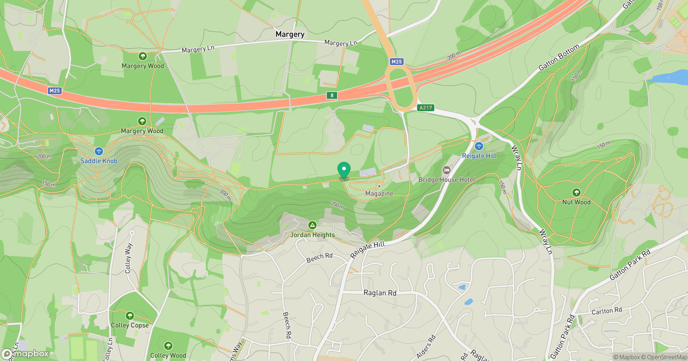
Grid reference: TQ255520
View on OpenStreetMapOpens a map in a new tab, centred on the hill.
Nearby Hills
Leith Hill
294m
Ditchling Beacon
248m
Worcestershire Beacon
425m
Glastonbury Tor
158m
The Roaches
505m
No comments yet. Be the first.