
Black Down
Good walks are even better shared.
Overview
Black Down, West Sussex
This is Black Down at SU919296 near Haslemere, DoBIH 2908. Its 280.8 m summit is the wooded knoll at SU 91946 29634. DoBIH records the knoll as about 20 m north-north-east of the trig point and 0.7 m higher. The hill is the highest point in West Sussex and the South Downs National Park, but the Temple of the Winds is a separate viewpoint rather than the exact summit.
A full-return walk
The National Trust’s Temple of the Winds trail begins and ends at the main car park on Tennyson’s Lane. Its published total is 3.2 km, taking about 1 hour 30 minutes. The route climbs the sunken track, passes bog ponds and Five Ways, heads south across the heath, visits the Temple of the Winds, then returns north through beech woodland to the starting track and car park. Total ascent is not stated.
The route is promoted for landscape and views. Its description does not certify a visit to the exact summit knoll. Any added summit detour changes the published totals. The Trust’s trail and property pages also give inconsistent parking coordinates and postcodes; use the named main car park and current site signs, and check the route map before setting out.
Landscape and history
Black Down is part of the Lower Greensand landscape of the western Weald. Sandstone, chert and underlying clay shape the slopes, and the British Geological Survey records deformation of the strata on the hill’s eastern side. This is not a chalk-and-flint summit. Prehistoric flint tools found here were brought into a landscape where the National Trust says flint does not occur naturally.
Historic tracks reflect stock movement, woodland work and quarrying. W. E. Hunter’s 1948 gift to the National Trust is commemorated at the Temple of the Winds. The heath and woodland outlooks are also associated with Tennyson. Gibbet Hill at Hindhead is a separate 272 m hill; it is not included in this circuit.
Planning and safety
The National Trust lists free parking on Tennyson’s Lane, with no camping or overnight stays. There is no toilet on site; the Trust directs visitors to public toilets in Haslemere. Train or bus travel requires an additional uphill approach that is not part of the short trail’s totals.
Take care on roots, uneven slopes and wet ground near bog ponds. Cattle graze throughout the year and dogs must be on leads. Open viewpoints may be windy, while trees can obscure the high-point knoll. Carry a suitable map and follow current access notices.
Explore routes near Black Down
Walks starting near this hill. Open a route to check its map, distance and full itinerary.
Hindhead Sailor's Stroll to Gibbet Hill
View route
Petworth Park: Capability Brown Hills and Lower Pond Circuit
View route
Petworth Walk with Men Walking & Talking
View route
Winkworth Arboretum: woodland and Rowe’s Flashe lake
View route
Route planning notes
These notes describe possible approaches. Check a route's map and access information when planning your walk.
Temple of the Winds woodland and heath circuit
Start and finish at the main National Trust car park on Tennyson’s Lane. Follow the Trust’s twelve-stage route uphill through the gate and sunken track, take the right fork past bog ponds, then the southbound path at Five Ways across the western heath. Turn uphill towards the woodland ridge and descend the signed path to the Temple of the Winds. Retrace that viewpoint spur, then follow the northbound path through the beech woodland and descend the sunken track to the original car park. The Trust gives 3.2 km and 1 hour 30 minutes for the full circuit; total ascent is not published. The viewpoint is not the exact summit knoll, and the route description does not establish contact with that knoll. The Trust’s pages give conflicting car-park grids and postcodes: use the named main car park and current signs rather than treating the trail-header coordinate as verified. https://www.nationaltrust.org.uk/visit/sussex/black-down/black-down-temple-of-the-winds-trail
Make a day of it, together
Find someone to share the walk with, or organise a day out along a route you like.
Hill facts and local notes
Classifications
Elevation
281m
921 ft
Prominence
192m
Coordinates
51.0586, -0.6894
SU919296
OS Map
186 197
Explorer: OL33 133
At the Summit
The 280.8 m summit is a wooded knoll at SU 91946 29634. DoBIH places it about 20 m north-north-east of the trig pillar at SU 91935 29612 and 0.7 m higher. The trig pillar and Temple of the Winds viewpoint are not the exact high point.
Terrain & Geology
Black Down belongs to the Lower Greensand landscape of the western Weald. The Hythe Beds include sandstone and chert, with underlying clay contributing to slope deformation; the British Geological Survey specifically records cambering on Black Down’s eastern side. The National Trust states that the prehistoric flint artefacts found here are not naturally occurring summit flint.
Views & Scenery
The Temple of the Winds and heathland viewpoints look over the western Weald towards the South Downs. The wooded high-point knoll should not be confused with the open viewpoint; distant visibility varies.
History & Heritage
Name Origin
A reliable derivation of “Black Down” is not established by the checked sources. The earlier explanation based on dark summit flint is unsupported: the National Trust states that flint does not occur naturally here.
Historical Significance
The National Trust records prehistoric flint tools and a network of historic tracks used for stock, woodland work and quarrying. W. E. Hunter gave Black Down to the Trust in 1948 in memory of his wife; the stone seat at the Temple of the Winds commemorates them. Tennyson is associated with the landscape and its views.
Getting There & Facilities
Parking
Use the signed main National Trust car park on Tennyson’s Lane for the Temple of the Winds circuit. The current property page lists free main and middle parking around SU920309, with a separate lower car park farther along the lane. Its grid/postcode details differ from the trail page, so check the current map and signs rather than relying on a single unverified coordinate. No camping or overnight stays.
Public Transport
Haslemere is the rail gateway. The National Trust describes the station as about 2 miles from Black Down and provides links for local buses, but this is not a verified station-to-summit route total. Check current rail/bus times and plan the uphill walking approach separately from the 3.2 km trail.
Nearby Facilities
The National Trust confirms that there is no toilet on site. It points visitors to non-Trust public toilets in the Waitrose car park in Haslemere; check their opening arrangements. The walking route has seats and viewpoints, but on-site refreshments are not confirmed.
Safety Information
Known Hazards
- Tree roots, uneven paths and sloping ground can be slippery; take particular care on the descent to the Temple of the Winds.
- Bog ponds and wet heath lie close to some tracks. Stay on established routes and supervise children near water and steep slopes.
- Livestock graze throughout the year. Keep dogs on leads and follow current notices.
- Camping and overnight stays are not permitted in the National Trust car parks. Confirm the intended main car park because published grid references differ.
General Safety Tips
- Check weather conditions before setting out
- Carry appropriate clothing and equipment
- Let someone know your planned route
- Take a map, compass, and GPS device
- Carry emergency supplies: food, water, first aid kit, torch
Hills
Some common questions about the hills answered
Are there group walks up Black Down?
Many walkers use Walkmates to join or organise walks with others. You can check for group walks around Black Down through the maps
Are there other walkers around Black Down?
Activity varies by location and time, but Walkmates lets you see whether others have shared walks or shown interest in this area. Find other people through the walking friends search walking friends for Black Down search or of course create your own walk for Black Down
Can I organise a walk to Black Down?
Yes. If there aren’t any walks listed already, you can create a walk and make it available for others to join.
If you're signed up to Walkmates, you can create a walk to Black Down.
How do I find a walk up this hill?
There are often multiple ways to walk this hill, depending on experience and route preference. Walkmates helps you explore walks and routes that others have shared.
Can I suggest a new route up Black Down?
Yes. You can suggest or create routes to share with others. Walkmates focuses on the social side of walking, so routes are used to help people organise walks and explore areas together, rather than as detailed navigation tools or route libraries.
Other uses really appreciate knowledgeable walkers sharing their routes. Share your favourite route to Black Down here
The is an error or something incorrect about this hill. How do I let you know?
We always strive to keep the information on Walkmates as accurate as possible. If you find an error, please let us know through the contact form and we'll aim to correct it as quickly as possible
Community Discussion
Comments
Location
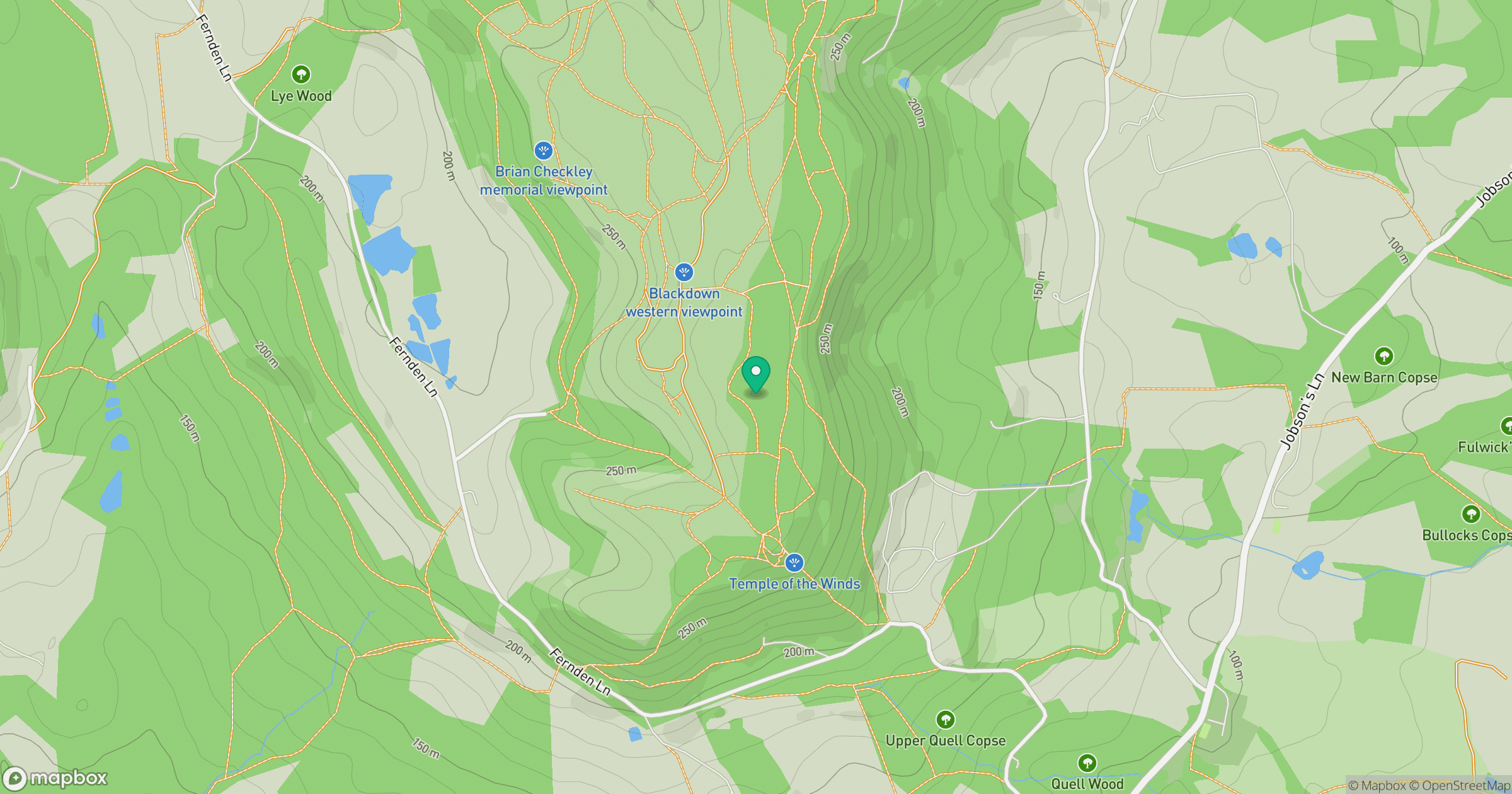
Grid reference: SU919296
View on OpenStreetMapOpens a map in a new tab, centred on the hill.
Nearby Hills
Leith Hill
294m
Ditchling Beacon
248m
Worcestershire Beacon
425m
Glastonbury Tor
158m
Titterstone Clee Hill
533m
No comments yet. Be the first.