

Dunley Hill
Good walks are even better shared.
Overview
Dunley Hill
Location: TQ104490, near Godalming, Surrey, UK
Elevation: 191 meters
Dunley Hill, a charming hill nestled in the South East of England, offers a delightful escape for hikers looking for a mix of natural beauty and a dash of history. At 191 meters, it’s not the highest hill in the country, but it certainly packs a delightful punch when it comes to views and accessibility.
Geology
The hill is a testament to the area’s geologic history, primarily consisting of Cretaceous chalk and flint. The chalk has contributed to the characteristic rolling hills of Surrey, shaped over millions of years by the ebb and flow of ancient seas. Strolling over the varied terrain, you may find fascinating chalk outcrops and interesting fossilised remains.
Routes
There are several routes to choose from, depending on your level of fitness and how much you wish to explore.
- The Dunley Hill Circular Walk is a moderate 8 km loop that combines woodland beauty and charming rural vistas, taking roughly 2.5 hours to complete.
- Alternatively, the Shackleford to Dunley Hill route is a straightforward 5 km jaunt, suitable for those seeking a leisurely stroll.
Summit Features
Upon reaching the summit, you are greeted by a small stone cairn and a charming wooden bench, perfect for a breather and some refreshments. It's a great spot to sit, ponder life’s great mysteries, or simply enjoy the view — just try not to get lost in thought and head back down when it’s time!
Views
The views from Dunley Hill are genuinely rewarding. You can see the beautiful Surrey Hills stretching out to the north, and on particularly clear days, the South Downs may peek through in the distance. The best seasons to enjoy these vistas are definitely spring and autumn, with their varied hues and comfortable walking conditions.
Hazards
While most of the trails are well maintained, be aware of muddy sections, especially after a downpour. And remember, no one appreciates a surprise fall into the squelchy bits!
Access
Getting to Dunley Hill is straightforward. The nearest parking can be found at Witley Common, only a short walk from the trails. If you prefer public transport, the Godalming railway station is located about three miles away, with bus services running to Witley village.
Facilities
Although you won't find amenities on the hill, nearby Godalming offers cafés, shops, and public toilets, perfect for a post-hike snack and a rest.
History
The name 'Dunley' traces its roots back to Old English, suggesting connections to animals or geographical features of the past. As an area steeped in history, Dunley Hill has seen the passage of time and retains stories of ancient earthworks and pathways created by those who walked before us.
In conclusion, Dunley Hill may not be the tallest or most famous, but it holds a special allure for those who appreciate its charm, geology, and the simplicity of the outdoors. So why wait? Grab your boots, lace them up, and head out for a delightful hike!
Explore routes near Dunley Hill
Public walks starting within 80 km of this hill. Nearby does not mean a route reaches the summit; check its map and access before setting out.
Prospects of Polesden from Denbies Hillside
View route
Leith Hill: woodland circuit from Starveall Corner
View route
Box Hill - Stepping Stones Circuit
View route
Box Hill Hike: Mickleham and Headley Heath full circuit
View route
Route planning notes
These notes describe possible approaches, not verified navigable routes or permission to cross land. Check current paths, local access rules and conditions before setting out.
Dunley Hill Circular Walk
A pleasant circular route starting from the village of Witley, this walk takes in wooded paths and open fields before summiting the hill.
Shackleford to Dunley Hill
A straightforward path beginning in Shackleford that leads directly to the summit, perfect for those who prefer a more direct approach.
Make a day of it, together
Find someone to share the walk with, or organise a day out along a route you like.
Photo Gallery
View all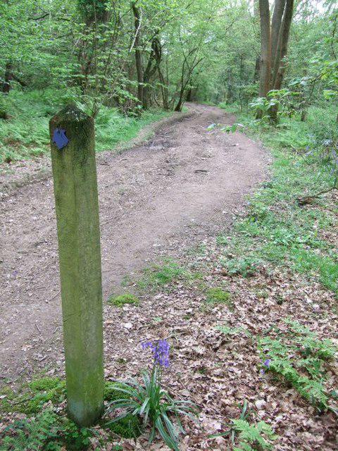 Photo could not load
TQ1049 : Old Simm's Copse
Martyn Davies
Hill facts and local notes
Classifications
Elevation
227m
745 ft
Prominence
105m
Coordinates
51.2295, -0.4202
TQ104490
OS Map
187
Explorer: 146
At the Summit
The summit features a small stone cairn and a unique wooden bench, inviting hikers to linger and enjoy the views.
Terrain & Geology
Dunley Hill is primarily composed of sediments from the Cretaceous period, with chalk and flint evidence underfoot. The landscape tells a story of ancient seas and climatic shifts, creating a fascinating mosaic of geology.
Views & Scenery
From the summit, you can spot the Surrey Hills and, on a clear day, even the faint outline of the South Downs to the south.
History & Heritage
Name Origin
The name 'Dunley' is believed to derive from Old English, meaning 'hill where dun (a type of animal or a hill) is found'.
Historical Significance
Dunley Hill is part of an ancient landscape used for centuries by locals, with remnants of historical earthworks and pathways.
Getting There & Facilities
Check current local access restrictions, parking rules and transport timetables before travelling. These notes do not confirm public access to the summit.
Parking
There is a small car park at the entrance to Witley Common, just a short walk from the trailhead.
Public Transport
Nearest railway station is Godalming, approximately 3 miles away. Bus services also run to Witley village.
Nearby Facilities
There are no facilities on the hill itself, but Godalming offers several cafés and public toilets for après-hike refreshments.
Safety Information
Known Hazards
- Watch out for muddy patches after rain—no one enjoys a surprise dip in the mud!
General Safety Tips
- Check weather conditions before setting out
- Carry appropriate clothing and equipment
- Let someone know your planned route
- Take a map, compass, and GPS device
- Carry emergency supplies: food, water, first aid kit, torch
Hills
Some common questions about the hills answered
Are there group walks up Dunley Hill?
Many walkers use Walkmates to join or organise walks with others. You can check for group walks around Dunley Hill through the maps
Are there other walkers around Dunley Hill?
Activity varies by location and time, but Walkmates lets you see whether others have shared walks or shown interest in this area. Find other people through the walking friends search walking friends for Dunley Hill search or of course create your own walk for Dunley Hill
Can I organise a walk to Dunley Hill?
Yes. If there aren’t any walks listed already, you can create a walk and make it available for others to join.
If you're signed up to Walkmates, you can create a walk to Dunley Hill.
How do I find a walk up this hill?
There are often multiple ways to walk this hill, depending on experience and route preference. Walkmates helps you explore walks and routes that others have shared.
Can I suggest a new route up Dunley Hill?
Yes. You can suggest or create routes to share with others. Walkmates focuses on the social side of walking, so routes are used to help people organise walks and explore areas together, rather than as detailed navigation tools or route libraries.
Other uses really appreciate knowledgeable walkers sharing their routes. Share your favourite route to Dunley Hill here
The is an error or something incorrect about this hill. How do I let you know?
We always strive to keep the information on Walkmates as accurate as possible. If you find an error, please let us know through the contact form and we'll aim to correct it as quickly as possible
Community Discussion
Comments
Location
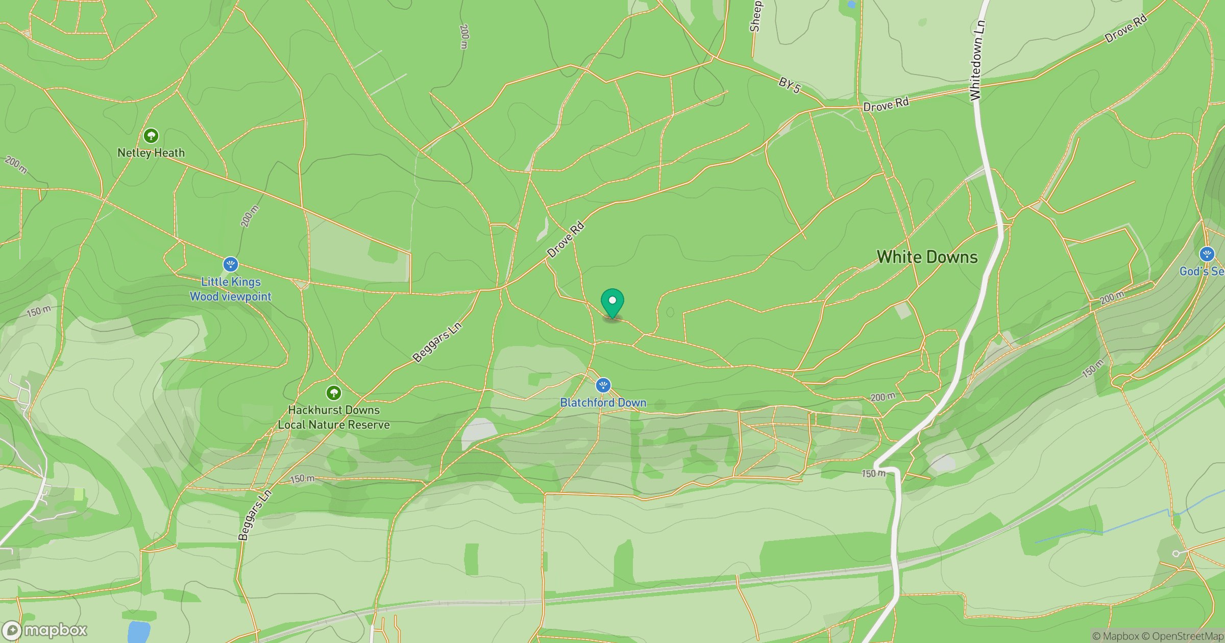
Grid reference: TQ104490
View on OpenStreetMapOpens a map in a new tab, centred on the hill.
Hills within 30 km
Straight-line distance, not a walking route or confirmation of access.
Leith Hill
294m
Holmbury Hill
261m
Hascombe Hill [Telegraph Hill]
198m
Reigate Hill
235m
Gibbet Hill
272m
No comments yet. Be the first.