
Telegraph Hill
Good walks are even better shared.
Overview
Telegraph Hill
Nestled within the stunning South Downs National Park, Telegraph Hill stands as a quintessential English hill, offering both beauty and a slice of history. With an elevation of 150 meters, it may not be the tallest around, but it's steeped in charm and character.
Geology
Telegraph Hill is primarily composed of chalk, a feature common to the South Downs, providing the area with its characteristic white cliffs and rolling landscapes. The chalky soil is not just a pretty face; it supports a diverse range of flora and fauna, making it a hotspot for nature enthusiasts.
Routes
One of the best ways to experience this lovely hill is via the South Downs Way. This well-trodden path offers an 8 km stretch alongside the hill, showcasing some of the best views the area has to offer. It is a moderate walk that anyone with a decent pair of shoes can conquer. Just don't forget your sandwiches!
Summit Features
Reaching the summit, you'll encounter a charming trig point, perfect for those Instagram uploads or bragging rights among your hiking buddies. The surrounding grassy expanse makes for an ideal picnic area—just watch out for cheeky birds looking to steal your lunch!
Terrain Type
The terrain is predominantly grassy, with a few challenging chalk paths. Perfect for a gentle hike, but be cautious when the ground is damp, as it can become remarkably slippery.
Views
From the summit, the views are nothing short of spectacular. The rolling downs stretch out beneath you, and on clear days, you can spot the iconic Seven Sisters cliffs in the distance. The best seasons to enjoy these vistas are late spring and autumn when the landscape is painted with vibrant colours and clarity is at its peak.
Hazards
As with any hike, be aware of the weather, especially during winter months when conditions can change rapidly. Slippery chalk paths can be an uninvited guest after rainfall—so tread carefully!
Nearby Summits
If you're feeling ambitious, consider extending your hike to nearby summits like Ditchling Beacon and Devil's Dyke. Both offer breathtaking views and a chance to tick a couple more peaks off your list.
Access
For those driving, the nearest parking is at Upper Beeding, a mere 3 km away. Accessible by public transport, regular buses run to the nearby villages, with the closest bus stop in Upper Beeding. The town of Steyning, just 5 km away, offers several amenities and makes a lovely stopping point before or after your adventure.
Facilities
Steyning is a gem with cafes and pubs aplenty to refresh you post-hike, and there are toilet facilities to make your adventure all the more comfortable.
History
Historically, this hill carries a weight of significance due to its use as a semaphore signalling point during the Napoleonic Wars. Its strategic position meant it was a valuable lookout, highlighting the blend of natural beauty with rich historical context—like a rather well-behaved student who also happens to be a secret agent!
Happy Hiking!
Whether you’re a seasoned walker or a casual Sunday stroller, Telegraph Hill offers an escape into nature without the need for a massive expedition. Remember to pack your snacks, and let the fresh air do the rest!
Explore routes near Telegraph Hill
Walks starting near this hill. Open a route to check its map, distance and full itinerary.
Hindhead Sailor's Stroll to Gibbet Hill
View route
Petworth Park: Capability Brown Hills and Lower Pond Circuit
View route
Frensham Little Pond and Snowball Ridge Walk
View route
Winkworth Arboretum: woodland and Rowe’s Flashe lake
View route
Route planning notes
These notes describe possible approaches. Check a route's map and access information when planning your walk.
South Downs Way
This iconic long-distance trail offers a scenic walk which runs adjacent to the hill, providing stunning views and easy access.
Make a day of it, together
Find someone to share the walk with, or organise a day out along a route you like.
Hill facts and local notes
Classifications
Elevation
207m
679 ft
Prominence
130m
Coordinates
51.0306, -0.7601
SU870264
OS Map
186 197
Explorer: OL33 133
At the Summit
The summit features a prominent trig point, a must for any aspiring peak-bagger, alongside scenic grassland offering a perfect picnic spot.
Terrain & Geology
Telegraph Hill is largely composed of chalk, typical of the South Downs, which creates its distinctive rolling hills and dry valleys. The area is a local hotspot for interesting chalk flora and fauna.
Views & Scenery
From the summit, you can see across the rolling downs to the iconic Seven Sisters cliffs and on a clear day, even out to the Solent.
History & Heritage
Name Origin
The name 'Telegraph Hill' stems from its historical use as a signalling station during the Napoleonic Wars, utilizing semaphore signals.
Historical Significance
The hill served as a strategic lookout point and has roots in military history, making it notable among local landmarks.
Getting There & Facilities
Parking
The nearest parking is at the village of Upper Beeding, around 3 km away from the hill with ample spots available.
Public Transport
Regular bus services connect to nearby villages; nearest bus stop is in Upper Beeding.
Nearby Facilities
There are several cafes and pubs in Steyning, as well as toilet facilities, making it a convenient pitstop post-walk.
Safety Information
Known Hazards
- Watch for sudden changes in weather, particularly in the winter months, and be cautious of slippery chalk paths after rain.
General Safety Tips
- Check weather conditions before setting out
- Carry appropriate clothing and equipment
- Let someone know your planned route
- Take a map, compass, and GPS device
- Carry emergency supplies: food, water, first aid kit, torch
Hills
Some common questions about the hills answered
Are there group walks up Telegraph Hill?
Many walkers use Walkmates to join or organise walks with others. You can check for group walks around Telegraph Hill through the maps
Are there other walkers around Telegraph Hill?
Activity varies by location and time, but Walkmates lets you see whether others have shared walks or shown interest in this area. Find other people through the walking friends search walking friends for Telegraph Hill search or of course create your own walk for Telegraph Hill
Can I organise a walk to Telegraph Hill?
Yes. If there aren’t any walks listed already, you can create a walk and make it available for others to join.
If you're signed up to Walkmates, you can create a walk to Telegraph Hill.
How do I find a walk up this hill?
There are often multiple ways to walk this hill, depending on experience and route preference. Walkmates helps you explore walks and routes that others have shared.
Can I suggest a new route up Telegraph Hill?
Yes. You can suggest or create routes to share with others. Walkmates focuses on the social side of walking, so routes are used to help people organise walks and explore areas together, rather than as detailed navigation tools or route libraries.
Other uses really appreciate knowledgeable walkers sharing their routes. Share your favourite route to Telegraph Hill here
The is an error or something incorrect about this hill. How do I let you know?
We always strive to keep the information on Walkmates as accurate as possible. If you find an error, please let us know through the contact form and we'll aim to correct it as quickly as possible
Community Discussion
Comments
Location
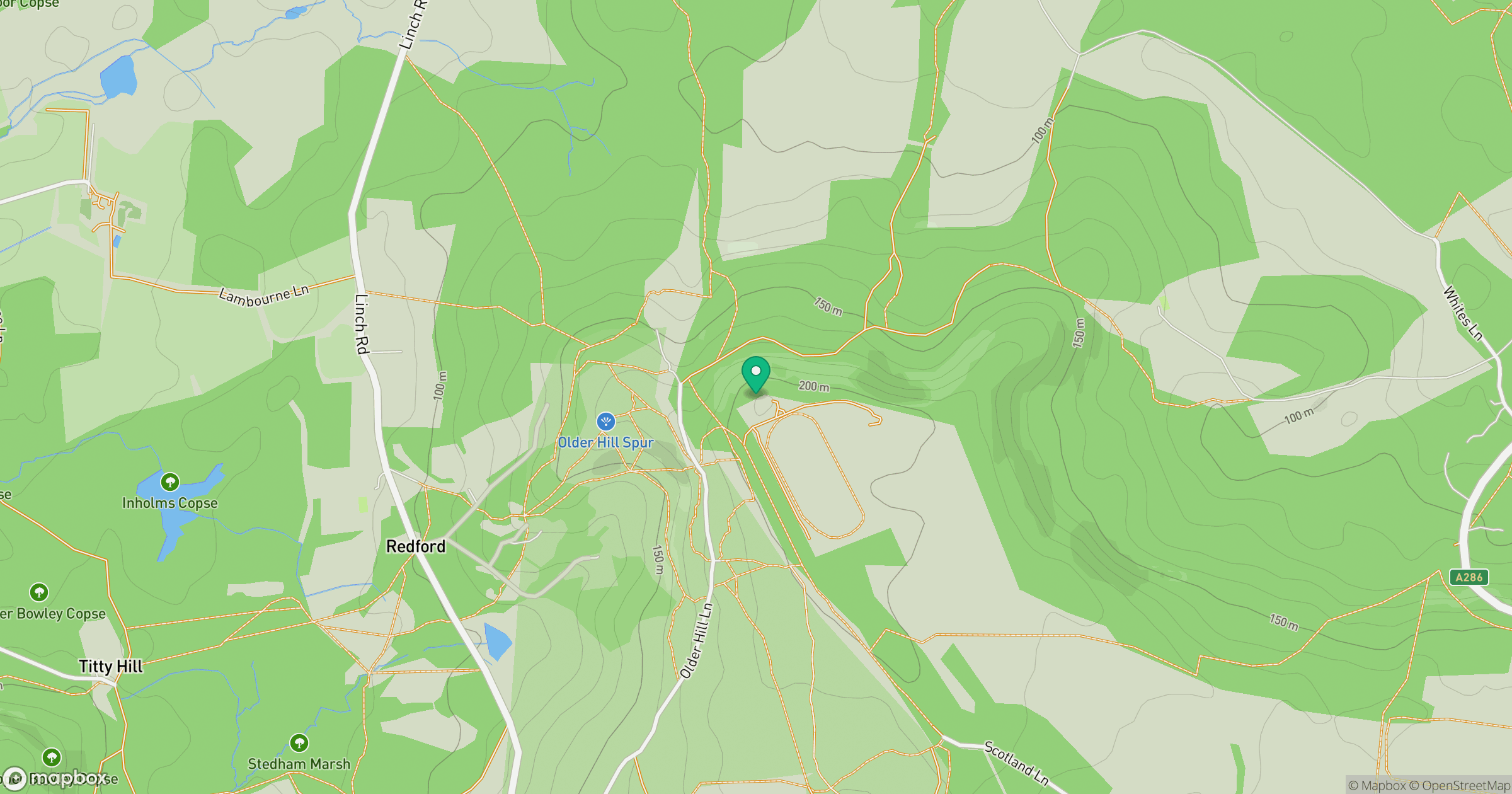
Grid reference: SU870264
View on OpenStreetMapOpens a map in a new tab, centred on the hill.
Nearby Hills
Leith Hill
294m
Ditchling Beacon
248m
Worcestershire Beacon
425m
Glastonbury Tor
158m
Titterstone Clee Hill
533m
No comments yet. Be the first.