

Greatmoor Hill
Good walks are even better shared.
NT4800 : Summit of Greatmoor Hill
Colin Park Photo source
Overview
Greatmoor Hill: A Hidden Gem of the Southern Pennines
Nestled in the Southern Pennines, Greatmoor Hill is often overshadowed by its taller neighbours, but don’t let that fool you. At 520 meters, this Marilyn promises excellent views and a satisfying hike.
Geology
Greatmoor Hill is primarily made up of Carboniferous limestone, which gives it unique geological features that will pique the interest of outdoor enthusiasts and geology buffs alike. While meandering along the paths, be sure to keep an eye out for impressive karst formations such as clints and grykes.
Routes
One of the most popular routes to tackle Greatmoor Hill starts from the Langsett Reservoir. The 10.5 km circuit is perfect for a sunny afternoon, taking approximately 3.5 hours to complete. This moderately challenging loop traverses varied terrain, allowing hikers to experience everything from serene woodlands to the open beauty of the moors.
Summit Features
Upon reaching the summit, hikers are welcomed by a charming stone cairn that marks this notable location. It’s the perfect spot to take a breather and soak in the panoramic views of Upper Don Valley. Make sure to capture that selfie with the cairn — proof that you were here!
Terrain Type
The terrain is a mix of moorland, rocky outcrops, and grassy patches, giving it a delightful character that's as rewarding as it is challenging.
Views
From the summit of Greatmoor Hill, the scenery extends far and wide. You'll be greeted by views of the rolling hills of the Peak District and the picturesque Upper Don Valley. Spring and autumn are particularly magical times to visit, where colours burst to life against the backdrop of clear blue skies.
Hazards
While Greatmoor Hill is accessible, it’s still essential to take care. The rugged terrain can pose risks with uneven footing, plus the weather can change sharper than a sheep's bleat at supper time. Always check conditions before setting off!
Nearby Summits
For those looking to make a day out of their hike, nearby peaks like Margery Hill (558 m) and Broomhead Moor (529 m) are within striking distance, offering even more stunning vistas.
Access
Accessing Greatmoor Hill is a breeze. The Langsett Reservoir car park provides ample space to park your vehicle, with signs pointing you in the right direction. For those without wheels, local buses from Penistone conveniently take you to the reservoir.
Facilities
While you won’t find a bustling village at the foot of the hill, a quaint café by the reservoir will fuel your adventure. Remember to check out the public toilets nearby for convenience.
History
The name 'Greatmoor' reflects the characteristics of the landscape, meaning 'great' and 'moor' in Old English. Historically significant for sheep farming, the area remains a crucial water supply thanks to the nearby reservoirs.
So grab your walking boots, pack your lunch, and make your way to Greatmoor Hill for an adventurous day out in the heart of the Southern Pennines — you'll be glad you did!
Explore routes near Greatmoor Hill
Walks starting near this hill. Open a route to check its map, distance and full itinerary.
Newcastleton Forest Priest Hill Viewpoint Trail
View route
Hawick: Wilton Lodge Park and River Teviot Circular
View route
Kielder Skyspace and Observatory Forest Walk
View route
Bakethin Hide Wild Walk
View route
Route planning notes
These notes describe possible approaches. Check a route's map and access information when planning your walk.
Langsett Reservoir Circuit
A scenic loop starting from Langsett Reservoir, offering a diverse experience of forest, moorland, and the summit of Greatmoor Hill.
Make a day of it, together
Find someone to share the walk with, or organise a day out along a route you like.
Photo Gallery
View all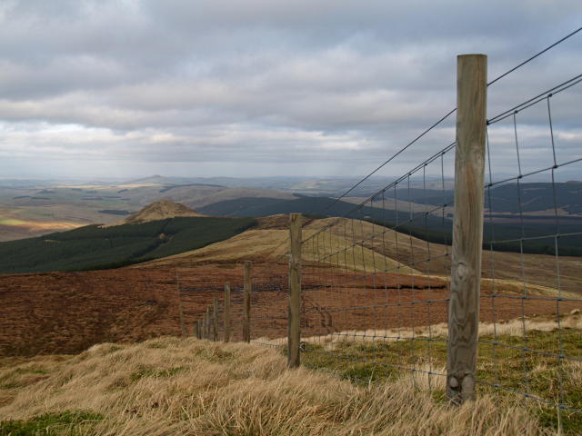 Photo could not load
NT4900 : Fence, Greatmoor Hill
Chris Eilbeck
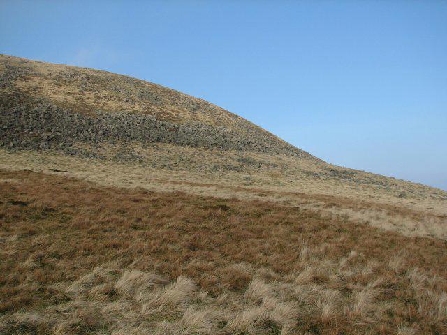 Photo could not load
NT4900 : Greatmoor Hill
Callum Black
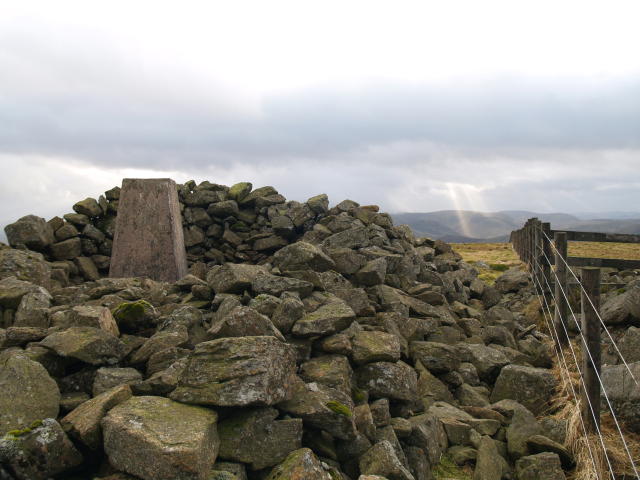 Photo could not load
NT4800 : Cairn and fence, Greatmoor Hill
Chris Eilbeck
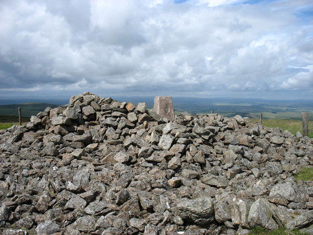 Photo could not load
NT4800 : Greatmoor Hill shelter and trig point
David Purchase
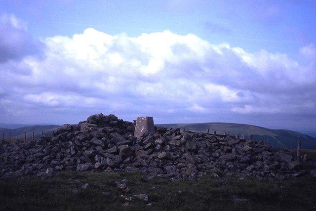 Photo could not load
NT4800 : Summit of Greatmoor Hill
Colin Park
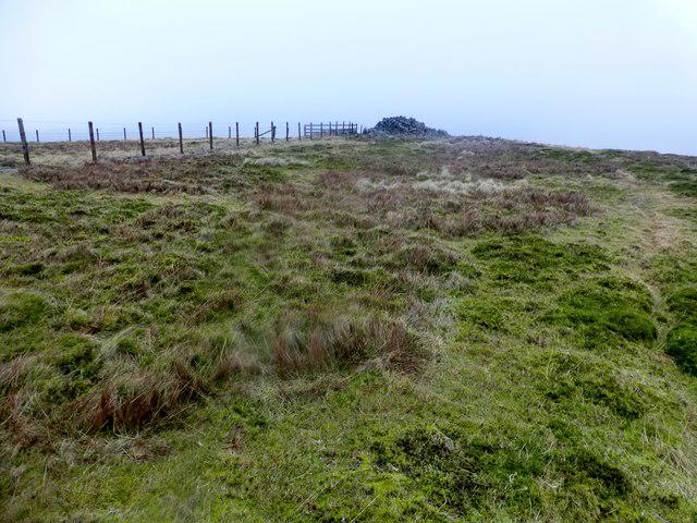 Photo could not load
NT4800 : Greatmoor Hill
Rude Health
Hill facts and local notes
Classifications
Elevation
599m
1,965 ft
Prominence
163m
Coordinates
55.2977, -2.8051
NT489006
OS Map
79
Explorer: 331
At the Summit
The summit is marked by a distinct stone cairn and provides a panoramic view of the surrounding moorland and valleys.
Terrain & Geology
Greatmoor Hill is predominantly composed of Carboniferous limestone, with a mix of grits and shales in surrounding areas. The limestone has created fascinating karst features such as clints and grykes that can be explored along the paths.
Views & Scenery
From the top, hikers can enjoy views over the Upper Don Valley and stretch to the distant hills of the Peak District.
History & Heritage
Name Origin
The name 'Greatmoor' derives from the Old English terms for 'great' and 'moor', reflecting the expansive moorland.
Historical Significance
Historically, this area has been a vital part of local sheep farming, and the nearby reservoirs are crucial for water supply.
Getting There & Facilities
Parking
Langsett Reservoir car park offers ample space for vehicles and is well-signed.
Public Transport
Buses run from nearby towns like Penistone to the Langsett area, making it accessible for walkers without a car.
Nearby Facilities
There are limited facilities at Langsett Reservoir, with a café open on weekends and public toilets available.
Safety Information
Known Hazards
- The terrain can be rugged with uneven footing; be wary of sudden weather changes common in moorland areas.
General Safety Tips
- Check weather conditions before setting out
- Carry appropriate clothing and equipment
- Let someone know your planned route
- Take a map, compass, and GPS device
- Carry emergency supplies: food, water, first aid kit, torch
Hills
Some common questions about the hills answered
Are there group walks up Greatmoor Hill?
Many walkers use Walkmates to join or organise walks with others. You can check for group walks around Greatmoor Hill through the maps
Are there other walkers around Greatmoor Hill?
Activity varies by location and time, but Walkmates lets you see whether others have shared walks or shown interest in this area. Find other people through the walking friends search walking friends for Greatmoor Hill search or of course create your own walk for Greatmoor Hill
Can I organise a walk to Greatmoor Hill?
Yes. If there aren’t any walks listed already, you can create a walk and make it available for others to join.
If you're signed up to Walkmates, you can create a walk to Greatmoor Hill.
How do I find a walk up this hill?
There are often multiple ways to walk this hill, depending on experience and route preference. Walkmates helps you explore walks and routes that others have shared.
Can I suggest a new route up Greatmoor Hill?
Yes. You can suggest or create routes to share with others. Walkmates focuses on the social side of walking, so routes are used to help people organise walks and explore areas together, rather than as detailed navigation tools or route libraries.
Other uses really appreciate knowledgeable walkers sharing their routes. Share your favourite route to Greatmoor Hill here
The is an error or something incorrect about this hill. How do I let you know?
We always strive to keep the information on Walkmates as accurate as possible. If you find an error, please let us know through the contact form and we'll aim to correct it as quickly as possible
Community Discussion
Comments
Location
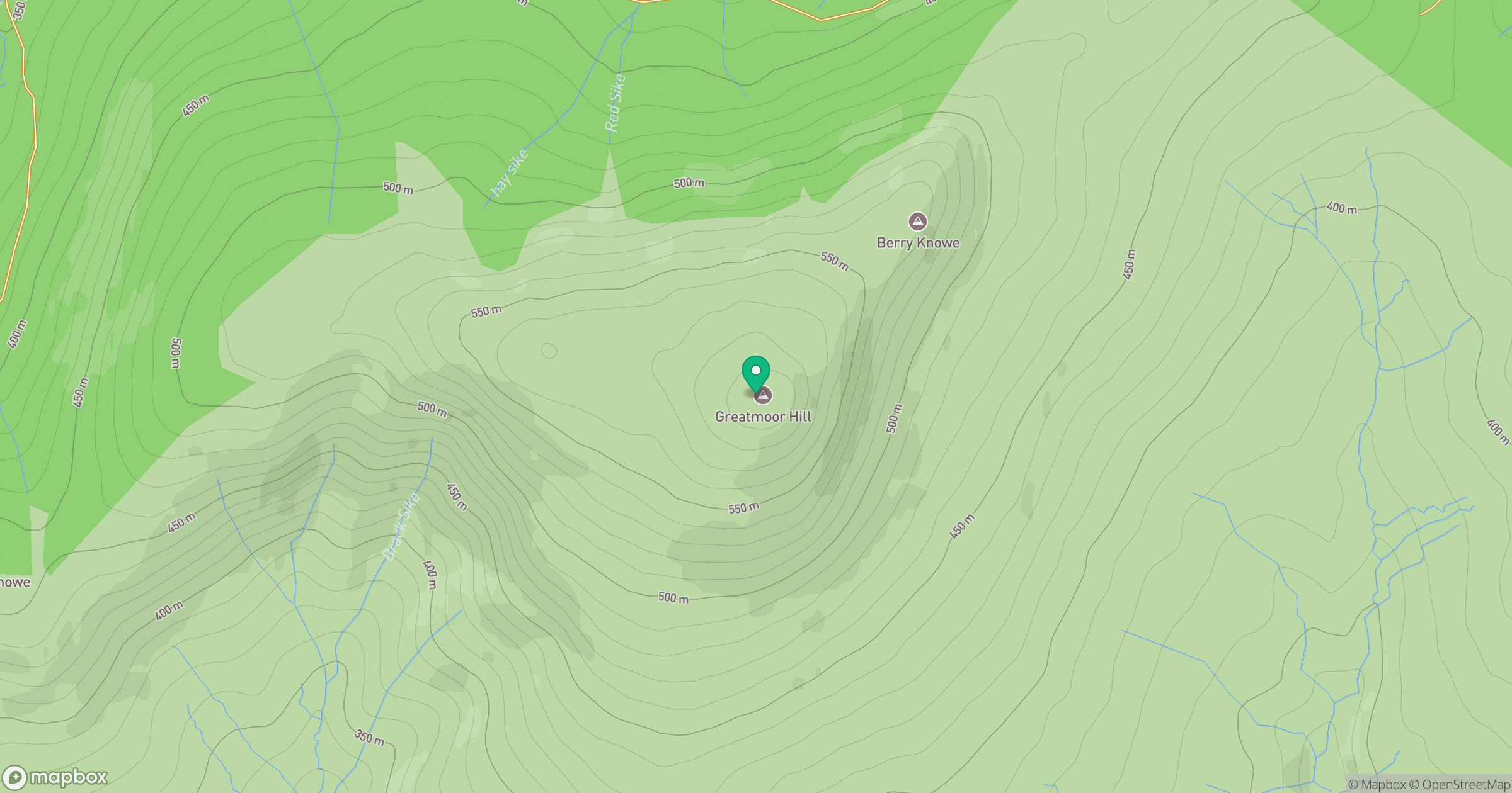
Grid reference: NT489006
View on OpenStreetMapOpens a map in a new tab, centred on the hill.




No comments yet. Be the first.