

Penchrise Pen
Good walks are even better shared.
Overview
Penchrise Pen
Penchrise Pen, nestled in the Southern Uplands of Scotland, stands at an elevation of 367 meters. While it may not be the highest of peaks, it certainly has a charm that draws hikers back time and time again.
Geology
The hill is comprised mainly of Silurian sandstone. This unique geology reflects a rich history characterized by ancient marine environments. You might even encounter some interesting rock formations along the way, perfect for geological enthusiasts or simply to marvel at nature's handiwork.
Routes
The most popular route to the summit is the Penchrise Pen Trail, which begins in the quaint hamlet of Alton. This 4.5 km trail is considered moderate in difficulty, winding through verdant woods and up to the summit. It typically takes about 2 hours, making it perfect for a leisurely afternoon hike.
Summit Features
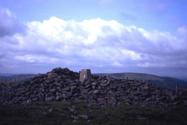
At the summit, you'll discover a trig point proudly marking the highest point, accompanied by a charming little cairn, built by fellow adventurers. It’s a great spot to catch your breath and snap a photo with the stunning views.
Terrain Type
The terrain is a mix of grassy paths and rocky outcrops. Keep your eyes peeled for tricky spots; after all, nobody wants to kiss the ground, even after a long hike!
Views
Once at the summit, expansive views of the surrounding hills will greet you. The Merrick range stands proudly to one side, a sight to behold, especially during the spring and autumn months when the colours are simply spectacular. For those who enjoy golden hour, summer sunsets from this vantage point can be nothing short of magical.
Hazards
As with any hillwalking, be cautious of uneven footing. Slips and trips can happen, especially on muddy trails, so sturdy and waterproof footwear is your best friend! Also, be prepared for changing weather; in Scotland, if you don't like it, just wait a minute!
Access
Getting to Penchrise Pen is quite straightforward. The nearest parking is right in Alton, though spaces can be limited. If you're relying on public transport, hop on a bus to Newton Stewart and a quick taxi ride will get you to the trailhead.
Facilities
Once you're back from your trek, the charming town of Newton Stewart offers cafes and public toilets to refresh and refuel.
History
The name Penchrise Pen hints at the playful nature of the local wildlife, suggesting a place where rabbits scamper about. The hill has been an integral part of the local community's outdoor culture, fostering a love for nature and camaraderie among hikers.
With all that said, Penchrise Pen awaits your visit. Pack your shoes, grab a companion (or go solo if you prefer), and get ready to explore. Happy hiking!
Explore routes near Penchrise Pen
Public walks starting within 80 km of this hill. Nearby does not mean a route reaches the summit; check its map and access before setting out.
Hawick: Wilton Lodge Park and River Teviot Circular
View route
Newcastleton Forest Priest Hill Viewpoint Trail
View route
Kielder Skyspace and Observatory Forest Walk
View route
Bakethin Hide Wild Walk
View route
Route planning notes
These notes describe possible approaches, not verified navigable routes or permission to cross land. Check current paths, local access rules and conditions before setting out.
Penchrise Pen Trail
A scenic route starting from the small hamlet of Alton, this trail meanders through lush woodlands before ascending towards the summit, providing a delightful mix of terrain and views.
Make a day of it, together
Find someone to share the walk with, or organise a day out along a route you like.
Photo Gallery
View all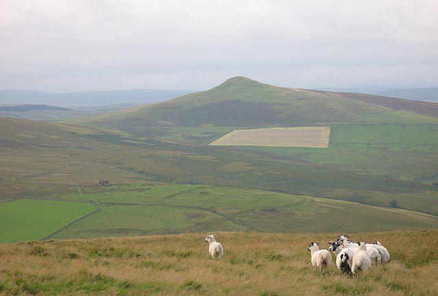 Photo could not load
NT4906 : Penchrise Pen
Richard Webb
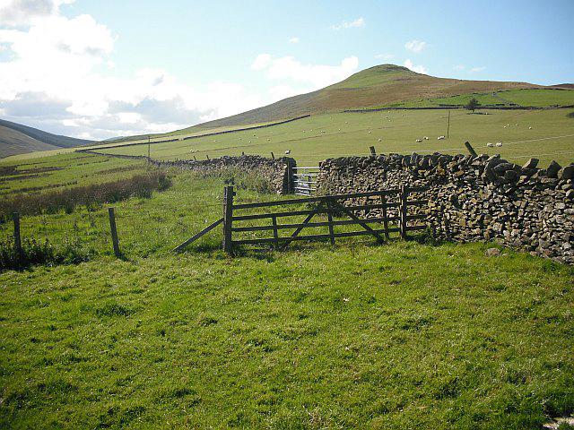 Photo could not load
NT4906 : Penchrise Pen
Richard Webb
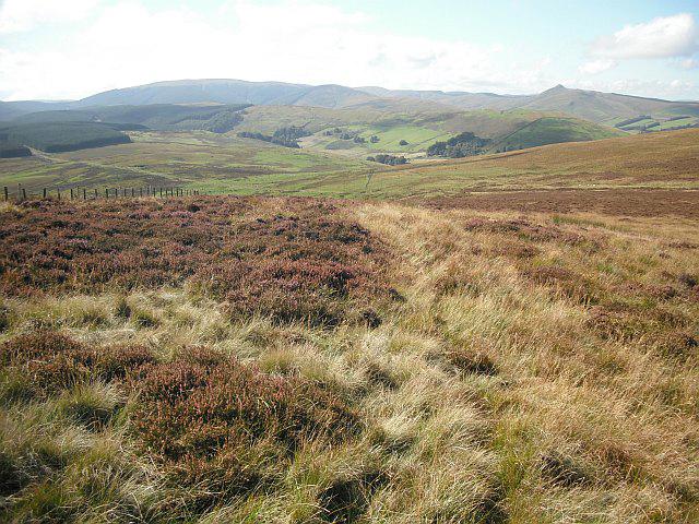 Photo could not load
NT4806 : Moorland, Penchrise Pen
Richard Webb
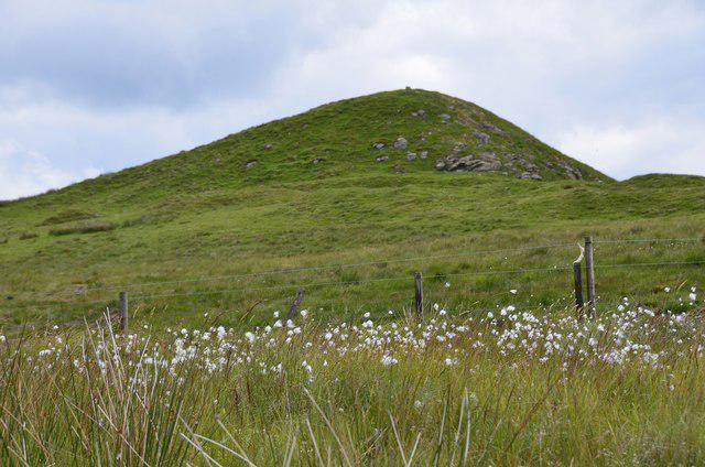 Photo could not load
NT4806 : Cotton grass by the summit of Penchrise Pen
Jim Barton
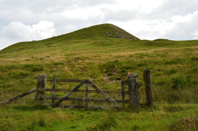 Photo could not load
NT4806 : Summit path, Penchrise Pen
Jim Barton
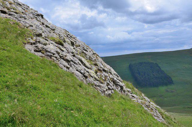 Photo could not load
NT4906 : Rock outcrop on Penchrise Pen
Jim Barton
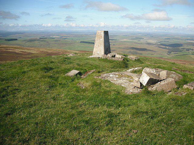 Photo could not load
NT4906 : Penchrise Pen
Richard Webb
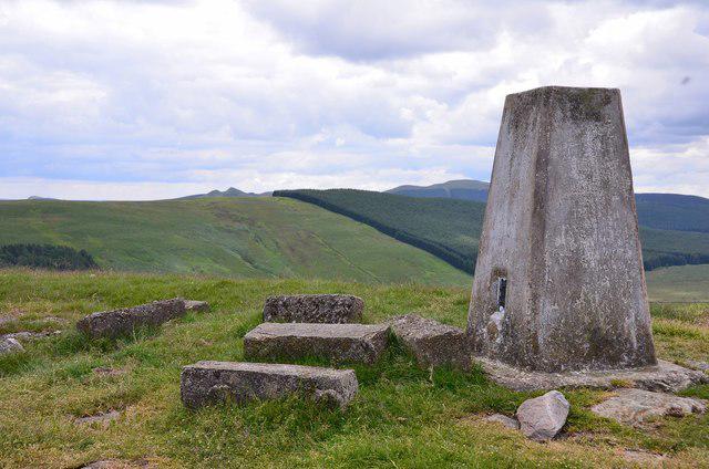 Photo could not load
NT4906 : Summit trig pillar, Penchrise Pen
Jim Barton
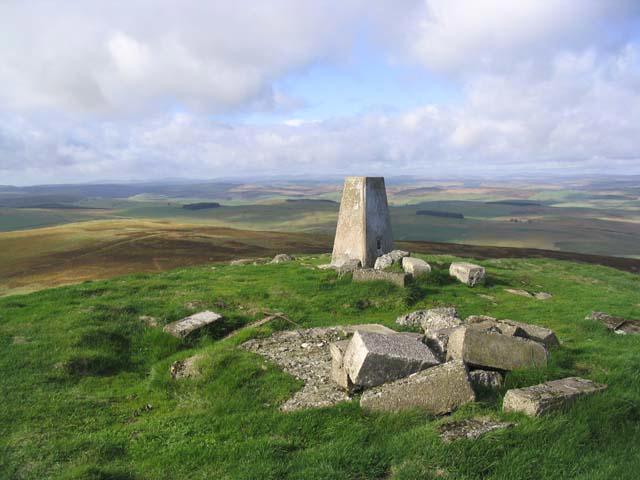 Photo could not load
NT4906 : The trig point at 439m on Penchrise Pen
Walter Baxter
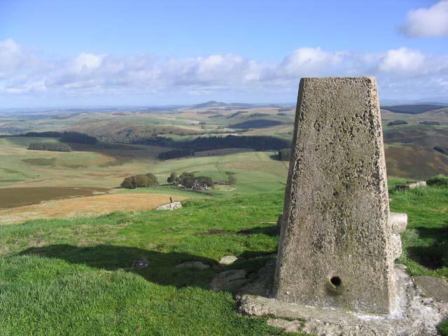
NT4906 : The trig point on Penchrise Pen
Walter Baxter
Hill facts and local notes
Classifications
Elevation
439m
1,440 ft
Prominence
115m
Coordinates
55.3474, -2.8046
NT490062
OS Map
79
Explorer: 331
At the Summit
The summit is adorned with a modest trig point, standing as a testament to the hill's prominence, with a delightful cairn nearby constructed by fellow hikers—quite the community effort!
Terrain & Geology
Penchrise Pen is primarily composed of Silurian sandstone, offering a fascinating look into the geological history of the area, with rocky outcrops that speak of ancient seas and shifting landscapes.
Views & Scenery
From the summit, breathtaking views of the surrounding hills, including the towering peaks of the Merrick range and the tranquil valleys below create a perfect backdrop for photographs.
History & Heritage
Name Origin
The name 'Penchrise' is thought to derive from a blend of Gaelic elements, referring to the 'hill where the rabbits run', which is befitting given the local wildlife.
Historical Significance
The hill has been a favourite among local hikers and nature enthusiasts for generations, serving as a hub for outdoor activities and a spot for community gatherings.
Getting There & Facilities
Check current local access restrictions, parking rules and transport timetables before travelling. These notes do not confirm public access to the summit.
Parking
Parking is available at the base of the trail in the hamlet of Alton, where space is limited but usually sufficient for a few cars.
Public Transport
The nearest bus stop is in Newton Stewart, from where a short taxi ride will take you to Alton.
Nearby Facilities
Although there are no facilities on the mountain, local cafes in Newton Stewart provide refreshments, and public toilets are available in the town.
Safety Information
Known Hazards
- Uneven terrain can lead to slips and trips; always keep a watchful eye out for concealed roots and rocks, especially when descending.
- In wet weather, paths can become muddy and slippery, so proper footwear is essential.
General Safety Tips
- Check weather conditions before setting out
- Carry appropriate clothing and equipment
- Let someone know your planned route
- Take a map, compass, and GPS device
- Carry emergency supplies: food, water, first aid kit, torch
Hills
Some common questions about the hills answered
Are there group walks up Penchrise Pen?
Many walkers use Walkmates to join or organise walks with others. You can check for group walks around Penchrise Pen through the maps
Are there other walkers around Penchrise Pen?
Activity varies by location and time, but Walkmates lets you see whether others have shared walks or shown interest in this area. Find other people through the walking friends search walking friends for Penchrise Pen search or of course create your own walk for Penchrise Pen
Can I organise a walk to Penchrise Pen?
Yes. If there aren’t any walks listed already, you can create a walk and make it available for others to join.
If you're signed up to Walkmates, you can create a walk to Penchrise Pen.
How do I find a walk up this hill?
There are often multiple ways to walk this hill, depending on experience and route preference. Walkmates helps you explore walks and routes that others have shared.
Can I suggest a new route up Penchrise Pen?
Yes. You can suggest or create routes to share with others. Walkmates focuses on the social side of walking, so routes are used to help people organise walks and explore areas together, rather than as detailed navigation tools or route libraries.
Other uses really appreciate knowledgeable walkers sharing their routes. Share your favourite route to Penchrise Pen here
The is an error or something incorrect about this hill. How do I let you know?
We always strive to keep the information on Walkmates as accurate as possible. If you find an error, please let us know through the contact form and we'll aim to correct it as quickly as possible
Community Discussion
Comments
Location
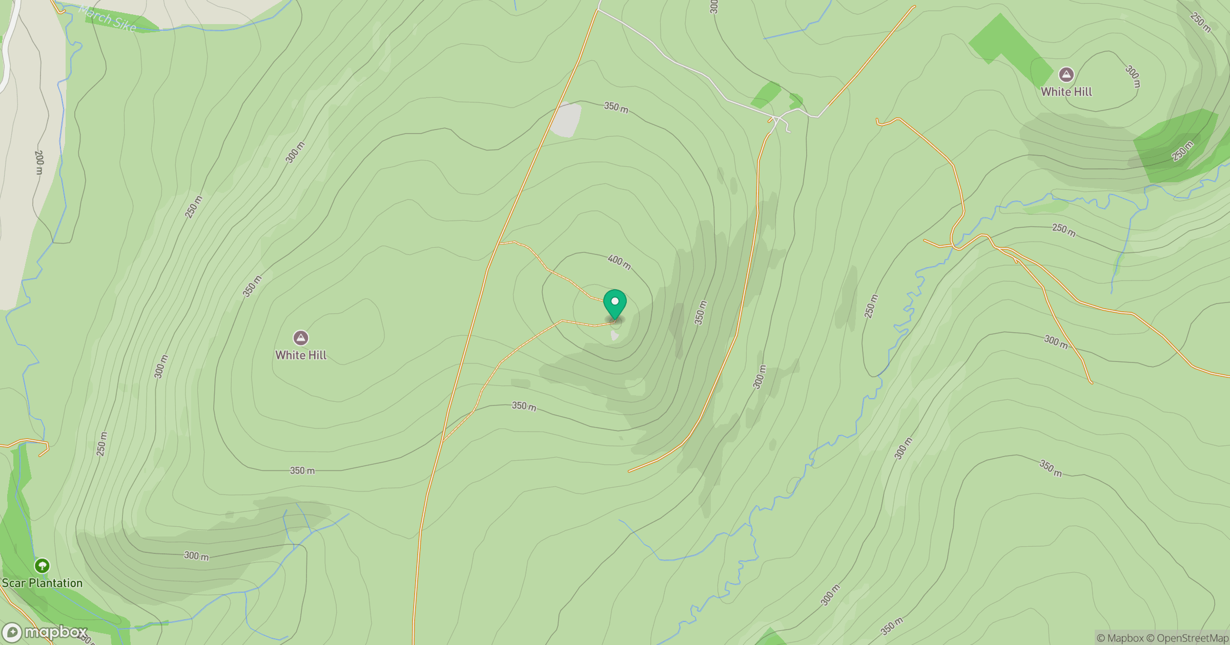
Grid reference: NT490062
View on OpenStreetMapOpens a map in a new tab, centred on the hill.
Hills within 30 km
Straight-line distance, not a walking route or confirmation of access.
No comments yet. Be the first.