

Pike Fell
Good walks are even better shared.
Overview
Pike Fell
Nestled in the stunning Lake District, Pike Fell is a must-visit destination for avid hikers and nature lovers alike. Standing at an elevation of 590 metres, it may not be the tallest summit in the region, but it certainly commands impressive views that are worth the trek.
Geology
Pike Fell's geological composition is fascinating, showcasing a blend of volcanic rocks intertwined with sedimentary layers. This unique mixture results from ancient volcanic activity, presenting a rare glimpse into the geographical history of the area. Keep an eye on the rocks as you hike; they might just tell you a story or two!
Routes
One of the recommended routes is the Pike Fell Circular Route. Starting in the charming village of Ennerdale Bridge, this 8.5 km trail takes approximately 4 hours to complete and is categorized as moderate in difficulty. The diversity of terrain – from woodland paths to open moorland – keeps your feet entertained and your eyes in awe.
Summit Features
Upon reaching the summit, hikers are greeted with a large stone cairn, perfect for a quick photo op or a snack break. It’s not just any stone pile; it’s a monument to your hiking prowess!
Terrain Type
Expect a delightful mix of rocky outcrops and grassy slopes, with a few squelchy boggy bits thrown in for good measure. If you’ve ever dreamed of experiencing an unintentional mud bath, your moment has arrived!
Views
The views from Pike Fell are simply stunning, with notable landmarks such as Great Gable and Ennerdale Water dotting the landscape. The best times to enjoy these vistas are early autumn when colours abound, or late spring, when the skies are clear and bright.
Hazards
Like any good adventure, there are a few hazards to keep in mind, including slippery rocks and the notorious Lake District weather that can change faster than you can say 'wet socks'. Always stay prepared!
Nearby Summits
Pike Fell is conveniently located near other majestic peaks, such as Great Gable and Pillar, both of which are fantastic options for more adventurous souls looking to extend their hiking experience.
Access
Getting to Pike Fell is fairly easy, with parking available in Ennerdale Bridge. Public transport options do exist, although you may have to brush up on your bus schedules to avoid waiting for hours.
Facilities
While Ennerdale Bridge has limited facilities, you'll find a quaint café and a welcoming pub to restore your energy after a hard day’s hiking.
History
The name 'Pike' indicates a pointed peak, while 'Fell' suggests a high, often barren area, perfectly encapsulating the character of this mountain. Historically, Pike Fell has been used for sheep grazing, enriching the local culture with folklore and tradition.
So lace up those boots, pack your snacks, and head on over to Pike Fell for an unforgettable experience. After all, it’s not just a walk in the park; it’s a climb in the fell!
Explore routes near Pike Fell
Public walks starting within 80 km of this hill. Nearby does not mean a route reaches the summit; check its map and access before setting out.
Newcastleton Forest Priest Hill Viewpoint Trail
View route
Kielder Skyspace and Observatory Forest Walk
View route
Bakethin Hide Wild Walk
View route
Hawick: Wilton Lodge Park and River Teviot Circular
View route
Route planning notes
These notes describe possible approaches, not verified navigable routes or permission to cross land. Check current paths, local access rules and conditions before setting out.
Pike Fell Circular Route
A scenic circular walk starting from the nearby village of Ennerdale Bridge, offering a blend of woodland paths and open moorland that leads to stunning views from the summit.
Make a day of it, together
Find someone to share the walk with, or organise a day out along a route you like.
Photo Gallery
View all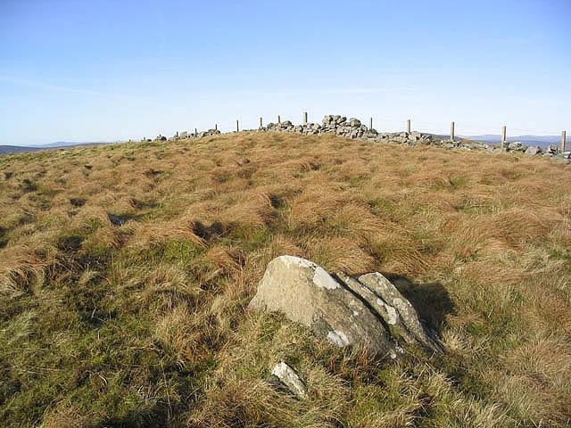 Photo could not load
NY4193 : The summit area of Pike Fell
Walter Baxter
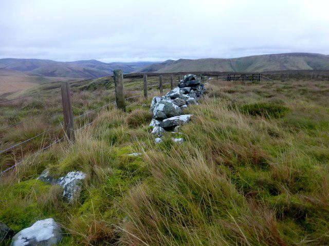 Photo could not load
NY4193 : Pike Fell
Rude Health
Hill facts and local notes
Classifications
Elevation
499m
1,637 ft
Prominence
108m
Coordinates
55.2363, -2.9249
NY412939
OS Map
79
Explorer: 324
At the Summit
At the summit, hikers will find a large stone cairn, which serves as the perfect spot for a celebratory snack or to ponder the mysteries of the universe (or just the snacks).
Terrain & Geology
Pike Fell is primarily composed of volcanic rock, with a mix of sedimentary layers that make for an interesting geological history. The rock formations showcase evidence of past volcanic activity, which contrasts with the surrounding lush landscapes.
Views & Scenery
From the summit, you'll be treated to panoramic views of the surrounding valleys and peaks, including the towering presence of Great Gable and the shimmering waters of Ennerdale Water.
History & Heritage
Name Origin
The name 'Pike' typically refers to a pointed hill or peak, while 'Fell' denotes a barren area of high land, illustrating the mountain's rugged character.
Historical Significance
Pike Fell has historically been a popular spot for sheep grazing and has local folklore associated with it, enriching its cultural heritage.
Getting There & Facilities
Check current local access restrictions, parking rules and transport timetables before travelling. These notes do not confirm public access to the summit.
Parking
There is a small parking area in Ennerdale Bridge with limited spaces. Arrive early, or risk seeing more wildlife than hikers!
Public Transport
Buses run from Cockermouth to Ennerdale Bridge, providing access for those without vehicles. Be sure to check the schedule as it’s not the fastest route!
Nearby Facilities
Facilities are limited in Ennerdale Bridge, but you can find a lovely local café serving hearty meals and a pub for post-hike refreshments.
Safety Information
Known Hazards
- Beware of slippery rocks, especially after rain, and watch out for sudden weather changes typical of the Lake District.
General Safety Tips
- Check weather conditions before setting out
- Carry appropriate clothing and equipment
- Let someone know your planned route
- Take a map, compass, and GPS device
- Carry emergency supplies: food, water, first aid kit, torch
Hills
Some common questions about the hills answered
Are there group walks up Pike Fell?
Many walkers use Walkmates to join or organise walks with others. You can check for group walks around Pike Fell through the maps
Are there other walkers around Pike Fell?
Activity varies by location and time, but Walkmates lets you see whether others have shared walks or shown interest in this area. Find other people through the walking friends search walking friends for Pike Fell search or of course create your own walk for Pike Fell
Can I organise a walk to Pike Fell?
Yes. If there aren’t any walks listed already, you can create a walk and make it available for others to join.
If you're signed up to Walkmates, you can create a walk to Pike Fell.
How do I find a walk up this hill?
There are often multiple ways to walk this hill, depending on experience and route preference. Walkmates helps you explore walks and routes that others have shared.
Can I suggest a new route up Pike Fell?
Yes. You can suggest or create routes to share with others. Walkmates focuses on the social side of walking, so routes are used to help people organise walks and explore areas together, rather than as detailed navigation tools or route libraries.
Other uses really appreciate knowledgeable walkers sharing their routes. Share your favourite route to Pike Fell here
The is an error or something incorrect about this hill. How do I let you know?
We always strive to keep the information on Walkmates as accurate as possible. If you find an error, please let us know through the contact form and we'll aim to correct it as quickly as possible
Community Discussion
Comments
Location
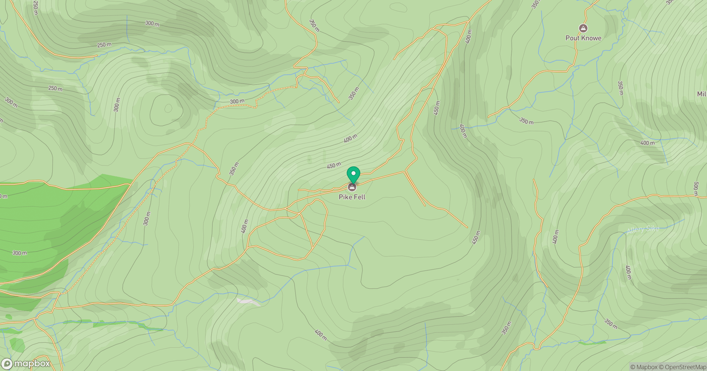
Grid reference: NY412939
View on OpenStreetMapOpens a map in a new tab, centred on the hill.
Hills within 30 km
Straight-line distance, not a walking route or confirmation of access.
No comments yet. Be the first.