

Skelfhill Pen
Good walks are even better shared.
Overview
Skelfhill Pen: A Hidden Gem in the Southern Uplands
Nestled in the Southern Uplands, Skelfhill Pen may not be the highest hill in the region, but what it lacks in elevation, it makes up for in charm and stunning views.
Geology
The composition of Skelfhill Pen is primarily sedimentary, featuring sandstone and mudstone. These geological formations create habitats that are bursting with biodiversity, making it a wonderful spot for the keen-eyed naturalist. Keep an eye out for local wildlife!
Routes
The most popular route starts from the B711 road. It's an easy trek that covers approximately 4.5 km and takes roughly 1.5 hours to the summit. The well-marked trail is suitable for families and those who are new to hiking.
Summit Features
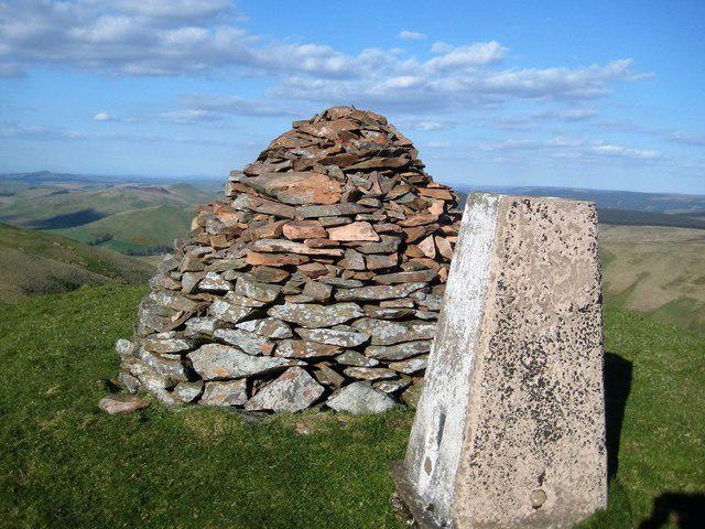
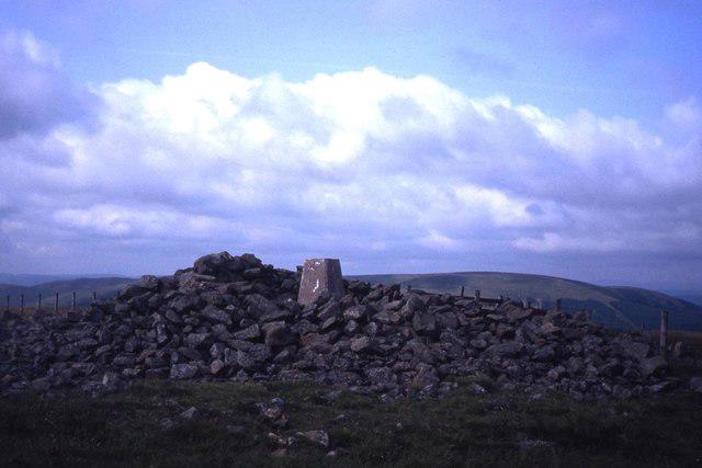
Reaching the summit, you'll encounter a sizeable cairn and the iconic trig point. These features not only provide a sense of achievement but also a perfect backdrop for that well-deserved selfie!
Terrain
Expect a mix of gentle grassy slopes and patches of heather, with some rocky areas near the top. It's the kind of place where you wouldn’t dare wear your best shoes—unless you fancy a mud facial!
Views
From the top, your efforts will be rewarded with views of Ewes Valley and the rolling hills of the Southern Uplands. The best time to take it all in is during late spring or autumn, when the air is clear and the view is unmissable.
Hazards
While the path is relatively easy, be mindful of the weather. Conditions can change quickly, so it's wise to check the forecast before setting off.
Access
Parking is available at a small pull-in along the B711, but space is limited, so early birds are best! If you're relying on public transport, your options are a tad limited—consider a scenic drive from Langholm, just 10 km away.
Facilities
While there are no facilities on the hill itself, the nearby town of Langholm has cafés and shops where you can replenish after your hike.
History
The name 'Skelfhill Pen' speaks to its historical significance as a navigational aid for shepherds in the area. It stands as a testament to the relationship between the land and those who have traversed it for generations.
Conclusion
Skelfhill Pen might not be the 'show-stopper' of the Southern Uplands, but it offers a delightful experience for those looking for a peaceful hike amid natural beauty. So lace up your boots, grab your camera, and set off on an adventure amongst the rolling hills of Scotland!
Whether you’re a seasoned hiker or simply looking for a weekend stroll, Skelfhill Pen won’t disappoint.
Happy hiking!
Explore routes near Skelfhill Pen
Public walks starting within 80 km of this hill. Nearby does not mean a route reaches the summit; check its map and access before setting out.
Hawick: Wilton Lodge Park and River Teviot Circular
View route
Newcastleton Forest Priest Hill Viewpoint Trail
View route
Kielder Skyspace and Observatory Forest Walk
View route
Bakethin Hide Wild Walk
View route
Route planning notes
These notes describe possible approaches, not verified navigable routes or permission to cross land. Check current paths, local access rules and conditions before setting out.
Starting from the B711 road
A straightforward ascent starting from the B711 road, suitable for most hikers. The path is well-marked and offers a gentle incline.
Make a day of it, together
Find someone to share the walk with, or organise a day out along a route you like.
Photo Gallery
View all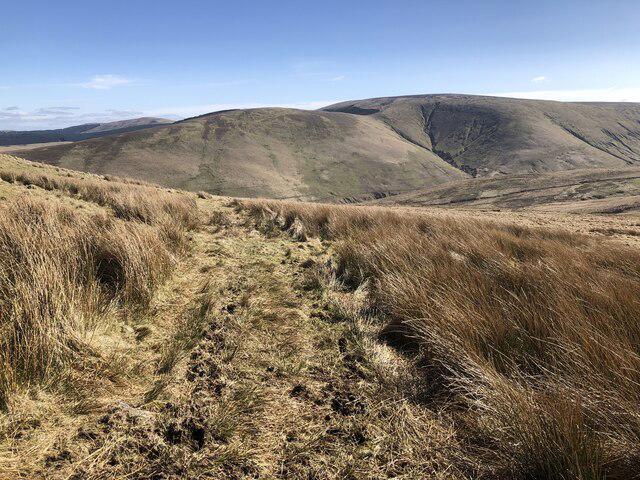 Photo could not load
NT4402 : Quadbike track beneath Skelfhill Pen
Richard Webb
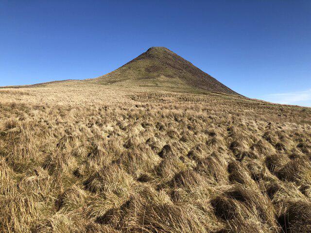 Photo could not load
NT4403 : Skelfhill Pen
Richard Webb
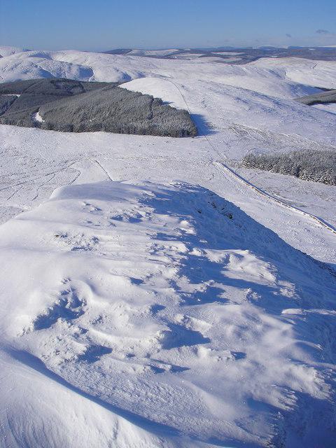 Photo could not load
NT4403 : Looking West Along the summit Ridge, Skelfhill Pen
Iain Lees
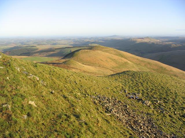 Photo could not load
NT4403 : Skelfhill Pen
Walter Baxter
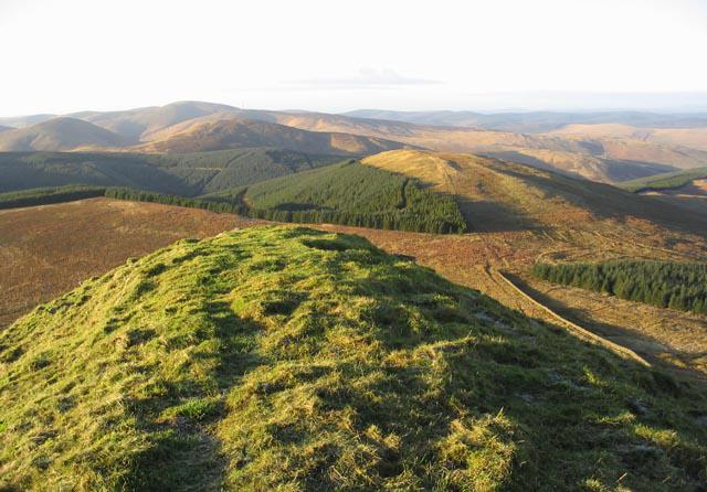 Photo could not load
NT4403 : The summit ridge of Skelfhill Pen
Walter Baxter
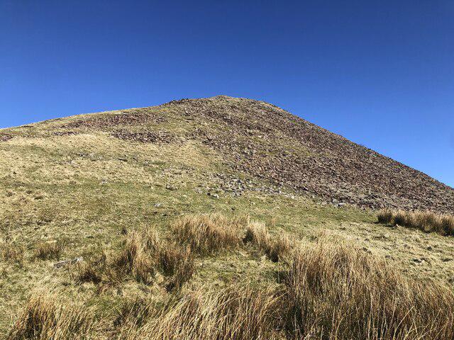 Photo could not load
NT4403 : Skelfhill Pen
Richard Webb
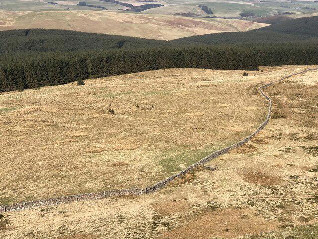 Photo could not load
NT4403 : View from Skelfhill Pen
Richard Webb
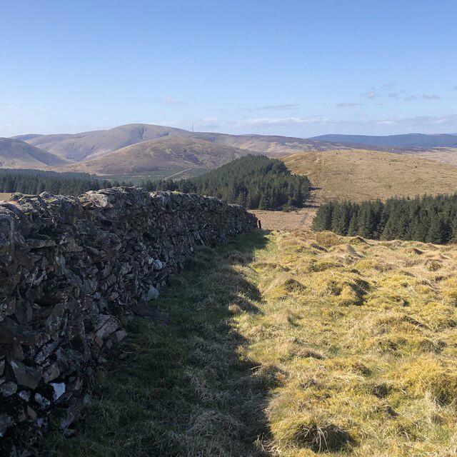 Photo could not load
NT4403 : Dyke under Skelfhill Pen
Richard Webb
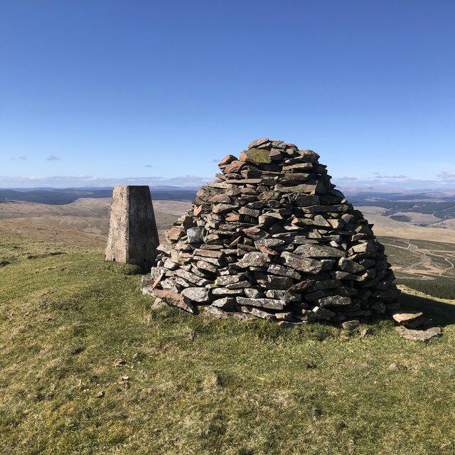 Photo could not load
NT4403 : Summit, Skelfhill Pen
Richard Webb
NT4403 : Skelfhill Pen Summit Cairn
John Tullie
Hill facts and local notes
Classifications
Elevation
532m
1,745 ft
Prominence
103m
Coordinates
55.3188, -2.8815
NT441031
OS Map
79
Explorer: 331
At the Summit
The summit features a large cairn that provides an excellent vantage point and serves as a popular spot for photographs. A trig point can also be found adjacent to the cairn, marking the highest point.
Terrain & Geology
The mountain is primarily composed of sedimentary rocks, with extensive areas of sandstone and mudstone. This geology contributes to the unique biodiversity of the area, hosting various flora and fauna uncommon in other regions.
Views & Scenery
From the summit, hikers can enjoy sweeping views over the surrounding valleys, including the Ewes Valley and the lush landscapes of the Southern Uplands.
History & Heritage
Name Origin
The name 'Skelfhill Pen' is derived from the Scottish Gaelic 'Sgiath 'a' Phenn anti meaning 'the hill of the shelter', reflecting its role as a sheltering landmark in the landscape.
Historical Significance
Historically, Skelfhill Pen has been used by shepherds as a navigation point due to its prominence in the area.
Getting There & Facilities
Check current local access restrictions, parking rules and transport timetables before travelling. These notes do not confirm public access to the summit.
Parking
There is a small pull-in on the B711 road just south of the starting point for the path. Limited space available.
Public Transport
There are limited bus services running from nearby towns, but hiring a car is the most convenient way to access the area.
Nearby Facilities
Facilities are sparse in the immediate vicinity, but Langholm offers several cafés, shops, and public toilets.
Safety Information
Known Hazards
- This area can be subject to sudden weather changes, including mist and rain, which can reduce visibility. Be sure to check local forecasts before heading out.
General Safety Tips
- Check weather conditions before setting out
- Carry appropriate clothing and equipment
- Let someone know your planned route
- Take a map, compass, and GPS device
- Carry emergency supplies: food, water, first aid kit, torch
Hills
Some common questions about the hills answered
Are there group walks up Skelfhill Pen?
Many walkers use Walkmates to join or organise walks with others. You can check for group walks around Skelfhill Pen through the maps
Are there other walkers around Skelfhill Pen?
Activity varies by location and time, but Walkmates lets you see whether others have shared walks or shown interest in this area. Find other people through the walking friends search walking friends for Skelfhill Pen search or of course create your own walk for Skelfhill Pen
Can I organise a walk to Skelfhill Pen?
Yes. If there aren’t any walks listed already, you can create a walk and make it available for others to join.
If you're signed up to Walkmates, you can create a walk to Skelfhill Pen.
How do I find a walk up this hill?
There are often multiple ways to walk this hill, depending on experience and route preference. Walkmates helps you explore walks and routes that others have shared.
Can I suggest a new route up Skelfhill Pen?
Yes. You can suggest or create routes to share with others. Walkmates focuses on the social side of walking, so routes are used to help people organise walks and explore areas together, rather than as detailed navigation tools or route libraries.
Other uses really appreciate knowledgeable walkers sharing their routes. Share your favourite route to Skelfhill Pen here
The is an error or something incorrect about this hill. How do I let you know?
We always strive to keep the information on Walkmates as accurate as possible. If you find an error, please let us know through the contact form and we'll aim to correct it as quickly as possible
Community Discussion
Comments
Location
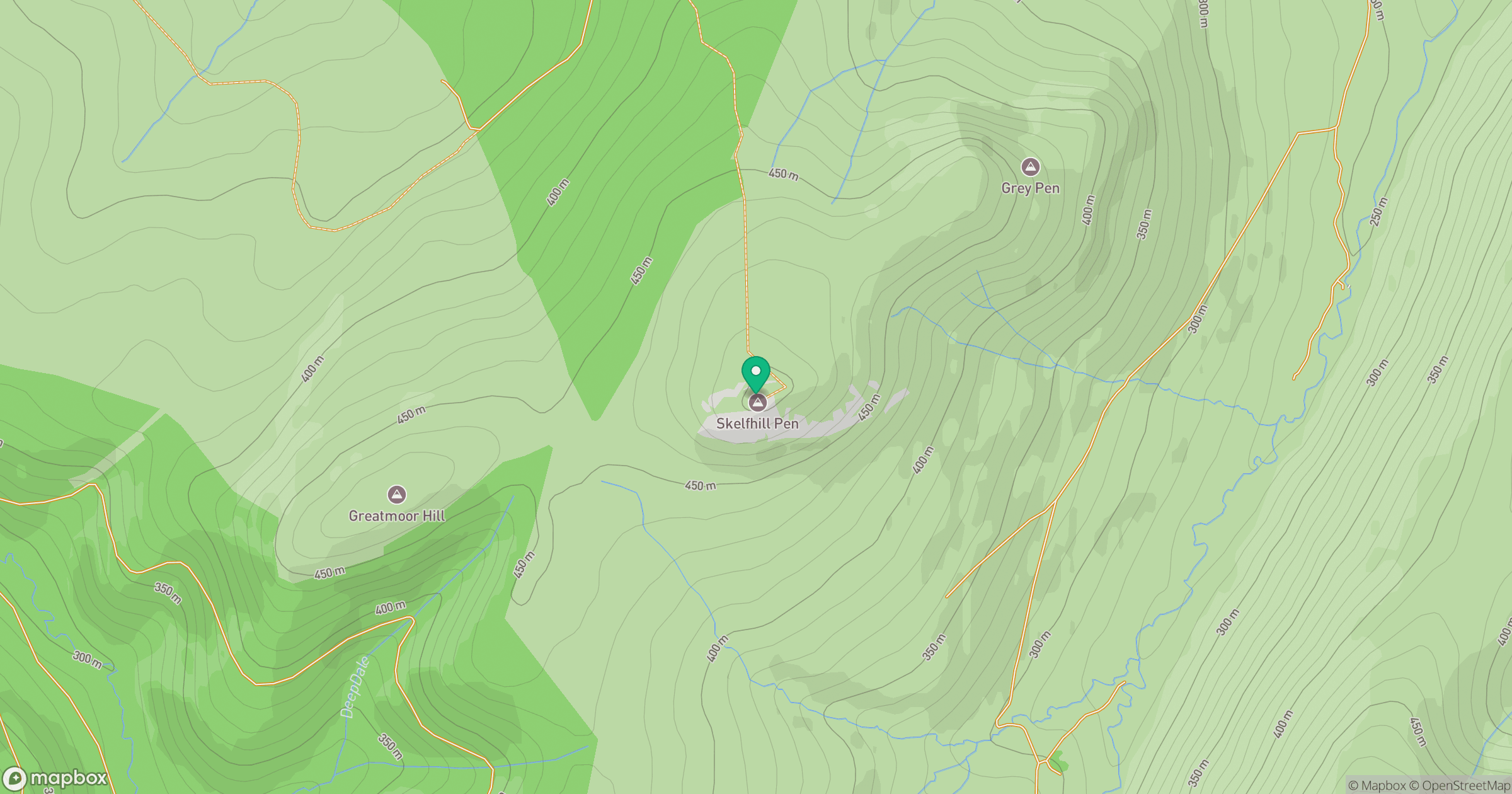
Grid reference: NT441031
View on OpenStreetMapOpens a map in a new tab, centred on the hill.
Hills within 30 km
Straight-line distance, not a walking route or confirmation of access.
No comments yet. Be the first.