

Ellson Fell
Good walks are even better shared.
NY4198 : Ellson Fell
Rude Health Photo source
Overview
Ellson Fell: A Lake District Gem
Ellson Fell is a delightful fell nestled within the picturesque Lake District, known for its moderate elevation and stunning views.
Geology
The mountain is composed primarily of sedimentary rocks, including mudstone and sandstone, revealing the region's rich geological history. It offers a unique perspective on how erosion over time has shaped the stunning landscapes we see today.
Routes
The most popular route starts in the charming village of Patterdale. This 7.5 km walk takes about 3.5 hours and offers moderate difficulty, making it accessible to a wide range of walkers. It's a scenic journey weaving through verdant valleys and lush landscapes that leave you pinching yourself at the sheer beauty of it all.
Summit Features
Upon reaching the summit, hikers will be greeted by a small cairn and a trig point. These are the perfect spots to rest, take in the surroundings, and capture some memorable photos.
Terrain Type
The terrain consists of grassy slopes interspersed with rocky outcrops, gradually steepening as one approaches the peak. A well-placed foot can mean the difference between breath-taking views and a tumble, so tread carefully!
Views
Once at the top, the views are nothing short of spectacular! Watch the horizon unveil Ullswater to the east and, if fortunate, spot the majestic Helvellyn rising to greet you from the south. The best times to enjoy these sights are in spring and autumn when the colours are vibrant and the air is crisp.
Hazards
As is the nature of the Lake District, be prepared for sudden weather changes. The sun may be shining one moment, and the next, you might find yourself tiptoeing in a rainstorm. It’s advisable to carry a waterproof jacket and sturdy footwear; after all, slipping can be more than a little embarrassing!
Nearby Summits
Ellson Fell is surrounded by other stunning peaks, including Place Fell and Angle Tarn Pikes, both worth a visit if you fancy extending your adventure.
Access
The nearest parking is at the Patterdale Hotel, but make sure to arrive early to secure a space! Public transport options are available, with local buses connecting Patterdale to Penrith. The village itself is very quaint and offers several facilities:
- Cafes and Pubs: Perfect for refueling.
- Toilets: Available at the village hall or various hotels.
History
The mountain's name, 'Ellson', likely derives from Old Norse, suggesting it has deep-rooted connections to the area’s historical Norse settlements. Over the years, it has become a cherished hiking destination, woven into the folklore and culture of the Lake District.
Now that you have the lowdown on Ellson Fell, it’s time to lace up your boots, pack some sandwiches, and embark on an unforgettable adventure in one of England's finest natural spaces!
Happy hiking!
Explore routes near Ellson Fell
Walks starting near this hill. Open a route to check its map, distance and full itinerary.
Newcastleton Forest Priest Hill Viewpoint Trail
View route
Hawick: Wilton Lodge Park and River Teviot Circular
View route
Kielder Skyspace and Observatory Forest Walk
View route
Bakethin Hide Wild Walk
View route
Route planning notes
These notes describe possible approaches. Check a route's map and access information when planning your walk.
Patterdale to Ellson Fell
Starting from the picturesque village of Patterdale, this route winds through lush valleys and offers stunning views.
Make a day of it, together
Find someone to share the walk with, or organise a day out along a route you like.
Photo Gallery
View all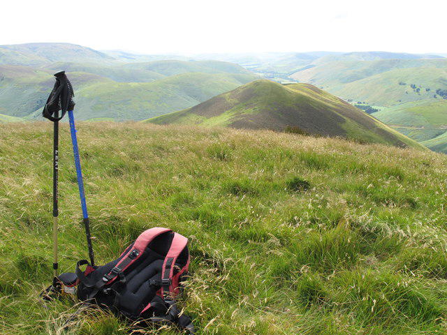 Photo could not load
NY4198 : Ellson Fell
Rude Health
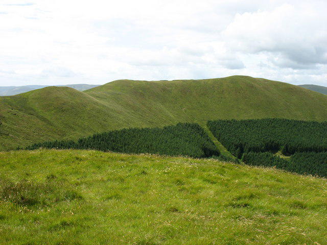 Photo could not load
NY4198 : Ellson Fell from Carlin Tooth
David Purchase
Hill facts and local notes
Classifications
Elevation
537m
1,762 ft
Prominence
163m
Coordinates
55.2771, -2.9297
NY410985
OS Map
79
Explorer: 324
At the Summit
At the summit, you will find a small cairn and a trig point, perfect for a celebratory selfie or elevenses.
Terrain & Geology
Ellson Fell primarily consists of sedimentary rocks, particularly mudstone and sandstone, which provide a rich glimpse into the geological history of the Lake District. The fell is a great example of how erosion has shaped the landscape over millennia.
Views & Scenery
From the summit, enjoy sweeping views of Ullswater to the east, and on a clear day, you might catch sight of Helvellyn to the south.
History & Heritage
Name Origin
The name 'Ellson' may derive from Old Norse meaning 'Ellis's hill', suggesting a historical connection to Norse settlers.
Historical Significance
Ellson Fell has served as a popular hiking destination for generations and is significant in local folklore.
Getting There & Facilities
Parking
The nearest parking is available at the Patterdale Hotel, with a small parking fee. Arrive early to secure a spot.
Public Transport
The closest bus stop is in Patterdale, accessible via local services from Penrith.
Nearby Facilities
Patterdale has local cafes and pubs where one can refuel after a hike, with facilities available. Toilets can be found at the village hall or hotels.
Safety Information
Known Hazards
- Be wary of sudden weather changes; the Lake District is notorious for its capricious climate. Also, loose stones can cause slips, so watch your step.
General Safety Tips
- Check weather conditions before setting out
- Carry appropriate clothing and equipment
- Let someone know your planned route
- Take a map, compass, and GPS device
- Carry emergency supplies: food, water, first aid kit, torch
Hills
Some common questions about the hills answered
Are there group walks up Ellson Fell?
Many walkers use Walkmates to join or organise walks with others. You can check for group walks around Ellson Fell through the maps
Are there other walkers around Ellson Fell?
Activity varies by location and time, but Walkmates lets you see whether others have shared walks or shown interest in this area. Find other people through the walking friends search walking friends for Ellson Fell search or of course create your own walk for Ellson Fell
Can I organise a walk to Ellson Fell?
Yes. If there aren’t any walks listed already, you can create a walk and make it available for others to join.
If you're signed up to Walkmates, you can create a walk to Ellson Fell.
How do I find a walk up this hill?
There are often multiple ways to walk this hill, depending on experience and route preference. Walkmates helps you explore walks and routes that others have shared.
Can I suggest a new route up Ellson Fell?
Yes. You can suggest or create routes to share with others. Walkmates focuses on the social side of walking, so routes are used to help people organise walks and explore areas together, rather than as detailed navigation tools or route libraries.
Other uses really appreciate knowledgeable walkers sharing their routes. Share your favourite route to Ellson Fell here
The is an error or something incorrect about this hill. How do I let you know?
We always strive to keep the information on Walkmates as accurate as possible. If you find an error, please let us know through the contact form and we'll aim to correct it as quickly as possible
Community Discussion
Comments
Location
View the hill's mapped position and surrounding paths.
Grid reference: NY410985
View on OpenStreetMapOpens a map in a new tab, centred on the hill.

No comments yet. Be the first.