
Geal Charn
Good walks are even better shared.
Overview
Geal Charn
Geal Charn, standing tall at 837 meters, is a proud Munro nestled in the breathtaking Scottish Highlands. With its rugged terrain and stunning views, it’s a favourite among walkers and climbers alike.
Geology
The mountain is predominantly made up of schist and granite, which have been chiseled by time and the elements into a fascinating landscape. The rocks might not be the most talkative companions, but they sure provide a dramatic backdrop to your climb.
Routes
There are a couple of well-trodden routes to reach the summit:
East Ridge Route
- Distance: 6.5 km
- Time: Approx. 3.5 hours
- Difficulty: Moderate
This route starts from a small car park, taking you through luscious slopes and rocky outcrops. Be ready for some delightful uphill action!
North-western Approach
- Distance: 7.2 km
- Time: Approx. 4 hours
- Difficulty: Challenging
For those itching for a bit more of a workout, this approach from Glen Roy is bound to deliver stunning views and a sense of accomplishment.
Summit Features
At the top, climbers will find a stout rock cairn. It’s the perfect spot to catch your breath, take a selfie, and pat yourself on the back for another Munro ticked off the list!
Terrain Type
Expect a mix of rocky surfaces and grassy patches. On wet days, watch your step—certain areas can feel a bit like an obstacle course!
Views
The vistas from the top are nothing short of spectacular. You’ll have Ben Nevis in sight along with the sweeping landscapes that characterise the Highlands. Late spring and early autumn are particularly splendid times to visit, when the views are often crystal clear.
Access
Nearest Parking: Look for a small parking area near grid reference NN507792. It’s a quaint little spot but can fill up quickly on sunny days!
Public Transport: While local buses run from Fort William, keep an eye on the times as they’ve been known to play hard to get.
Nearest Town: Fort William is your closest urban centre, rich with amenities and character.
Facilities
While you won’t find any facilities on the mountain itself, Fort William is decked out with cafes, public toilets, and shops to fuel your adventure.
History
Name Meaning: 'Geal Charn' translates to 'white cairn', which is rather fitting given its summit marker.
Significance: This Munro boasts a place in the hearts of many Highland walkers, standing proud among its peers.
Pack your bags, lace your boots, and get ready to embrace the wild beauty that is Geal Charn. It’s a real gem in the crown of Scotland’s mountainous heritage.
Happy hiking!
Explore routes near Geal Charn
Walks starting near this hill. Open a route to check its map, distance and full itinerary.
Fort Augustus to Kytra Lock: Caledonian Canal Towpath
View route
Ben Nevis via Mountain Path
View route
Banavie to Glen Loy Aqueduct: Neptune’s Staircase Canal Towpath
View route
Kenmore: Drummond Hill Black Rock Trail above Loch Tay
View route
Route planning notes
These notes describe possible approaches. Check a route's map and access information when planning your walk.
East Ridge Route
This scenic route starts from the small car park near the open moorland to the east, leading you through grassy slopes and rocky outcrops to the summit.
North-western Approach
A slightly more challenging trail that starts from the Glen Roy area, this route offers stunning views of the surrounding valleys and lakes.
Make a day of it, together
Find someone to share the walk with, or organise a day out along a route you like.
Hill facts and local notes
Classifications
Elevation
1,050m
3,444 ft
Prominence
311m
Coordinates
56.8978, -4.4572
NN504811
OS Map
42
Explorer: OL50 393
At the Summit
The summit features a prominent rock cairn, which is a traditional marker for summiteers, and offers a panoramic view of the surrounding peaks.
Terrain & Geology
Geal Charn is primarily composed of an underlying layer of schist and granite. These stones have weathered over time, creating a rugged yet stunning landscape that defines its character.
Views & Scenery
At the top, you can enjoy breathtaking views of Ben Nevis to the south and the Nevis Range, as well as the beautiful Glen Roy with its famous parallel roads.
History & Heritage
Name Origin
The name 'Geal Charn' translates from Gaelic as 'white cairn', likely referencing its summit features.
Historical Significance
It is a popular destination for hikers, drawing those eager to conquer another Munro and experience the natural beauty of the Highlands.
Getting There & Facilities
Parking
There is a small parking area near the access point to the East Ridge Route at grid reference NN507792, suitable for several cars.
Public Transport
The nearest bus service operates from Fort William to nearby villages, but check the schedule as it may be limited, particularly in the off-peak season.
Nearby Facilities
Fort William offers various facilities, including cafes, restaurants, and public toilets. Bring your own snacks as you might not find a café up on the mountain!
Safety Information
Known Hazards
- Be cautious of occasional rocky outcrops that may be slippery, particularly when wet. Weather can change rapidly in the Highlands, so always be prepared.
General Safety Tips
- Check weather conditions before setting out
- Carry appropriate clothing and equipment
- Let someone know your planned route
- Take a map, compass, and GPS device
- Carry emergency supplies: food, water, first aid kit, torch
Hills
Some common questions about the hills answered
Are there group walks up Geal Charn?
Many walkers use Walkmates to join or organise walks with others. You can check for group walks around Geal Charn through the maps
Are there other walkers around Geal Charn?
Activity varies by location and time, but Walkmates lets you see whether others have shared walks or shown interest in this area. Find other people through the walking friends search walking friends for Geal Charn search or of course create your own walk for Geal Charn
Can I organise a walk to Geal Charn?
Yes. If there aren’t any walks listed already, you can create a walk and make it available for others to join.
If you're signed up to Walkmates, you can create a walk to Geal Charn.
How do I find a walk up this hill?
There are often multiple ways to walk this hill, depending on experience and route preference. Walkmates helps you explore walks and routes that others have shared.
Can I suggest a new route up Geal Charn?
Yes. You can suggest or create routes to share with others. Walkmates focuses on the social side of walking, so routes are used to help people organise walks and explore areas together, rather than as detailed navigation tools or route libraries.
Other uses really appreciate knowledgeable walkers sharing their routes. Share your favourite route to Geal Charn here
The is an error or something incorrect about this hill. How do I let you know?
We always strive to keep the information on Walkmates as accurate as possible. If you find an error, please let us know through the contact form and we'll aim to correct it as quickly as possible
Community Discussion
Comments
Location
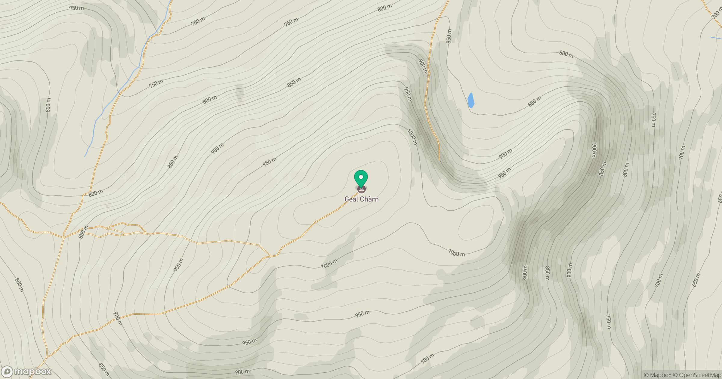
Grid reference: NN504811
View on OpenStreetMapOpens a map in a new tab, centred on the hill.
No comments yet. Be the first.