

Binnein Shuas
Good walks are even better shared.
NN4682 : Binnein Shuas summit from the north-east
Iain A Robertson Photo source
Overview
Binnein Shuas
Binnein Shuas, standing tall at 943 meters, is a proud Munro nestled in the scenic Scottish Highlands. Well-loved by hikers, this mountain serves as a beacon for those in search of adventure and memorable vistas.
Geology
Comprising robust granite rock, Binnein Shuas exhibits the rugged beauty characteristic of the Highlands. The legacy of glacial activity is evident, offering fascinating landforms and a glimpse into the past geology that has shaped this area over millennia.
Routes
West Highland Way
This scenic hiking trail provides an excellent approach to the mountain. Spanning approximately 11 km, it takes an estimated 4 hours to complete. Expect a moderate level of difficulty and enjoy the well-trodden paths as you make your way towards the summit.
Path from the A82
For those who relish a steeper challenge, this direct route from the A82 covers about 6.5 km. It can be tackled in around 3 hours and is classified as challenging, rewarding hikers with fantastic views as they ascend.
Summit Features
At the majestic summit, you'll find a small yet iconic cairn, providing a perfect photo opportunity against the backdrop of sprawling landscapes.
Terrain Type
Hiking Binnein Shuas means navigating rocky paths accentuated by grassy patches; however, be prepared for some boggy areas, particularly after rain!
Views
The vistas from the top are nothing short of breathtaking. Marvel at Loch Linnie and the enchanting landscape of Glencoe Valley, especially during the summer months when skies are clearer. Late spring to early autumn is when you'll want to hit the trails for the best views.
Hazards
Always keep an eye on changing weather conditions. The terrain can be slick, and visibility may diminish quickly, so remain vigilant.
Access
Parking
A convenient car park lies close to the A82, just a short 2 km stroll from the mountain's base.
Public Transport
Buses from Glasgow do pass through the area, but check the schedules to ensure you find a suitable option.
Nearest Town
Ballachulish is your closest bet for food and facilities, with a mere 10 km between the town and the mountain.
Facilities
Check out Ballachulish for cafes, shops, and public toilets to stock up on essentials before you embark on your adventure.
History
The name 'Binnein Shuas' speaks of its towering presence in the landscape. Historically cherished, this mountain continues to thrive as a favorite among climbers seeking to tackle the Munros.
With striking views and a sense of history etched into its granite, Binnein Shuas pulls on the heartstrings of every outdoor enthusiast fortunate enough to lay eyes on it.
Happy hiking!
Explore routes near Binnein Shuas
Walks starting near this hill. Open a route to check its map, distance and full itinerary.
Coire Ardair lochan from Aberarder and back
View route
Fort Augustus to Kytra Lock: Caledonian Canal Towpath
View route
Great Glen Way low route: Fort Augustus to Invermoriston Old Bridge
View route
Ben Nevis via Mountain Path
View route
Route planning notes
These notes describe possible approaches. Check a route's map and access information when planning your walk.
West Highland Way
A scenic section of the West Highland Way provides access from the east, leading to the summit via well-trodden paths.
Path from the A82
Starting from the A82, this route offers a direct ascent to the summit with spectacular views along the way.
Make a day of it, together
Find someone to share the walk with, or organise a day out along a route you like.
Photo Gallery
View all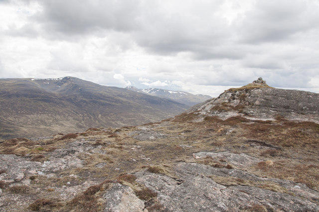 Photo could not load
NN4682 : Binnein Shuas summit from the north-east
Iain A Robertson
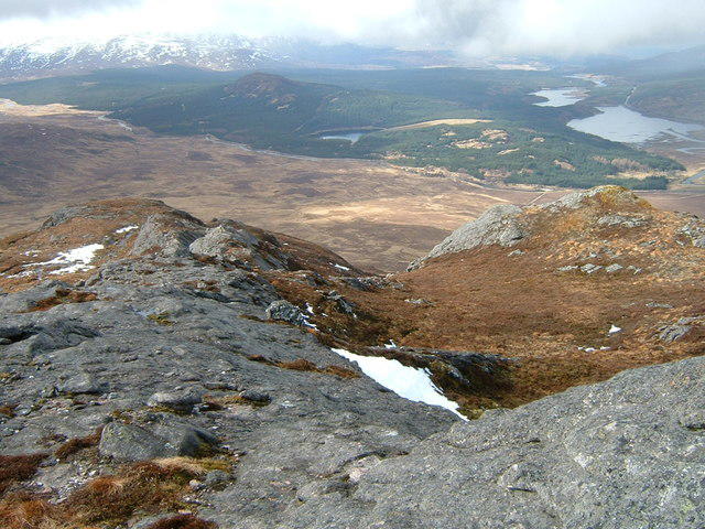 Photo could not load
NN4682 : Southwest from Binnein Shuas
Jim Barton
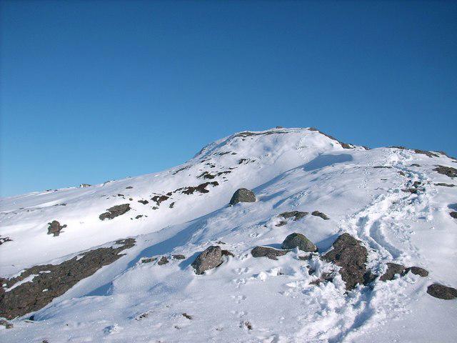 Photo could not load
NN4682 : The summit of Binnein Shuas
Stephen Middlemiss
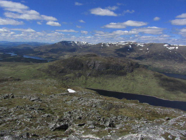 Photo could not load
NN4682 : On the summit of Creag Pitridh with view to Binnein Shuas & Creag Meagaidh
Colin Park
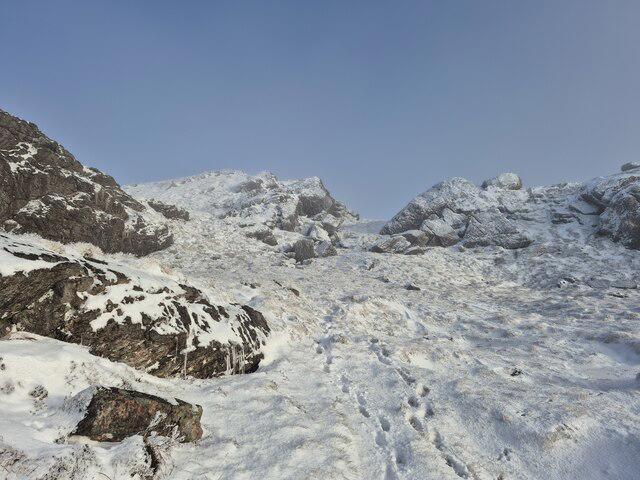 Photo could not load
NN4682 : Binnein Shuas
Steven Brown
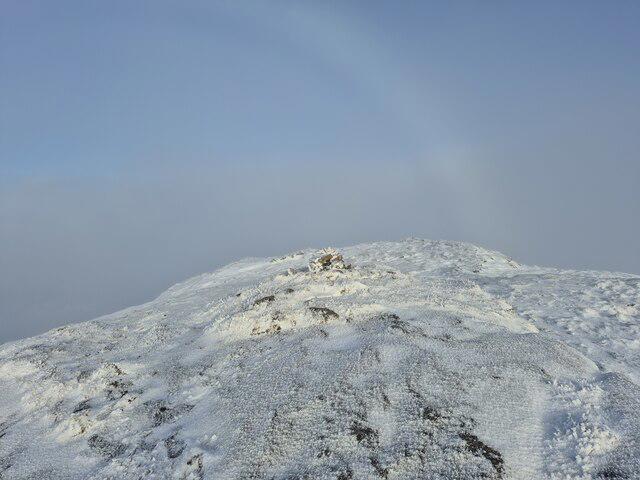 Photo could not load
NN4682 : Summit of Binnein Shuas
Steven Brown
Hill facts and local notes
Classifications
Elevation
747m
2,451 ft
Prominence
391m
Coordinates
56.9098, -4.5259
NN462826
OS Map
34 42
Explorer: OL50 OL55 393 401
At the Summit
The summit is crowned with a small cairn that boasts stunning vistas across the surrounding landscape.
Terrain & Geology
The mountain is primarily composed of granite, which is a staple rock type in the Highlands, giving it a rugged, durable appearance. The area features interesting glacial landforms, testament to the last Ice Age's influence.
Views & Scenery
From the summit, enjoy sweeping views of the surrounding peaks, Loch Linnie, and the rugged terrain of the Glencoe valley.
History & Heritage
Name Origin
The name 'Binnein Shuas' is derived from Scots Gaelic, meaning 'the top peak of the binnein', which reflects its towering stature in the landscape.
Historical Significance
Binnein Shuas has long been revered by locals and is a popular ascent for climbers seeking to conquer the Munros.
Getting There & Facilities
Parking
There is parking available at the car park near the A82, approximately 2 km from the base of the mountain.
Public Transport
The nearest bus stop can be found along the A82 with services from Glasgow. However, checking schedules is advisable as options may be limited.
Nearby Facilities
In Ballachulish, you can find cafes and shops to stock up on essentials before your hike. Public toilets are available in the village.
Safety Information
Known Hazards
- Beware of sudden weather changes typical in the Highlands. The rocky terrain can be slippery, and mist can roll in quickly, reducing visibility.
General Safety Tips
- Check weather conditions before setting out
- Carry appropriate clothing and equipment
- Let someone know your planned route
- Take a map, compass, and GPS device
- Carry emergency supplies: food, water, first aid kit, torch
Hills
Some common questions about the hills answered
Are there group walks up Binnein Shuas?
Many walkers use Walkmates to join or organise walks with others. You can check for group walks around Binnein Shuas through the maps
Are there other walkers around Binnein Shuas?
Activity varies by location and time, but Walkmates lets you see whether others have shared walks or shown interest in this area. Find other people through the walking friends search walking friends for Binnein Shuas search or of course create your own walk for Binnein Shuas
Can I organise a walk to Binnein Shuas?
Yes. If there aren’t any walks listed already, you can create a walk and make it available for others to join.
If you're signed up to Walkmates, you can create a walk to Binnein Shuas.
How do I find a walk up this hill?
There are often multiple ways to walk this hill, depending on experience and route preference. Walkmates helps you explore walks and routes that others have shared.
Can I suggest a new route up Binnein Shuas?
Yes. You can suggest or create routes to share with others. Walkmates focuses on the social side of walking, so routes are used to help people organise walks and explore areas together, rather than as detailed navigation tools or route libraries.
Other uses really appreciate knowledgeable walkers sharing their routes. Share your favourite route to Binnein Shuas here
The is an error or something incorrect about this hill. How do I let you know?
We always strive to keep the information on Walkmates as accurate as possible. If you find an error, please let us know through the contact form and we'll aim to correct it as quickly as possible
Community Discussion
Comments
Location
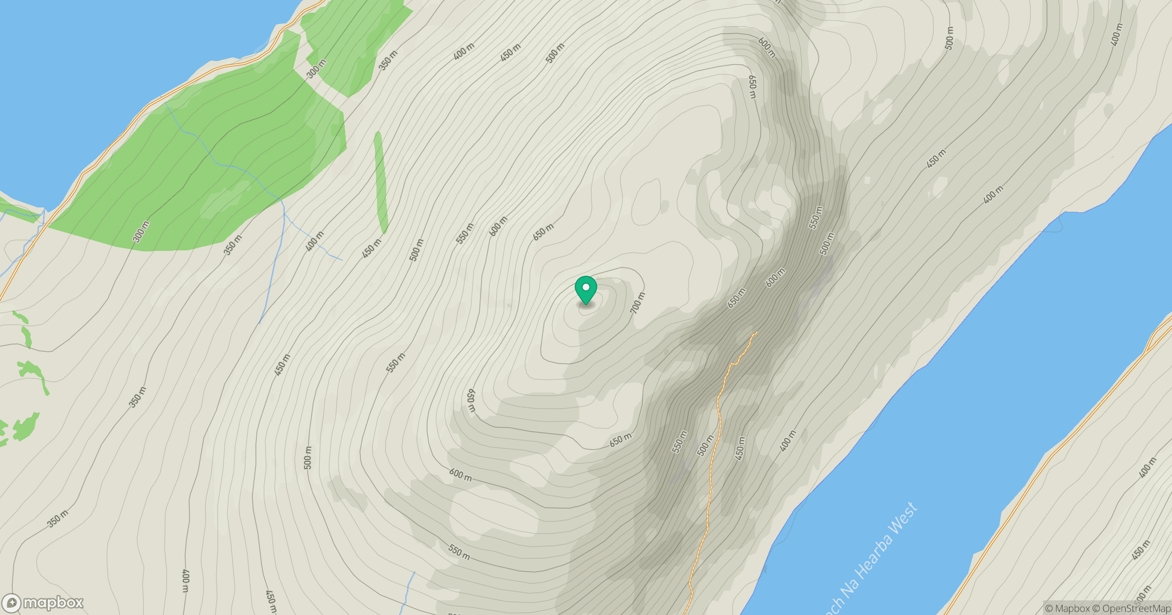
Grid reference: NN462826
View on OpenStreetMapOpens a map in a new tab, centred on the hill.
No comments yet. Be the first.