
Carn Dearg
Good walks are even better shared.
Overview
Carn Dearg: A Highland Classic
Nestled in the breathtaking Scottish Highlands, Carn Dearg stands tall at 1024 meters, ready to challenge spirits and legs alike. This Munro is a favourite among hikers for its stunning views and not-too-technical routes.
Geology
The mountain's granite composition and glacial features are a testament to its ancient formation. Glacial striations decorate the surrounding terrain, providing tangible evidence of the powerful forces that shaped this beautiful landscape centuries ago.
Route Options
For the adventurous, the North Ridge Route is highly recommended. Starting from the car park at NN504764, this 7 km route ascends steadily and offers splendid views along the way. It provides a moderate challenge, ideal for those with hillwalking experience.
Should you be feeling more ambitious, consider the Glencoe Approach. This 10 km trek through the stunning Glencoe valley demands a bit more stamina, especially as you tackle the final steep ascent. At six hours, it’s no walk in the park but the view from the top will have you singing its praises!
Summit Features
Reaching the summit is like stepping into a postcard. You’re greeted by a large stone cairn and 360-degree vistas that include iconic Highland peaks and the serene Loch Leven. Prepare your camera – this is Instagram gold!
Terrain and Hazards
Carn Dearg’s terrain mixes grassy slopes with rocky patches that may challenge the unsteady. Keep alert for loose rocks, especially near the summit, and wear sturdy footwear. As always in Scotland, be ready for unpredictable weather – it can change quicker than you can say 'scone'.
Views
Stand atop Carn Dearg and bask in captivating views of the surrounding landscape: the striking Aonach Eagach ridge and Buachaille Etive Mor will leave you breathless (and not just from the climb!). Spring and autumn offer the best visibility and conditions.
Access and Facilities
Access is straightforward via local transport links to Ballachulish, only a short drive from the trailheads. Parking is readily available but fills up quickly, so an early start is wise. In Ballachulish, you’ll find pubs and cafes to refuel post-hike, so save some energy for a pint!
Conclusion
With its enchanting beauty, rich history, and various routes for different skill levels, Carn Dearg is a must-visit for anyone looking to experience the robust charm of the Scottish Highlands. Grab your hiking boots and a trusty friend – adventure awaits!
Don't forget to pack your sense of humour along with your waterproofs; after all, who doesn’t love a good soggy bottom?
Explore routes near Carn Dearg
Walks starting near this hill. Open a route to check its map, distance and full itinerary.
Fort Augustus to Kytra Lock: Caledonian Canal Towpath
View route
Ben Nevis via Mountain Path
View route
Banavie to Glen Loy Aqueduct: Neptune’s Staircase Canal Towpath
View route
Kenmore: Drummond Hill Black Rock Trail above Loch Tay
View route
Route planning notes
These notes describe possible approaches. Check a route's map and access information when planning your walk.
North Ridge Route
A straightforward ascent via the scenic north ridge, offering excellent views of the surrounding peaks.
Glencoe Approach
Starting from the delightful Glencoe valley, this route winds through lush greenery before tackling a steeper section closer to the summit.
Make a day of it, together
Find someone to share the walk with, or organise a day out along a route you like.
Hill facts and local notes
Classifications
Elevation
1,034m
3,392 ft
Prominence
158m
Coordinates
56.8552, -4.4547
NN504764
OS Map
42
Explorer: OL50 393
At the Summit
The summit features a large stone cairn and a stunning panoramic view that will make you want to take endless selfies.
Terrain & Geology
Carn Dearg is primarily composed of granite with distinctive glacial features such as moraines and striations, which tell a tale of the ice that once carved these mountain landscapes.
Views & Scenery
From the summit, you can see the impressive Aonach Eagach ridge, Buachaille Etive Mor, and the tranquil waters of Loch Leven.
History & Heritage
Name Origin
The name 'Carn Dearg' translates to 'Red Hill' in Gaelic, likely referring to the distinctive reddish hue of the granite under certain light conditions.
Historical Significance
Carn Dearg has long been a part of local folklore and history, often frequented by both seasoned climbers and those looking to soak in the rich natural beauty of the Highlands.
Getting There & Facilities
Parking
There is a large car park at the base of the North Ridge Route located at NN504764, which fills up quickly during peak times.
Public Transport
Buses run regularly from nearby towns, but check the schedule as services may be limited on weekends and public holidays.
Nearby Facilities
Cafes and toilets are available in Ballachulish, but it's best to light your inner scout and be prepared with your own snacks and refreshments for the hike.
Safety Information
Known Hazards
- Beware of sudden weather changes, especially in the Highlands. Also, loose rocks near the summit can be treacherous, so watch your step!
General Safety Tips
- Check weather conditions before setting out
- Carry appropriate clothing and equipment
- Let someone know your planned route
- Take a map, compass, and GPS device
- Carry emergency supplies: food, water, first aid kit, torch
Hills
Some common questions about the hills answered
Are there group walks up Carn Dearg?
Many walkers use Walkmates to join or organise walks with others. You can check for group walks around Carn Dearg through the maps
Are there other walkers around Carn Dearg?
Activity varies by location and time, but Walkmates lets you see whether others have shared walks or shown interest in this area. Find other people through the walking friends search walking friends for Carn Dearg search or of course create your own walk for Carn Dearg
Can I organise a walk to Carn Dearg?
Yes. If there aren’t any walks listed already, you can create a walk and make it available for others to join.
If you're signed up to Walkmates, you can create a walk to Carn Dearg.
How do I find a walk up this hill?
There are often multiple ways to walk this hill, depending on experience and route preference. Walkmates helps you explore walks and routes that others have shared.
Can I suggest a new route up Carn Dearg?
Yes. You can suggest or create routes to share with others. Walkmates focuses on the social side of walking, so routes are used to help people organise walks and explore areas together, rather than as detailed navigation tools or route libraries.
Other uses really appreciate knowledgeable walkers sharing their routes. Share your favourite route to Carn Dearg here
The is an error or something incorrect about this hill. How do I let you know?
We always strive to keep the information on Walkmates as accurate as possible. If you find an error, please let us know through the contact form and we'll aim to correct it as quickly as possible
Community Discussion
Comments
Location
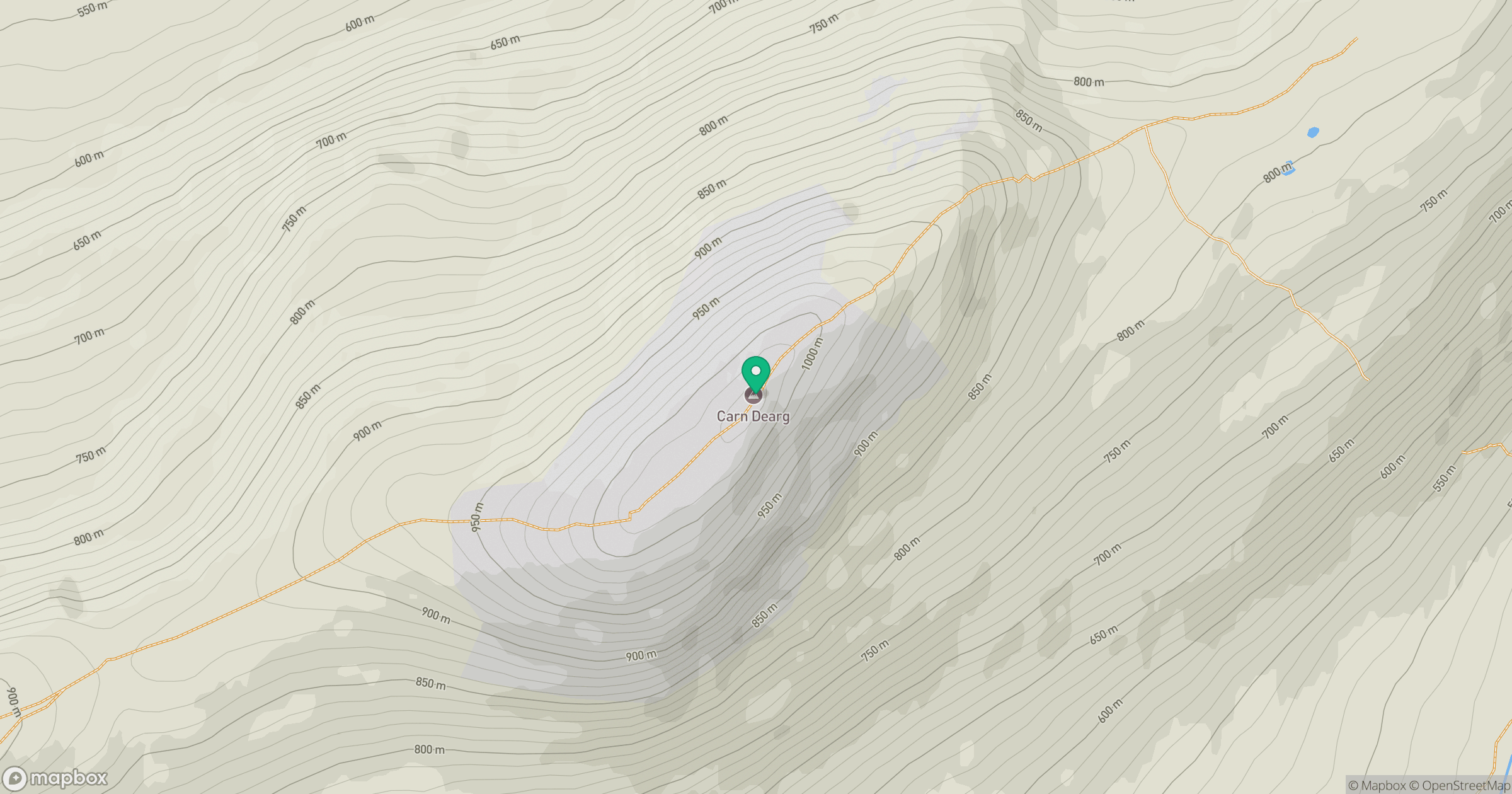
Grid reference: NN504764
View on OpenStreetMapOpens a map in a new tab, centred on the hill.
No comments yet. Be the first.