

Gairich
Good walks are even better shared.
NN0299 : Grassy summit area of Gairich
Steven Brown Photo source
Overview
Gairich: A Highland Gem
Nestled in the stunning Scottish Highlands, Gairich stands as a proud Munro, reaching an impressive elevation of 810 meters. Known for its breathtaking views and rugged beauty, this mountain is a must-visit for any hiking enthusiast.
Geology
Gairich is made primarily of formidable metamorphic schists. These ancient rocks tell a story that goes back millions of years, formed under immense heat and pressure. The rocky terrain can be challenging, but it’s the perfect backdrop for an epic adventure.
Routes
The most popular route is the 'Gairich from the West', which is about 10 km long and typically takes around 4 hours to traverse. This moderately challenging route is well-marked, and as you ascend, you’ll be rewarded with increasingly stunning views. Remember, a little sweat goes a long way in experiencing the Highland beauty!
Summit Features
Upon reaching the summit, hikers are greeted by a lovely stone cairn, ideal for photos and a place to catch your breath. The panoramic scenery around you is simply jaw-dropping; make sure you take a moment to soak it all in.
Terrain
The terrain varies, comprising rocky outcrops and grassy slopes, with a sprinkle of boggy bits that can test your boots—keep your eyes peeled!
Views
From the summit, you’ll be treated to magnificent views of Loch Arkaig to the south and the expansive Great Glen to the north. On clear days, the towering Nevis Range graces the horizon. The best times to appreciate these views are in spring and summer when the heather paints the landscape in hues of purple.
Hazards
Be cautious of loose rocks, especially when the ground is wet. The atmosphere can change as quickly as you can say 'Highland weather', so pack adequately to prepare for anything!
Nearby Summits
If you’re keen for more, consider tackling nearby summits like Sgurr na Ciche and Cnap a' Chaochal. A perfect way to extend your adventure!
Access
You'll find parking at a small layby on the A861, about 4 km from the trailhead, but be sure to park responsibly. If you're relying on public transport, buses from Fort William serve Kinlochailort, from where it’s a brief walk to the trailhead.
Facilities
Fort William is the nearest town where you can find abundant facilities, from cafes to shops—ideal for stocking up on snacks before your journey.
History
The name 'Gairich' hints at its breezy conditions; it translates from Gaelic as 'the windy place'. With its prominent stature, Gairich is not just another peak but a beloved milestone for Munro-baggers and artists alike.
Put on your hiking boots, grab your camera, and head out to Gairich—where the highs are worth the climbs!
Explore routes near Gairich
Walks starting near this hill. Open a route to check its map, distance and full itinerary.
Banavie to Glen Loy Aqueduct: Neptune’s Staircase Canal Towpath
View route
Ben Nevis via Mountain Path
View route
Loch Affric full circuit from River Affric
View route
Fort Augustus to Kytra Lock: Caledonian Canal Towpath
View route
Route planning notes
These notes describe possible approaches. Check a route's map and access information when planning your walk.
Gairich from the West
A popular route starting from the western approach, this path provides a steady incline with a well-marked trail, leading to stunning views as you ascend.
Make a day of it, together
Find someone to share the walk with, or organise a day out along a route you like.
Photo Gallery
View all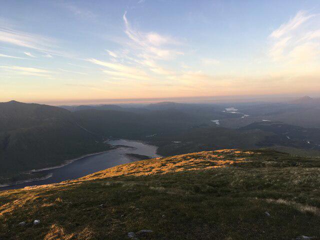 Photo could not load
NN0299 : Grassy summit area of Gairich
Steven Brown
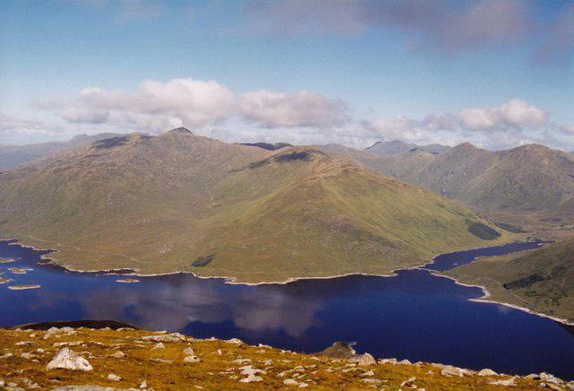 Photo could not load
NN0299 : Gairich summit
AlastairG
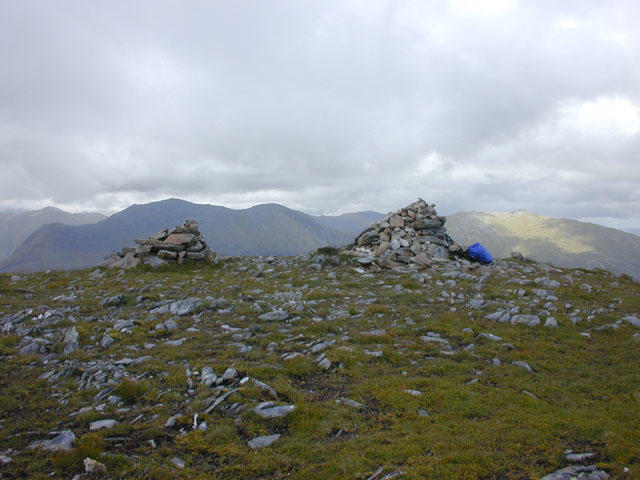 Photo could not load
NN0299 : Gairich summit cairns
Nigel Brown
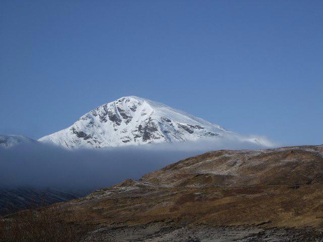 Photo could not load
NN0299 : Snowy Gairich from across Loch Quoich
Tim Denvir
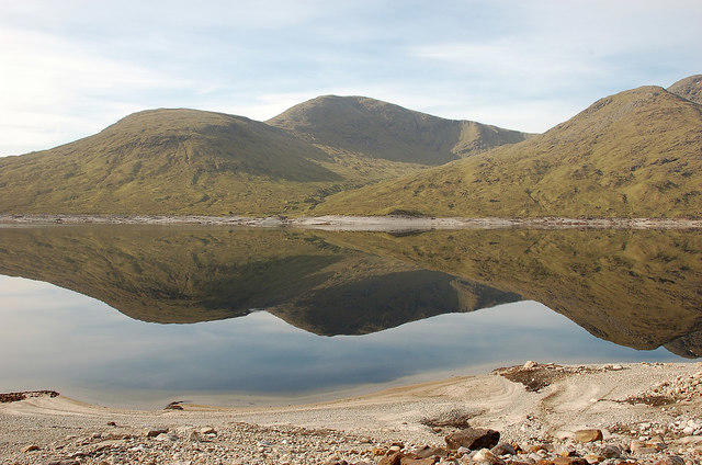 Photo could not load
NN0299 : Gairich from Loch Quoich
Jim Barton
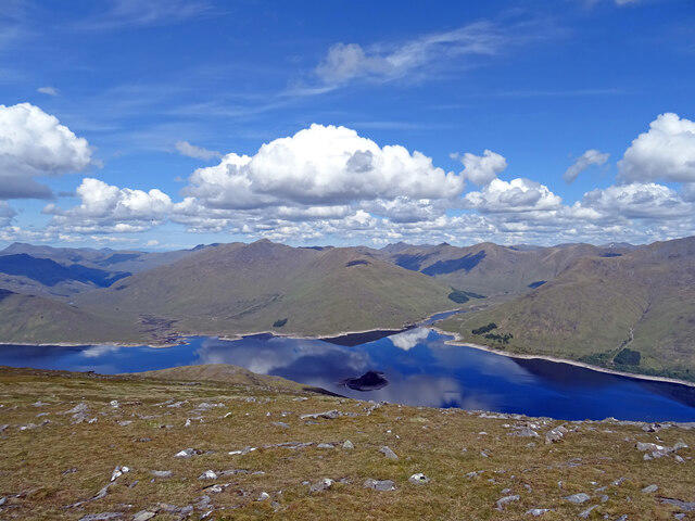 Photo could not load
NN0299 : Gairich Grandeur
Adam Ward
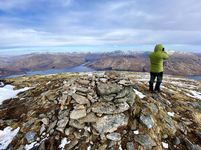 Photo could not load
NN0299 : On the Munro of Gairich 919m
Iain Lees
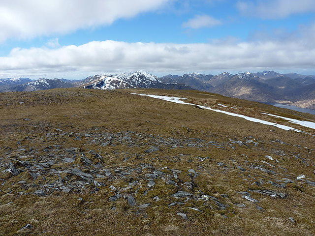 Photo could not load
NN0299 : From Gairich west into Knoydart
Richard Law
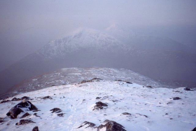 Photo could not load
NN0299 : On Gairich
Richard Webb
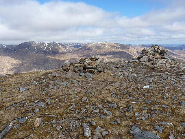
NN0299 : Gairich summit cairn
Richard Law
Hill facts and local notes
Classifications
Elevation
919m
3,015 ft
Prominence
552m
Coordinates
57.0449, -5.2558
NN025995
OS Map
33
Explorer: 399
At the Summit
At the summit, you'll find a splendid stone cairn that offers a perfect selfie opportunity alongside breathtaking vistas.
Terrain & Geology
Gairich is primarily composed of metamorphic schists, which are the result of intense pressure and heat over geological time. This gives the mountain its rugged appearance and impressive cliffs.
Views & Scenery
The summit offers impressive views of Loch Arkaig to the south and the faint outlines of the Great Glen to the north. On a clear day, the Nevis range can also be seen.
History & Heritage
Name Origin
The name 'Gairich' is derived from the Gaelic 'Gaothair,' meaning 'the windy place', a fitting tribute to the breezy summit.
Historical Significance
Gairich's prominence makes it a beloved target for Munro-baggers, while its striking beauty has inspired many artists over the decades.
Getting There & Facilities
Parking
There's a small layby on the A861, around 4 km from the start of the trail. Park with care, as this road can be busy with local traffic.
Public Transport
The nearest bus service runs from Fort William to Kinlochailort. From there, it's about a 4 km walk to the trailhead.
Nearby Facilities
Facilities are limited on the mountain itself, but Fort William offers numerous cafes, toilets, and shops to stock up before your adventure.
Safety Information
Known Hazards
- Watch for loose rocks, especially in wet conditions; the terrain can be slippery. Also, beware of sudden changes in weather, typical in the Highlands.
General Safety Tips
- Check weather conditions before setting out
- Carry appropriate clothing and equipment
- Let someone know your planned route
- Take a map, compass, and GPS device
- Carry emergency supplies: food, water, first aid kit, torch
Hills
Some common questions about the hills answered
Are there group walks up Gairich?
Many walkers use Walkmates to join or organise walks with others. You can check for group walks around Gairich through the maps
Are there other walkers around Gairich?
Activity varies by location and time, but Walkmates lets you see whether others have shared walks or shown interest in this area. Find other people through the walking friends search walking friends for Gairich search or of course create your own walk for Gairich
Can I organise a walk to Gairich?
Yes. If there aren’t any walks listed already, you can create a walk and make it available for others to join.
If you're signed up to Walkmates, you can create a walk to Gairich.
How do I find a walk up this hill?
There are often multiple ways to walk this hill, depending on experience and route preference. Walkmates helps you explore walks and routes that others have shared.
Can I suggest a new route up Gairich?
Yes. You can suggest or create routes to share with others. Walkmates focuses on the social side of walking, so routes are used to help people organise walks and explore areas together, rather than as detailed navigation tools or route libraries.
Other uses really appreciate knowledgeable walkers sharing their routes. Share your favourite route to Gairich here
The is an error or something incorrect about this hill. How do I let you know?
We always strive to keep the information on Walkmates as accurate as possible. If you find an error, please let us know through the contact form and we'll aim to correct it as quickly as possible
Community Discussion
Comments
Location
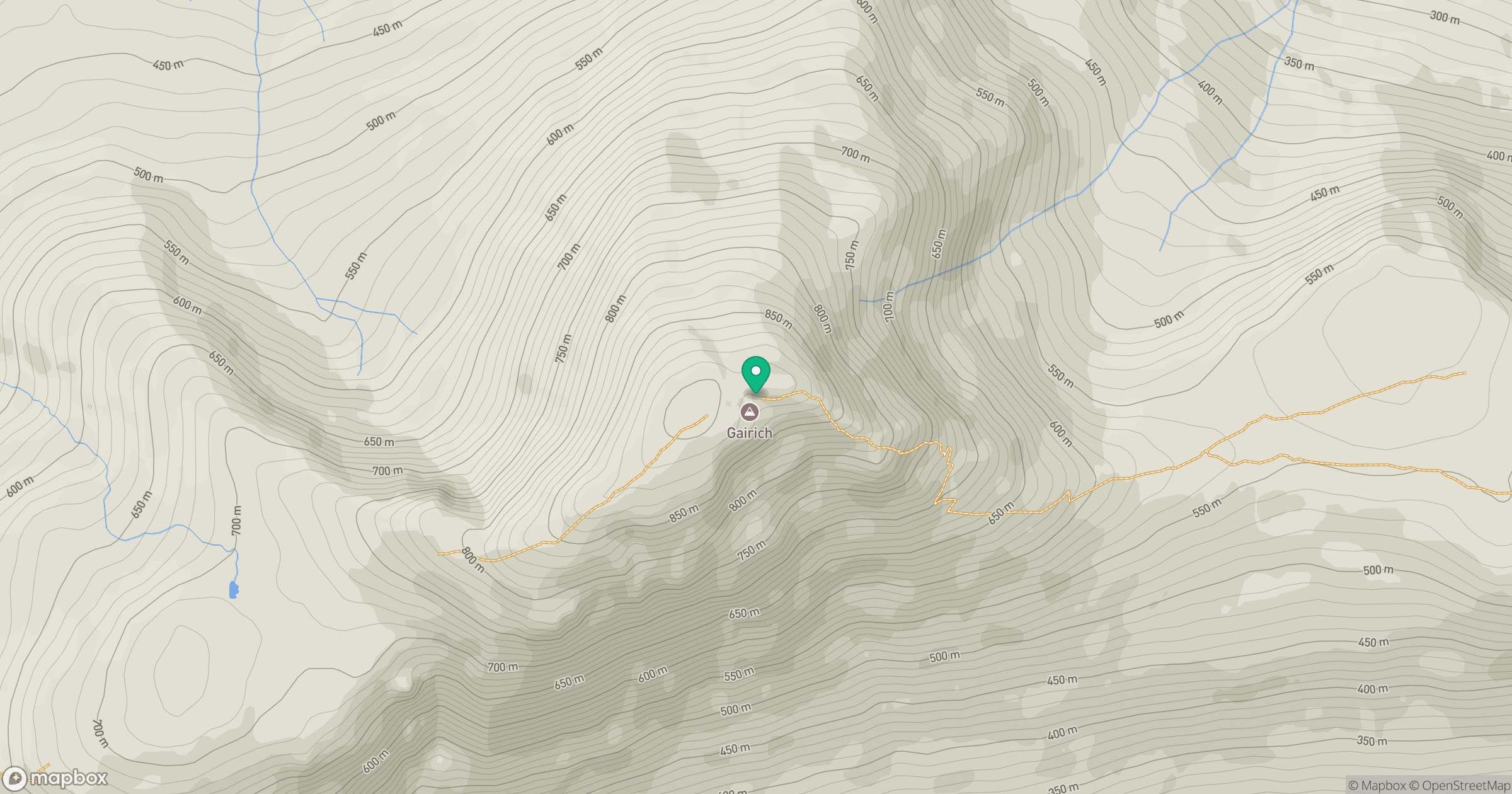
Grid reference: NN025995
View on OpenStreetMapOpens a map in a new tab, centred on the hill.
Nearby Hills
Gleouraich
1,035m
Sgurr a' Mhaoraich
1,027m
Sgurr Fhuaran
1,069m
An Caisteal
622m
Mam Sodhail
1,179m
No comments yet. Be the first.