
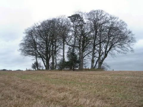
Fursdon Hill
Good walks are even better shared.
Overview
Fursdon Hill
Nestled in the rolling countryside of Devon, Fursdon Hill may not be the highest in the land, but it surely packs a punch in terms of enchanting views and delightful trails. With an elevation of 148 meters, this hill is perfect for a family day out or a tranquil escape from the hustle and bustle.
Geology
Fursdon Hill boasts fascinating geology primarily comprised of Devonian sedimentary rocks. The layers of sandstone and mudstone that make up this hill have weathered gracefully over time, creating a vibrant tapestry of flora and fauna that hikers are sure to appreciate.
Routes
One popular route is the Fursdon Hill Circular Route, starting from the quaint hamlet of Fursdon. This route is approximately 5 km long and is rated as easy, making it beginner-friendly and suitable for the whole family. Expect the trek to take around 2 hours, perfect for a casual stroll.
Summit Features
The summit is marked by a small cairn—ideal for a quick photo op or two! It’s a great spot to grab a bite to eat, relax, and take in your surroundings.
Terrain Type
Expect grassy stretches and the occasional rocky outcrop. Keep your waterproof boots on standby, particularly after any rain, as there may be some muddy patches to navigate.
Views
From the top, you will be rewarded with stunning views of the Devon countryside. Look out for the picturesque villages and, on clear days, the moors of Dartmoor in the distance. The best times to embrace these views are during the spring and early autumn when the landscape comes alive with colour.
Hazards
While the paths are generally safe, do be careful of muddy areas after rain, and watch out for any low-hanging branches that might catch you unawares. You wouldn’t be the first hiker to exit the woods with the latest hairstyle!
Nearby Summits
If you’re looking to extend your journey, nearby summits include Haldon Hill (201 meters) and Great Haldon (288 meters), both offering more trails and different perspectives of the beautiful Devon landscape.
Access
Parking is limited near Fursdon, so be courteous to the locals when you park. If you're relying on public transport, hop off at the Longdown bus stop and take a brief walk to the start of your adventure. The bustling town of Exeter is a mere 10 km away, providing ample facilities and refreshments.
Facilities
While there’s nothing on the hill itself, Exeter offers a wealth of cafes and toilets for your convenience before or after your hike.
History
The name 'Fursdon' is said to derive from Old English, relating to the natural growth found in the area. Historically, it may have served as a lookout point for locals, adding an air of intrigue to your hike.
In summary, Fursdon Hill is a charming destination for anyone looking to enjoy Devon's natural beauty without the strenuous climb. So grab your walking boots, pack a sandwich, and make a day of it—after all, there’s nothing like a bit of fresh air and fine views to lift the spirits!
Explore routes near Fursdon Hill
Public walks starting within 80 km of this hill. Nearby does not mean a route reaches the summit; check its map and access before setting out.
Killerton to Clyston Mill: Broadclyst farmland and heritage walk
View route
Tiverton Grand Western Canal: Crownhill Bridge Return
View route
Exeter Canal, Double Locks and Countess Wear river circuit
View route
Sampford Peverell to Whipcott Bridge: Grand Western Canal return
View route
Route planning notes
These notes describe possible approaches, not verified navigable routes or permission to cross land. Check current paths, local access rules and conditions before setting out.
Fursdon Hill Circular Route
A straightforward circular route starting from the nearby hamlet of Fursdon. It encompasses stunning views of the surrounding countryside.
Make a day of it, together
Find someone to share the walk with, or organise a day out along a route you like.
Photo Gallery
View all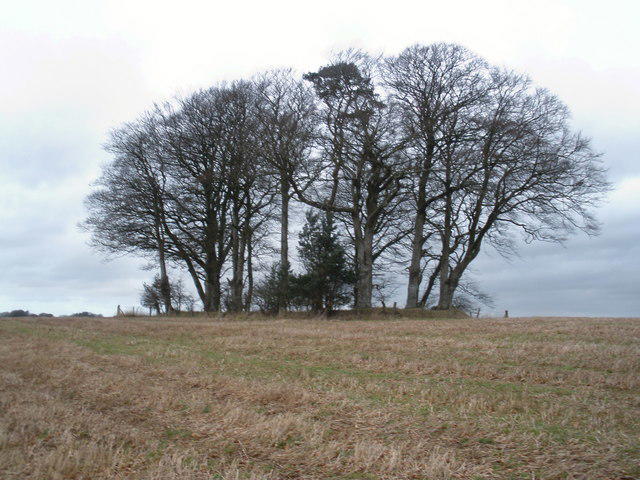 Photo could not load
SS9204 : The top of Fursdon Hill
Roger Cornfoot
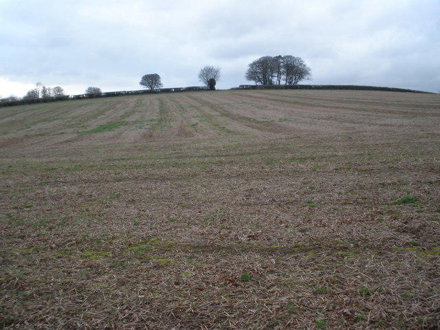 Photo could not load
SS9204 : Looking up to Fursdon Hill
Roger Cornfoot
Hill facts and local notes
Classifications
Elevation
254m
833 ft
Prominence
112m
Coordinates
50.8345, -3.5293
SS924049
OS Map
192
Explorer: 114S
At the Summit
The summit is adorned with a modest cairn, providing a perfect picturesque spot for photos and a welcome break to enjoy your packed lunch.
Terrain & Geology
Fursdon Hill is primarily composed of Devonian sedimentary rocks, with layers of sandstone and mudstone that have weathered into the lush landscape we see today. This type of geology contributes to the rich biodiversity in the area.
Views & Scenery
From the summit, one can see the rolling hills of Devon, and on a clear day, the distant Dartmoor can be spotted in the haze. Keep your eyes peeled for the quaint villages dotting the landscape.
History & Heritage
Name Origin
The name 'Fursdon' possibly originates from Old English, meaning 'the hill where furs grow', alluding to the area's wild and natural beauty.
Historical Significance
Fursdon Hill offers a glimpse into the picturesque countryside of Devon, an area steeped in history and tradition. In bygone days, this hill may have been a watchpoint for locals.
Getting There & Facilities
Check current local access restrictions, parking rules and transport timetables before travelling. These notes do not confirm public access to the summit.
Parking
There is limited roadside parking available near the hamlet of Fursdon. Do be considerate of the locals’ driveways.
Public Transport
The nearest bus stop is in the village of Longdown, approximately 4 km away. From there, a short walk leads to the start of your adventure.
Nearby Facilities
There are no facilities on the hill itself, but the town of Exeter features numerous cafes and public toilets that hikers can use before or after their trek.
Safety Information
Known Hazards
- Be cautious of muddy patches after rainfall and watch for low-hanging branches on overgrown paths.
General Safety Tips
- Check weather conditions before setting out
- Carry appropriate clothing and equipment
- Let someone know your planned route
- Take a map, compass, and GPS device
- Carry emergency supplies: food, water, first aid kit, torch
Hills
Some common questions about the hills answered
Are there group walks up Fursdon Hill?
Many walkers use Walkmates to join or organise walks with others. You can check for group walks around Fursdon Hill through the maps
Are there other walkers around Fursdon Hill?
Activity varies by location and time, but Walkmates lets you see whether others have shared walks or shown interest in this area. Find other people through the walking friends search walking friends for Fursdon Hill search or of course create your own walk for Fursdon Hill
Can I organise a walk to Fursdon Hill?
Yes. If there aren’t any walks listed already, you can create a walk and make it available for others to join.
If you're signed up to Walkmates, you can create a walk to Fursdon Hill.
How do I find a walk up this hill?
There are often multiple ways to walk this hill, depending on experience and route preference. Walkmates helps you explore walks and routes that others have shared.
Can I suggest a new route up Fursdon Hill?
Yes. You can suggest or create routes to share with others. Walkmates focuses on the social side of walking, so routes are used to help people organise walks and explore areas together, rather than as detailed navigation tools or route libraries.
Other uses really appreciate knowledgeable walkers sharing their routes. Share your favourite route to Fursdon Hill here
The is an error or something incorrect about this hill. How do I let you know?
We always strive to keep the information on Walkmates as accurate as possible. If you find an error, please let us know through the contact form and we'll aim to correct it as quickly as possible
Community Discussion
Comments
Location
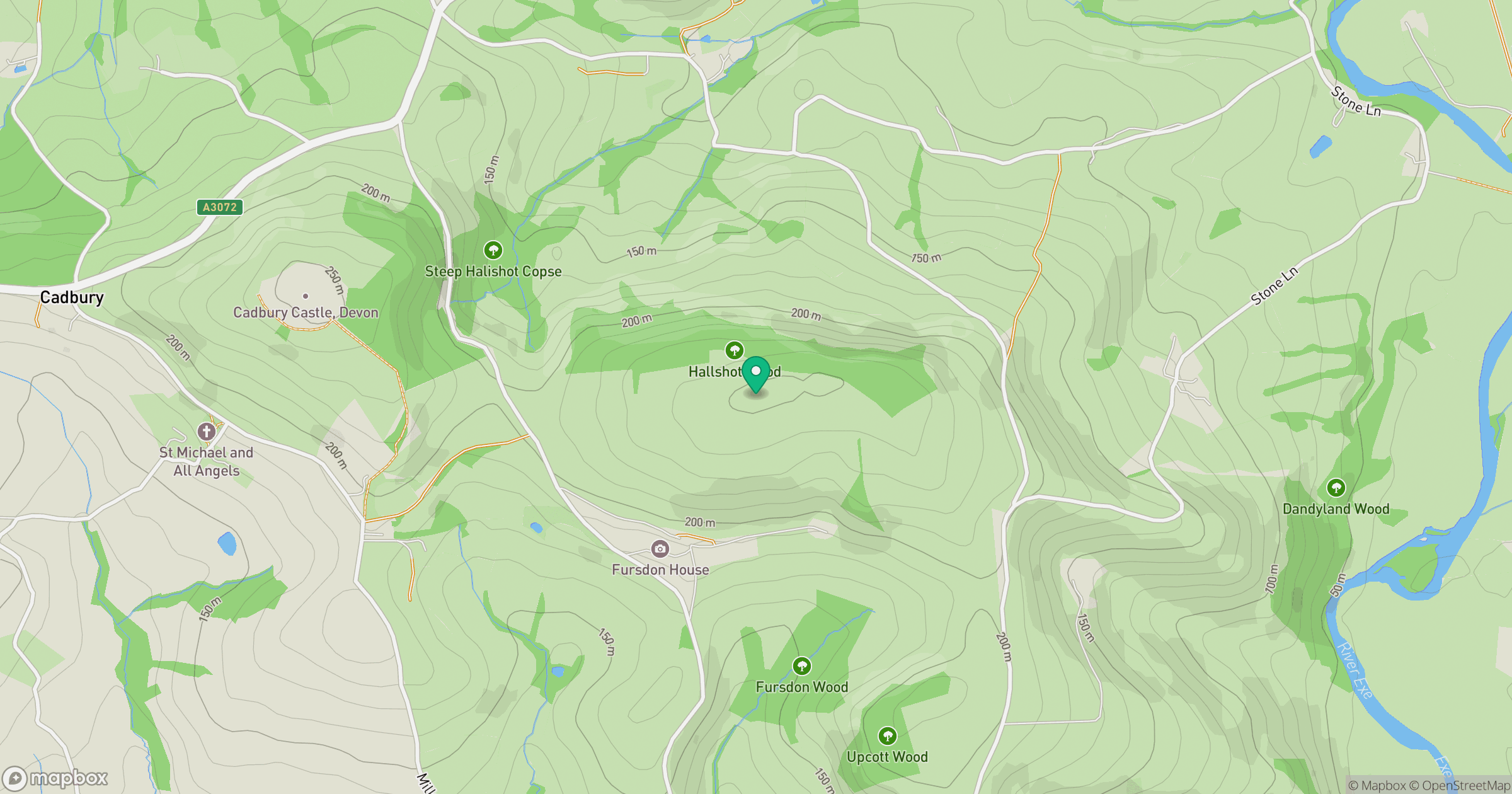
Grid reference: SS924049
View on OpenStreetMapOpens a map in a new tab, centred on the hill.
Hills within 30 km
Straight-line distance, not a walking route or confirmation of access.
No comments yet. Be the first.