

Mardon Down
Good walks are even better shared.
Overview
Mardon Down
Mardon Down, standing at an elevation of 361 meters, is a charming Marilyn located in the picturesque Dartmoor region of Devon. This unassuming hill packs a punch with its stunning views and rich geological features, making it a popular destination for walkers and outdoor enthusiasts alike!
Geology
The hill is formed mainly of granite, which has been sculpted by the elements over thousands of years. The classic granite tors adorning Mardon Down add character and provide various photo opportunities – sheer granite walls and rocky outcrops as far as the eye can see!
Routes
The Mardon Down Circular Walk is a local favourite, covering about 8 kilometers in a pleasant loop from Mardon's Cross. This route is moderate in difficulty and can typically be walked in around 2.5 hours, allowing for plenty of time to enjoy the scenery without breaking a sweat.
Summit Features
At the summit, expect to be greeted by delightful panoramic views. A substantial granite outcrop sits proudly at the top, providing an excellent place to rest your weary legs. Plus, there’s a prehistoric cairn, giving this spot a sprinkle of ancient allure – just be careful not to disturb the boulders, as they have a tendency to keep their own secrets!
Terrain Type
The terrain is primarily grassy with rocky outcrops dotted throughout the landscape, creating both beautiful scenery and slightly uneven walking surfaces, so do tread carefully.
Views
On a clear day, the vantage point from the summit rewards you with breathtaking views. Sightlines extend to the south where Plymouth Sound glimmers and to the north, the moors of Dartmoor reveal their sweeping beauty. Best seasons to visit are spring and early autumn when the weather is kind and the views clearer.
Hazards
Beware of sudden weather changes that Dartmoor is notorious for! Slippery rocks after rainfall can also be a challenge, so it pays to keep your wits about you.
Nearby Summits
If you're in the mood for a bit more adventure, both Hound Tor and Great Mis Tor are accessible nearby, offering further exploration avenues for the keen hiker.
Access
Parking can be a bit limited at Mardon's Cross, so arrive early if you can. If you're a fan of public transport, Widecombe-in-the-Moor isn't too far away and the bus route will get you at least within a pleasant walk of the trailhead.
Facilities
Should you need a post-hike treat, the charming village of Widecombe-in-the-Moor boasts several lovely cafes, plus public toilets to freshen up.
History
The meaning of Mardon links back to the Old English terms for 'lake' and 'hill', hinting at the geographical features found in the vicinity. Historically, Mardon Down and its surroundings bear evidence of past human activity, with remnants of ancient structures scattered about, telling tales of long-gone generations.
With its easy accessibility, rich geological features, and spectacular views, Mardon Down is undoubtedly a delight for hikers of all levels.
So pack your walking boots, and who knows, you might just find that the journey is the destination after all!
Explore routes near Mardon Down
Public walks starting within 80 km of this hill. Nearby does not mean a route reaches the summit; check its map and access before setting out.
Moretonhampstead to Lustleigh: Wray Valley woodland railway trail
View route
Castle Drogo and Fingle Bridge: Teign Gorge woodland circuit
View route
Exeter Canal, Double Locks and Countess Wear river circuit
View route
Exe Estuary Trail: Topsham station to Exmouth station
View route
Route planning notes
These notes describe possible approaches, not verified navigable routes or permission to cross land. Check current paths, local access rules and conditions before setting out.
Mardon Down Circular Walk
A delightful circular route starting from the nearby village of Mardon's Cross, weaving through lush moorland and stunning landscapes.
Make a day of it, together
Find someone to share the walk with, or organise a day out along a route you like.
Photo Gallery
View all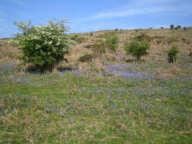 Photo could not load
SX7687 : Dartmoor: Mardon Down
Nigel Cox
Hill facts and local notes
Classifications
Elevation
357m
1,172 ft
Prominence
141m
Coordinates
50.6702, -3.7452
SX767870
OS Map
191
Explorer: OL28N
At the Summit
At the summit, you'll find a large granite outcrop offering panoramic views and a prehistoric cairn, adding a touch of ancient mystery to your hike.
Terrain & Geology
Mardon Down is largely composed of granite, typical of the Dartmoor region. The hill exhibits classic granite tors, a feature forming over millions of years of weathering, making it a geologist's joy.
Views & Scenery
On a clear day, you can see as far as Plymouth Sound to the south and the grandeur of Dartmoor's moors stretching to the north.
History & Heritage
Name Origin
The name 'Mardon' is believed to be derived from 'Mere' meaning 'lake' and 'Dun' meaning 'hill'.
Historical Significance
The area is steeped in history, with evidence of early human settlement and the remains of ancient stone structures.
Getting There & Facilities
Check current local access restrictions, parking rules and transport timetables before travelling. These notes do not confirm public access to the summit.
Parking
Mardon's Cross offers limited roadside parking; alternatively, you can park at the nearby village of Widecombe-in-the-Moor.
Public Transport
The nearest bus stop is in Widecombe-in-the-Moor, about a 5 km walk from the start of the route.
Nearby Facilities
Widecombe-in-the-Moor has several cafes and a public toilet facility.
Safety Information
Known Hazards
- Be wary of sudden weather changes typical in moorland areas. Slippery rocks after rain can pose hazards.
General Safety Tips
- Check weather conditions before setting out
- Carry appropriate clothing and equipment
- Let someone know your planned route
- Take a map, compass, and GPS device
- Carry emergency supplies: food, water, first aid kit, torch
Hills
Some common questions about the hills answered
Are there group walks up Mardon Down?
Many walkers use Walkmates to join or organise walks with others. You can check for group walks around Mardon Down through the maps
Are there other walkers around Mardon Down?
Activity varies by location and time, but Walkmates lets you see whether others have shared walks or shown interest in this area. Find other people through the walking friends search walking friends for Mardon Down search or of course create your own walk for Mardon Down
Can I organise a walk to Mardon Down?
Yes. If there aren’t any walks listed already, you can create a walk and make it available for others to join.
If you're signed up to Walkmates, you can create a walk to Mardon Down.
How do I find a walk up this hill?
There are often multiple ways to walk this hill, depending on experience and route preference. Walkmates helps you explore walks and routes that others have shared.
Can I suggest a new route up Mardon Down?
Yes. You can suggest or create routes to share with others. Walkmates focuses on the social side of walking, so routes are used to help people organise walks and explore areas together, rather than as detailed navigation tools or route libraries.
Other uses really appreciate knowledgeable walkers sharing their routes. Share your favourite route to Mardon Down here
The is an error or something incorrect about this hill. How do I let you know?
We always strive to keep the information on Walkmates as accurate as possible. If you find an error, please let us know through the contact form and we'll aim to correct it as quickly as possible
Community Discussion
Comments
Location
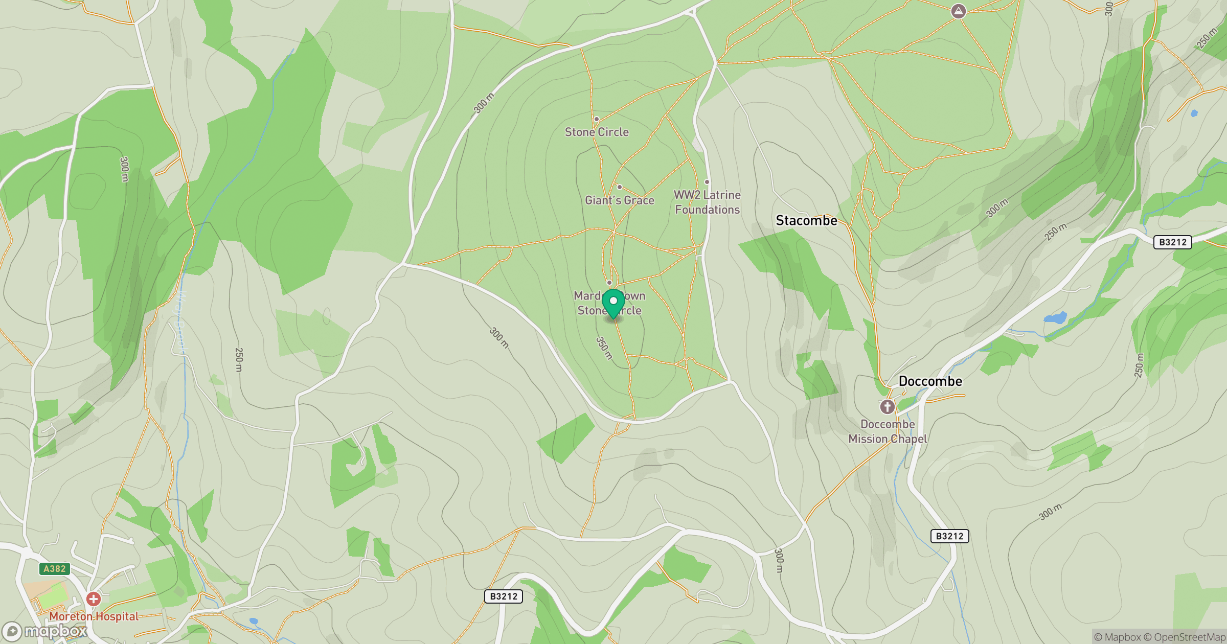
Grid reference: SX767870
View on OpenStreetMapOpens a map in a new tab, centred on the hill.
Hills within 30 km
Straight-line distance, not a walking route or confirmation of access.
No comments yet. Be the first.