

Foel Fenlli
Good walks are even better shared.
SJ1660 : Foel Fenlli
Oliver Dixon Photo source
Overview
Foel Fenlli, also known as Moel Fenlli, is a 510.9 m hill in the Clwydian Range above Bwlch Penbarras. Its summit cairn stands within an Iron Age hillfort overlooking the Vale of Clwyd. The pass offers a short but steep hillwalk; longer routes can include neighbouring Moel Famau.
Foel Fenlli
Foel Fenlli, also known as Moel Fenlli, rises above Bwlch Penbarras in the Clwydian Range, Denbighshire. The current Database of British and Irish Hills records 510.9 m, 152.4 m prominence and a cairn at the summit. It is a Marilyn, Dodd and Dewey. Moel Famau, across the pass to the north, is a separate, higher hill. DoBIH · National Landscape
Hillfort and summit
The summit stands within an extensive Iron Age hillfort, with banks, ditches and a western entrance. Archaeological records describe a Bronze Age burial mound beneath the modern summit cairn, and Roman-period finds from the hillfort. Keep to existing paths and steps; do not move stones or damage the banks. Coflein · Countryside Code
Welsh tradition connects the name with Benlli Gawr. This is a legendary association, not proof that a particular ruler occupied the fort. National Library of Wales, BENLLI GAWR entry
Choosing a walk
Bwlch Penbarras summit return: start at the pass car park, approximately SJ162605. Use the western-flank Offa’s Dyke Path approach to the hillfort entrance, then the summit path, and retrace that approach. The direct northern slope is a steeper alternative; the short outing still requires secure footing on narrow, rocky and stepped ground, especially in wet weather. Take care at the pass-road crossing. Cadw site audit, D1B · AA route directions
Loggerheads two-summit circuit: Walking Britain publishes a 15.4 km, approximately 6-hour circuit with 509 m ascent from Loggerheads Country Park, SJ197626. It goes via Llanferres and Bwlch Crug-glas to Foel Fenlli, crosses Bwlch Penbarras to Moel Famau, and returns via Ffrith Farm and the valley. This is a complete two-summit day with road sections and A494 crossings. Read the full itinerary and plan those crossings; its totals do not describe the short pass-based ascent. Walking Britain walk 1259
Offa’s Dyke Path skirts Foel Fenlli; a summit visit requires leaving the through-trail. The trail here must not be confused with the ancient dyke or the present England–Wales border. National Landscape · National Trail guidance
Landscape and conditions
The Clwydian Range’s geological spine consists of Silurian sedimentary strata, including mudstones and sandstones. British Geological Survey
Foel Fenlli overlooks the Vale of Clwyd, with neighbouring Moel Famau visible to the north. Its open slopes can be windy and cloud can obscure path junctions. Wet grass, mud, rock and steps need care; snow or ice makes the steep sections more difficult. Carry navigation, suitable clothing, water, food and a torch, and turn back when conditions exceed your experience. Keep dogs under control, use a lead near livestock, and follow local notices. Coflein · Archaeologist’s site visit · Countryside Code
Parking and facilities
Use the Bwlch Penbarras / upper Moel Famau car park for the short ascent. Council charges checked on 16 October 2026 were £2.50 for four hours or £6 all day, with opening hours of 08:00–18:00 in winter and 08:00–21:00 in summer. Overnight parking and camping are not permitted. Check the latest signs and return before closing. Council parking information
The lower Coed Moel Famau car park, SJ171610, is a different location, with toilets and picnic facilities. Loggerheads also has a visitor centre and café. Do not assume these are facilities at the pass or summit. Natural Resources Wales
Ruthin has no railway station; a rail journey requires onward road transport. Check Traveline Cymru for both outward and return travel, including the distance from your stop to the chosen start. Do not rely on an old seasonal-bus reference as a current service to Bwlch Penbarras. Council travel guidance
Explore routes near Foel Fenlli
Walks starting near this hill. Open a route to check its map, distance and full itinerary.
Llangollen to Horseshoe Falls: Canal Towpath from Market Street
View route
World’s End and back
View route
Dyserth to Prestatyn: old railway walkway return
View route
Chester Walk with Men Walking & Talking
View route
Route planning notes
These notes describe possible approaches. Check a route's map and access information when planning your walk.
Foel Fenlli from Bwlch Penbarras: summit return
Start at Bwlch Penbarras (SJ162605). Follow Offa’s Dyke Path around the western flank to the hillfort entrance, then take the summit path and retrace this approach to the same car park. This return avoids the very steep direct northern line. Expect narrow rocky paths and steps, slippery when wet. Cross the pass road carefully and keep to existing paths through the earthworks.
Loggerheads circuit: Foel Fenlli and Moel Famau
Walking Britain walk 1259: start at Loggerheads (SJ197626), go via Llanferres and Bwlch Crug-glas to Foel Fenlli, then Bwlch Penbarras and Moel Famau; return via Ffrith Farm and the valley to Loggerheads. Published total: 15.4 km, about 6 hours, 509 m ascent. Includes road sections and A494 crossings. Use the complete guide; these totals are for both summits and the full return.
Make a day of it, together
Find someone to share the walk with, or organise a day out along a route you like.
Photo Gallery
View all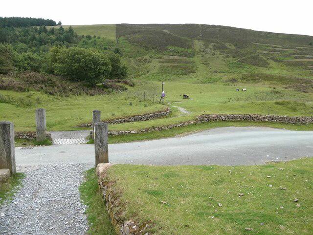 Photo could not load
SJ1660 : Foel Fenlli
Oliver Dixon
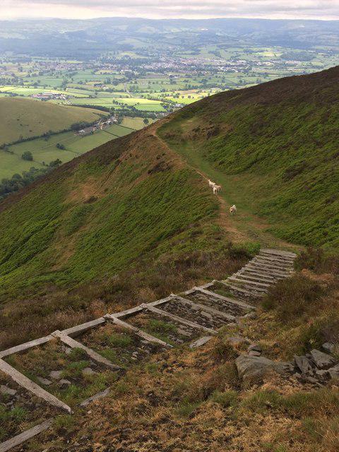 Photo could not load
SJ1659 : Steps on Moel Fenlli
Eirian Evans
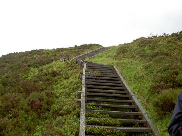 Photo could not load
SJ1660 : Footpath leading to the summit of Foel Fenlli.
David Quinn
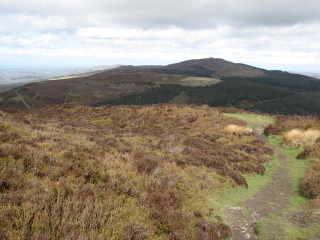 Photo could not load
SJ1660 : Ditch and bank on Foel Fenlli
John S Turner
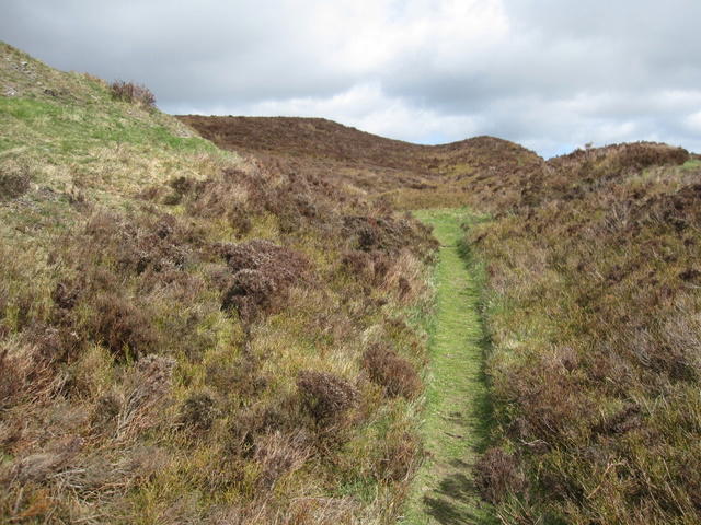 Photo could not load
SJ1660 : Banks and ditches on Foel Fenlli
John S Turner
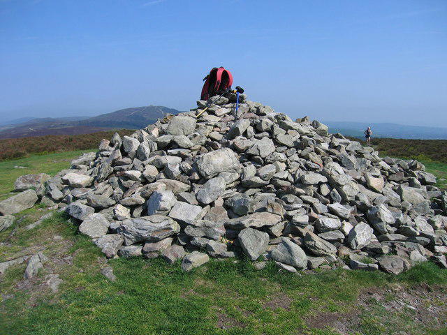 Photo could not load
SJ1660 : Foel Fenlli
Rude Health
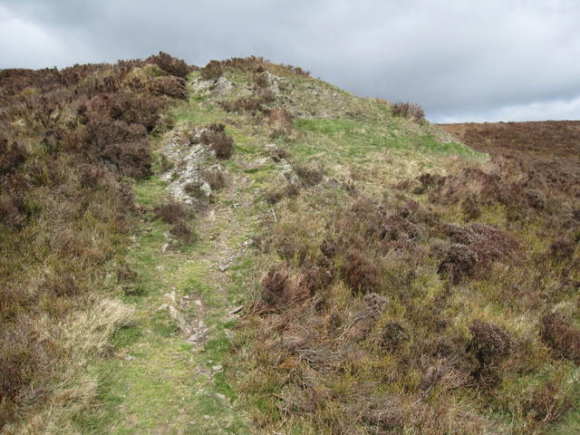 Photo could not load
SJ1660 : Not the top of Foel Fenlli
John S Turner
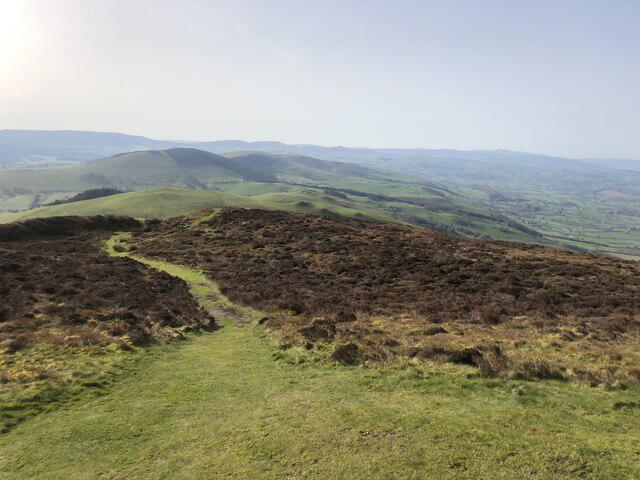 Photo could not load
SJ1660 : Path from the summit of Moel Fenlli
Eirian Evans
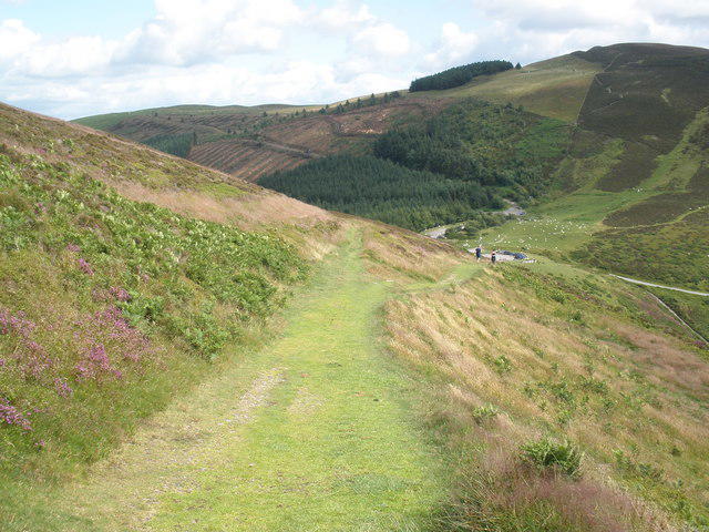 Photo could not load
SJ1660 : Fan Fenlli, from the north, on Offas Dyke path
Roger Cornfoot
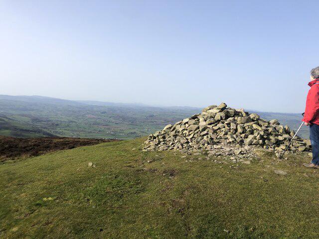
SJ1660 : Cairn at the top of Moel Fenlli
Eirian Evans
Hill facts and local notes
Classifications
Elevation
511m
1,676 ft
Prominence
152m
Coordinates
53.1313, -3.2497
SJ164600
OS Map
116
Explorer: 265
At the Summit
A modern stone cairn stands on an earlier burial mound within the hillfort. DoBIH records the summit feature as a cairn.
Terrain & Geology
The Clwydian Range’s geological spine is formed from Silurian sedimentary strata, including mudstones and sandstones. This is regional context; no precise summit rock formation is assigned here.
Views & Scenery
Views over the Vale of Clwyd and north towards neighbouring Moel Famau.
History & Heritage
Name Origin
Also known as Moel Fenlli. Welsh tradition associates the name with the legendary Benlli Gawr; this is folklore rather than archaeological proof of his residence.
Historical Significance
The summit is enclosed by an Iron Age hillfort with surviving banks, ditches and a western entrance. A Bronze Age burial mound and Roman-period finds show activity from different periods. Offa’s Dyke Path passes around the hill; it is distinct from the ancient earthwork and the modern national border.
Getting There & Facilities
Parking
For the short ascent use Bwlch Penbarras / upper Moel Famau car park, approximately SJ162605. The council lists £2.50 for four hours or £6 all day, with 08:00–18:00 winter and 08:00–21:00 summer opening. Overnight parking/camping is not permitted. Check current signs. This is separate from the lower Coed Moel Famau car park at SJ171610; postcode CH7 5SH covers a wide area.
Public Transport
Ruthin has no railway station; rail travel requires an onward bus or taxi connection. Use Traveline Cymru to check the complete outward and return journey and the walk from your stop to the chosen trailhead. Do not assume a bus serves Bwlch Penbarras: https://www.traveline.cymru/
Nearby Facilities
Carry food and water for the hill. Toilets and picnic facilities are at the separate lower Coed Moel Famau car park (SJ171610), subject to opening hours. Loggerheads Country Park has a visitor centre and café. These are not facilities at the summit or a guarantee of toilets at Bwlch Penbarras.
Safety Information
Known Hazards
- Steep, narrow and rocky paths and steps; wet grass and mud can be slippery, especially on the direct northern slope.
- Open upland slopes can be windy; low cloud can obscure the route.
- Take care crossing the Bwlch Penbarras road. Longer Loggerheads routes include A494 crossings and road sections.
- Protect the hillfort: use existing paths and steps, avoid damaging banks, and leave stones in place.
- Keep dogs under control and on a lead near livestock; follow local access notices.
Seasonal Hazards
Snow and ice make steep paths and steps more difficult. Check weather, daylight and local notices; allow time to return before the car park closes.
General Safety Tips
- Check weather conditions before setting out
- Carry appropriate clothing and equipment
- Let someone know your planned route
- Take a map, compass, and GPS device
- Carry emergency supplies: food, water, first aid kit, torch
Hills
Some common questions about the hills answered
Are there group walks up Foel Fenlli?
Many walkers use Walkmates to join or organise walks with others. You can check for group walks around Foel Fenlli through the maps
Are there other walkers around Foel Fenlli?
Activity varies by location and time, but Walkmates lets you see whether others have shared walks or shown interest in this area. Find other people through the walking friends search walking friends for Foel Fenlli search or of course create your own walk for Foel Fenlli
Can I organise a walk to Foel Fenlli?
Yes. If there aren’t any walks listed already, you can create a walk and make it available for others to join.
If you're signed up to Walkmates, you can create a walk to Foel Fenlli.
How do I find a walk up this hill?
There are often multiple ways to walk this hill, depending on experience and route preference. Walkmates helps you explore walks and routes that others have shared.
Can I suggest a new route up Foel Fenlli?
Yes. You can suggest or create routes to share with others. Walkmates focuses on the social side of walking, so routes are used to help people organise walks and explore areas together, rather than as detailed navigation tools or route libraries.
Other uses really appreciate knowledgeable walkers sharing their routes. Share your favourite route to Foel Fenlli here
The is an error or something incorrect about this hill. How do I let you know?
We always strive to keep the information on Walkmates as accurate as possible. If you find an error, please let us know through the contact form and we'll aim to correct it as quickly as possible
Community Discussion
Comments
Location
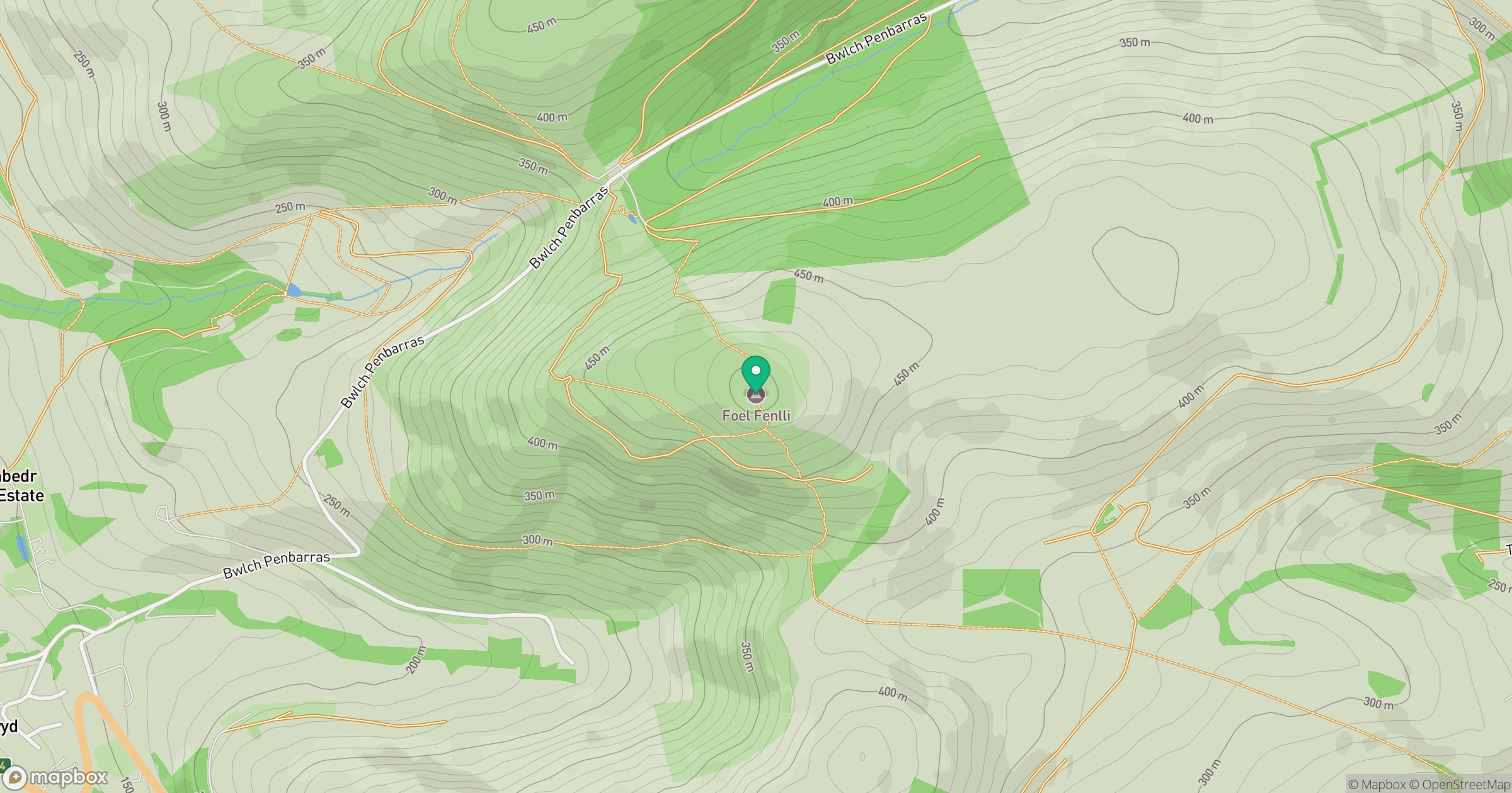
Grid reference: SJ164600
View on OpenStreetMapOpens a map in a new tab, centred on the hill.
No comments yet. Be the first.