
Moel y Gaer
Good walks are even better shared.
Overview
Moel y Gaer
Introduction
Nestled in the scenic Clwydian Range, Moel y Gaer stands proudly at 471 meters. It provides a rewarding hike for both seasoned trekkers and those just looking for a pleasant day out amid nature.
Geology
The geology of Moel y Gaer is fascinating; composed primarily of Carboniferous limestone and sandstone, it creates a unique landscape of rugged outcrops and lush vegetation. Take a moment to appreciate the natural beauty, but remember, it's not the geology that will keep you fit!
Routes
One popular route is the Llandegla Circular, which begins at Llandegla village. This medium-difficulty route sprawls over 10.5 km, taking around 3.5 hours, and offers a delightful combination of forest tracks and open vistas. Perfect for working off that cake you had at the café!
Summit Features
At the summit, you’ll find an ancient hillfort and a trig point. A great place to snap a picture or two and wonder how many cups of tea it took to carry those stones up there!
Terrain
Expect a mixed terrain that includes grassy slopes alongside rocky sections. Be prepared for boggy patches, particularly after the rains; the last thing you want is to lose your shoe to a rogue puddle!
Views
The view from the top is nothing short of spectacular. You can see across the Vale of Clwyd towards the Snowdonia range and, on the clearest of days, catch sight of the Dee Estuary. Spring and early autumn are the best seasons to enjoy these vistas, with lush greenery and clear blue skies.
Hazards
Be wary of your footing! The rocky segments can be slippery, especially when wet, so tread carefully, dear hiker.
Nearby Summits
Just around the corner, you have Moel Fammau, standing tall at 551 meters, and Y Fernaig, which adds another layer of exploration for those looking to extend their hikes.
Access
Parking is found at Llandegla Forest, only a 15-minute stroll from your starting point. Public transport is available via infrequent buses; a taxi might be the safest option to reach this hidden gem. The nearest town, Llandegla, is charming and will welcome you warmly.
Facilities
Llandegla boasts a pub for post-hike refreshment and a café to refill your energy with a slice of cake, plus restrooms near the car park because, come on, we all need a break sometime!
History
The name Moel y Gaer literally means 'hill of the fort', hinting at its role in ancient times as a stronghold. A visit here isn’t just a hike but a walk through history, where the echoes of the past whisper among the winds.
Conclusion
So put on those hiking boots, grab a sandwich, and hit the trail to Moel y Gaer. Your legs may ache, but the memories and views will be worth every step!
Explore routes near Moel y Gaer
Walks starting near this hill. Open a route to check its map, distance and full itinerary.
Dyserth to Prestatyn: old railway walkway return
View route
Chester Walk with Men Walking & Talking
View route
Liverpool Waterfront Walk with Men Walking & Talking
View route
Waverton to Chester Shot Tower: Shropshire Union Canal Return
View route
Route planning notes
These notes describe possible approaches. Check a route's map and access information when planning your walk.
Llandegla Circular
A delightful loop starting from the village of Llandegla, this route offers a blend of forest tracks and open moorland.
Make a day of it, together
Find someone to share the walk with, or organise a day out along a route you like.
Hill facts and local notes
Classifications
Elevation
304m
996 ft
Prominence
128m
Coordinates
53.2129, -3.1835
SJ210690
OS Map
117
Explorer: 265
At the Summit
The summit features a notable ancient hillfort and a trig point, both of which offer perfect spots for a cheeky selfie with the grand views.
Terrain & Geology
Moel y Gaer is primarily composed of Carboniferous limestone and sandstone, which contributes to its rugged features and excellent drainage, making for a pleasant hiking experience despite some rocky sections.
Views & Scenery
From the summit, hikers can enjoy sweeping views over the Vale of Clwyd, the Snowdonia range, and even glimpses of the Dee Estuary on a clear day.
History & Heritage
Name Origin
Moel y Gaer translates to 'hill of the fort', indicative of its past as a significant fortification.
Historical Significance
The hillfort dates back to the Iron Age, showcasing the historical importance of this location in ancient Welsh culture.
Getting There & Facilities
Parking
There is a small car park at Llandegla Forest, about a 15-minute walk from the trailhead for the Llandegla Circular route.
Public Transport
Buses run from Wrexham to Llandegla, but check schedules as they can be a bit sporadic; taxis are a safe bet.
Nearby Facilities
While on the mountain itself you'll need to rough it, Llandegla offers a pub and a café, plus public toilets near the car park.
Safety Information
Known Hazards
- Watch your step on rocky sections; the terrain can be uneven and slippery in wet conditions.
General Safety Tips
- Check weather conditions before setting out
- Carry appropriate clothing and equipment
- Let someone know your planned route
- Take a map, compass, and GPS device
- Carry emergency supplies: food, water, first aid kit, torch
Hills
Some common questions about the hills answered
Are there group walks up Moel y Gaer?
Many walkers use Walkmates to join or organise walks with others. You can check for group walks around Moel y Gaer through the maps
Are there other walkers around Moel y Gaer?
Activity varies by location and time, but Walkmates lets you see whether others have shared walks or shown interest in this area. Find other people through the walking friends search walking friends for Moel y Gaer search or of course create your own walk for Moel y Gaer
Can I organise a walk to Moel y Gaer?
Yes. If there aren’t any walks listed already, you can create a walk and make it available for others to join.
If you're signed up to Walkmates, you can create a walk to Moel y Gaer.
How do I find a walk up this hill?
There are often multiple ways to walk this hill, depending on experience and route preference. Walkmates helps you explore walks and routes that others have shared.
Can I suggest a new route up Moel y Gaer?
Yes. You can suggest or create routes to share with others. Walkmates focuses on the social side of walking, so routes are used to help people organise walks and explore areas together, rather than as detailed navigation tools or route libraries.
Other uses really appreciate knowledgeable walkers sharing their routes. Share your favourite route to Moel y Gaer here
The is an error or something incorrect about this hill. How do I let you know?
We always strive to keep the information on Walkmates as accurate as possible. If you find an error, please let us know through the contact form and we'll aim to correct it as quickly as possible
Community Discussion
Comments
Location
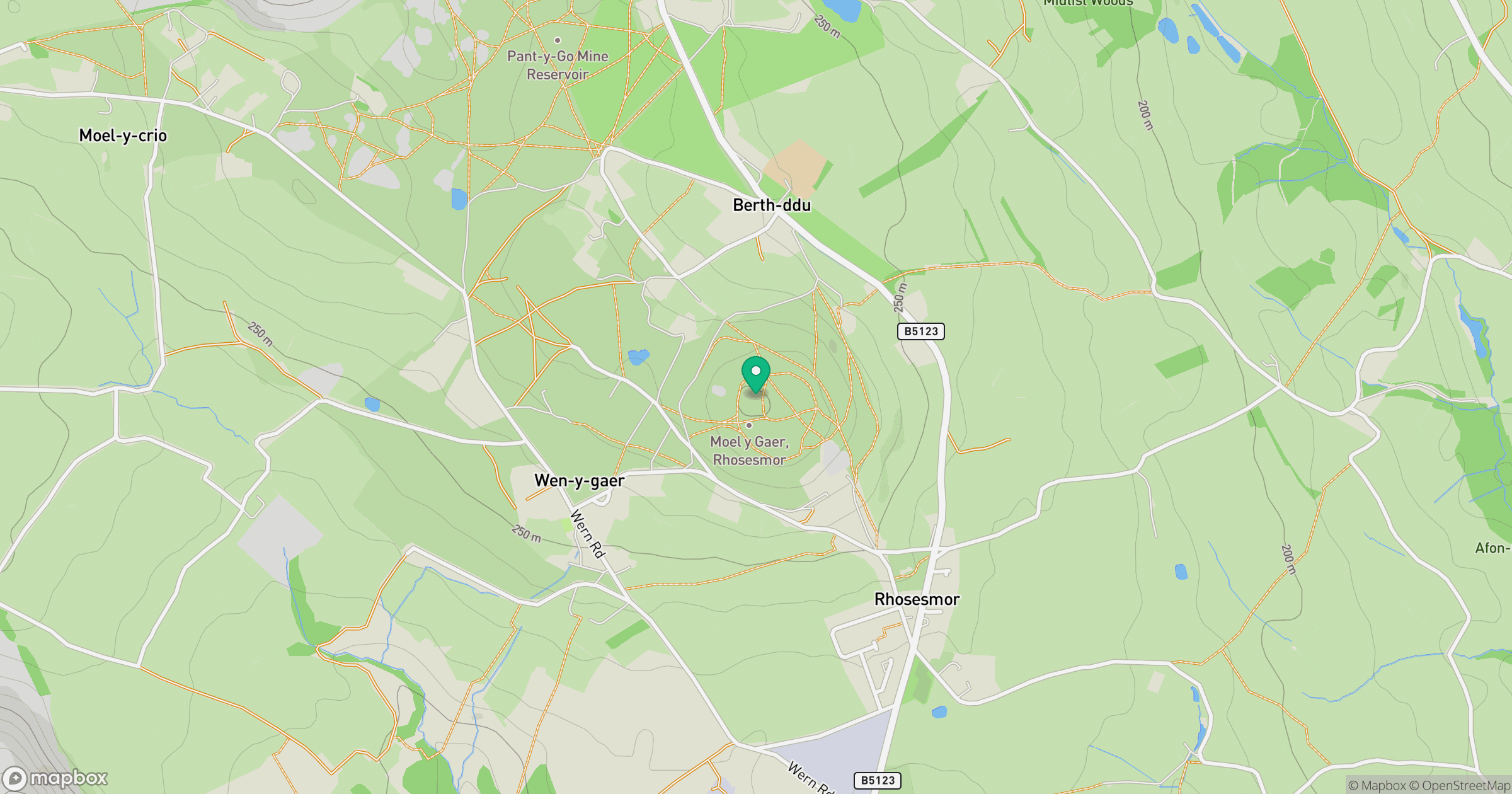
Grid reference: SJ210690
View on OpenStreetMapOpens a map in a new tab, centred on the hill.
No comments yet. Be the first.