

Cyrn-y-Brain
Good walks are even better shared.
SJ2148 : Heather moorland
John H Darch Photo source
Overview
Cyrn-y-Brain
Cyrn-y-Brain, standing tall at 462 meters, is a marvelous mountain in the Clwydian Range, perfect for those seeking a bit of adventure without having to climb a proper mountain (snowdon you're safe!).
Geology
The geological composition of Cyrn-y-Brain includes limestone and sandstone, which gives the mountain its rugged charm. Over millennia, erosion has played a major role in shaping its current appearance, providing not only a scenic view but a peek into the ancient earth's story.
Routes
Trevor to Cyrn-y-Brain Circular
This is a popular route among hikers that combines a gentle ascent with breathtaking views. Starting from the charming village of Trevor, you’ll meander through lush landscapes and eventually reach the summit. It’s about 8.5 km and should take around 3 hours. Not too shabby for those Instagram shots!
Summit Features
Reaching the summit, you will find a pleasant stone cairn, which is a prime spot for selfies! The panoramic views will almost make you forget about the huffing and puffing you just went through.
Terrain Type
The main path is grassy with a few rocky patches as you approach the top. It's well-maintained and with care, most walkers can manage it without needing climbing gear.
Views
From Cyrn-y-Brain, the views are utterly delightful. You can see the Vale of Llangollen, the flowing River Dee, and when conditions are just right, the majestic peaks of Snowdonia in the distance. Spring and summer are the best times to visit to really appreciate the lush greenery and colourful wildflowers.
Hazards
While the route isn’t overly treacherous, be mindful of loose rocks and slippery areas after rainfall. Remember, nobody wants to end up in a muddy heap!
Nearby Summits
If you fancy a longer hike, consider making an adventure out of visiting nearby summits like Moel Fferna, which is a bit higher at 600 meters, or Cilcain Mountain for an extra challenge.
Access
The nearest parking is free and located in Trevor. If you're relying on public transport, the train station at Ruabon helps you reach the start of the hike conveniently. Llangollen, with its quaint shops and eateries, is the nearest town, offering lovely amenities before and after your trek.
Facilities
After an invigorating day of hiking, you can treat yourself to a well-deserved cup of tea or a slice of cake at one of Llangollen's cafes. Public toilets are also available at convenient spots.
History
The name 'Cyrn-y-Brain' might make you raise an eyebrow, translating to 'peak of the brain', which is quite fitting as you might feel you've worked your intellect after reaching the summit! This area is rich in history, with traces of human habitation dating back to prehistoric times.
So pack up your hiking boots, grab your walking sticks, and head to Cyrn-y-Brain for a delightful day out in nature. Just watch your step; nobody wants to slip on a muddy path!
Explore routes near Cyrn-y-Brain
Walks starting near this hill. Open a route to check its map, distance and full itinerary.
World’s End and back
View route
Llangollen to Horseshoe Falls: Canal Towpath from Market Street
View route
Ellesmere Walk with Men Walking & Talking
View route
Chester Walk with Men Walking & Talking
View route
Route planning notes
These notes describe possible approaches. Check a route's map and access information when planning your walk.
Trevor to Cyrn-y-Brain Circular
A circular route starting from Trevor, it gently ascends to the summit while offering stunning views of the surrounding valleys and hills. The descent loops back through woodland, providing a refreshing change in scenery.
Make a day of it, together
Find someone to share the walk with, or organise a day out along a route you like.
Photo Gallery
View all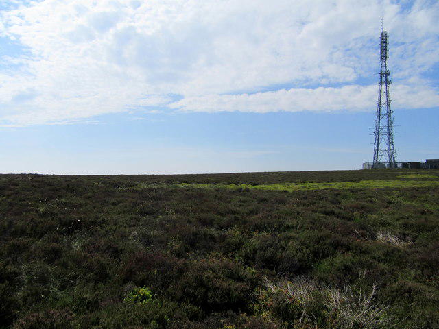 Photo could not load
SJ2148 : Heather moorland
John H Darch
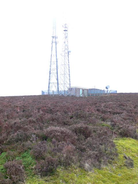 Photo could not load
SJ2048 : Llangollen VHF masts on Cyrn-y-Brain
Eirian Evans
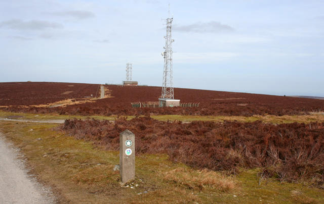 Photo could not load
SJ2048 : Transmitter towers on Cyrn-y-Brain
Espresso Addict
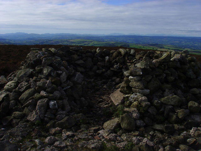 Photo could not load
SJ2048 : Hollow Cairn
AntJB
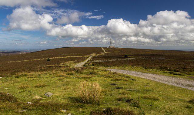 Photo could not load
SJ2048 : Cyrn-y-Brain
Peter McDermott
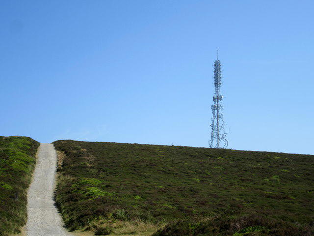 Photo could not load
SJ2048 : Moorland transmitter
John H Darch
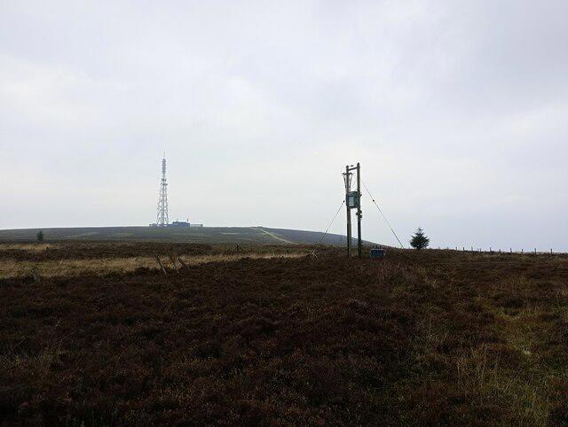 Photo could not load
SJ2048 : Power pole and transformer on Cyrn-y-Brain
shikari
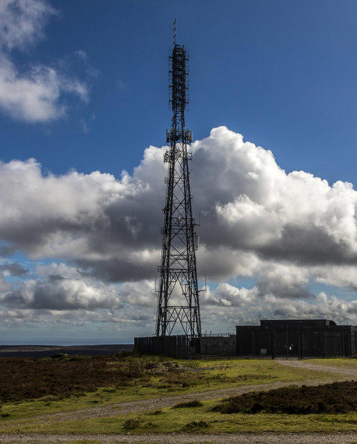 Photo could not load
SJ2048 : Cyrn-y-Brain
Peter McDermott
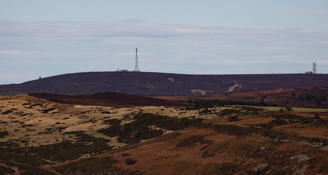 Photo could not load
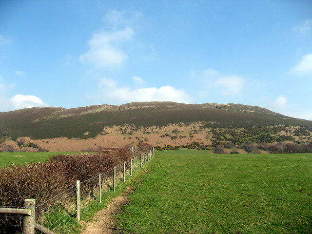
SJ2048 : Cyrn-y-Brain
Peter McDermott
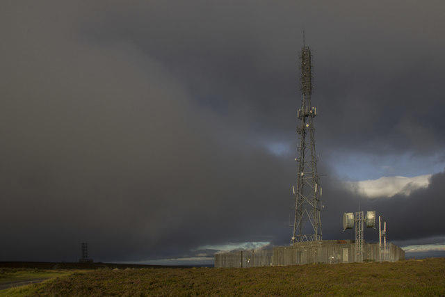
SJ2048 : Storm Brewing on Cyrn-y-Brain
Geraint Roberts
Hill facts and local notes
Classifications
Elevation
565m
1,852 ft
Prominence
164m
Coordinates
53.0314, -3.1822
SJ208488
OS Map
117
Explorer: 256
At the Summit
The summit features a small stone cairn, perfect for a quick selfie to prove you made it, as well as panoramic views over the Vale of Llangollen.
Terrain & Geology
Cyrn-y-Brain is primarily composed of limestone and sandstone, which have been eroded over time to create its distinctive features. The cliffs in the area provide spectacular views while offering a glimpse into the geological history of the region.
Views & Scenery
From the summit, hikers can enjoy views across the Vale of Llangollen, the River Dee, and even as far as Snowdonia on a clear day. The iconic Horseshoe Pass is also visible.
History & Heritage
Name Origin
The name Cyrn-y-Brain translates to 'peak of the brain,' a bit like a mountain-sized thought bubble, but it’s more likely a reference to the shape of the hill.
Historical Significance
This area has been inhabited since prehistoric times, with nearby archaeological sites highlighting its historical importance.
Getting There & Facilities
Parking
Parking is available at Trevor, near the canal area. This parking is free but can fill up quickly during weekends.
Public Transport
The nearest train stop is at Ruabon, with a bus service running to Trevor. Local buses from towns like Llangollen also service the area.
Nearby Facilities
There are several cafes and pubs in Llangollen, along with public toilets available near the starting and ending points.
Safety Information
Known Hazards
- Some areas may be steep and uneven, particularly near the summit. Be cautious of loose rocks and slippery paths after rain.
General Safety Tips
- Check weather conditions before setting out
- Carry appropriate clothing and equipment
- Let someone know your planned route
- Take a map, compass, and GPS device
- Carry emergency supplies: food, water, first aid kit, torch
Hills
Some common questions about the hills answered
Are there group walks up Cyrn-y-Brain?
Many walkers use Walkmates to join or organise walks with others. You can check for group walks around Cyrn-y-Brain through the maps
Are there other walkers around Cyrn-y-Brain?
Activity varies by location and time, but Walkmates lets you see whether others have shared walks or shown interest in this area. Find other people through the walking friends search walking friends for Cyrn-y-Brain search or of course create your own walk for Cyrn-y-Brain
Can I organise a walk to Cyrn-y-Brain?
Yes. If there aren’t any walks listed already, you can create a walk and make it available for others to join.
If you're signed up to Walkmates, you can create a walk to Cyrn-y-Brain.
How do I find a walk up this hill?
There are often multiple ways to walk this hill, depending on experience and route preference. Walkmates helps you explore walks and routes that others have shared.
Can I suggest a new route up Cyrn-y-Brain?
Yes. You can suggest or create routes to share with others. Walkmates focuses on the social side of walking, so routes are used to help people organise walks and explore areas together, rather than as detailed navigation tools or route libraries.
Other uses really appreciate knowledgeable walkers sharing their routes. Share your favourite route to Cyrn-y-Brain here
The is an error or something incorrect about this hill. How do I let you know?
We always strive to keep the information on Walkmates as accurate as possible. If you find an error, please let us know through the contact form and we'll aim to correct it as quickly as possible
Community Discussion
Comments
Location
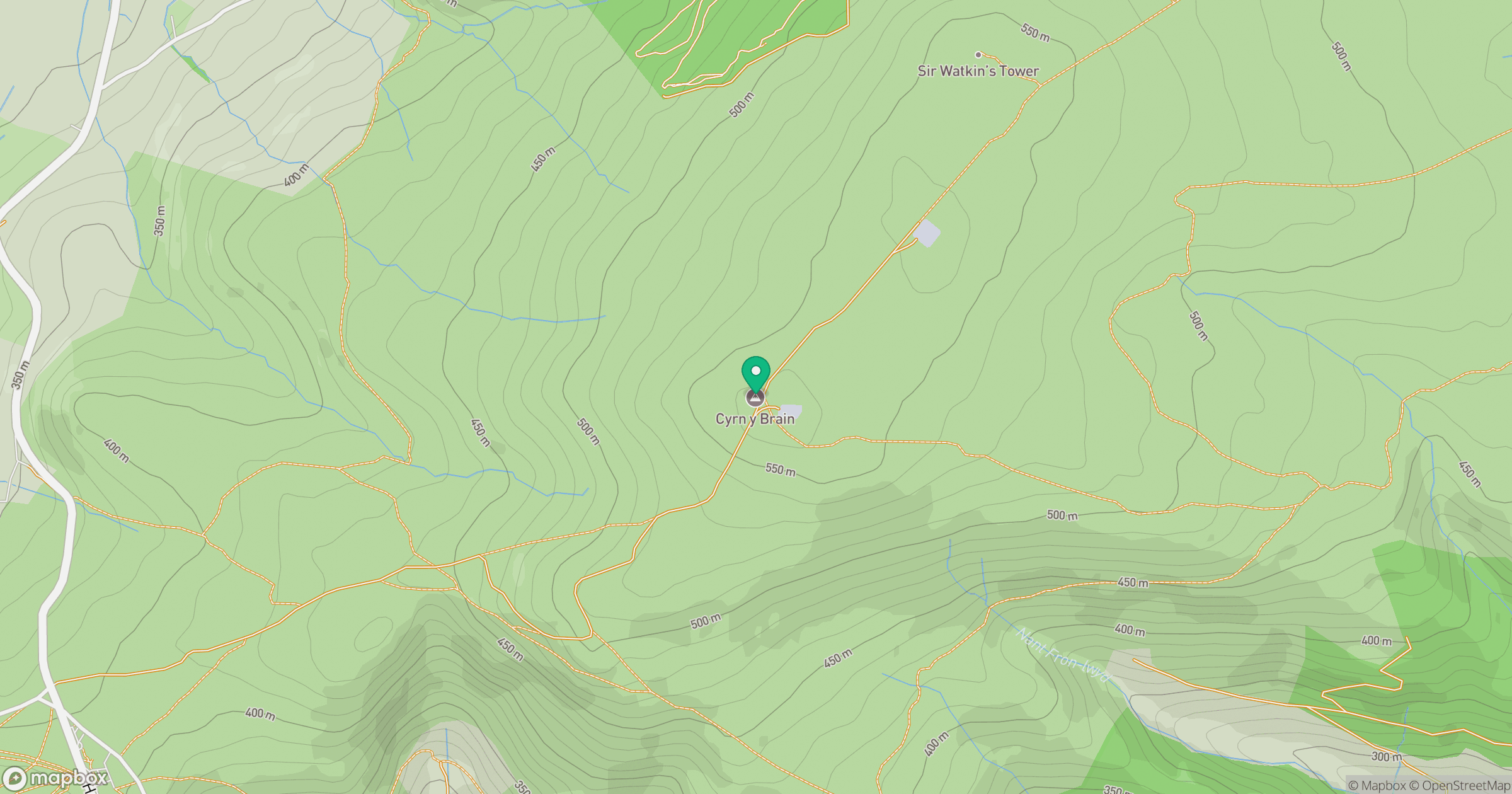
Grid reference: SJ208488
View on OpenStreetMapOpens a map in a new tab, centred on the hill.
No comments yet. Be the first.