

Moel Arthur
Good walks are even better shared.
Overview
Moel Arthur
Moel Arthur is a 455.8 m hill in the Clwydian Range, overlooking the Vale of Clwyd. DoBIH records 120 m of drop and a summit cairn at SJ 14530 66034. Surveyed ground 5 m north-east is 3 cm lower. It is a HuMP, rather than a Marilyn, and no summit trig pillar is recorded.
A short complete circuit
Start and finish at Moel Arthur car park, SJ 147 657. The My Mountains and Me route climbs the track and left-hand summit path, crosses the hillfort area, descends on the opposite side, then turns sharply right onto the Offa’s Dyke Path to return around the hill to the same car park. Its estimate is about 2.1 km and roughly 1 hour for the full loop. No total ascent is given.
The route description does not explicitly identify the surveyed cairn. Use the summit grid reference if exact summit contact matters, and do not assume any additional diversion is included in the published distance or time. Take a map; the climb is steep and uneven and the route is unsuitable for pushchairs.
Longer walks from Coed Llangwyfan and the council’s Penycloddiau circuit are separate routes. Their distances, climb totals and timings must not be mixed with this short circuit.
Landscape and history
Silurian sandstones and silty mudstones of the Elwy Formation are exposed around Moel Arthur. BGS describes sandstone close to the summit and layered rocks on its slopes, part of an ancient marine sedimentary succession. The Iron Age hillfort retains substantial banks and ditches. The landscape authority also records possible Bronze Age remains and later archaeological investigations. Moel means bare; an Arthurian origin for this specific name has not been verified.
Access and facilities
The small Moel Arthur car park has limited spaces and no facilities according to the walking sources. Bring supplies and check current parking signs. Coed Llangwyfan is a different starting point, with free daytime parking but no overnight parking. Public transport requires advance planning; no direct bus to the short route’s car park was verified.
Checked 18 October 2026, NRW’s Coed Llangwyfan page displays a nine-week road-access notice from 10 August, diverting vehicles via Nannerch, without specifying the year. Check current information rather than treating it as a confirmed present closure.
Care on the hill
Expect steep, slippery or muddy ground and exposed weather. Use existing paths, protect the earthworks and keep dogs controlled around livestock. The short circuit’s summit-area visit does not remove the need for navigation or suitable footwear.
Explore routes near Moel Arthur
Public walks starting within 80 km of this hill. Nearby does not mean a route reaches the summit; check its map and access before setting out.
Dyserth to Prestatyn: old railway walkway return
View route
Llangollen to Horseshoe Falls: Canal Towpath from Market Street
View route
World’s End and back
View route
Liverpool Waterfront Walk with Men Walking & Talking
View route
Route planning notes
These notes describe possible approaches, not verified navigable routes or permission to cross land. Check current paths, local access rules and conditions before setting out.
Moel Arthur car park and hillfort circuit
Start and finish at the small Moel Arthur car park, SJ 147 657. Follow the uphill track, take the left-hand path climbing to the hillfort, descend from the opposite side, then turn sharply right onto the Offa’s Dyke Path and follow it around the hill back to the same car park. My Mountains and Me gives about 2.1 km and roughly 1 hour for this complete circuit; no ascent total is supplied. The guide reaches the summit area but does not explicitly identify the DoBIH cairn at SJ 14530 66034. These totals do not certify a separate exact-summit diversion or an extension to another hill. Carry an OS map and follow current signs. https://www.mymountainsandme.com/blog/moel-arthur-circular-walk
Make a day of it, together
Find someone to share the walk with, or organise a day out along a route you like.
Photo Gallery
View all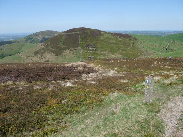 Photo could not load
SJ1465 : Offa's Dyke Path heading towards Moel Arthur
Tim Heaton
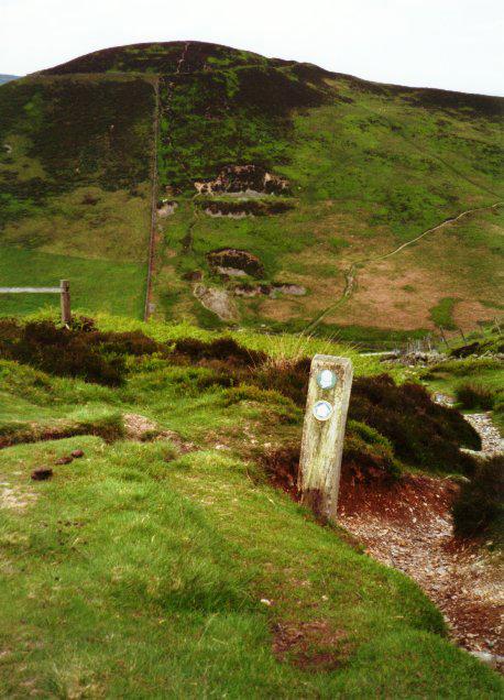 Photo could not load
SJ1465 : Towards Moel Arthur
Graham Horn
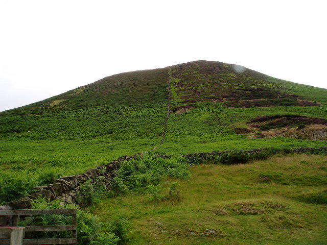 Photo could not load
SJ1465 : Moel Arthur
Eirian Evans
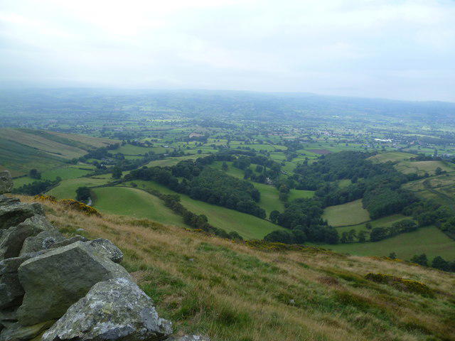 Photo could not load
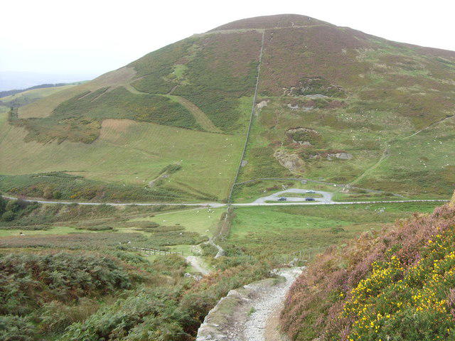
SJ1465 : Descending Moel Arthur
Michael Graham
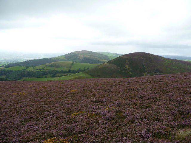 Photo could not load
SJ1465 : Heather moorland in the Clwydian Range
Jeremy Bolwell
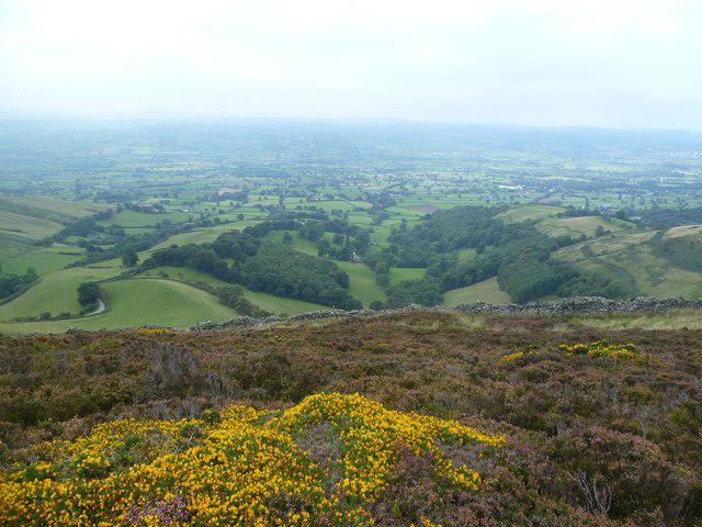 Photo could not load
SJ1465 : Descending Moel Arthur
Michael Graham
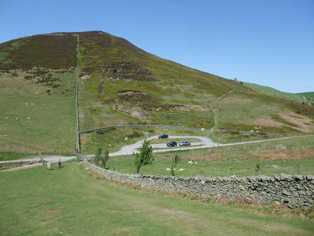 Photo could not load
SJ1465 : Car park at the foot of Moel Arthur
Tim Heaton
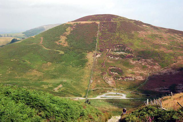 Photo could not load
SJ1465 : Moel Arthur hill fort
John Sparshatt
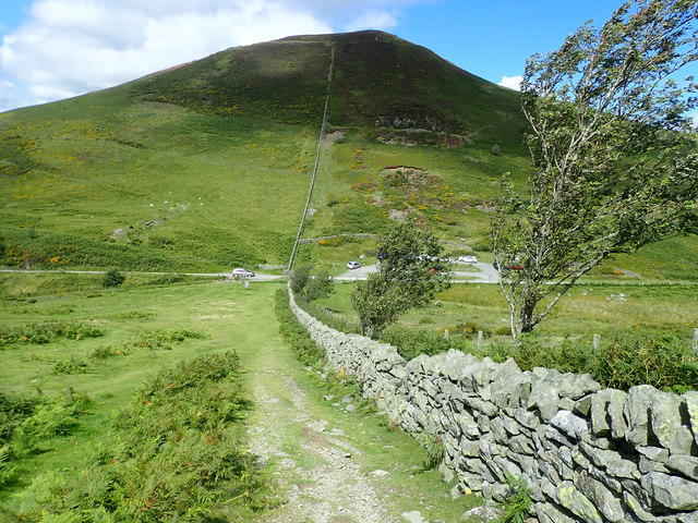 Photo could not load
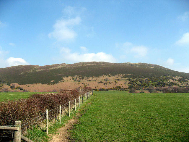
SJ1465 : Moel Arthur from Moel Llys y Coed
Eirian Evans
SJ1465 : Moel Arthur
John Harrison
Hill facts and local notes
Classifications
Elevation
456m
1,495 ft
Prominence
120m
Coordinates
53.1845, -3.2805
SJ145660
OS Map
116
Explorer: 265
At the Summit
DoBIH records the 455.8 m summit as a cairn at SJ1453066034. Ground 5 m north-east of the cairn was measured 3 cm lower. The recorded survey used Leica NA730 and Leica GS15 equipment. No trig pillar is identified as the summit.
Terrain & Geology
Moel Arthur exposes Silurian sandstone and silty mudstone of the Elwy Formation. BGS records sandstone/mudstone layers on the south-eastern slopes and sandstone in a quarry 75 m east of the summit. These rocks belong to the marine turbidite succession of the Clwydian Range.
Views & Scenery
The hillfort overlooks the Vale of Clwyd. Clear conditions open wider views across the Clwydian Range and towards Eryri; distant visibility is weather dependent.
History & Heritage
Name Origin
Moel is Welsh for “bare”, commonly used for a bare hill. The name contains Arthur, but a documented connection to the historical or legendary King Arthur has not been established by the sources checked.
Historical Significance
Moel Arthur has a roughly circular Iron Age hillfort overlooking the Vale of Clwyd, with substantial banks and ditches and an inturned north-eastern entrance. The official landscape account also discusses possible Bronze Age remains, three copper axes found in 1962 and later archaeological investigations.
Getting There & Facilities
Check current local access restrictions, parking rules and transport timetables before travelling. These notes do not confirm public access to the summit.
Parking
The short circuit starts at the small Moel Arthur car park, SJ 147 657, identified by the council walking leaflet. The route author describes it as free, with limited spaces and no facilities; check current signs. Coed Llangwyfan, SJ 138 668, is a different NRW car park with free daytime parking and no overnight parking. Starting there requires a different route.
Public Transport
NRW names Buckley as the nearest mainline station for its Coed Llangwyfan access point and directs visitors to Traveline Cymru for onward travel. No scheduled service directly to the Moel Arthur car park was verified; plan the full outward and return connection before travelling. Public-transport approach distances are not included in the short circuit.
Nearby Facilities
The council’s hillfort walk leaflet lists no facilities and the short-route author reports none at Moel Arthur car park. Bring water and food, and arrange toilets and refreshments before heading up. Do not assume facilities at the summit or Coed Llangwyfan.
Safety Information
Known Hazards
- Steep, uneven paths and wet grass require care; bring suitable footwear, layers and a map.
- Livestock graze the surrounding countryside. Keep dogs under close control, follow local signs and close gates.
- Protect the hillfort earthworks: use existing paths and do not disturb stones or archaeological remains.
- Checked 18 October 2026: NRW displays a road-access notice for Coed Llangwyfan lasting nine weeks from 10 August, with diversion via Nannerch, but gives no year. Check current road and site information rather than assuming this notice remains active.
General Safety Tips
- Check weather conditions before setting out
- Carry appropriate clothing and equipment
- Let someone know your planned route
- Take a map, compass, and GPS device
- Carry emergency supplies: food, water, first aid kit, torch
Hills
Some common questions about the hills answered
Are there group walks up Moel Arthur?
Many walkers use Walkmates to join or organise walks with others. You can check for group walks around Moel Arthur through the maps
Are there other walkers around Moel Arthur?
Activity varies by location and time, but Walkmates lets you see whether others have shared walks or shown interest in this area. Find other people through the walking friends search walking friends for Moel Arthur search or of course create your own walk for Moel Arthur
Can I organise a walk to Moel Arthur?
Yes. If there aren’t any walks listed already, you can create a walk and make it available for others to join.
If you're signed up to Walkmates, you can create a walk to Moel Arthur.
How do I find a walk up this hill?
There are often multiple ways to walk this hill, depending on experience and route preference. Walkmates helps you explore walks and routes that others have shared.
Can I suggest a new route up Moel Arthur?
Yes. You can suggest or create routes to share with others. Walkmates focuses on the social side of walking, so routes are used to help people organise walks and explore areas together, rather than as detailed navigation tools or route libraries.
Other uses really appreciate knowledgeable walkers sharing their routes. Share your favourite route to Moel Arthur here
The is an error or something incorrect about this hill. How do I let you know?
We always strive to keep the information on Walkmates as accurate as possible. If you find an error, please let us know through the contact form and we'll aim to correct it as quickly as possible
Community Discussion
Comments
Location
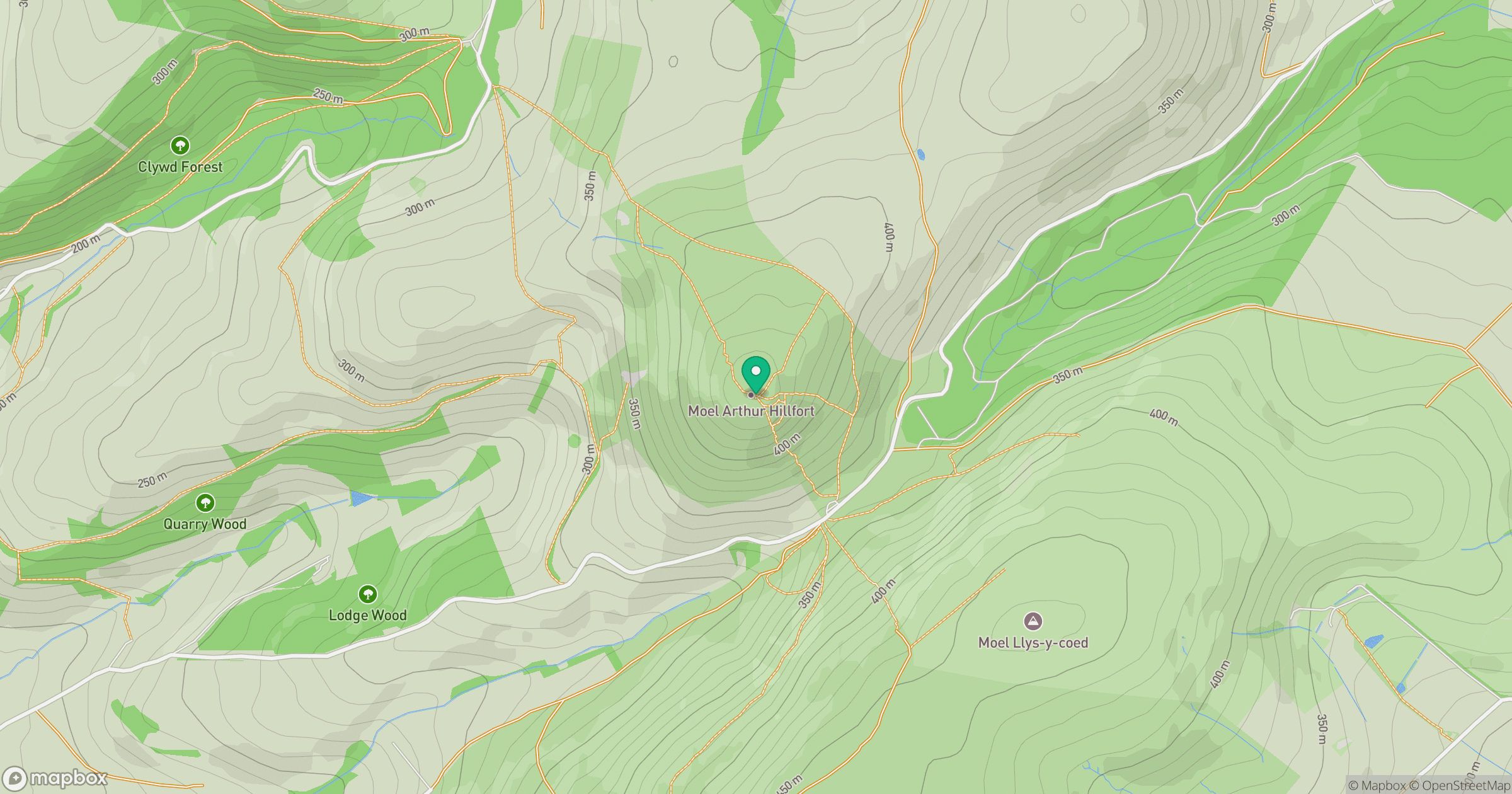
Grid reference: SJ145660
View on OpenStreetMapOpens a map in a new tab, centred on the hill.
Hills within 30 km
Straight-line distance, not a walking route or confirmation of access.
No comments yet. Be the first.