

Foel Cocyn
Good walks are even better shared.
SH6204 : Ffridd Cocyn
Rude Health Photo source
Explore routes near Foel Cocyn
Walks starting near this hill. Open a route to check its map, distance and full itinerary.
Cadair Idris - Pony Path
View route
Mawddach Trail: Penmaenpool to Dolgellau Riverside Return
View route
Mawddach Trail: Penmaenpool to Arthog Estuary Return
View route
Coed y Brenin: Pont Ty'n-y-groes and Mawddach Forest Trail
View route
Route planning notes
These notes describe possible approaches. Check a route's map and access information when planning your walk.
Llanberis Path
A steady ascent starting from the village of Aberdaron, this path winds through scenic landscapes and offers a gentle climb to the summit.
Wern Road Route
Beginning at the northeast side of Foel Cocyn, this route provides an exhilarating approach with some steep sections.
Make a day of it, together
Find someone to share the walk with, or organise a day out along a route you like.
Photo Gallery
View all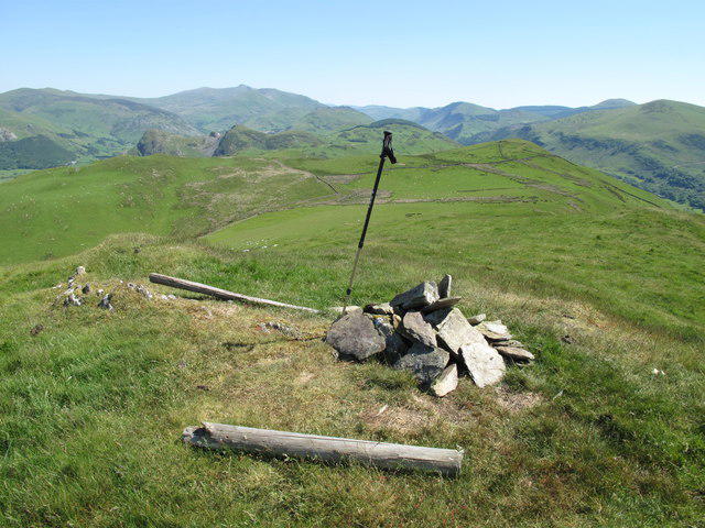 Photo could not load
SH6204 : Ffridd Cocyn
Rude Health
Hill facts and local notes
Classifications
Elevation
313m
1,026 ft
Prominence
250m
Coordinates
52.6189, -4.0332
SH624042
OS Map
135
Explorer: OL23W
At the Summit
The summit features a prominent cairn, with a stunning 360-degree view of the surrounding landscapes, including the peaks of Snowdonia in the distance.
Terrain & Geology
Foel Cocyn is primarily composed of Ordovician mudstones and sandstones, giving it a robust yet somewhat rugged appearance. The geological formations here are a testament to the area's ancient marine environments.
Views & Scenery
From the summit, hikers can enjoy breathtaking views of the Snowdon massif, Anglesey, and Cardigan Bay. It's a veritable feast for the eyes.
History & Heritage
Name Origin
The name 'Foel Cocyn' translates to 'Hill of the Hollow' in Welsh, a nod to the landscape's topography.
Historical Significance
Historically, the hill has been used as a local landmark and is rich in folklore, adding to the cultural fabric of the region.
Getting There & Facilities
Parking
Parking is available at the start of the Wern Road Route in the village of Clynnog Fawr, providing convenient access to the trails.
Public Transport
Buses run from Caernarfon to Clynnog Fawr, but it's advisable to check the latest schedules as they can vary.
Nearby Facilities
There are cafes and shops in Caernarfon. Public toilets are available in the town, as well as at certain points along the routes.
Safety Information
Known Hazards
- Poor weather conditions can arise quickly, leading to reduced visibility. Steep slopes near the summit may pose risks without proper precautions.
General Safety Tips
- Check weather conditions before setting out
- Carry appropriate clothing and equipment
- Let someone know your planned route
- Take a map, compass, and GPS device
- Carry emergency supplies: food, water, first aid kit, torch
Hills
Some common questions about the hills answered
Are there group walks up Foel Cocyn?
Many walkers use Walkmates to join or organise walks with others. You can check for group walks around Foel Cocyn through the maps
Are there other walkers around Foel Cocyn?
Activity varies by location and time, but Walkmates lets you see whether others have shared walks or shown interest in this area. Find other people through the walking friends search walking friends for Foel Cocyn search or of course create your own walk for Foel Cocyn
Can I organise a walk to Foel Cocyn?
Yes. If there aren’t any walks listed already, you can create a walk and make it available for others to join.
If you're signed up to Walkmates, you can create a walk to Foel Cocyn.
How do I find a walk up this hill?
There are often multiple ways to walk this hill, depending on experience and route preference. Walkmates helps you explore walks and routes that others have shared.
Can I suggest a new route up Foel Cocyn?
Yes. You can suggest or create routes to share with others. Walkmates focuses on the social side of walking, so routes are used to help people organise walks and explore areas together, rather than as detailed navigation tools or route libraries.
Other uses really appreciate knowledgeable walkers sharing their routes. Share your favourite route to Foel Cocyn here
The is an error or something incorrect about this hill. How do I let you know?
We always strive to keep the information on Walkmates as accurate as possible. If you find an error, please let us know through the contact form and we'll aim to correct it as quickly as possible
Community Discussion
Comments
Location
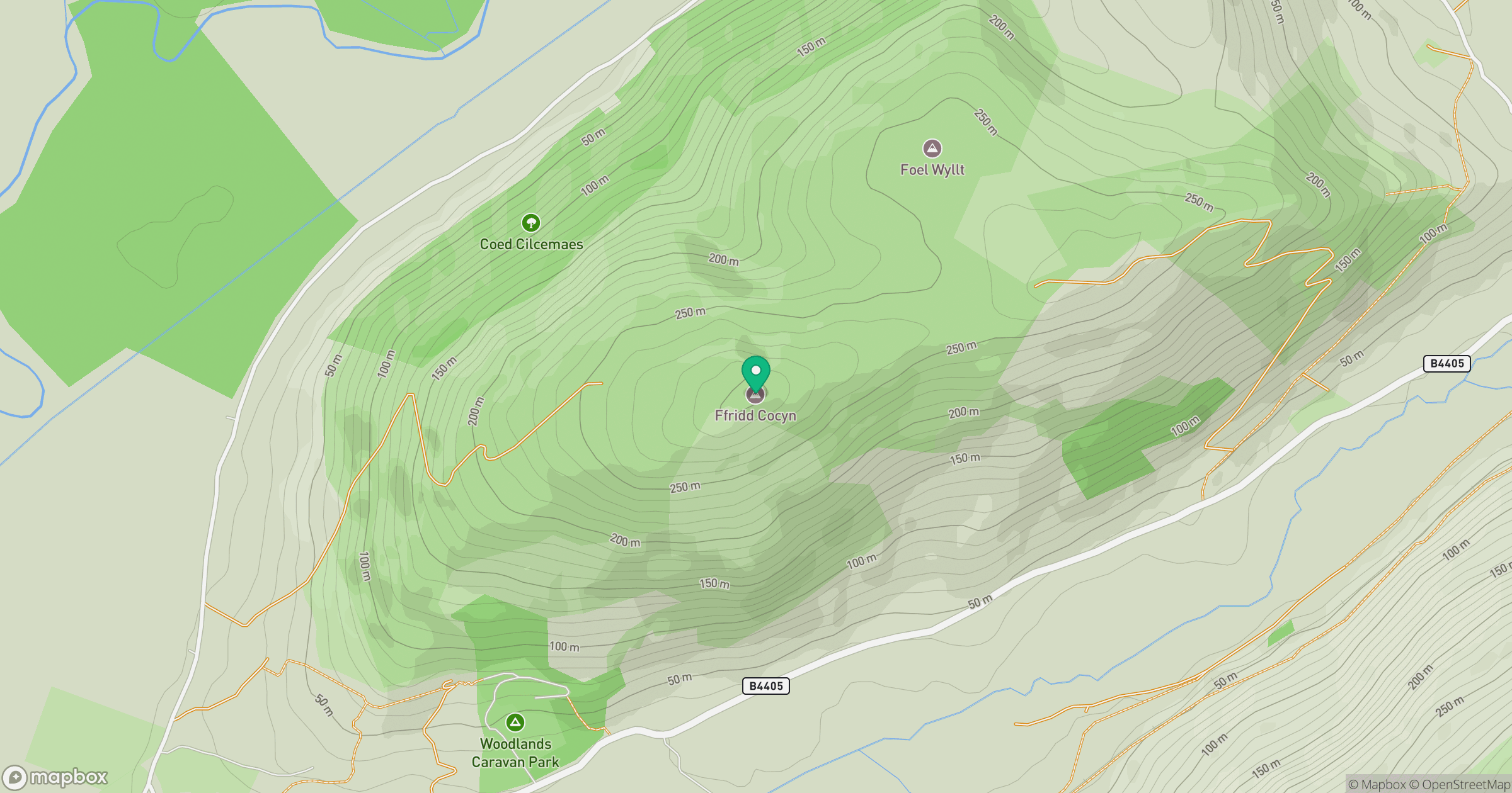
Grid reference: SH624042
View on OpenStreetMapOpens a map in a new tab, centred on the hill.
Nearby Hills
Cadair Idris - Penygadair
893m
Y Garn
629m
Rhinog Fawr
720m
Pumlumon Fawr [Plynlimon]
752m
Moelwyn Mawr
770m
No comments yet. Be the first.