

Corlan Fraith
Good walks are even better shared.
Overview
Corlan Fraith: The Grey Lurker
Nestled in the heart of Snowdonia National Park, Corlan Fraith stands as a sentinel among Welsh peaks. At 596 meters, it's not the tallest of the bunch, but it offers a uniquely exhilarating experience that will leave any hiker feeling like they've conquered a great beast.
Geology
Corlan Fraith is crafted from ancient volcanic rock, a product of the Ordovician geological period that did wonders to shape the dramatic landscapes of Snowdonia. Those rock formations are not just pretty faces; they are home to a range of flora and fauna that thrive in this unique environment. And just think — that rock might have once been molten lava. Hot stuff, right?
Parking and Access
Getting to Corlan Fraith is a piece of cake! Start from the Llyn Crafnant car park, a small but perfectly formed patch of gravel which can hold around 20 vehicles. It’s a favoured spot, so you might need to play the parking game if you arrive late. If you're relying on public transport, don’t sweat it—buses run from nearby towns, with the closest stop being in Capel Curig. Just a scenic 5 km walk and you’ll be on your way to glory!
The Routes
Two main routes lead to the summit:
- Llyn Crafnant Approach: A well-loved, moderately challenging path, taking approximately 3.5 hours and 8 km in distance. Here, views of the lake will entice you, and the flora will keep your spirits high.
- Blaenau Ffestiniog Route: This is the quieter sibling of the first route, offering a more challenging experience at 9.5 km and 4.5 hours. Perfect for those who enjoy solitude or testing their mettle.
Summit Features
As you reach the summit, you'll find a trig point welcoming you like an old friend. Don’t forget to mark your achievement with a photo before descending; after all, it happened, and proof is a necessity!
Terrain
Expect an enchanting collection of rocky paths, grassy expanses, and the occasional bog to skip over. Make sure you're wearing sturdy boots unless you fancy your toes getting acquainted with, let’s say, the less glamorous aspects of mother nature.
Views
From the summit, behold a panorama featuring the majesty of the Snowdonia range, with the ever-proud peaks of the Carneddau visible on clearer days. Snap away during spring or autumn when the scenery is enhanced by the vivid colours of blooming heather and the cool, crisp air.
Hazards
Don't forget that the weather can be as fickle as a cat on a hot tin roof. Visibility can drop like a stone, so plan wisely and do keep an extra pair of socks handy — your feet will thank you!
Nearby Summits
While Corlan Fraith is a gem, don’t forget about its neighbours, such as Y Ro Wen, soaring to 765 meters, and the mighty Moel Siabod at 872 meters.
Facilities
Unfortunately, the summit itself is devoid of facilities, but fear not! The village of Penmachno offers cafes, pubs, and toilets aplenty to recharge after your adventure.
A Touch of History
Corlan Fraith, meaning 'grey lurking place,' speaks to the mountain's foggy, mysterious beauty. Its presence is steeped in local folklore, embodying the spirit and resilience of the Welsh culture.
In essence, Corlan Fraith is not just a mountain; it’s an experience. With breathtaking views, engaging geology, and a touch of humour along the way, it invites adventurers to create stories worth telling.
Happy hiking!
Explore routes near Corlan Fraith
Public walks starting within 80 km of this hill. Nearby does not mean a route reaches the summit; check its map and access before setting out.
Cadair Idris - Pony Path
View route
Mawddach Trail: Penmaenpool to Dolgellau Riverside Return
View route
Mawddach Trail: Penmaenpool to Arthog Estuary Return
View route
Mawddach Trail: Dolgellau to Barmouth
View route
Route planning notes
These notes describe possible approaches, not verified navigable routes or permission to cross land. Check current paths, local access rules and conditions before setting out.
Llyn Crafnant Approach
A popular scenic route starting from Llyn Crafnant, offering stunning views throughout the ascent.
Blaenau Ffestiniog Route
A less trodden path that provides a quieter experience, weaving through lush woodlands and rocky outcrops.
Make a day of it, together
Find someone to share the walk with, or organise a day out along a route you like.
Photo Gallery
View all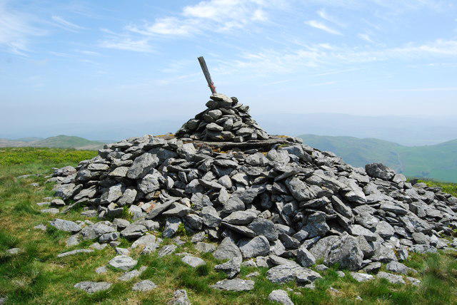 Photo could not load
SH6300 : Cairn atop Corlan Fraith
John Haynes
Hill facts and local notes
Classifications
Elevation
406m
1,332 ft
Prominence
103m
Coordinates
52.5813, -4.0222
SH630000
OS Map
135
Explorer: OL23W
At the Summit
The summit is crowned with a sizeable trig point, inviting weary but triumphant walkers to take a well-earned selfie. After all, what's the point of climbing if not for the 'gram?
Terrain & Geology
Corlan Fraith is primarily composed of volcanic rock formed during the Ordovician period, showcasing rugged landscapes and fascinating outcrops that tell a story of ancient geological activity. Don't worry, it's not nearly as boring as it sounds!
Views & Scenery
Stunning views of the Snowdonia range, the distant peaks of the Carneddau Mountains, and on a clear day, even the Isle of Anglesey.
History & Heritage
Name Origin
The name Corlan Fraith translates to 'grey lurking place,' possibly referring to its misty and elusive nature.
Historical Significance
The mountain is part of the rich tapestry of Welsh cultural heritage, often referenced in folklore and local tales about ancient warriors and mythical creatures.
Getting There & Facilities
Check current local access restrictions, parking rules and transport timetables before travelling. These notes do not confirm public access to the summit.
Parking
There is a designated car park at Llyn Crafnant, suitable for around 20 vehicles. It's first come, first served, so arrive early - or be prepared to do the parking shuffle!
Public Transport
Buses operate from nearby towns, with the closest stop at Capel Curig, approximately 5 km away. Bring your walking boots for an extra warm-up.
Nearby Facilities
No facilities at the summit, but Penmachno has cafes, pubs, and toilet facilities, ensuring you're well-prepared for the journey.
Safety Information
Known Hazards
- Variable weather conditions can change rapidly; low visibility can occur. Be prepared and pack extra socks for the inevitable boggy misadventures.
General Safety Tips
- Check weather conditions before setting out
- Carry appropriate clothing and equipment
- Let someone know your planned route
- Take a map, compass, and GPS device
- Carry emergency supplies: food, water, first aid kit, torch
Hills
Some common questions about the hills answered
Are there group walks up Corlan Fraith?
Many walkers use Walkmates to join or organise walks with others. You can check for group walks around Corlan Fraith through the maps
Are there other walkers around Corlan Fraith?
Activity varies by location and time, but Walkmates lets you see whether others have shared walks or shown interest in this area. Find other people through the walking friends search walking friends for Corlan Fraith search or of course create your own walk for Corlan Fraith
Can I organise a walk to Corlan Fraith?
Yes. If there aren’t any walks listed already, you can create a walk and make it available for others to join.
If you're signed up to Walkmates, you can create a walk to Corlan Fraith.
How do I find a walk up this hill?
There are often multiple ways to walk this hill, depending on experience and route preference. Walkmates helps you explore walks and routes that others have shared.
Can I suggest a new route up Corlan Fraith?
Yes. You can suggest or create routes to share with others. Walkmates focuses on the social side of walking, so routes are used to help people organise walks and explore areas together, rather than as detailed navigation tools or route libraries.
Other uses really appreciate knowledgeable walkers sharing their routes. Share your favourite route to Corlan Fraith here
The is an error or something incorrect about this hill. How do I let you know?
We always strive to keep the information on Walkmates as accurate as possible. If you find an error, please let us know through the contact form and we'll aim to correct it as quickly as possible
Community Discussion
Comments
Location
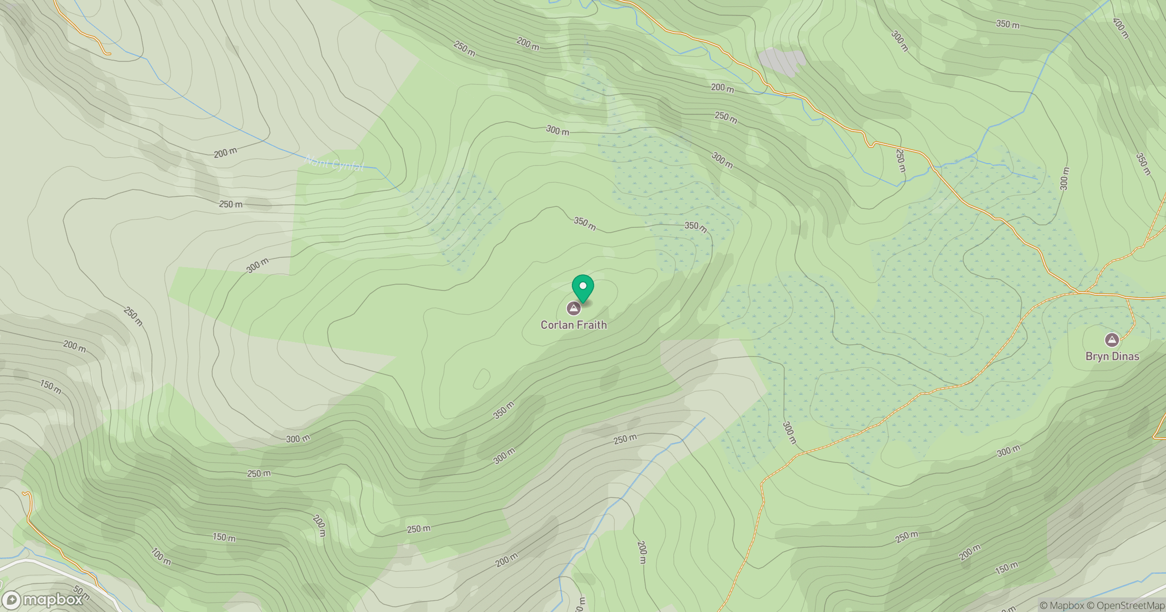
Grid reference: SH630000
View on OpenStreetMapOpens a map in a new tab, centred on the hill.
Hills within 30 km
Straight-line distance, not a walking route or confirmation of access.
Cadair Idris - Penygadair
893m
Y Garn
629m
Rhinog Fawr
721m
Pumlumon Fawr [Plynlimon]
753m
Llechwedd Melyn
196m
No comments yet. Be the first.