
Tal y Gareg
Good walks are even better shared.
Overview
Tal y Gareg
Overview
Nestled in the stunning Snowdonia National Park, Tal y Gareg stands proudly at an elevation of 570 meters. Known as a Marilyn, it may not be the tallest peak, but its distinct character and beauty captivate hikers and nature lovers alike.
Geology
The mountain’s rugged face is crafted from ancient volcanic rock, giving it a personality that speaks of ages long past. The presence of rhyolite offers diverse textures and layers to explore, while the occasional obsidian can be found, a striking reminder of its fiery origins. Let’s hope you don’t trip over any of the geological treasures!
Routes
Ogwen Valley Approach:
- Description: A delightful stroll through verdant valleys and lakes. Perfect for families and those who enjoy the gentler side of hiking.
- Distance: 8.5 km
- Estimated Time: 4.5 hours
- Difficulty: Moderate
North Face Traverse:
- Description: For the adventurer at heart, this route offers scrambling and adrenaline-pumping views.
- Distance: 6.0 km
- Estimated Time: 5 hours
- Difficulty: Challenging
Summit Features
Achieving the summit rewards hikers with a granite cairn, standing in defiance of the ravages of time, perfect for a moment of contemplation or the ideal posed picture to make friends jealous.
Terrain Type
The journey is a mix of rocky and grassy terrain, with some boggy patches thrown in for good measure - a true test for any sturdy boot!
Views
From the top, gaze upon the breathtaking expanse of Snowdonia. Notable spots include Tryfan and Llyn Ogwen, and don't miss out on soaking in the vistas during spring, when nature dresses in all her finery.
Hazards
Hiking safety is key! Sudden weather changes and slippery rocks may present risks. Keep your wits about you and try to avoid the worst case of ‘slip and slide’—your pride will appreciate it!
Nearby Summits
If you're feeling adventurous, nearby peaks such as Tryfan (918 m) and Pen yr Ole Wen (978 m) offer fantastic extensions to your hiking itinerary.
Access
Reaching Tal y Gareg is convenient. Parking can be found at Ogwen Cottage, which gets busy—arriving early is advisable! For those relying on public transport, frequent bus services link to Bangor. The closest town, Bethesda, serves as an excellent base for your adventures.
Facilities
While venturing through nature, don’t forget the essentials. Ogwen Cottage has public toilets and a café where you can grab a hot drink—perfect for warming chilly fingers and toes post-hike.
History
The name Tal y Gareg translates to 'the forehead of the rock', which is both poetic and fitting considering its prominent profile. The area is steeped in Welsh culture and folklore, adding an enriching layer of history to your adventure.
Conclusion
Tal y Gareg, while not the heavyweight champion of the Welsh mountains, offers a delightful hiking experience packed with stunning views, intriguing geology, and a touch of Welsh magic. Lace up those boots, grab your walking sticks, and prepare for a memorable outing!
Explore routes near Tal y Gareg
Public walks starting within 80 km of this hill. Nearby does not mean a route reaches the summit; check its map and access before setting out.
Cadair Idris - Pony Path
View route
Mawddach Trail: Penmaenpool to Dolgellau Riverside Return
View route
Mawddach Trail: Penmaenpool to Arthog Estuary Return
View route
Mawddach Trail: Dolgellau to Barmouth
View route
Route planning notes
These notes describe possible approaches, not verified navigable routes or permission to cross land. Check current paths, local access rules and conditions before setting out.
Ogwen Valley Approach
A scenic route starting from the Ogwen Valley, skirting beautiful lakes and taking you through lush greenery as you ascend the mountain.
North Face Traverse
A more challenging route that requires some scrambling and offers thrilling views along the way. Not for the faint of heart!
Make a day of it, together
Find someone to share the walk with, or organise a day out along a route you like.
Hill facts and local notes
Classifications
Elevation
189m
620 ft
Prominence
123m
Coordinates
52.6160, -4.1003
SH579041
OS Map
135
Explorer: OL23W
At the Summit
The summit is marked by a prominent granite cairn, which not only serves as a guide for wandering hikers but is also a fantastic spot for a selfie with breathtaking views.
Terrain & Geology
Tal y Gareg is primarily composed of ancient volcanic rock, specifically rhyolite. This gives the mountain its rugged appearance and creates fascinating formations that hikers can explore. You might even find obsidian rock, remnants of prehistoric volcanic activity.
Views & Scenery
On a clear day, one can see the sprawling landscapes of Snowdonia, including peaks like Tryfan and the glistening waters of Llyn Ogwen. It's a showstopper of a view, truly.
History & Heritage
Name Origin
The name Tal y Gareg translates from Welsh to 'the forehead of the rock', which is fitting given its rugged appearance and rocky summit.
Historical Significance
The area holds cultural significance as part of the broader Snowdonia region, rich in Welsh heritage and folklore, often featured in local tales passed down through generations.
Getting There & Facilities
Check current local access restrictions, parking rules and transport timetables before travelling. These notes do not confirm public access to the summit.
Parking
Parking is available at the Ogwen Cottage car park. Arrive early, as it fills up faster than a bad pun at a comedy club.
Public Transport
Bus services are available from Bangor to Ogwen Cottage, making it a breeze for public transport users to access the area.
Nearby Facilities
There are basic facilities like public toilets at Ogwen Cottage, and the occasional café offering warm drinks and snacks - perfect for a well-deserved treat after your hike.
Safety Information
Known Hazards
- Potential for sudden weather changes, slippery rocks, and steep cliffs along certain routes. Watch your step and your sandwich!
General Safety Tips
- Check weather conditions before setting out
- Carry appropriate clothing and equipment
- Let someone know your planned route
- Take a map, compass, and GPS device
- Carry emergency supplies: food, water, first aid kit, torch
Hills
Some common questions about the hills answered
Are there group walks up Tal y Gareg?
Many walkers use Walkmates to join or organise walks with others. You can check for group walks around Tal y Gareg through the maps
Are there other walkers around Tal y Gareg?
Activity varies by location and time, but Walkmates lets you see whether others have shared walks or shown interest in this area. Find other people through the walking friends search walking friends for Tal y Gareg search or of course create your own walk for Tal y Gareg
Can I organise a walk to Tal y Gareg?
Yes. If there aren’t any walks listed already, you can create a walk and make it available for others to join.
If you're signed up to Walkmates, you can create a walk to Tal y Gareg.
How do I find a walk up this hill?
There are often multiple ways to walk this hill, depending on experience and route preference. Walkmates helps you explore walks and routes that others have shared.
Can I suggest a new route up Tal y Gareg?
Yes. You can suggest or create routes to share with others. Walkmates focuses on the social side of walking, so routes are used to help people organise walks and explore areas together, rather than as detailed navigation tools or route libraries.
Other uses really appreciate knowledgeable walkers sharing their routes. Share your favourite route to Tal y Gareg here
The is an error or something incorrect about this hill. How do I let you know?
We always strive to keep the information on Walkmates as accurate as possible. If you find an error, please let us know through the contact form and we'll aim to correct it as quickly as possible
Community Discussion
Comments
Location
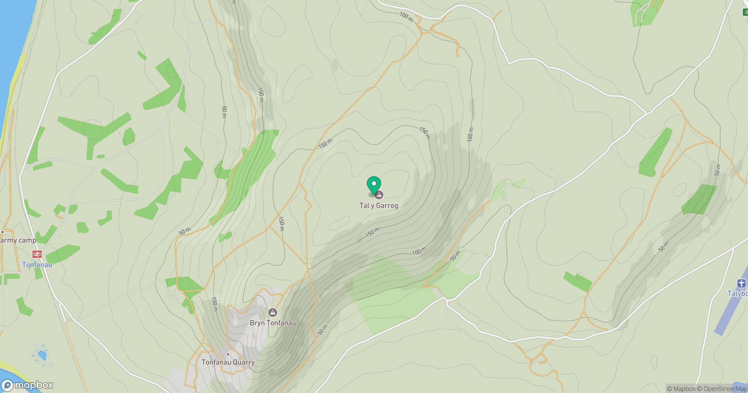
Grid reference: SH579041
View on OpenStreetMapOpens a map in a new tab, centred on the hill.
Hills within 30 km
Straight-line distance, not a walking route or confirmation of access.
Cadair Idris - Penygadair
893m
Y Garn
629m
Rhinog Fawr
721m
Pumlumon Fawr [Plynlimon]
753m
Foel Cocyn
313m
No comments yet. Be the first.