

Flat Holm
Good walks are even better shared.
ST2264 : Flatholm Lighthouse
Morag Sinton Photo source
Overview
Flat Holm: A Hidden Gem in Cardiff Bay
Introduction
Nestled in the Bristol Channel, Flat Holm is a small but fascinating island just off the coast of Cardiff. Standing at a towering elevation of 12 meters, it may not be the highest mountain you've ever summited, but the views are simply stunning!
Geology
Flat Holm's geology is predominantly limestone, part of the extensive Carboniferous limestone deposits. This geological richness fosters a unique ecosystem, perfect for budding naturalists and avid bird watchers alike. Notably, the island hosts a variety of seabirds and rare plants.
Routes
The Flat Holm Walk offers a leisurely 3.5 km loop that showcases the island's natural beauty and history. This route is perfect for families, as it takes about 1.5 hours to complete at an easy pace, leaving plenty of time for exclamations of 'Look at that view!'
Summit Features
At the summit, visitors will find a modest observation point and the historic lighthouse that has been guiding mariners for generations. It’s a great spot to take a cheeky selfie, so make sure you’ve got your camera ready!
Terrain
The island's terrain is a delightful mix of grassy patches and rocky outcrops. It's easy on the feet in most places, but do watch out for the occasional mischievous clump of seaweed if you're near the shore.
Views
From the summit, enjoy breathtaking views of the Bristol Channel, and on a clear day, you may even glimpse the peaks of the Brecon Beacons. Spring and summer are the prime seasons for these vistas, enhanced by the blooming wildflowers - nature’s own confetti!
Hazards
While Flat Holm is generally safe, there's a bit of British weather unpredictability. The coastal paths may become slippery after rain, so do tread carefully. Also, observe strong tides if you plan on wandering the shoreline.
Nearby Summits
Just a stone’s throw away is Steep Holm, slightly taller at 19 meters and equally alluring. It’s worth a visit if you fancy a bit of island-hopping.
Access
Access to Flat Holm is conveniently located at Cardiff Bay where ferry services run regularly. Nearest parking is available for day-trippers, and the bay is easily reached via public transport.
Facilities
On the island, you'll find basic facilities including toilets and a visitor centre during the summer. Don’t forget to pack your own picnic, as the café choices can be limited and quirky!
History
The etymology of Flat Holm is derived from Old Norse, hinting at its age-old charm. Historically, it has been significant as a quarantine station and played roles during the world wars, a quiet witness to many events.
Conclusion
Flat Holm may not be the tallest peak, but what it lacks in elevation, it surely makes up with charm, wildlife, and endless vistas. Whether you’re an avid hiker or just looking for a pleasant day trip, this little island is worth a visit.
Happy hiking!
Explore routes near Flat Holm
Walks starting near this hill. Open a route to check its map, distance and full itinerary.
Weston-super-Mare Walk with Men Walking & Talking
View route
Cardiff: Hailey Park to Blackweir Bridge on the Taff Trail
View route
Yatton to Sandford Strawberry Line and Cider Orchards
View route
Newport Fourteen Locks to Risca: Monmouthshire Canal Return
View route
Route planning notes
These notes describe possible approaches. Check a route's map and access information when planning your walk.
Flat Holm Walk
A gentle circular walk around the island, suitable for all ages.
Make a day of it, together
Find someone to share the walk with, or organise a day out along a route you like.
Photo Gallery
View all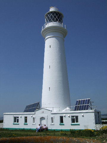 Photo could not load
ST2264 : Flatholm Lighthouse
Morag Sinton
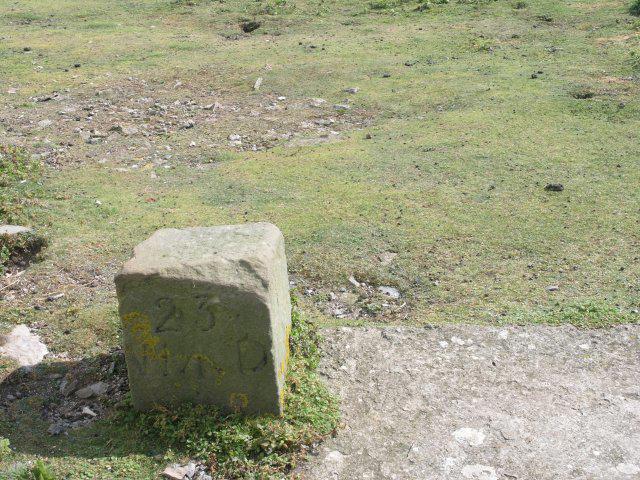 Photo could not load
ST2264 : War Department benchmark
Hywel Williams
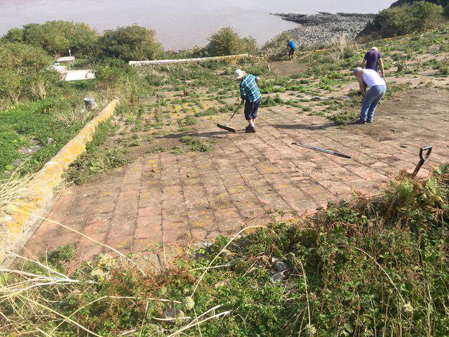 Photo could not load
ST2264 : Weed clearance on water catchment
Alan Hughes
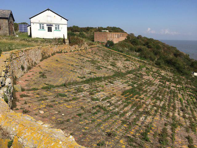 Photo could not load
ST2264 : Water catchment facility
Alan Hughes
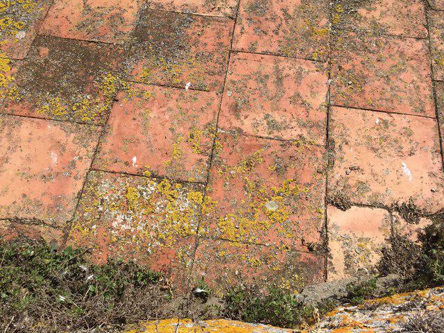 Photo could not load
ST2264 : Close up of tiles
Alan Hughes
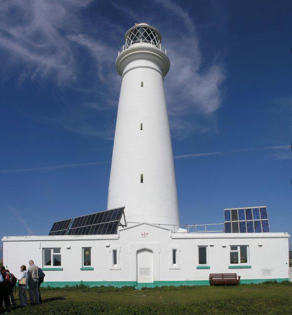 Photo could not load
ST2264 : Flat Holm Lighthouse
Hywel Williams
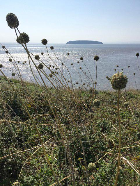 Photo could not load
ST2264 : Wild leeks
Alan Hughes
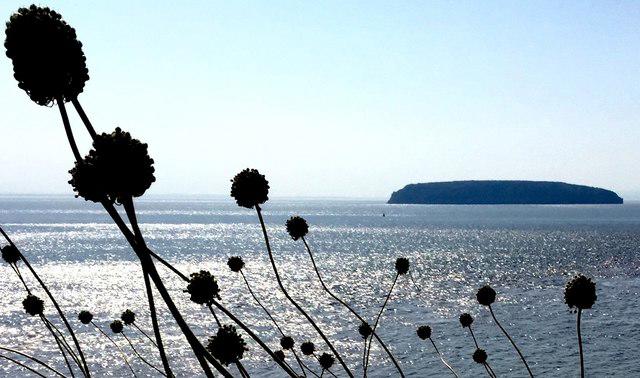 Photo could not load
ST2264 : Wild leeks and Steep Holm
Alan Hughes
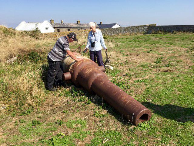 Photo could not load
ST2264 : Cannon on Flat Holm
Alan Hughes
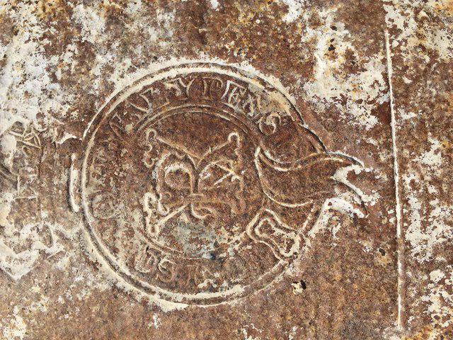
ST2264 : Inscription on cannon
Alan Hughes
Hill facts and local notes
Classifications
Elevation
32m
106 ft
Prominence
32m
Coordinates
51.3756, -3.1184
ST222646
OS Map
171 182
Explorer: 151E 153
At the Summit
The summit features a small observation point and a historic lighthouse, providing a great spot for a quick selfie and some splendid views.
Terrain & Geology
The island is primarily composed of limestone, which has created a unique habitat for diverse flora and fauna. The underlying geology is part of the Carboniferous limestone, giving rise to features such as sea caves and blowholes.
Views & Scenery
From the summit, walkers can see the Bristol Channel, the distant Brecon Beacons, and the city of Cardiff.
History & Heritage
Name Origin
Flat Holm derives its name from the Old Norse 'Holmr' meaning 'small island'.
Historical Significance
Flat Holm has served various purposes throughout history, including a quarantine station in the 19th century and importance during the First and Second World Wars.
Getting There & Facilities
Parking
Parking is available at Cardiff Bay, with a designated area for visitors to drop off before boarding the ferry.
Public Transport
Regular bus services connect Cardiff city centre to Cardiff Bay, and ferries operate to Flat Holm from the Bay.
Nearby Facilities
There are basic facilities on the island, including toilets and a visitor centre during the summer months. Bring your own snacks, as the café is quite limited!
Safety Information
Known Hazards
- Coastal paths may become slippery after rain, and strong tides can impact access to some areas around the shoreline.
General Safety Tips
- Check weather conditions before setting out
- Carry appropriate clothing and equipment
- Let someone know your planned route
- Take a map, compass, and GPS device
- Carry emergency supplies: food, water, first aid kit, torch
Hills
Some common questions about the hills answered
Are there group walks up Flat Holm?
Many walkers use Walkmates to join or organise walks with others. You can check for group walks around Flat Holm through the maps
Are there other walkers around Flat Holm?
Activity varies by location and time, but Walkmates lets you see whether others have shared walks or shown interest in this area. Find other people through the walking friends search walking friends for Flat Holm search or of course create your own walk for Flat Holm
Can I organise a walk to Flat Holm?
Yes. If there aren’t any walks listed already, you can create a walk and make it available for others to join.
If you're signed up to Walkmates, you can create a walk to Flat Holm.
How do I find a walk up this hill?
There are often multiple ways to walk this hill, depending on experience and route preference. Walkmates helps you explore walks and routes that others have shared.
Can I suggest a new route up Flat Holm?
Yes. You can suggest or create routes to share with others. Walkmates focuses on the social side of walking, so routes are used to help people organise walks and explore areas together, rather than as detailed navigation tools or route libraries.
Other uses really appreciate knowledgeable walkers sharing their routes. Share your favourite route to Flat Holm here
The is an error or something incorrect about this hill. How do I let you know?
We always strive to keep the information on Walkmates as accurate as possible. If you find an error, please let us know through the contact form and we'll aim to correct it as quickly as possible
Community Discussion
Comments
Location
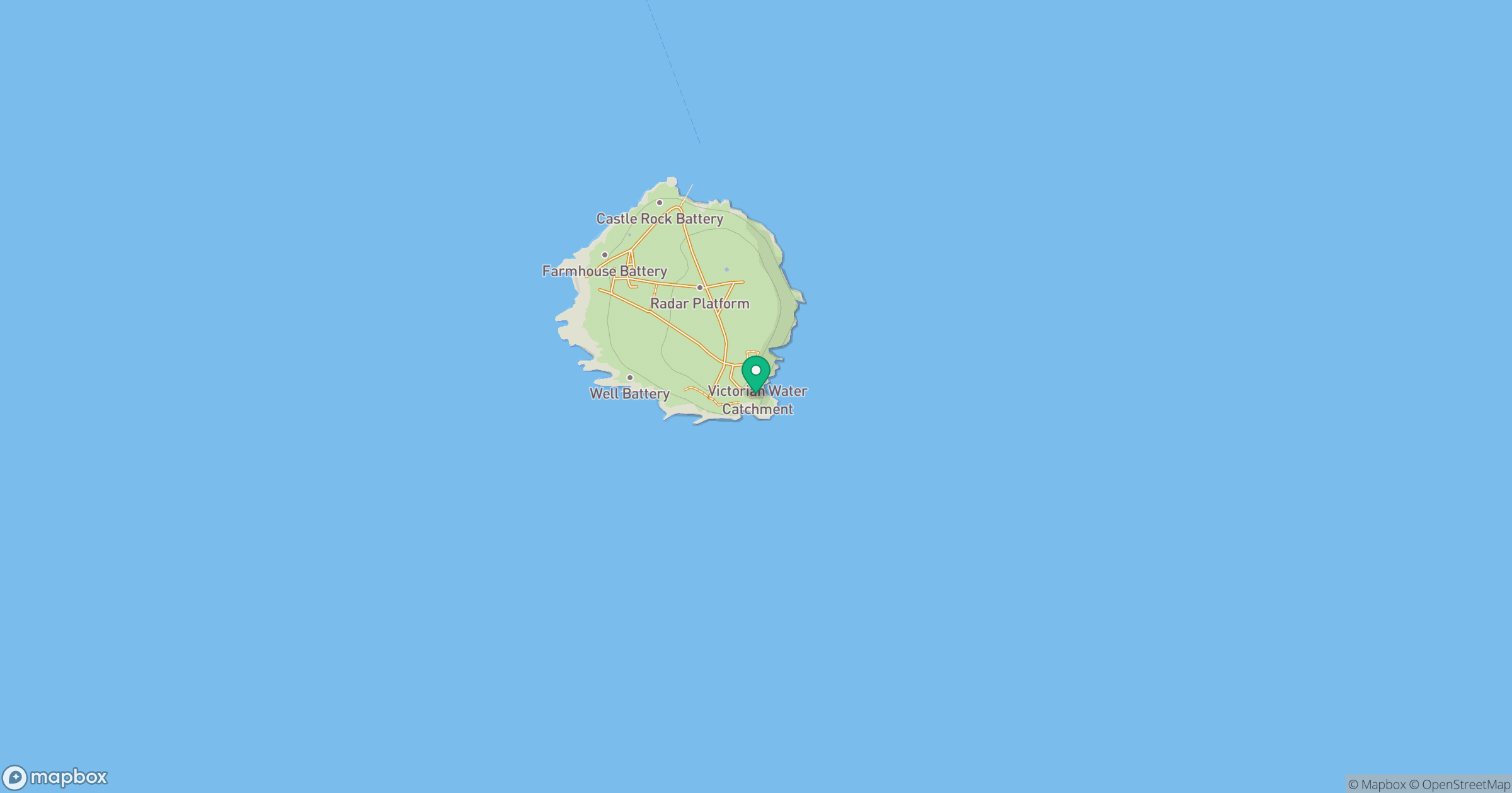
Grid reference: ST222646
View on OpenStreetMapOpens a map in a new tab, centred on the hill.


No comments yet. Be the first.