
Garth Hill
Good walks are even better shared.
Overview
Garth Hill, often called the Garth, rises above Pentyrch and Gwaelod-y-Garth northwest of Cardiff. Its recorded 306.9 m summit at ST103835 is a trig point on an ancient burial mound. Steep approaches lead to an open grassy ridge with views towards Cardiff, the Taff Valley and the Bristol Channel.
Garth Hill
Garth Hill rises above Pentyrch and Gwaelod-y-Garth, northwest of Cardiff. The recorded height is 306.9 m. At ST103835, the trig point stands on an ancient burial mound; DoBIH records ground 510 m east-northeast as 6.4 m lower. The mound and eastern shoulder are distinct summit features.
Returning walking routes
The BBC’s Pentyrch circuit starts and finishes outside the Lewis Arms. It links Coed y Bedw, Georgetown and Gwaelod-y-Garth with the summit, returning south over the Ridgeway Walk and Mountain Road. Its approximately 4.5 miles converts to about 7.2 km. It has steep sections, steps and stiles; no duration or ascent figure is published.
Cardiff Ramblers’ longer circuit starts and finishes at Radyr station car park. It visits Forest Farm, Morganstown, the Garth summit, Taffs Well and Castell Coch before returning along the Taff. The source gives 16.5 km, 400 m of climbing and a strenuous description, without a duration. These figures belong to this full circuit and must not be transferred to the shorter walk.
The planning notes summarise the complete returns. Carry detailed mapping and the original source directions, and check current access notices rather than relying on older descriptions alone.
Access and facilities
The summit grid reference is not a parking location. Arrange lawful parking for the chosen start and check restrictions. Do not assume that pub car parks are available for a walk. Taffs Well and Radyr provide railway approaches, and Cardiff Bus 136 serves Pentyrch; check travel times for your date and the last return. The Gwaelod y Garth Inn offers refreshments below the hill, subject to opening times. Bring supplies for the ridge and do not rely on toilets at Taffs Well station.
Terrain, safety and views
Grassy slopes and woodland paths can be steep, muddy and slippery. The longer circuit includes a rocky descent, roads and a railway crossing. Coed y Bedw has steps and stiles, requires dogs on leads and manages ash dieback: follow all closure signs. Keep clear of steep drops, give livestock space and protect the burial mounds. The ridge is exposed to wind and poor visibility. On clear days the outlook includes Cardiff, the Taff Valley and the Bristol Channel.
Heol Goch suffered flood-related disruption in 2026. Cardiff Bus reported its reopening and resumed routes from 6 August, with temporary lights. That dated notice does not guarantee all paths or future road access; check for current works and restrictions before travelling.
Geology, name and history
Garth Hill includes Pennant Sandstone, part of the Carboniferous succession of the South Wales Coalfield. These sandstone beds are interleaved with thinner mudstone and siltstone layers. The limestone of nearby Little Garth is a separate geological feature; the exact bed beneath the summit mound has not been established here.
The name uses Welsh garth, meaning a hill or ridge. Owen and Morgan’s place-name dictionary places Gwaelod-y-garth under this topographical sense, distinct from the separate sense meaning an enclosure.
Cadw records five Bronze Age round barrows on the ridge, scheduled as GM107. The trig-point mound is an ancient earthwork, not evidence that villagers recently raised the hill. Nearby separate hill destinations include Craig yr Allt (273 m) and Caerphilly Common (270.8 m).
Explore routes near Garth Hill
Walks starting near this hill. Open a route to check its map, distance and full itinerary.
Cardiff: Hailey Park to Blackweir Bridge on the Taff Trail
View route
Dinas Powys Over-50s Stroll and Coffee Morning
View route
Cosmeston Strollers
View route
Newport Fourteen Locks to Risca: Monmouthshire Canal Return
View route
Route planning notes
These notes describe possible approaches. Check a route's map and access information when planning your walk.
Pentyrch, Coed y Bedw and Garth summit circuit
Start and finish outside the Lewis Arms in Pentyrch. Follow Heol Goch and Cefn Bychan, descend through woodland, cross the road and follow the fields into Coed y Bedw. Continue via Georgetown to Gwaelod-y-Garth. Take the steep lane beside the inn, then the signed hillside track to the eastern shoulder. Turn along the ridge to the trig point on the summit burial mound. Return south on the Ridgeway Walk, cross the minor road onto Mountain Road and descend to Pentyrch and the original start. BBC Weatherman Walking gives about 4.5 miles (7.2 km) for this complete circuit. It publishes no duration or total ascent. Expect steep slopes, steps and stiles; obey reserve closures and roadwork notices.
Radyr, Garth summit and Castell Coch circuit
Start and finish at Radyr station car park (ST136803). Walk through Forest Farm and beside the old canal, then cross the Taff to Morganstown. Continue via Garth Wood and the Pentyrch fields, cross Heol Goch and climb onto the Garth to visit the summit trig and mound. Follow the ridge east, descend the rocky path and turn down to Gwaelod-y-Garth. Cross the river to Taffs Well, then use the railway footbridge and road crossings to reach the Taff Trail. Continue to Fforest Fawr and Castell Coch, descend to Tongwynlais and return along the Taff, crossing the footbridge back to Radyr station. Cardiff Ramblers gives 16.5 km and 400 m total climbing, describing it as strenuous; no duration is published. Check current closures and carry the full source directions.
Make a day of it, together
Find someone to share the walk with, or organise a day out along a route you like.
Hill facts and local notes
Classifications
Elevation
307m
1,007 ft
Prominence
221m
Coordinates
51.5433, -3.2943
ST103835
OS Map
171
Explorer: 151E
At the Summit
The recorded 306.9 m summit at ST103835 is a trig point on an ancient mound, one of the ridge’s Bronze Age burial monuments. DoBIH records ground 510 m ENE as 6.4 m lower. The mound-top summit should not be described as an unmodified natural high point, and the eastern shoulder is not the recorded summit.
Terrain & Geology
Garth Hill includes Pennant Sandstone, part of the Carboniferous succession of the South Wales Coalfield. These sandstone beds are interleaved with thinner mudstone and siltstone layers. The limestone of nearby Little Garth is a separate geological feature; the exact bed beneath the summit mound has not been established here.
Views & Scenery
In clear weather, the ridge overlooks Cardiff, the Taff Valley and the Bristol Channel. Visibility depends on cloud and weather; no particular season guarantees a clear view.
Best Seasons
Woodland approaches add spring foliage and autumn colour, while the open ridge offers wider views when visibility is good. Do not rely on a seasonal visibility guarantee.
History & Heritage
Name Origin
The name uses Welsh garth, meaning a hill or ridge. Owen and Morgan’s place-name dictionary places Gwaelod-y-garth under this topographical sense, distinct from the separate sense meaning an enclosure.
Historical Significance
Cadw schedules five round barrows along the summit ridge as monument GM107. These grass-covered earthen burial mounds date broadly to the Bronze Age, about 2300–800 BC, and preserve evidence of prehistoric burial and ritual activity. They should be treated as archaeological monuments rather than modern summit cairns.
Getting There & Facilities
Parking
ST103835 is the summit, not a car park. For the Pentyrch circuit, arrange lawful village parking near the Lewis Arms start and do not assume pub parking is available to walkers. The longer circuit starts at Radyr station car park, ST136803; check its current terms. The local flying club describes a mountain-road lay-by, but the narrow approach can suffer subsidence and is not an ample designated hill car park. Keep gates and passing places clear.
Public Transport
Taffs Well is the nearby railway station for eastern approaches; the longer circuit starts at Radyr station. Cardiff Bus service 136 links Cardiff city centre with Pentyrch and Creigiau. Check the operator’s timetable for your date and the return journey; no fixed hourly service is assumed.
Nearby Facilities
Plan to be self-sufficient on the open ridge. The Gwaelod y Garth Inn on Main Road, CF15 9HH, offers food and drink below the hill; check opening times. Pentyrch is another village base. Transport for Wales lists no toilets at Taffs Well station; do not assume public toilets or unrestricted pub facilities.
Safety Information
Known Hazards
- Steep grassy and rocky paths can be slippery in rain or frost; wear suitable footwear and carry navigation and weather protection.
- The circuits include roads without pavements, road crossings and, on the Radyr circuit, a railway level crossing; use the designated crossings carefully.
- Coed y Bedw is managing ash dieback. Obey path-closure signs and keep dogs on a lead in the reserve.
- Keep clear of steep eastern drops and give livestock space. Avoid damaging the scheduled burial mounds.
- Heol Goch has had flood damage and temporary traffic controls. Check current road and path notices before setting out.
Seasonal Hazards
Wet weather can leave woodland and field paths muddy or waterlogged; frost can make steep ground slippery. The open ridge is exposed to wind and poor visibility. Follow current woodland management, roadwork and closure signs.
General Safety Tips
- Check weather conditions before setting out
- Carry appropriate clothing and equipment
- Let someone know your planned route
- Take a map, compass, and GPS device
- Carry emergency supplies: food, water, first aid kit, torch
Hills
Some common questions about the hills answered
Are there group walks up Garth Hill?
Many walkers use Walkmates to join or organise walks with others. You can check for group walks around Garth Hill through the maps
Are there other walkers around Garth Hill?
Activity varies by location and time, but Walkmates lets you see whether others have shared walks or shown interest in this area. Find other people through the walking friends search walking friends for Garth Hill search or of course create your own walk for Garth Hill
Can I organise a walk to Garth Hill?
Yes. If there aren’t any walks listed already, you can create a walk and make it available for others to join.
If you're signed up to Walkmates, you can create a walk to Garth Hill.
How do I find a walk up this hill?
There are often multiple ways to walk this hill, depending on experience and route preference. Walkmates helps you explore walks and routes that others have shared.
Can I suggest a new route up Garth Hill?
Yes. You can suggest or create routes to share with others. Walkmates focuses on the social side of walking, so routes are used to help people organise walks and explore areas together, rather than as detailed navigation tools or route libraries.
Other uses really appreciate knowledgeable walkers sharing their routes. Share your favourite route to Garth Hill here
The is an error or something incorrect about this hill. How do I let you know?
We always strive to keep the information on Walkmates as accurate as possible. If you find an error, please let us know through the contact form and we'll aim to correct it as quickly as possible
Community Discussion
Comments
Location
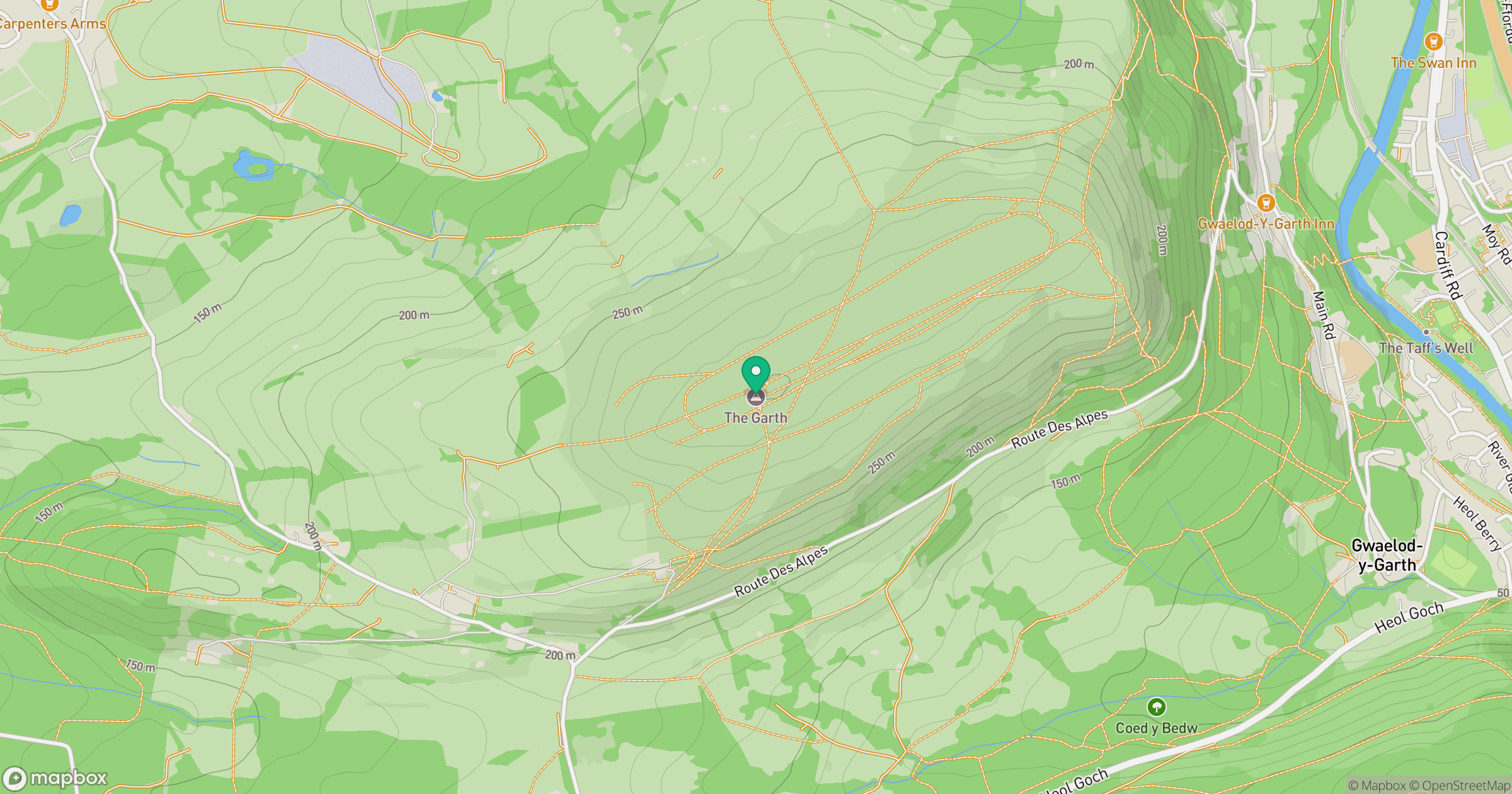
Grid reference: ST103835
View on OpenStreetMapOpens a map in a new tab, centred on the hill.



No comments yet. Be the first.