

Fan Foel
Good walks are even better shared.
SN8122 : Fan Foel
Alan Hughes Photo source
Overview
Fan Foel: A Hidden Gem of the Brecon Beacons
Nestled within the picturesque landscape of the Brecon Beacons, Fan Foel stands proudly at an elevation of 781 meters. Often overshadowed by its more famous neighbours, it is the perfect choice for those looking to enjoy a tranquil hike without the crowds.
Geology
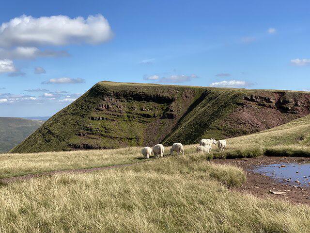
Fan Foel's bedrock is formed from Old Red Sandstone, providing a rich geologic history that can captivate geology enthusiasts. The landscape is characterized by glacial erosion that has led to its current sweeping hills and rocky outcrops, making every step a little geological adventure.
Routes
Two popular routes lead to the summit, balancing challenge and accessibility:
- Fan Foel Circular Walk: This 7.5 km circular route is a moderate trek startin from Trecastle, offering a grand tour of the area.
- Direct Ascent from the A470: For those in a bit of a hurry or seeking a simpler ascent, this 3 km direct route is incredibly straightforward.
Summit Features
Upon reaching the summit, hikers are greeted with a sturdy stone cairn and a trig point which can be a delightful backdrop for that all-important summit selfie.
Terrain
The terrain varies from grassy slopes to rocky patches, with boggy areas that keep your feet guessing. Good boots are essential to navigate both the gentle and rugged parts of the journey.
Views
The summit offers breathtaking panoramas of central Brecon Beacons, allowing you to feast your eyes on majestic peaks like Pen y Fan. For the best experience, aim for spring or autumn; the views are stunning, and the trails are less crowded.
Hazards
Though inviting, pay attention to the often wet and boggy conditions that can be tricky. The rocky terrain near the summit can also challenge even the best of boots, so tread carefully!
Access
Parking is available at a small off-road car park, perfect for early birds. If you prefer public transport, buses run from Brecon to Trecastle, but it’s wise to check their timetable first. The town of Brecon is the nearest bet for amenities before your adventure.
Facilities
While the mountain itself boasts no facilities, Brecon has ample cafes for a hot drink or a snack after your walk. Be sure to stop by for a well-deserved treat!
History
Flanked by stunning views and lush landscapes, Fan Foel’s name translates to 'Bald Peak' in Welsh - a fitting title given its unique summit. This peak resonates with significance for many hikers seeking a slice of Welsh tranquillity.
So lace up your hiking boots, grab your walking stick, and lose yourself in the beauty of Fan Foel—and remember, there’s no such thing as bad weather, just inappropriate clothing!
Explore routes near Fan Foel
Walks starting near this hill. Open a route to check its map, distance and full itinerary.
Usk Reservoir: Glasfynydd Forest and Dam Circuit
View route
Aircraft Crash Site - Wellington Bomber and Vampire Jet (Black Mountain range)
View route
Pen y Fan via Corn Du from Storey Arms
View route
Ammanford Walk with Men Walking & Talking
View route
Route planning notes
These notes describe possible approaches. Check a route's map and access information when planning your walk.
Fan Foel Circular Walk
A lovely circular route starting from the village of Trecastle, offering panoramic views and gentle gradients.
Direct Ascent from the A470
A straightforward ascent directly from the A470 road, perfect for those looking to bag a peak quickly.
Make a day of it, together
Find someone to share the walk with, or organise a day out along a route you like.
Photo Gallery
View all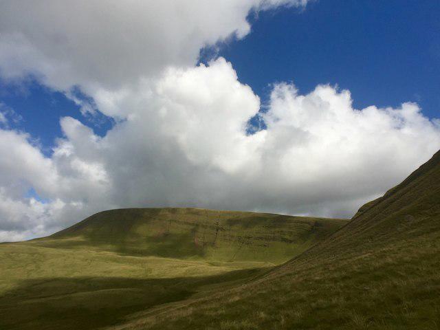 Photo could not load
SN8122 : Fan Foel
Alan Hughes
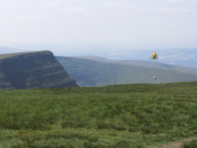 Photo could not load
SN8222 : Helicopter delivering stone for footpath improvements on Fan Foel
Colin Park
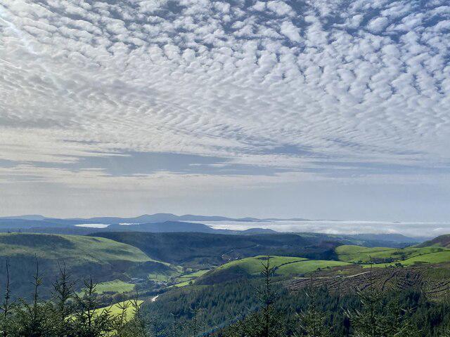 Photo could not load
SN8222 : Mynydd Du in the clouds
Alan Hughes
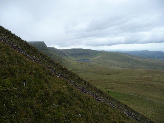 Photo could not load
SN8222 : The slope of Fan Foel in the Carmarthen Fans
Jeremy Bolwell
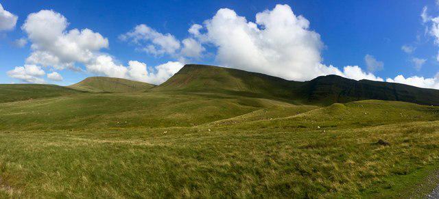 Photo could not load
SN8222 : Fan Sir Gaer
Alan Hughes
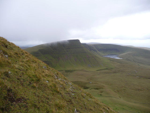 Photo could not load
SN8222 : View towards Picws Du from Fan Foel
Jeremy Bolwell
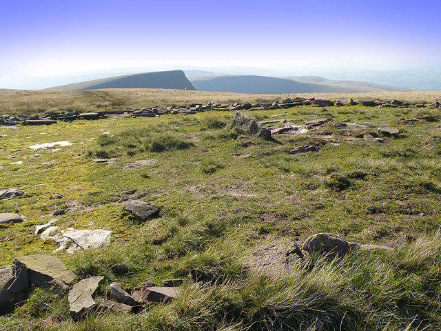 Photo could not load
SN8222 : Fan Foel
Stuart Wilding
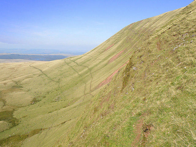 Photo could not load
SN8222 : Fan Foel
Stuart Wilding
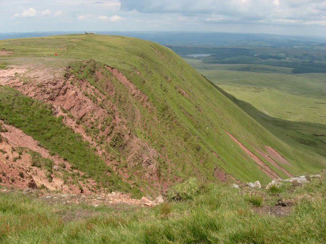 Photo could not load
SN8222 : Fan Foel
Gareth James
SN8222 : Upland grazing
Alan Hughes
Hill facts and local notes
Classifications
Elevation
781m
2,562 ft
Prominence
4m
Coordinates
51.8871, -3.7139
SN821223
OS Map
160
Explorer: OL12W
At the Summit
The summit features a prominent stone cairn, which seasoned hikers might argue is the best spot for a selfie (or a cheeky snack). A small trig point can also be found marking the elevation.
Terrain & Geology
Fan Foel is primarily composed of Old Red Sandstone, offering a fascinating glimpse into the geological history of the region. The rugged landscape is a result of glacial erosion, leaving behind smooth, sweeping hills interspersed with rocky outcrops.
Views & Scenery
From the summit, you can enjoy sweeping views of the central Brecon Beacons, including Pen y Fan and Cribyn, as well as Dartmoor on a particularly clear day. Breathtaking is an understatement!
History & Heritage
Name Origin
The name 'Fan Foel' means 'Bald Peak' in Welsh, a nod to the stripped-back nature of its summit.
Historical Significance
Fan Foel has been a popular hiking destination for many years, with numerous walkers noting its tranquil atmosphere, perfect for escaping the hustle and bustle of daily life.
Getting There & Facilities
Parking
There's a small off-road car park near the base at SN825220 that can accommodate several vehicles. Arriving early on weekends is recommended to secure a spot.
Public Transport
Local bus services from Brecon to Trecastle operate intermittently. For the most reliable visits, checking the local timetable before the journey is wise.
Nearby Facilities
There are no facilities on the mountain itself, but Brecon offers several cafes, such as The Cafe at 21 and toilets at the Brecon Visitor Centre.
Safety Information
Known Hazards
- Wet and boggy conditions can be encountered, especially after rain. The terrain can also be rocky near the summit, so caution is advised.
General Safety Tips
- Check weather conditions before setting out
- Carry appropriate clothing and equipment
- Let someone know your planned route
- Take a map, compass, and GPS device
- Carry emergency supplies: food, water, first aid kit, torch
Hills
Some common questions about the hills answered
Are there group walks up Fan Foel?
Many walkers use Walkmates to join or organise walks with others. You can check for group walks around Fan Foel through the maps
Are there other walkers around Fan Foel?
Activity varies by location and time, but Walkmates lets you see whether others have shared walks or shown interest in this area. Find other people through the walking friends search walking friends for Fan Foel search or of course create your own walk for Fan Foel
Can I organise a walk to Fan Foel?
Yes. If there aren’t any walks listed already, you can create a walk and make it available for others to join.
If you're signed up to Walkmates, you can create a walk to Fan Foel.
How do I find a walk up this hill?
There are often multiple ways to walk this hill, depending on experience and route preference. Walkmates helps you explore walks and routes that others have shared.
Can I suggest a new route up Fan Foel?
Yes. You can suggest or create routes to share with others. Walkmates focuses on the social side of walking, so routes are used to help people organise walks and explore areas together, rather than as detailed navigation tools or route libraries.
Other uses really appreciate knowledgeable walkers sharing their routes. Share your favourite route to Fan Foel here
The is an error or something incorrect about this hill. How do I let you know?
We always strive to keep the information on Walkmates as accurate as possible. If you find an error, please let us know through the contact form and we'll aim to correct it as quickly as possible
Community Discussion
Comments
Location
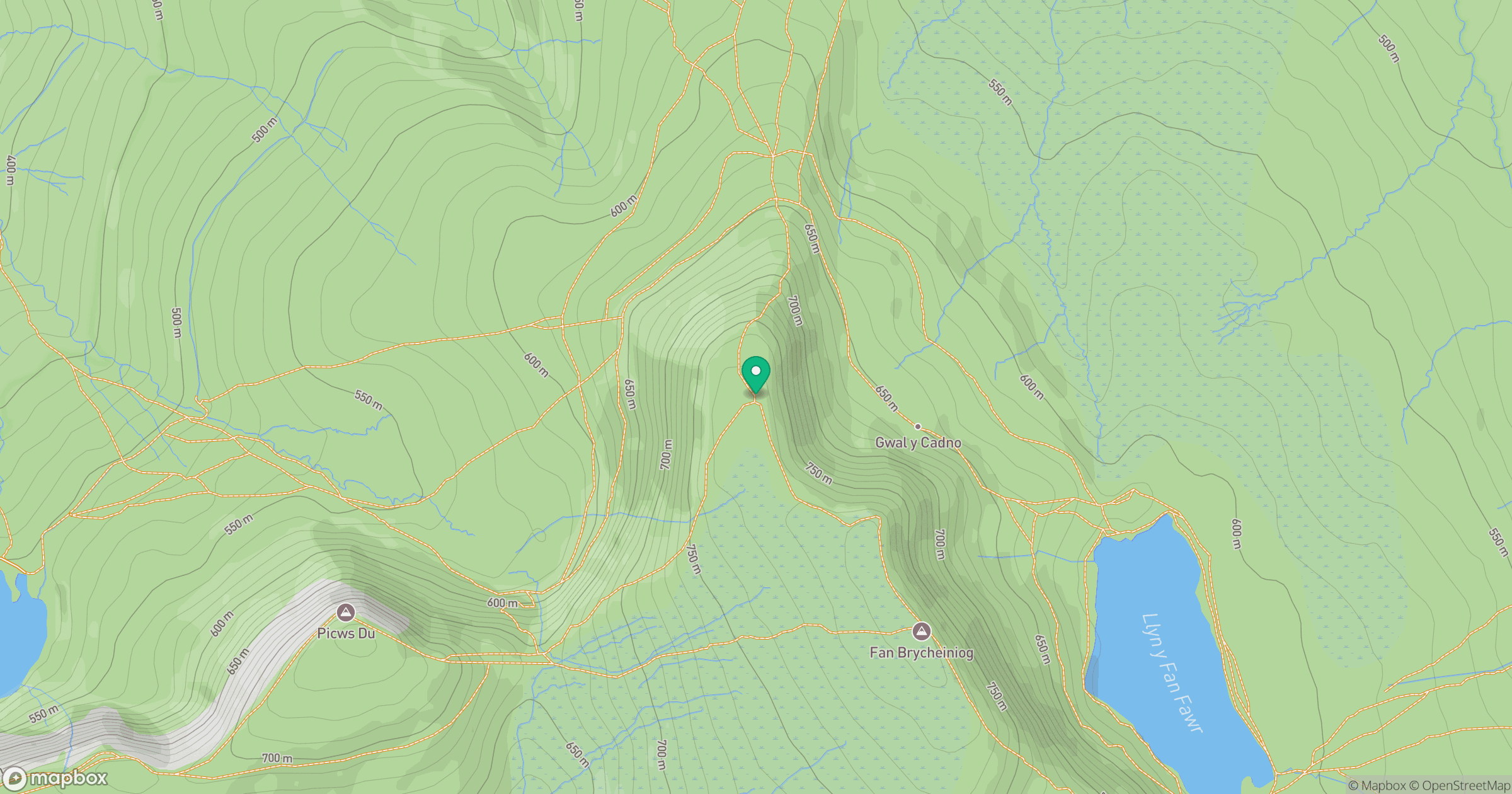
Grid reference: SN821223
View on OpenStreetMapOpens a map in a new tab, centred on the hill.


No comments yet. Be the first.