

Duncryne
Good walks are even better shared.
NS4385 : Duncryne
Stephen Sweeney Photo source
Overview
Duncryne, known locally as the Dumpling, is a 142 m hill beside Gartocharn at the southern end of Loch Lomond. Its rounded outline rises above farmland, with a short gated path leading through woodland and up a steeper final slope. The trig-point area looks over the loch and its islands towards the Highland hills; the precise highest ground lies 5 m southeast of the pillar. Start from the limited Duncryne Road lay-by or take the longer return walk from the village.
Duncryne: the Dumpling above Gartocharn
Duncryne rises to 142 m above the farmland beside Gartocharn, near the southern end of Loch Lomond. The hill's rounded shape explains its local nickname, the Dumpling. It is a small Tump with a 70 m drop, not a Marilyn. A short approach leads through woods and gates to a steeper upper slope.
Summit and outlook
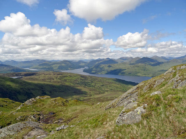
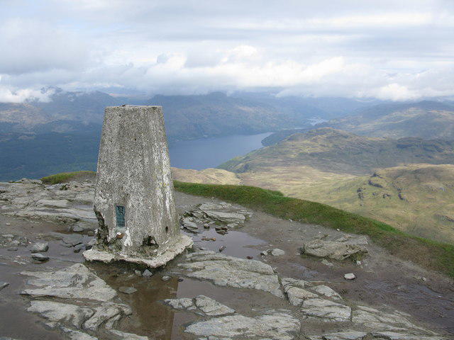
The concrete trig pillar is a useful landmark. DoBIH locates the precise high point on unmarked ground 5 m southeast, at NS 43567 85927. The loch, wooded islands and Highland skyline are the main attraction, including Ben Lomond, the Luss hills and the Arrochar hills. The Campsies lie across the lowlands. Weather and vegetation affect the outlook.
Two complete return walks
The short option starts at the Duncryne Road lay-by, NS432856. Follow the woodland gates and fenced lane, climb the upper path to the trig-point area, and retrace the same path. Walkhighlands publishes 1.25 km, 88 m ascent and 40 minutes for this complete return, without the village approach.
The village option starts on Church Road in Gartocharn, NS428862, then reaches Duncryne Road via the A811 junction. Continue to the established gate, follow the same hill path to the trig-point area, and return all the way to Church Road. Walking Britain publishes 3.3 km, 85 m ascent and 1 hour 10 minutes for this complete return.
Both sets of figures cover the published trig-point returns. The precise high ground is 5 m southeast of the pillar; the two publishers' ascent figures remain with their own routes.
Terrain and care
The route uses a gated woodland path, a grassy lane between fences and a steep upper path through bracken. Mud is common, particularly in winter. Wear footwear with grip. The village start adds road walking and the A811 junction. Follow the established path, keep dogs under close control, leave no litter and light no fires.
Getting there
The Duncryne Road lay-by only accommodates a few cars. When it is full, the local community directs walkers to the Millennium Hall car park on Church Road. Keep farm entrances and the road clear. McColl's service 309 connects Balloch and Alexandria with Gartocharn, continuing towards Drymen and Balmaha; Church Road is the village stop. Check the current operator timetable for both journeys.
Gartocharn has a shop, filling station and post office. Plan toilet stops before the walk. RSPB Loch Lomond's Nature Hub at High Wards Farm is a separate destination with its own facilities and parking arrangements, not the Duncryne trailhead.
A much older volcano
The Geological Society of Glasgow identifies Duncryne as a volcanic vent formed in the Carboniferous, about 350 million years ago. Erupted debris accumulated within the vent and consolidated into resistant rock. Later erosion and glaciation stripped away softer surroundings. The abandoned quarry beside the approach exposes fragmented volcanic material. The volcano did not originate in the Ice Age.
People and name
Tom Weir, who lived in Gartocharn, regularly climbed Duncryne. An interview republished by Friends of Loch Lomond & The Trossachs records his recollection of daily visits. Local accounts also credit John Groome with many years of voluntary path care. The Dumpling nickname reflects the hill's rounded shape.
Other hills
Conic Hill (361 m), Dumgoyne (427 m) and Duncolm (401.1 m) are separate outings in the wider area. Their heights come from the checked DoBIH rows; none is an extension included in the two routes above.
Explore routes near Duncryne
Walks starting near this hill. Open a route to check its map, distance and full itinerary.
Finnich Glen geology walk
View route
Ben Lomond in the trossachs
View route
Loch Ard Forest: Sculpture Trail and Little Loch Ard
View route
Aberfoyle woodland wellbeing walk
View route
Route planning notes
These notes describe possible approaches. Check a route's map and access information when planning your walk.
Duncryne trig-point return from Duncryne Road
Start at the small Duncryne Road lay-by, NS432856. Follow the signposted path through woodland gates and the fenced grassy lane, then climb the steeper upper path to the trig-point area. Return by the same path to the lay-by. Walkhighlands gives 1.25 km, 88 m ascent and 40 minutes for this complete return; those figures exclude the village approach. The figures cover the trig-point return; the precise high ground is 5 m southeast of the pillar. Expect mud and leave farm gates clear.
Duncryne trig-point return from Gartocharn
Start on Church Road in Gartocharn, NS428862. Reach Duncryne Road via the A811 junction, walk uphill to the established woodland gate, and follow the gated path and fenced lane to the trig-point area. Retrace the entire route to Church Road. Walking Britain gives 3.3 km, 85 m ascent and 1 hour 10 minutes for this village return. The figures cover the trig-point return; the precise high ground is 5 m southeast of the pillar. Take care at the main-road crossing and on Duncryne Road. The community directs overflow parking to the Millennium Hall car park.
Make a day of it, together
Find someone to share the walk with, or organise a day out along a route you like.
Photo Gallery
View all Photo could not load
NS4385 : Duncryne
Stephen Sweeney
 Photo could not load
NS4385 : Duncryne from the west
Richard Sutcliffe
 Photo could not load
NS4385 : View towards Duncryne
Richard Sutcliffe
 Photo could not load
NS4385 : Duncryne Hill
George Lanyon
 Photo could not load
NS4385 : Loch Lomond from Duncryne Hill
Thomas Nugent
 Photo could not load
NS4385 : Duncryne Hill
Stanley Howe
 Photo could not load
NS4385 : Summit of Duncryne
Stephen Sweeney
 Photo could not load
NS4385 : View to Duncryne
Stephen Sweeney
 Photo could not load
NS4385 : Trig point on the summit of Duncryne
Stephen Sweeney

NS4385 : Duncryne Hill Trig Point Pillar
bob balmer
Hill facts and local notes
Classifications
Elevation
142m
466 ft
Prominence
70m
Coordinates
56.0406, -4.5127
NS435859
OS Map
56
Explorer: OL38 347
At the Summit
A concrete trig pillar stands close to the summit. The Database of British and Irish Hills records the 142 m high point as unmarked ground 5 m southeast of the trig, at NS 43567 85927. Do not mistake the pillar itself for the precise highest point.
Terrain & Geology
Duncryne is the resistant remnant of a Carboniferous volcanic vent formed about 350 million years ago. The Geological Society of Glasgow describes erupted fragments falling or sliding back into the vent and becoming cemented together. Later weathering and glaciation removed surrounding softer material. A small abandoned quarry beside the approach exposes fragmented volcanic rock, described by the Society as probably basaltic. The volcanic origin predates the Ice Age.
Views & Scenery
Views extend over southern Loch Lomond and its wooded islands towards Ben Lomond, the Luss hills and the Arrochar hills, with the Campsies across the surrounding lowlands. Visibility and vegetation affect how much can be seen.
History & Heritage
Name Origin
The local nickname the Dumpling refers to the hill's rounded resemblance to a cloutie dumpling.
Historical Significance
Broadcaster and mountaineer Tom Weir lived at Gartocharn and regularly climbed Duncryne. In a Jenny Taggart interview attributed to the Scots Independent in February 2005 and republished by Friends of Loch Lomond & The Trossachs, he recalled daily visits. The local community also remembers John Groome for his voluntary care of the path and signs.
Getting There & Facilities
Parking
A small lay-by beside the path entrance on Duncryne Road, around half a mile from Gartocharn, has room for only a few cars. If full, the community asks visitors to use the Millennium Hall car park on Church Road and walk up from the village. Do not obstruct gates or the road; follow signs at the parking area.
Public Transport
McColl's service 309 links Alexandria and Balloch with Gartocharn, Drymen and Balmaha, including the Church Road stop in Gartocharn. Connect with rail at Balloch and walk from the village to Duncryne Road. Check the operator's current timetable for outward and return journeys.
Nearby Facilities
Gartocharn has a village shop, filling station and post office. Use facilities before starting rather than relying on toilets at the hill entrance. RSPB Loch Lomond has toilets at its Nature Hub at High Wards Farm, but it is a separate destination with its own parking and visiting arrangements.
Safety Information
Known Hazards
- The upper path is steep and can be slippery when muddy.
- The village return includes the A811 junction and walking on Duncryne Road; take care around traffic.
- Keep farm gates and the narrow road clear when parking.
Seasonal Hazards
The community specifically warns that the path can become muddy, particularly in winter. Wear footwear with grip and take care on the steep upper section.
General Safety Tips
- Check weather conditions before setting out
- Carry appropriate clothing and equipment
- Let someone know your planned route
- Take a map, compass, and GPS device
- Carry emergency supplies: food, water, first aid kit, torch
Hills
Some common questions about the hills answered
Are there group walks up Duncryne?
Many walkers use Walkmates to join or organise walks with others. You can check for group walks around Duncryne through the maps
Are there other walkers around Duncryne?
Activity varies by location and time, but Walkmates lets you see whether others have shared walks or shown interest in this area. Find other people through the walking friends search walking friends for Duncryne search or of course create your own walk for Duncryne
Can I organise a walk to Duncryne?
Yes. If there aren’t any walks listed already, you can create a walk and make it available for others to join.
If you're signed up to Walkmates, you can create a walk to Duncryne.
How do I find a walk up this hill?
There are often multiple ways to walk this hill, depending on experience and route preference. Walkmates helps you explore walks and routes that others have shared.
Can I suggest a new route up Duncryne?
Yes. You can suggest or create routes to share with others. Walkmates focuses on the social side of walking, so routes are used to help people organise walks and explore areas together, rather than as detailed navigation tools or route libraries.
Other uses really appreciate knowledgeable walkers sharing their routes. Share your favourite route to Duncryne here
The is an error or something incorrect about this hill. How do I let you know?
We always strive to keep the information on Walkmates as accurate as possible. If you find an error, please let us know through the contact form and we'll aim to correct it as quickly as possible
Community Discussion
Comments
Location
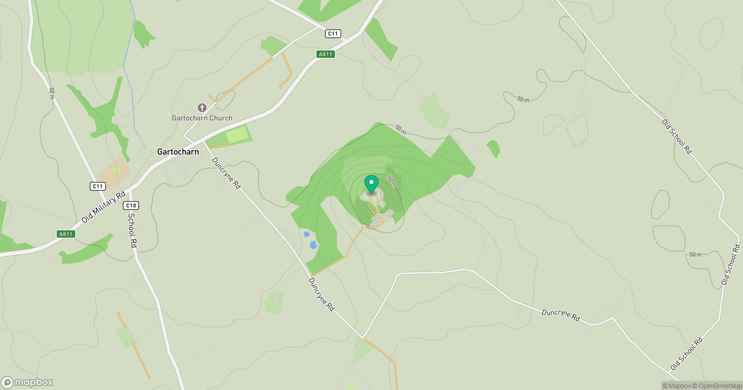
Grid reference: NS435859
View on OpenStreetMapOpens a map in a new tab, centred on the hill.
No comments yet. Be the first.