

Dumbleton Hill
Good walks are even better shared.
SP0035 : Rough Grazing on the Dumbleton Estate
Trevor Rickard Photo source
Overview
Dumbleton Hill
Dumbleton Hill, standing at a modest elevation of 297 meters, is a gem nestled in the beautiful Cotswolds. With its rolling grassy terrain and friendly sheep (who may or may not want to steal your lunch), it's a perfect destination for both seasoned hikers and families alike.
Geology
The hill is primarily formed of limestone, characteristic of the Cotswold area, which creates a diverse array of flora and fauna. It’s a hotspot for limestone-loving plants and wildlife, so keep your eyes peeled for some fantastic photo opportunities!
Routes
Dumbleton Hill Circular Walk
This moderate circular walk is approximately 4.5 km long and takes around 1.5 hours to complete. Starting from Dumbleton village, it will guide you around the hill, providing some of the most scenic views this side of Worcestershire.
Summit Features
The summit is crowned with a stone cairn and a trig point; perfect for taking a break and posing for that all-important Instagram shot. Don’t forget to take in the fresh air—after all, it's the only workout you can do while being outdoors!
Terrain
Expect grassy paths with some rocky patches here and there. The walk is generally pleasant but do watch your step, especially if the ground is damp!
Views
From the top, you’ll be rewarded with breathtaking views of the surrounding countryside. On a clear day, you can even spot the Malvern Hills in the distance. Best seasons to visit? Spring and autumn, when the weather is just right for exploring.
Hazards
While Dumbleton Hill isn’t known for major hazards, watch out for livestock sharing the paths, and be extra careful on any steep sections after rain—nobody wants to slip and end up rolling down a hill (unless you’re a child, then it’s fair game).
Nearby Summits
Don’t forget to check out Bredon Hill, towering over Dumbleton at 340 meters—an excellent option for a day packed with exploration!
Access
Parking can be found in the village itself, just a short walk from the start of your adventure. And should you be relying on public transport, there’s a local bus service that can drop you near the village.
Facilities
Dumbleton village offers a pub and a few tea rooms where you can refuel after your trek. However, public toilet availability may be a bit scarce, so plan ahead.
History
The name Dumbleton comes from Old English, meaning 'valley of the lazy river'. This charming detail is reflective of the serene nature that surrounds this area. Historically, the hill has been a lookout and grazing area, demonstrating its significance to the local community.
In summary, Dumbleton Hill is a cracking choice for a walk, with engaging views and a warm local atmosphere. Just remember your camera and maybe a snack or two. Happy hiking!
Explore routes near Dumbleton Hill
Walks starting near this hill. Open a route to check its map, distance and full itinerary.
Winchcombe and Belas Knap: Cotswold Way and Sudeley Valley circuit
View route
Evesham Walk with Men Walking & Talking
View route
Pershore Bridges: River Avon and Tiddesley Wood circular walk
View route
Cheltenham Walk with Men Walking & Talking
View route
Route planning notes
These notes describe possible approaches. Check a route's map and access information when planning your walk.
Dumbleton Hill Circular Walk
A delightful circular route starting from Dumbleton village, taking you around the hill with picturesque views.
Make a day of it, together
Find someone to share the walk with, or organise a day out along a route you like.
Photo Gallery
View all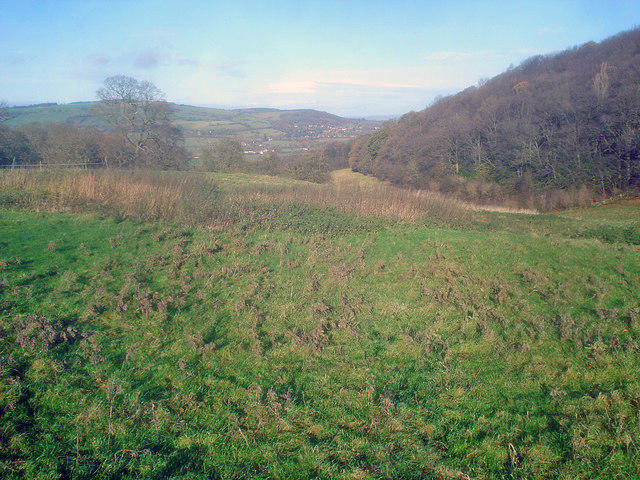 Photo could not load
SP0035 : Rough Grazing on the Dumbleton Estate
Trevor Rickard
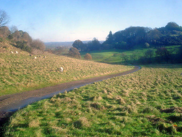 Photo could not load
SP0035 : Farm road on Dumbleton Hill
Trevor Rickard
Hill facts and local notes
Classifications
Elevation
168m
551 ft
Prominence
42m
Coordinates
52.0165, -1.9892
SP008353
OS Map
150
Explorer: OL45N
At the Summit
The summit features a stone cairn and a trig point, perfect for that obligatory summit selfie. Bring a camera, you won't want to forget this!
Terrain & Geology
Dumbleton Hill is primarily composed of limestone, which is characteristic of the Cotswolds. The area's unique geology has resulted in rich biodiversity and a stunning landscape of rolling hills and dry valleys.
Views & Scenery
From the summit, enjoy sweeping views of the surrounding Cotswold countryside, including glimpses of the Malvern Hills on a clear day.
History & Heritage
Name Origin
The name 'Dumbleton' is derived from Old English, meaning 'valley of the lazy river'.
Historical Significance
Dumbleton Hill has been used by locals for centuries for grazing sheep and as a vantage point during events.
Getting There & Facilities
Parking
There's a small car park at Dumbleton village, which is just a stone's throw away from the start of the hiking routes.
Public Transport
The nearest bus stop is in Dumbleton village, with services from nearby towns. Check local timetables for current routes.
Nearby Facilities
In Dumbleton village, you'll find a pub and a few tea rooms. Facilities such as toilets may be limited, so plan accordingly.
Safety Information
Known Hazards
- Be cautious of livestock on the paths and watch your footing on some of the steeper sections, especially after rain.
General Safety Tips
- Check weather conditions before setting out
- Carry appropriate clothing and equipment
- Let someone know your planned route
- Take a map, compass, and GPS device
- Carry emergency supplies: food, water, first aid kit, torch
Hills
Some common questions about the hills answered
Are there group walks up Dumbleton Hill?
Many walkers use Walkmates to join or organise walks with others. You can check for group walks around Dumbleton Hill through the maps
Are there other walkers around Dumbleton Hill?
Activity varies by location and time, but Walkmates lets you see whether others have shared walks or shown interest in this area. Find other people through the walking friends search walking friends for Dumbleton Hill search or of course create your own walk for Dumbleton Hill
Can I organise a walk to Dumbleton Hill?
Yes. If there aren’t any walks listed already, you can create a walk and make it available for others to join.
If you're signed up to Walkmates, you can create a walk to Dumbleton Hill.
How do I find a walk up this hill?
There are often multiple ways to walk this hill, depending on experience and route preference. Walkmates helps you explore walks and routes that others have shared.
Can I suggest a new route up Dumbleton Hill?
Yes. You can suggest or create routes to share with others. Walkmates focuses on the social side of walking, so routes are used to help people organise walks and explore areas together, rather than as detailed navigation tools or route libraries.
Other uses really appreciate knowledgeable walkers sharing their routes. Share your favourite route to Dumbleton Hill here
The is an error or something incorrect about this hill. How do I let you know?
We always strive to keep the information on Walkmates as accurate as possible. If you find an error, please let us know through the contact form and we'll aim to correct it as quickly as possible
Community Discussion
Comments
Location
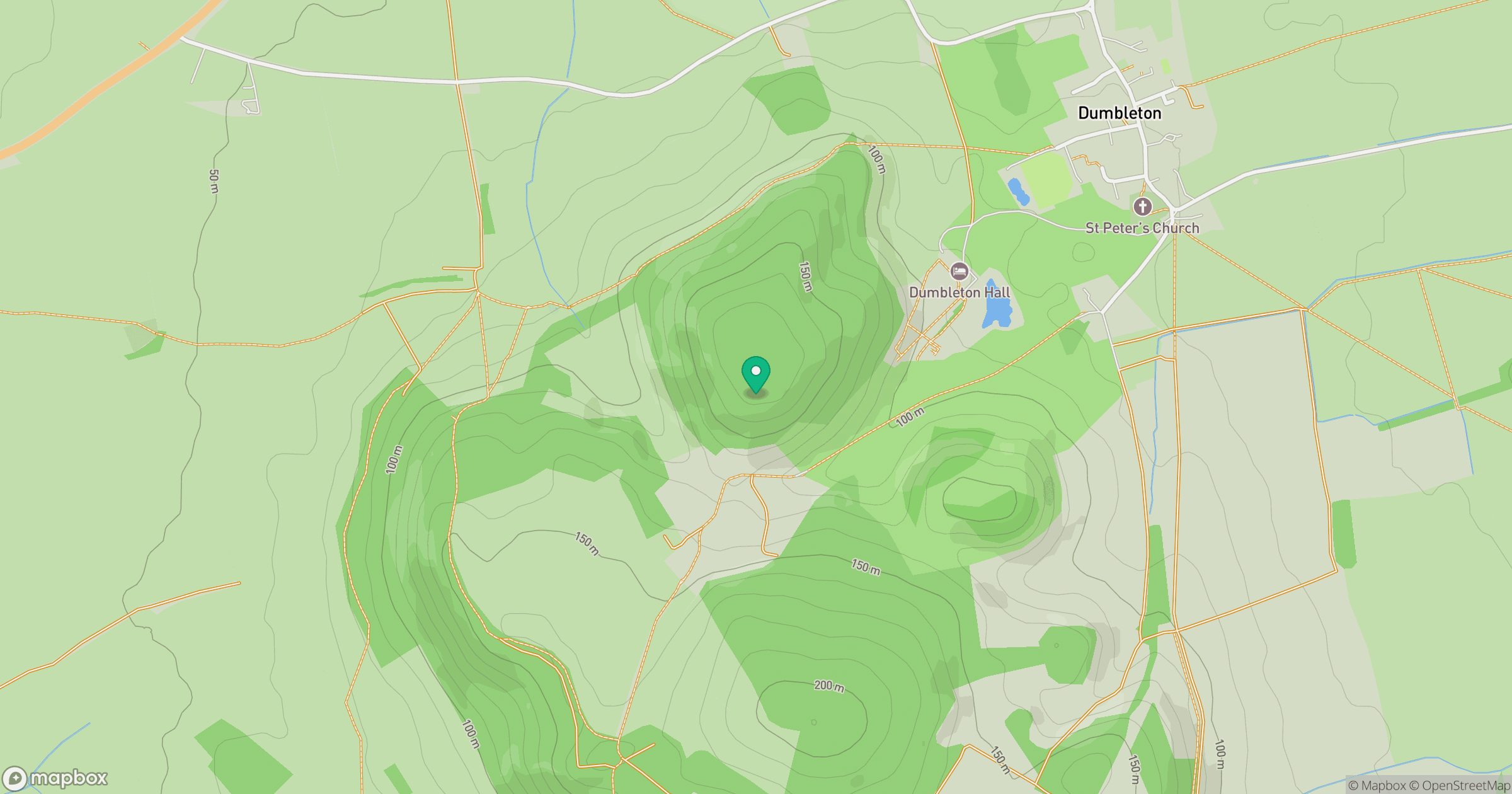
Grid reference: SP008353
View on OpenStreetMapOpens a map in a new tab, centred on the hill.
Nearby Hills
Worcestershire Beacon
425m
Titterstone Clee Hill
533m

The Wrekin
407m
Long Mynd - Pole Bank
517m
Stiperstones
537m
No comments yet. Be the first.