

Worcestershire Beacon
Good walks are even better shared.
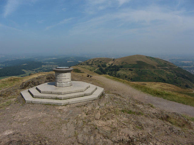
SO7645 : Toposcope on the Worcestershire Beacon
Philip Halling Photo source
Overview
Worcestershire Beacon is the 425.1m high point of the Malvern Hills and the county of Worcestershire. Rising above Great Malvern, it has a rocky summit with a trig pillar and topograph. Paths lead up from Beacon Road near the Wyche Cutting and from the town through St Ann's Well and Happy Valley. The open ridge offers wide views over the Severn plain and towards the Welsh hills.
Worcestershire Beacon
At 425.1m, Worcestershire Beacon is the highest summit in the Malvern Hills and Worcestershire. It rises directly above Great Malvern, with an open ridge and a rocky summit. The natural high point is a rock between the trig pillar and topograph.
Walking to the summit
Upper Beacon Road provides a high starting point for the surfaced approach past the Gold Mine and Summer Hill. For a longer outing, the Gardiners Quarry route combines the summit with a return extension to Jubilee car park. Its full circuit is 10km, with an OS guide time of 3 hours 20 minutes. Great Malvern also gives access to the northern slopes through St Ann's Well and Happy Valley.
Rocks and landscape
The hill exposes the Malverns Complex: ancient igneous rocks altered and deformed during a long Precambrian history. Diorite and tonalite are prominent, with granite on the north-western and southern slopes. Look east over Great Malvern and the Severn plain, and west across Herefordshire towards the Black Mountains in clear weather.
A beacon in a working landscape
A plan of about 1633 shows a fire-bucket beacon near the present trig pillar. Banks and ditches on the northern slopes preserve parts of the 17th-century King's Third enclosure. Grazing helps keep the upper slopes open; use established paths and keep dogs on leads near livestock.
Planning your walk
The summit is exposed to wind, and steep paths can be slippery. Bring weatherproof clothing, suitable footwear and a map. Great Malvern has rail access, shops and refreshments; St Ann's Well and Cafe H2O are useful lower-level stops.
Further reading: OS route guide, BGS geology, Malvern Hills Trust history guide.
Explore routes near Worcestershire Beacon
Walks starting near this hill. Open a route to check its map, distance and full itinerary.
Malvern Hills Circular Walk
View route
Croome: Park Seat and the river landscape
View route
Brockhampton: damson orchards and Apple Core trail
View route
Pershore Bridges: River Avon and Tiddesley Wood circular walk
View route
Route planning notes
These notes describe possible approaches. Check a route's map and access information when planning your walk.
Upper Beacon Road out-and-back
Start and finish at Upper Beacon Road car park near the Wyche Cutting. Follow the surfaced path north past the Gold Mine marker and around Summer Hill to the summit. Return the same way. The final climb is steep.
Gardiners Quarry, Worcestershire Beacon and Jubilee loop
Start at Gardiners Quarry car park (SO766420). Climb to the ridge and head north via Jubilee Hill, the Wyche Cutting, Gold Mine and Summer Hill to the Beacon. Retrace to above Gardiners, continue south to Jubilee car park, then follow lower western paths north to the start. This is the complete OS 10km outing, with a guide time of 3 hours 20 minutes. Take care crossing the Wyche road.
Make a day of it, together
Find someone to share the walk with, or organise a day out along a route you like.
Photo Gallery
View all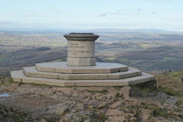 Photo could not load
SO7645 : Toposcope on the Worcestershire Beacon
Philip Halling
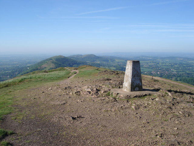 Photo could not load
SO7645 : The triangulation pillar on the Worcester Beacon
Trevor Rickard
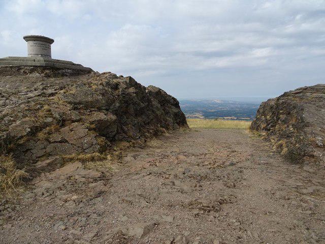 Photo could not load
SO7645 : The summit of the Malvern Hills
Philip Halling
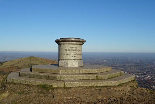 Photo could not load
SO7645 : Toposcope on the Worcestershire Beacon
Philip Halling
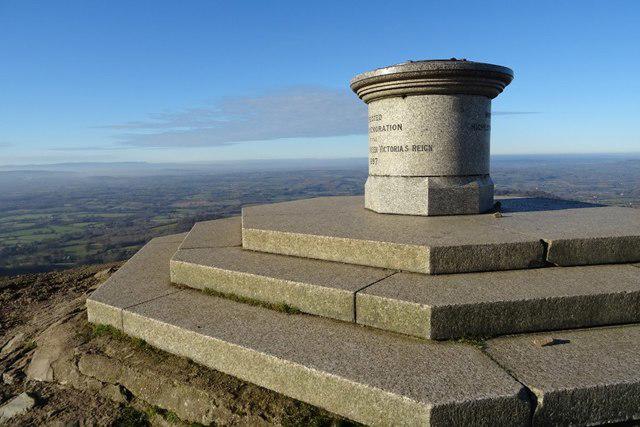 Photo could not load
SO7645 : Toposcope on the Worcestershire Beacon
Philip Halling
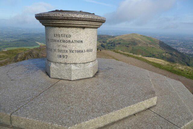 Photo could not load
SO7645 : Toposcope on the Worcestershire Beacon
Philip Halling
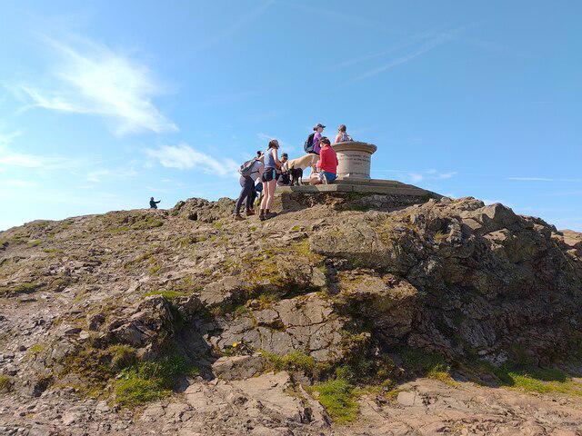 Photo could not load
SO7645 : Worcestershire Beacon toposcope
Oscar Taylor
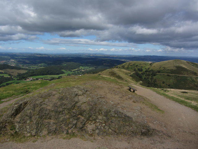 Photo could not load
SO7645 : View north from Worcestershire Beacon, Malvern Hills
Colin Park
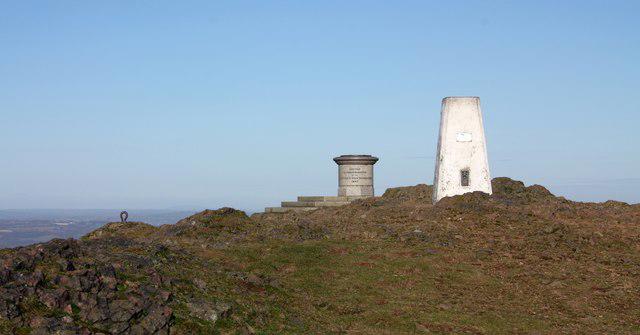 Photo could not load
SO7645 : At the top of the Malverns
Bob Embleton
SO7645 : View north from Worcestershire Beacon
Gareth James
Hill facts and local notes
Classifications
Elevation
425m
1,395 ft
Prominence
336m
Coordinates
52.1049, -2.3390
SO768452
OS Map
150
Explorer: 190
At the Summit
The natural summit is a rock between the topograph and trig pillar. DoBIH records it as 0.3m higher than the ground by the trig pillar 12m to the south, and 1m higher than the topograph 10m to the north.
Terrain & Geology
Worcestershire Beacon exposes Precambrian rocks of the Malverns Complex, chiefly intrusive igneous rocks that were later altered, sheared and metamorphosed. Diorite and tonalite dominate the complex; granite also crops out on the north-western and southern slopes of the Beacon. The complex formed through a long geological history beginning around 677 million years ago.
Views & Scenery
Open views east over Great Malvern and the Severn plain, west across Herefordshire towards the Black Mountains in clear weather, and along the Malvern ridge.
History & Heritage
Name Origin
Beacon refers to the hill's use for signal fires. A 17th-century plan records a fire-bucket beacon near the site of the present trig pillar.
Historical Significance
A plan of about 1633 shows a fire-bucket beacon supported on a timber structure near the present trig pillar. The banks and ditches enclosing the northern side of the hill include surviving parts of the King's Third, laid out during the 17th-century enclosure of Malvern Chase.
Getting There & Facilities
Parking
Upper Beacon Road car park near the Wyche Cutting (WR14 4EH) is a convenient high starting point for the surfaced summit path. It is managed by the Malvern Hills Trust and is pay-and-display. Gardiners Quarry car park (SO766420) serves the longer ridge walk. Check the Trust's parking information and on-site signs for current charges and restrictions.
Public Transport
Great Malvern railway station provides access through the town to the eastern side of the hills. Colwall station is an alternative for approaches from the west or a station-to-station walk. Check current rail and local bus timetables when planning your return.
Nearby Facilities
Refreshments are available in Great Malvern, at St Ann's Well cafe and at Cafe H2O near the Wyche Cutting. Public toilets are listed at St Ann's Well and the Wyche Cutting. Check opening times before relying on facilities.
Safety Information
Known Hazards
- Steep slopes and uneven rocky paths; surfaces can be slippery in wet or icy conditions.
- The open summit and ridge are exposed to strong winds.
- Keep dogs on leads near grazing cattle and sheep and follow local signs.
- Longer ridge routes cross the road at the Wyche Cutting.
General Safety Tips
- Check weather conditions before setting out
- Carry appropriate clothing and equipment
- Let someone know your planned route
- Take a map, compass, and GPS device
- Carry emergency supplies: food, water, first aid kit, torch
Hills
Some common questions about the hills answered
Are there group walks up Worcestershire Beacon?
Many walkers use Walkmates to join or organise walks with others. You can check for group walks around Worcestershire Beacon through the maps
Are there other walkers around Worcestershire Beacon?
Activity varies by location and time, but Walkmates lets you see whether others have shared walks or shown interest in this area. Find other people through the walking friends search walking friends for Worcestershire Beacon search or of course create your own walk for Worcestershire Beacon
Can I organise a walk to Worcestershire Beacon?
Yes. If there aren’t any walks listed already, you can create a walk and make it available for others to join.
If you're signed up to Walkmates, you can create a walk to Worcestershire Beacon.
How do I find a walk up this hill?
There are often multiple ways to walk this hill, depending on experience and route preference. Walkmates helps you explore walks and routes that others have shared.
Can I suggest a new route up Worcestershire Beacon?
Yes. You can suggest or create routes to share with others. Walkmates focuses on the social side of walking, so routes are used to help people organise walks and explore areas together, rather than as detailed navigation tools or route libraries.
Other uses really appreciate knowledgeable walkers sharing their routes. Share your favourite route to Worcestershire Beacon here
The is an error or something incorrect about this hill. How do I let you know?
We always strive to keep the information on Walkmates as accurate as possible. If you find an error, please let us know through the contact form and we'll aim to correct it as quickly as possible
Community Discussion
Comments
Location
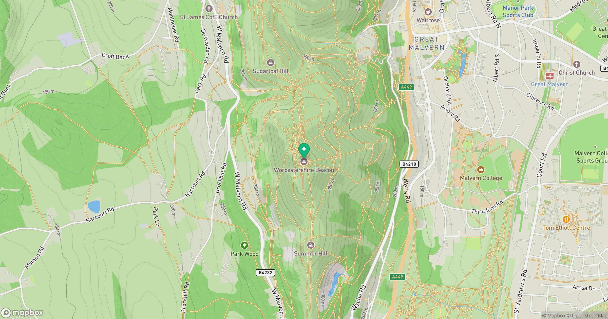
Grid reference: SO768452
View on OpenStreetMapOpens a map in a new tab, centred on the hill.
Nearby Hills
Titterstone Clee Hill
533m

The Wrekin
407m
Long Mynd - Pole Bank
517m
Stiperstones
537m
Glastonbury Tor
158m
No comments yet. Be the first.