

Alderton Hill
Good walks are even better shared.
Overview
Alderton Hill: A Hidden Gem of the Cotswolds
Nestled in the picturesque Cotswolds, Alderton Hill might not be the highest peak around, but it sure packs a punch when it comes to scenic charm!
Geology
Alderton Hill showcases Jurassic limestone, which gives the surrounding area its unique characteristic and serves as a reminder of our planet's rich geological history. Look closely, and you might spot embedded fossils – perfect for the amateur paleontologist in your group.
Access and Parking
Getting to Alderton Hill is quite straightforward! The nearest parking is conveniently located in the village of Alderton, near the village hall. Just bear in mind that parking can fill up on sunny weekends, so arrive early!
Public transport options include a bus service from Winchcombe, making this hill accessible without a car. Your adventure begins with a sprinkle of rustic charm in this lovely village.
Route Information
The Alderton Hill Circular Walk is a delightful option for hikers. Covering approximately 5.5 km, this route typically takes about 2 hours. The terrain is mainly grassy, with some rocky outcrops, providing a gentle challenge to most hikers. If you're dressed for the occasion and bring your best walking boots, you’re in for a treat!
Summit Features
Upon reaching the summit, you'll be greeted by a humble stone cairn – it’s the ideal spot to catch your breath and snap a panoramic photo with the rolling hills as your backdrop. It's an ode to hikers who, like you, value a good view!
Views
The summit rewards you with breathtaking views of the scenic Cotswolds, revealing a patchwork of fertile fields and villages that look straight out of a storybook. To experience this beauty, aim for late spring or early autumn for the best visibility and vibrant colours.
Hazards
While the walk is relatively gentle, be cautious of slippery paths during rainy spells – remember, a wise hiker knows that there’s no joy in a swift tumble! Keep an eye out for any curious farm animals along the way as well.
Nearby Attractions
If you’re keen to explore further, nearby summits like Cleeve Hill and Bredon Hill offer additional walking opportunities with their own unique features and views.
History
Interestingly, the name Alderton hints at the area’s agricultural roots, reflecting a rich farming history that has been maintained through the years. A stroll through the village isn’t just about nature; it’s about immersing yourself in the heritage of this beautiful region.
Conclusion
In summary, Alderton Hill is a delightful destination for those seeking a taste of the Cotswolds' charm without the crowds. Whether you’re a seasoned hiker or just looking for a leisurely day out, this little hill has got your back – and a crack of dry stone walls awaits you on the other side. So lace up those hiking boots and head out for a grand adventure!
Happy hiking!
Explore routes near Alderton Hill
Public walks starting within 80 km of this hill. Nearby does not mean a route reaches the summit; check its map and access before setting out.
Winchcombe and Belas Knap: Cotswold Way and Sudeley Valley circuit
View route
Pershore Bridges: River Avon and Tiddesley Wood circular walk
View route
Croome: Park Seat and the river landscape
View route
Bourton-on-the-Water and Wyck Rissington: Greystones and three rivers
View route
Route planning notes
These notes describe possible approaches, not verified navigable routes or permission to cross land. Check current paths, local access rules and conditions before setting out.
Alderton Hill Circular Walk
A lovely circular route starting and ending in Alderton village, taking you through lush fields and wooded areas before reaching the summit.
Make a day of it, together
Find someone to share the walk with, or organise a day out along a route you like.
Photo Gallery
View all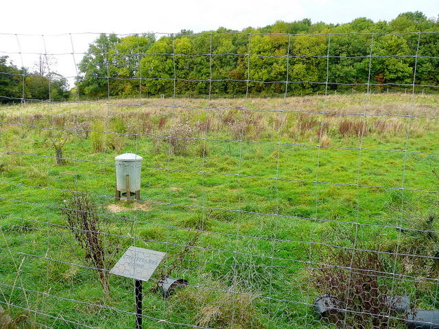 Photo could not load
SP0034 : Game bird equipment
Jonathan Billinger
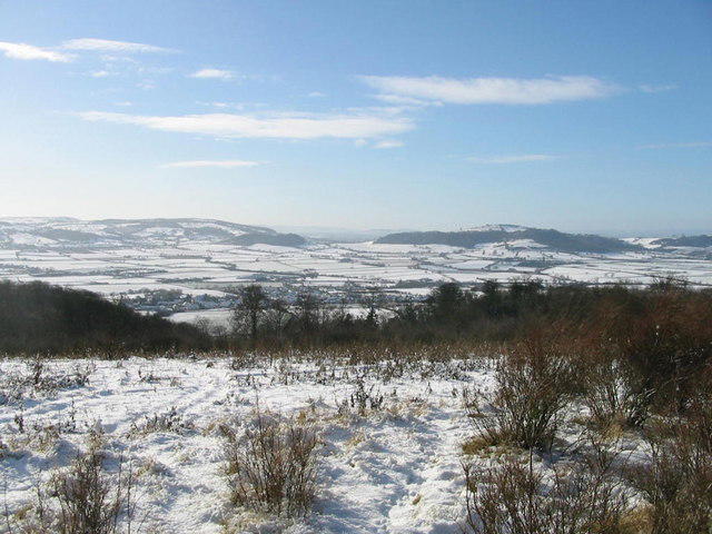 Photo could not load
SP0034 : Looking south-west from summit of Alderton Hill
Adrian Phillips
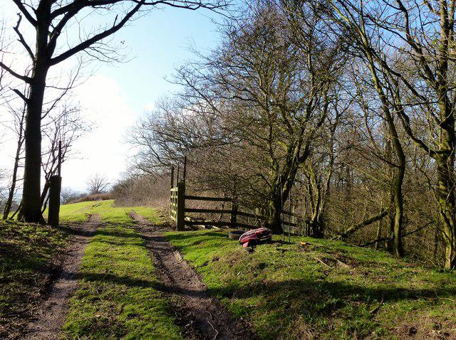 Photo could not load
SP0034 : Alderton Hill
Rude Health
Hill facts and local notes
Classifications
Elevation
203m
666 ft
Prominence
142m
Coordinates
52.0094, -1.9875
SP009345
OS Map
150
Explorer: OL45N
At the Summit
At the summit, you will find a charming stone cairn, truly a perfect spot for a selfie if you can catch your breath first!
Terrain & Geology
Alderton Hill is predominantly formed from Jurassic limestone, offering a fascinating glimpse into the geological past with exposed rock faces and diverse soil types.
Views & Scenery
From the summit, expect stunning vistas of the surrounding Cotswold countryside, including the iconic rolling hills and quaint villages.
History & Heritage
Name Origin
The name Alderton is derived from Old English, meaning 'farm by the river Alde', hinting at the area's agricultural history.
Historical Significance
Historically, this region has been significant for its farming heritage and picturesque rural landscapes, drawing visitors for centuries.
Getting There & Facilities
Check current local access restrictions, parking rules and transport timetables before travelling. These notes do not confirm public access to the summit.
Parking
You can park in the village of Alderton, near the village hall. Limited space but generally enough for a few cars.
Public Transport
The nearest bus service is a short walk away in the nearby village of Winchcombe, connecting to Cheltenham and other towns.
Nearby Facilities
There are no public toilets at the summit, but the quaint village of Alderton has a lovely café where you can grab a cuppa post-walk.
Safety Information
Known Hazards
- Slippery paths during wet seasons, and potential encounters with farm animals if you're venturing through nearby fields.
General Safety Tips
- Check weather conditions before setting out
- Carry appropriate clothing and equipment
- Let someone know your planned route
- Take a map, compass, and GPS device
- Carry emergency supplies: food, water, first aid kit, torch
Hills
Some common questions about the hills answered
Are there group walks up Alderton Hill?
Many walkers use Walkmates to join or organise walks with others. You can check for group walks around Alderton Hill through the maps
Are there other walkers around Alderton Hill?
Activity varies by location and time, but Walkmates lets you see whether others have shared walks or shown interest in this area. Find other people through the walking friends search walking friends for Alderton Hill search or of course create your own walk for Alderton Hill
Can I organise a walk to Alderton Hill?
Yes. If there aren’t any walks listed already, you can create a walk and make it available for others to join.
If you're signed up to Walkmates, you can create a walk to Alderton Hill.
How do I find a walk up this hill?
There are often multiple ways to walk this hill, depending on experience and route preference. Walkmates helps you explore walks and routes that others have shared.
Can I suggest a new route up Alderton Hill?
Yes. You can suggest or create routes to share with others. Walkmates focuses on the social side of walking, so routes are used to help people organise walks and explore areas together, rather than as detailed navigation tools or route libraries.
Other uses really appreciate knowledgeable walkers sharing their routes. Share your favourite route to Alderton Hill here
The is an error or something incorrect about this hill. How do I let you know?
We always strive to keep the information on Walkmates as accurate as possible. If you find an error, please let us know through the contact form and we'll aim to correct it as quickly as possible
Community Discussion
Comments
Location
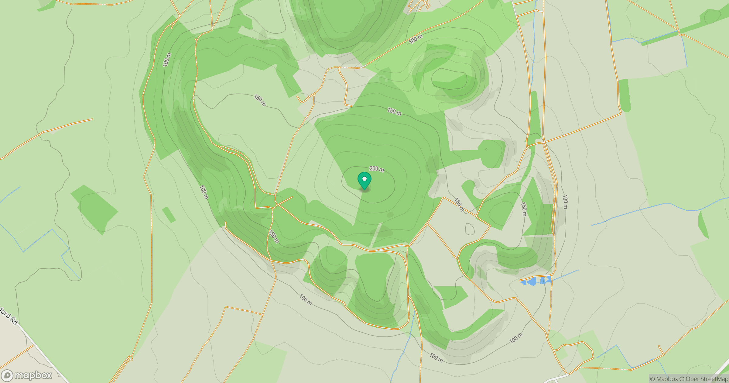
Grid reference: SP009345
View on OpenStreetMapOpens a map in a new tab, centred on the hill.
Hills within 30 km
Straight-line distance, not a walking route or confirmation of access.
Worcestershire Beacon
425m
Cleeve Hill
330m
Bredon Hill
299m
Seven Wells Hill
319m
Birdlip Hill
300m
No comments yet. Be the first.