

Cleeve Hill
Good walks are even better shared.
SO9924 : Trig point on Cleeve Hill
Philip Halling Photo source
Overview
Cleeve Hill reaches 330 m on Cleeve Common, the highest ground in the Cotswolds and Gloucestershire. The common combines limestone grassland, old quarries, archaeology and an active golf course. The true summit lies beside the southern trig beyond the radio masts; the separate escarpment trig is at 317 m and offers wider views. Walks range from a short grassy approach to longer circuits with steep sections.
Cleeve Hill
Cleeve Hill is the 330 m high point of the Cotswolds and Gloucestershire. Cleeve Common is a broad area of limestone grassland north-east of Cheltenham, shared by walkers, grazing animals and golfers.
Summit and views
The summit is beyond the radio masts on the southern common. Its highest ground lies on the fence line 5 m west of the trig point. A second trig on the escarpment stands at 317 m. The escarpment offers views across Cheltenham and the vales towards the Malverns and, in clear weather, the Black Mountains; the higher summit has a more restricted outlook.
Walks
The Common Ring starts at Quarry car park and explores Postlip, Wontley Farm, the masts and escarpment. Cotswolds National Landscape publishes it as 9.66 km, taking 3.5–4.5 hours, with steep sections. The National Trail leaflet also describes a 6.4 km shortcut taking 2–3 hours. These circuits do not specify a visit to the southern summit trig.
For a short summit-trig visit, the Walks on Wheels guide describes a 600 m return route from the Radio Masts entrance. It follows the wall over almost-level short grass. The guide’s accessibility information covers that route to the trig, rather than the precise highest ground beside it. Longer variants cross uneven slopes.
Access and facilities
The common is privately owned, with public access on foot. Use the designated car parks: Radio Masts for the southern approach, or Quarry car park beside the golf club for the northern common. Quarry and golf-club parking are charged, and Quarry closes at night. Follow the posted parking and closing information.
Stagecoach W serves Cleeve Hill from Cheltenham and Winchcombe. Refreshments and toilets are at the golf clubhouse during opening hours; the toilets have steps. Bookable Tramper hire offers access to parts of the common.
Landscape and care
Old quarries expose Jurassic limestone. Cleeve Cloud’s Iron Age hillfort and other earthworks reflect the common’s long history. Protect the SSSI by leaving stone, fossils and plants undisturbed, and contact the Trust before arranging a group activity.
Keep clear of quarry edges and loose rock, watch for golf balls, and give livestock space. Follow the local dog code and close gates. Unsurfaced paths can be slippery when wet, and fog can make navigation difficult.
Explore routes near Cleeve Hill
Walks starting near this hill. Open a route to check its map, distance and full itinerary.
Cheltenham Walk with Men Walking & Talking
View route
Winchcombe and Belas Knap: Cotswold Way and Sudeley Valley circuit
View route
Bourton-on-the-Water and Wyck Rissington: Greystones and three rivers
View route
Evesham Walk with Men Walking & Talking
View route
Route planning notes
These notes describe possible approaches. Check a route's map and access information when planning your walk.
Cleeve Hill Common Ring (full circuit)
From Quarry car park (SO989272), follow the published Cotswold Way circuit via Postlip, Wontley Farm, the radio masts and escarpment. Cotswolds National Landscape gives 3.5–4.5 hours. There are steep sections and golf-course crossings. The published circuit does not specify a visit to the separate 330 m summit trig.
Cleeve Hill Common Ring (short circuit)
From Quarry car park, take the National Trail leaflet’s shortcut across the common to the radio masts, then return along the escarpment. The leaflet gives 2–3 hours, mostly level walking and no stiles. Watch for golf balls on the common-and-viewpoint circuit.
Radio Masts to the summit trig (return)
Cotswolds National Landscape’s Walks on Wheels Route 1 starts at the Radio Masts entrance (SO994248). Turn right along the wall for 300 m to the southern summit trig, then return the same way. Short grass, almost level and unsurfaced. The 600 m route reaches the trig; access to the precise highest ground 5 m west is not assessed by this guide.
Make a day of it, together
Find someone to share the walk with, or organise a day out along a route you like.
Photo Gallery
View all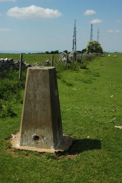 Photo could not load
SO9924 : Trig point on Cleeve Hill
Philip Halling
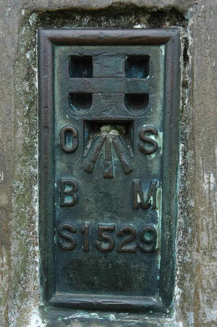 Photo could not load
SO9924 : Trig point number Cleeve Hill
Philip Halling
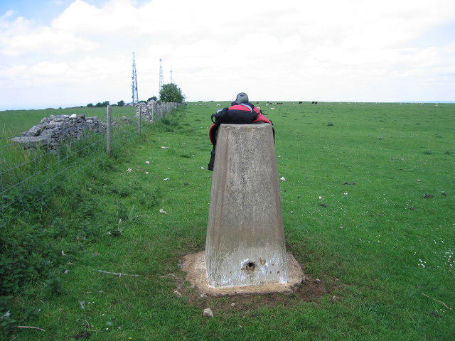 Photo could not load
SO9924 : Cleeve Hill
Rude Health
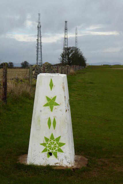 Photo could not load
SO9924 : Trig point on Cleeve Common
Philip Halling
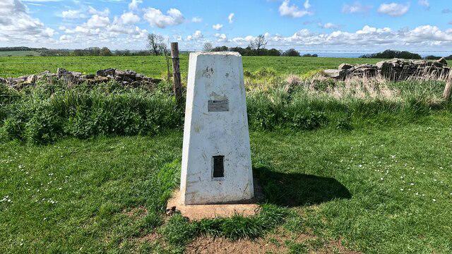 Photo could not load
SO9924 : Trig pillar on Cleeve Hill
steven ruffles
Hill facts and local notes
Classifications
Elevation
330m
1,083 ft
Prominence
237m
Coordinates
51.9199, -2.0059
SO996245
OS Map
163
Explorer: 179
At the Summit
The highest ground is on the fence line 5 m west of the southern trig point, beyond the radio masts. DoBIH records the ground as 10 cm below the trig’s flush bracket. This 330 m summit is separate from the 317 m trig on the escarpment, where the better-known viewpoint is located.
Terrain & Geology
Jurassic limestone forms the upper common, with Inferior Oolite strata exposed in old quarries. Older Jurassic clays and silts underlie much of the escarpment. The rocks, fossils and limestone grassland are protected within Cleeve Common SSSI. Leave stone and fossils in place.
Views & Scenery
The escarpment has views over Cheltenham and the surrounding vales towards the Malvern Hills, with the Black Mountains visible in clear conditions. The 330 m summit beyond the masts has more limited views.
History & Heritage
Name Origin
Cleeve is related to Old English clif, meaning a cliff or steep slope.
Historical Significance
Cleeve Cloud contains the earthworks of an Iron Age hillfort, protected as a scheduled monument. Quarrying and later golf-course landscaping altered the site. The common also preserves a cross dyke and evidence of its long use for grazing.
Getting There & Facilities
Parking
For the southern summit approach, the Radio Masts parking area (SO994249) has limited space. For the northern common and Common Ring walks, use Quarry car park (SO989272), reached via the lane signed to Cleeve Hill Golf Club from the B4632. The Trust asks common visitors to use Quarry first, with golf-club parking as overflow. Charges apply at both; follow payment signs. Quarry’s gate is locked at night, with the closing time posted at its entrance. West Down/Wardens’ Wood (SP009239) is another designated access point. Keep entrances and tracks clear.
Public Transport
Stagecoach W links Cheltenham and Winchcombe via Cleeve Hill. The Common Trust advises alighting at the Rising Sun or Golf Club stop. Check the current timetable and return service before travelling; approaches from lower settlements can involve steep climbing.
Nearby Facilities
The golf clubhouse has refreshments at Flynn’s on the Hill and toilets during opening hours; the Trust notes steps to the toilets. There are no separate public conveniences on the common. Tramper all-terrain scooter hire is available by booking through Cleeve Common Trust, with collection at the golf club. Paths on the common are unsurfaced; the Radio Masts access gate requires a RADAR key to open fully.
Safety Information
Known Hazards
- Steep escarpment and quarry edges, with loose rock on some faces; keep clear of drops.
- Golf is played on the common. Watch for flying balls when crossing fairways and keep off greens and tees.
- Sheep and cattle graze the common. Give animals space, close gates and keep dogs on leads around livestock.
- Fog and low cloud can make the open common difficult to navigate; the land manager advises avoiding it in poor visibility.
- Grass and stone tracks are unsurfaced and can be slippery when wet.
Seasonal Hazards
Cattle may be present all year; sheep normally graze from late April to late November. On open-access land, keep dogs on a short lead from 1 March to 31 July and whenever near livestock. Adders occur on the common, with most encounters between March and October; keep dogs close and use main paths.
General Safety Tips
- Check weather conditions before setting out
- Carry appropriate clothing and equipment
- Let someone know your planned route
- Take a map, compass, and GPS device
- Carry emergency supplies: food, water, first aid kit, torch
Hills
Some common questions about the hills answered
Are there group walks up Cleeve Hill?
Many walkers use Walkmates to join or organise walks with others. You can check for group walks around Cleeve Hill through the maps
Are there other walkers around Cleeve Hill?
Activity varies by location and time, but Walkmates lets you see whether others have shared walks or shown interest in this area. Find other people through the walking friends search walking friends for Cleeve Hill search or of course create your own walk for Cleeve Hill
Can I organise a walk to Cleeve Hill?
Yes. If there aren’t any walks listed already, you can create a walk and make it available for others to join.
If you're signed up to Walkmates, you can create a walk to Cleeve Hill.
How do I find a walk up this hill?
There are often multiple ways to walk this hill, depending on experience and route preference. Walkmates helps you explore walks and routes that others have shared.
Can I suggest a new route up Cleeve Hill?
Yes. You can suggest or create routes to share with others. Walkmates focuses on the social side of walking, so routes are used to help people organise walks and explore areas together, rather than as detailed navigation tools or route libraries.
Other uses really appreciate knowledgeable walkers sharing their routes. Share your favourite route to Cleeve Hill here
The is an error or something incorrect about this hill. How do I let you know?
We always strive to keep the information on Walkmates as accurate as possible. If you find an error, please let us know through the contact form and we'll aim to correct it as quickly as possible
Community Discussion
Comments
Location
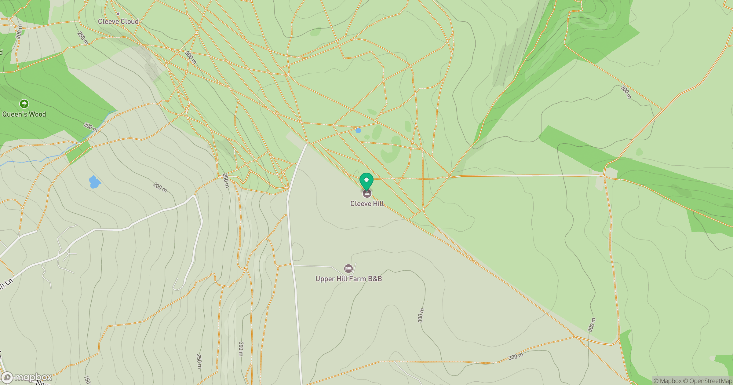
Grid reference: SO996245
View on OpenStreetMapOpens a map in a new tab, centred on the hill.
Nearby Hills
Worcestershire Beacon
425m
Titterstone Clee Hill
533m

The Wrekin
407m
Glastonbury Tor
158m
Long Mynd - Pole Bank
517m
No comments yet. Be the first.