

Dixton Hill
Good walks are even better shared.
SO9830 : Dixton Hill
Mary and Angus Hogg Photo source
Overview
Dixton Hill
Dixton Hill may not be the highest point in the Cotswolds, but it certainly offers a heap of charm and magnificent views. Standing at 248 meters, this Marilyn invites walkers to explore its gentle slopes and lush surroundings.
Geology
Dixton Hill is primarily composed of limestone, which contributes to the scenic quality of the area. The gentle erosion over generations has sculpted the landscape into what we see today, rich in fossils for the amateur paleontologist.
Routes
There are several routes that you can take up Dixton Hill. The Dixton Hill Circular Walk is a lovely 5.5 km trek suitable for most fitness levels and meanders through picture-perfect woodlands. For a simpler jaunt, try the From Woodmancote path, which is about 3 km and takes a leisurely pace, making it ideal for families.
Summit Features
At the summit, you will find a modest cairn with sweeping views across the Cotswolds and the River Wye valley. This spot is perfect for a well-deserved rest and to soak in the breathtaking scenery.
Terrain
Expect grassy slopes with a few rocky outcrops. While the paths are generally easy to navigate, the British weather can make them slippery, so keep your wits about you — mud is a frequent guest here!
Views
The views from Dixton Hill are a delight, with highlights including the Malvern Hills and sometimes even the Brecon Beacons in clearer conditions. Spring and early autumn offer the best views, with blooming flora enhancing the experience.
Access
You can park at Woodmancote village with convenient access to the trails. Public transportation is available from Tewkesbury, making it quite accessible for those traveling without a car.
Facilities
While there aren’t facilities directly on the hill, Tewkesbury offers cafes and pubs to refuel after your adventure. Remember to reward yourself with a classic cream tea!
History
The name Dixton carries an intriguing etymology, believed to refer back to ancient times. The hill has historical significance as a viewpoint, and remains a delightful escape for the discerning hiker.
So, whether it's a peaceful stroll or a day of serious trekking you're after, Dixton Hill has something for everyone. Just don’t forget your camera!
Happy hiking!
Explore routes near Dixton Hill
Walks starting near this hill. Open a route to check its map, distance and full itinerary.
Winchcombe and Belas Knap: Cotswold Way and Sudeley Valley circuit
View route
Cheltenham Walk with Men Walking & Talking
View route
Evesham Walk with Men Walking & Talking
View route
Pershore Bridges: River Avon and Tiddesley Wood circular walk
View route
Route planning notes
These notes describe possible approaches. Check a route's map and access information when planning your walk.
Dixton Hill Circular Walk
This picturesque circular route takes you through woodlands and across open fields, providing splendid views of the surrounding countryside and a chance to enjoy the flora and fauna.
From Woodmancote
A straightforward route from Woodmancote, navigating through charming lanes and light woodland, suitable for families and casual walkers.
Make a day of it, together
Find someone to share the walk with, or organise a day out along a route you like.
Photo Gallery
View all Photo could not load
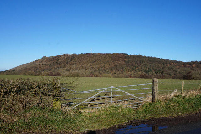
SO9830 : Dixton Hill
Mary and Angus Hogg
 Photo could not load
SO9830 : Dixton Hill from the west
Terry Jacombs
 Photo could not load
SO9830 : Dixton Hill
Christine Johnstone
 Photo could not load
SO9830 : Dixton Hill
Robin Webster
Hill facts and local notes
Classifications
Elevation
164m
538 ft
Prominence
66m
Coordinates
51.9740, -2.0216
SO986306
OS Map
150
Explorer: 190
At the Summit
The summit features a small, unassuming cairn, with panoramic views over the Cotswold escarpment and the River Wye valley.
Terrain & Geology
Dixton Hill is primarily composed of limestone, a rock that has been eroded over millennia to create the gentle slopes and rolling hills. The area is rich in fossils, giving a peek into the region's ancient marine past.
Views & Scenery
Distant views of the Malvern Hills to the west and the Severn Vale to the south guarantees a satisfying vista. On a clear day, you may even spot the Brecon Beacons in the distance.
History & Heritage
Name Origin
The name 'Dixton' is believed to originate from Old English, meaning 'Dida's ridge', hinting at its long-history and cultural significance.
Historical Significance
Historically, Dixton Hill has served as a strategic viewing point, with signs of ancient settlements found in the area.
Getting There & Facilities
Parking
There is parking available at Woodmancote village, with a small car park just off the main road. Be sure to arrive early on weekends as it fills up quickly!
Public Transport
Bus services operate from nearby towns, with regular stops at Woodmancote, making it accessible for those without a vehicle.
Nearby Facilities
Cafes and pubs are located in Tewkesbury, with facilities available in the surrounding villages. Be sure to grab a cream tea if you pass one!
Safety Information
Known Hazards
- Slippery paths in wet conditions; always watch your step, especially when it’s muddy.
General Safety Tips
- Check weather conditions before setting out
- Carry appropriate clothing and equipment
- Let someone know your planned route
- Take a map, compass, and GPS device
- Carry emergency supplies: food, water, first aid kit, torch
Hills
Some common questions about the hills answered
Are there group walks up Dixton Hill?
Many walkers use Walkmates to join or organise walks with others. You can check for group walks around Dixton Hill through the maps
Are there other walkers around Dixton Hill?
Activity varies by location and time, but Walkmates lets you see whether others have shared walks or shown interest in this area. Find other people through the walking friends search walking friends for Dixton Hill search or of course create your own walk for Dixton Hill
Can I organise a walk to Dixton Hill?
Yes. If there aren’t any walks listed already, you can create a walk and make it available for others to join.
If you're signed up to Walkmates, you can create a walk to Dixton Hill.
How do I find a walk up this hill?
There are often multiple ways to walk this hill, depending on experience and route preference. Walkmates helps you explore walks and routes that others have shared.
Can I suggest a new route up Dixton Hill?
Yes. You can suggest or create routes to share with others. Walkmates focuses on the social side of walking, so routes are used to help people organise walks and explore areas together, rather than as detailed navigation tools or route libraries.
Other uses really appreciate knowledgeable walkers sharing their routes. Share your favourite route to Dixton Hill here
The is an error or something incorrect about this hill. How do I let you know?
We always strive to keep the information on Walkmates as accurate as possible. If you find an error, please let us know through the contact form and we'll aim to correct it as quickly as possible
Community Discussion
Comments
Location
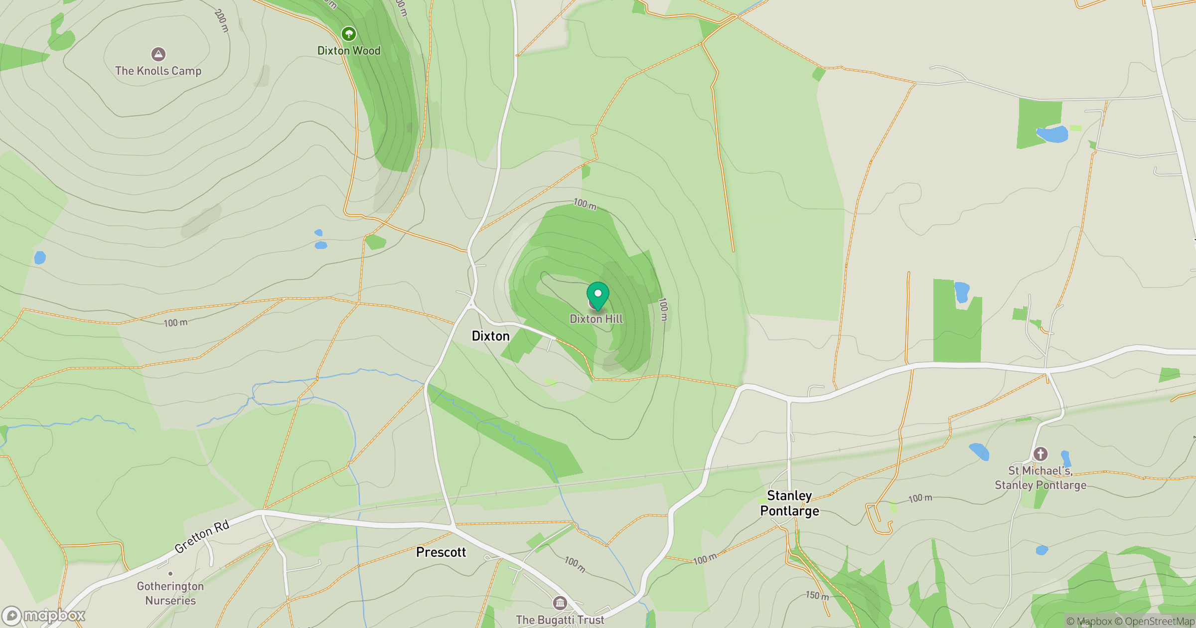
Grid reference: SO986306
View on OpenStreetMapOpens a map in a new tab, centred on the hill.
Nearby Hills
Worcestershire Beacon
425m
Titterstone Clee Hill
533m
The Wrekin
407m
Long Mynd - Pole Bank
517m
Glastonbury Tor
158m
No comments yet. Be the first.