

Mullwharchar
Good walks are even better shared.
NX4586 : Lochan on Mullwharchar
Billy McCrorie Photo source
Overview
Mullwharchar: A Hiker's Haven in the Southern Uplands
Introduction
Mullwharchar, rising to 654 meters, invites adventurers to explore its vibrant landscapes and captivating views. Nestled in the Southern Uplands, this mountain may not be the tallest in Scotland, but it certainly packs a punch when it comes to the beauty and character.
Geology
The terrain of Mullwharchar is primarily made up of Old Red Sandstone, which gives its slopes a unique reddish tint. This rock formation was laid down in the Devonian period and has been shaped magnificently by glacial activity, offering both a feast for the eyes and a challenge for hikers.
Routes
The most popular route to the summit begins at the Grey Mare's Tail car park. The trail follows the contours of the hill, leading you upwards past a picturesque waterfall, great for a quick splash or a photo-op.
With a distance of approximately 14.5 km round trip, it typically takes around 4.5 hours to complete, making it a moderate trek suitable for most.
Summit Features
At the summit, you'll discover a charming cairn, perfect for a celebratory biscuit break and a chance to catch your breath. The panoramic view from the top offers a variety of sights that will make all your hiking mates green with envy.
Terrain Type
Expect a mix of grassy pathways interspersed with rocky outcrops. Keep an eye out for boggy areas, especially in the spring when the ground's a bit more forgiving.
Views
Highlights
From Mullwharchar, the views stretch far and wide. To the north, the towering peaks of the Galloway Hills loom, while to the east, Loch Doon glimmers like a jewel. It's not just a walk, it’s a place where you’ll find nature showcasing its finest.
Best Seasons
The enchanting sights are best enjoyed in spring and autumn, when the skies are clearer and the colours more vibrant, though a summer ascent is accompanied by lush green hills.
Hazards
Always be prepared for unpredictable weather; a sunny morning might just decide to play dress-up as a rainy afternoon. The rocky sections require careful navigation, so wear sturdy boots to dodge any unfortunate tumbles.
Nearby Summits
A short journey from Mullwharchar, you can also tackle nearby heights like Benyellary (735 meters) and the impressive Craignaw (747 meters). These offer additional hiking opportunities for the keen explorer.
Access
Nearest Parking
The Grey Mare's Tail car park is your starting point, providing ample parking, though it can get full quite quickly, especially on weekends.
Public Transport
If you're not driving, take the train to Dumfries, hop on a bus to Moffat, and then a quick taxi to the car park. Not too shabby!
Nearest Town
Moffat is the closest town, and it's got all the amenities you’d need for a pre- or post-hike refuel.
Facilities
Moffat boasts a delightful range of cafes and pubs where you can unwind after your adventure. Don't forget the public toilets in the town.
History
Name Meaning
Mullwharchar’s name reflects its heritage, with Gaelic origins hinting at a hill that evokes notions of natural beauty and charm.
Significance
Mullwharchar is a cherished spot among local residents and hikers alike, serving as a testament to the stunning landscape that Scotland embodies.
Conclusion
In conclusion, Mullwharchar offers a splendid day out that promises not only exercise but also some terrific memories. Whether you’re a seasoned trekker or just out for a casual stroll, this peak beckons with the kind of charm that only the Scottish uplands can provide. Remember, it's not about the destination but the splendid sights along the way!
Happy hiking!
Explore routes near Mullwharchar
Walks starting near this hill. Open a route to check its map, distance and full itinerary.
Loch Trool: Full Loch and Oak Woodland Circuit
View route
Carrick Forest Drive: Stinchar Bridge to Loch Doon
View route
Glentrool Water of Trool and Spout Head Trail
View route
Wood of Cree Waterfalls and Scrubland Circuit
View route
Route planning notes
These notes describe possible approaches. Check a route's map and access information when planning your walk.
From the Grey Mare's Tail
A popular ascent via the scenic Grey Mare's Tail waterfall offers a well-trodden path that provides beautiful views as you climb.
Make a day of it, together
Find someone to share the walk with, or organise a day out along a route you like.
Photo Gallery
View all Photo could not load
NX4586 : Lochan on Mullwharchar
Billy McCrorie
 Photo could not load
NX4586 : Mullwharchar from Loch Doon
Keith Burns
 Photo could not load
NX4586 : Mullwharchar From Bow
Alex Scott
 Photo could not load
NX4586 : Rocks on Mullwharchar
Billy McCrorie
 Photo could not load
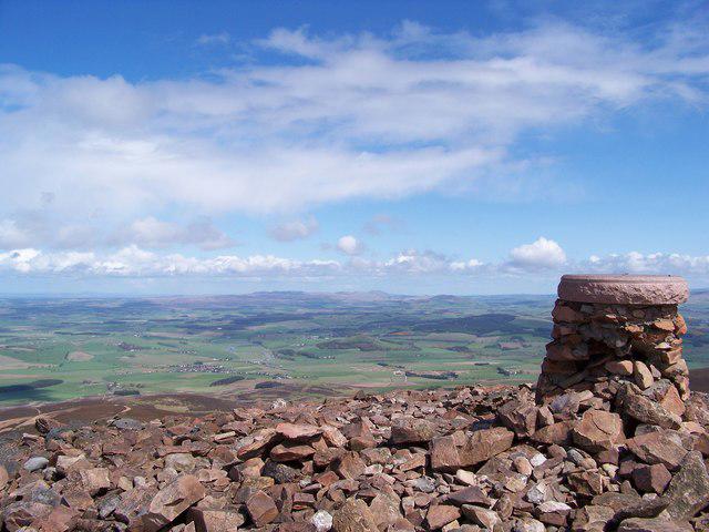
NX4586 : Mullwharchar cairn
Chris Wimbush
 Photo could not load
NX4586 : Mullwharchar summit cairn
Leslie Barrie
 Photo could not load
NX4586 : Mullwharchar summit cairn
Leslie Barrie
 Photo could not load
NX4586 : Mullwharchar summit
David Brown
 Photo could not load
NX4586 : Summit of Mullwharchar
Richard Webb

NX4586 : Cairn on Mullwharchar
Billy McCrorie
Hill facts and local notes
Classifications
Elevation
692m
2,270 ft
Prominence
187m
Coordinates
55.1499, -4.4273
NX454866
OS Map
77
Explorer: 318
At the Summit
The summit is marked by a small cairn that serves as a perfect picnic spot. On a clear day, the views make you feel like the king (or queen) of the world.
Terrain & Geology
Mullwharchar is mainly composed of Old Red Sandstone, a sedimentary rock that gives the terrain a distinctive reddish hue. Glacial processes during the last Ice Age have shaped its smooth slopes and rugged features.
Views & Scenery
From the summit, you can spot the rolling hills of the Southern Uplands, the shimmering waters of Loch Doon, and on a clear day, even the distant peaks of the Galloway Hills.
History & Heritage
Name Origin
The name 'Mullwharchar' is derived from the Gaelic 'Mull a' Chara', meaning 'the hill of the cauldron' which perhaps refers to the area's bowl-like topography.
Historical Significance
Mullwharchar stands as a fine example of the Scottish landscape and is frequented by hikers keen to explore the Southern Uplands.
Getting There & Facilities
Parking
Parking is available at the Grey Mare's Tail car park, which can accommodate around 30 vehicles but gets busy during weekends.
Public Transport
The nearest train station is at Dumfries, from where you can take a bus to Moffat, followed by a short taxi ride to the trailhead.
Nearby Facilities
Moffat has several cafes, pubs, and small shops. Public toilets are available in the town.
Safety Information
Known Hazards
- Beware of sudden weather changes typical of the Scottish hills. Also, watch your footing, as the rocky sections can be slippery, especially when damp.
General Safety Tips
- Check weather conditions before setting out
- Carry appropriate clothing and equipment
- Let someone know your planned route
- Take a map, compass, and GPS device
- Carry emergency supplies: food, water, first aid kit, torch
Hills
Some common questions about the hills answered
Are there group walks up Mullwharchar?
Many walkers use Walkmates to join or organise walks with others. You can check for group walks around Mullwharchar through the maps
Are there other walkers around Mullwharchar?
Activity varies by location and time, but Walkmates lets you see whether others have shared walks or shown interest in this area. Find other people through the walking friends search walking friends for Mullwharchar search or of course create your own walk for Mullwharchar
Can I organise a walk to Mullwharchar?
Yes. If there aren’t any walks listed already, you can create a walk and make it available for others to join.
If you're signed up to Walkmates, you can create a walk to Mullwharchar.
How do I find a walk up this hill?
There are often multiple ways to walk this hill, depending on experience and route preference. Walkmates helps you explore walks and routes that others have shared.
Can I suggest a new route up Mullwharchar?
Yes. You can suggest or create routes to share with others. Walkmates focuses on the social side of walking, so routes are used to help people organise walks and explore areas together, rather than as detailed navigation tools or route libraries.
Other uses really appreciate knowledgeable walkers sharing their routes. Share your favourite route to Mullwharchar here
The is an error or something incorrect about this hill. How do I let you know?
We always strive to keep the information on Walkmates as accurate as possible. If you find an error, please let us know through the contact form and we'll aim to correct it as quickly as possible
Community Discussion
Comments
Location
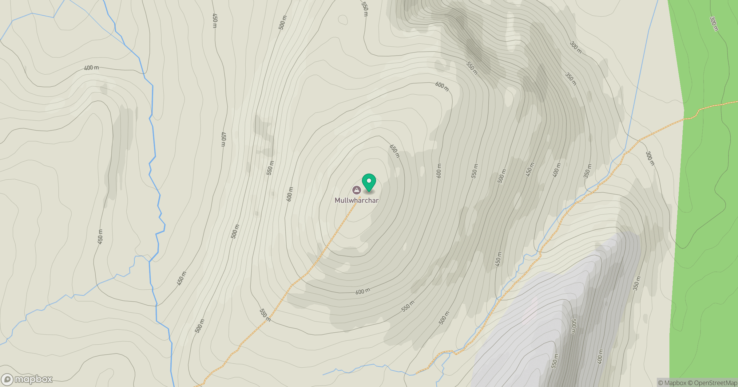
Grid reference: NX454866
View on OpenStreetMapOpens a map in a new tab, centred on the hill.
No comments yet. Be the first.