
Cruach nan Capull
Good walks are even better shared.
Overview
Cruach nan Capull
Cruach nan Capull, standing proudly at 625 meters, is a captivating Marilyn located in the Argyll and Bute region of the Scottish Highlands. It’s a hill that offers both challenge and charm, sure to entice hikers of all levels.
Geology
The mountain's slopes are predominantly made up of Old Red Sandstone, giving it a unique geological character. Hiking over its reddish rocks can ignite a newfound appreciation for Earth’s history—just try not to get too lost in the ancient past!
Route Options
There are multiple routes to the summit, but two stand out:
Glen Shira Route: This moderate route spans approximately 7 km and takes around 3.5 hours. Starting in the picturesque Glen Shira, it provides a relatively gentle ascent with greenery that would make even the toughest of hikers pause to appreciate nature.
Briar Hill Route: For those seeking a more challenging outing, the Briar Hill Route covers about 8.5 km in 4 hours and takes you through rocky 'scrambles'. It’s a route that rewards perseverance with breathtaking views at the top—very Instagrammable, if that’s your bag!
Summit Features
Upon reaching the summit, you will be greeted by a large stone cairn, a perfect place to catch your breath and admire the 360-degree panoramas. Don’t forget to take a couple of selfies; your friends need proof you made it!
Terrain and Views
Expect a mix of grassy expanses interspersed with rocky patches—a little bit of everything! The views from the top are phenomenal, featuring Loch Fyne and the hills of Cowal. The best seasons for these vistas are spring and autumn, when the air is crisp and visibility is at its peak.
Hazards
As with any Highland hike, beware of the rocky terrain. And suffice to say, weather can change faster than you can say ‘Scotland’. Be prepared, and keep your wits about you!
Nearby Summits
If you’re looking to extend your hiking adventure, consider tackling nearby peaks such as Beinn an Lochain (739m) and the ever-popular Ben More (966m).
Access and Facilities
Parking is available at the end of Glen Shira, offering a good start point. While public transport options are sparse, the charming town of Dunoon provides several amenities, including cafes and toilets—perfect for post-hike recovery.
History
The name Cruach nan Capull translates to 'Hill of the Horses', hinting at its pastoral past. Take a moment at the summit to ponder the history of the land beneath your feet.
In conclusion, whether you're hunting for solitude or simply enjoy the thrill of conquerable heights, Cruach nan Capull is well worth a visit. Happy hiking!
Explore routes near Cruach nan Capull
Public walks starting within 80 km of this hill. Nearby does not mean a route reaches the summit; check its map and access before setting out.
Glen Kin group walk
View route
Bishop’s Glen group walk
View route
West Bay walk and talk
View route
West Bay walk and talk
View route
Route planning notes
These notes describe possible approaches, not verified navigable routes or permission to cross land. Check current paths, local access rules and conditions before setting out.
Glen Shira Route
A scenic route starting from Glen Shira, providing stunning views and a gradual ascent to the summit.
Briar Hill Route
A more challenging route that traverses rocky terrain and leads to spectacular panoramas.
Make a day of it, together
Find someone to share the walk with, or organise a day out along a route you like.
Hill facts and local notes
Classifications
Elevation
481m
1,578 ft
Prominence
130m
Coordinates
56.1274, -5.1003
NS074970
OS Map
56
Explorer: OL37N 360S 362N 363N
At the Summit
The summit boasts a large stone cairn and impressive views overlooking Loch Fyne and the surrounding hills.
Terrain & Geology
Cruach nan Capull is primarily composed of Old Red Sandstone, which was formed during the Devonian period. The varied geology also allows for some fascinating rock formations typical of the region.
Views & Scenery
From the summit, one can see the expansive Loch Fyne, the distant hills of the Cowal Peninsula, and, on a clear day, the peaks of the Isle of Arran.
History & Heritage
Name Origin
Cruach nan Capull translates from Gaelic as 'Hill of the Horses'.
Historical Significance
Historically, the area has been a route for cattle and horses, reflecting its pastoral heritage.
Getting There & Facilities
Check current local access restrictions, parking rules and transport timetables before travelling. These notes do not confirm public access to the summit.
Parking
There is limited parking available at the end of Glen Shira where the route begins.
Public Transport
Public transport options are limited; it is advisable to travel by car. The nearest bus stop is in Dunoon, approximately 10 miles away.
Nearby Facilities
Dunoon offers several cafes, restaurants, and public toilets, making it a good base for hikers.
Safety Information
Known Hazards
- Uneven and rocky terrain, with potential for sudden weather changes in the Highlands.
General Safety Tips
- Check weather conditions before setting out
- Carry appropriate clothing and equipment
- Let someone know your planned route
- Take a map, compass, and GPS device
- Carry emergency supplies: food, water, first aid kit, torch
Hills
Some common questions about the hills answered
Are there group walks up Cruach nan Capull?
Many walkers use Walkmates to join or organise walks with others. You can check for group walks around Cruach nan Capull through the maps
Are there other walkers around Cruach nan Capull?
Activity varies by location and time, but Walkmates lets you see whether others have shared walks or shown interest in this area. Find other people through the walking friends search walking friends for Cruach nan Capull search or of course create your own walk for Cruach nan Capull
Can I organise a walk to Cruach nan Capull?
Yes. If there aren’t any walks listed already, you can create a walk and make it available for others to join.
If you're signed up to Walkmates, you can create a walk to Cruach nan Capull.
How do I find a walk up this hill?
There are often multiple ways to walk this hill, depending on experience and route preference. Walkmates helps you explore walks and routes that others have shared.
Can I suggest a new route up Cruach nan Capull?
Yes. You can suggest or create routes to share with others. Walkmates focuses on the social side of walking, so routes are used to help people organise walks and explore areas together, rather than as detailed navigation tools or route libraries.
Other uses really appreciate knowledgeable walkers sharing their routes. Share your favourite route to Cruach nan Capull here
The is an error or something incorrect about this hill. How do I let you know?
We always strive to keep the information on Walkmates as accurate as possible. If you find an error, please let us know through the contact form and we'll aim to correct it as quickly as possible
Community Discussion
Comments
Location
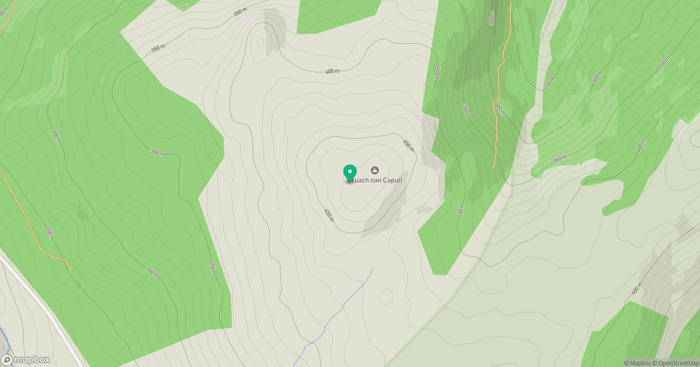
Grid reference: NS074970
View on OpenStreetMapOpens a map in a new tab, centred on the hill.
Hills within 30 km
Straight-line distance, not a walking route or confirmation of access.

No comments yet. Be the first.