
Barr nan Damh
Good walks are even better shared.
Overview
Barr nan Damh
Overview
Barr nan Damh, a majestic Munro in the Scottish Highlands, stands at 855 meters, proudly watching over the stunning landscape of its surroundings. Known as the 'Hill of the Stag', this mountain gives hikers a taste of the wild beauty that Scotland is famed for.
Geology
The mountain's ancient Lewisian gneiss provides a fascinating glimpse into Scotland’s geology. This robust rock has been weathering the elements for millions of years, leaving behind rugged formations that challenge even the most seasoned climbers.
Routes
One of the most enjoyable ways to summit Barr nan Damh is via the Inverliever Forest Trail. This 9.5 km route offers a moderate difficulty level and promises scenic wonders throughout. Expect to climb through woodland before being greeted by open vistas that make every step worth it.
Summit Features
At the peak, you'll find a sturdy stone cairn which serves as a perfect spot for a break and to take in the stunning views. The sight of the Atlantic in the distance is enough to make even the most serious hiker pause in awe.
Terrain
The terrain varies from rocky outcrops to lush grass, with some tricky scree areas. It keeps the adventure enticing, so make sure your hiking boots are ready for action!
Views
Don’t forget your camera! The views are nothing short of spectacular, with highlights including Ben Nevis to the south and stunning islands like Mull and Skye on a clear day. The best time to enjoy these views is during late spring to early autumn.
Hazards
As beautiful as it is, Barr nan Damh does come with its hazards. Be cautious of loose rocks and scree, especially if the path is wet. Good footwear may save you from an unexpected tumble!
Nearby Summits
For those looking to extend their adventure, nearby summits such as Beinn a'Chochuill and Beinn an Dothaidh provide additional challenges and views.
Access
The Inverliever Forest car park is the nearest access point, offering ample parking for trekkers. The scenic town of Oban is just a short journey away, where you can replenish your energy with local delights.
Facilities
In Oban, numerous cafes and public toilets are available, ensuring you have the necessary comforts before and after your hike.
History
The name Barr nan Damh has a rich backstory. Recognising this mountain as the 'Hill of the Stag' reflects a traditional connection to wildlife and hunting in the area. It’s a place steeped in culture and history, making the trek even more worthwhile.
So grab your gear, lace up your boots, and prepare for an adventure that promises stunning views and a hearty dose of Scottish charm. Happy hiking!
Explore routes near Barr nan Damh
Public walks starting within 80 km of this hill. Nearby does not mean a route reaches the summit; check its map and access before setting out.
Glen Kin group walk
View route
Crinan Canal: Bellanoch and Dunardry towpath return
View route
Bishop’s Glen group walk
View route
West Bay walk and talk
View route
Route planning notes
These notes describe possible approaches, not verified navigable routes or permission to cross land. Check current paths, local access rules and conditions before setting out.
Inverliever Forest Trail
This popular route starts from the Inverliever Forest, offering a good mix of challenging climbs and scenic views through the trees leading up to the summit.
Make a day of it, together
Find someone to share the walk with, or organise a day out along a route you like.
Hill facts and local notes
Classifications
Elevation
175m
574 ft
Prominence
104m
Coordinates
56.1301, -5.1770
NS026975
OS Map
55
Explorer: 360S 362N
At the Summit
The summit features a large stone cairn, a classic Highland sight, with stunning panoramic views across the surrounding valleys and towards the Atlantic coast. Don’t forget to take a selfie; the views are definitely Instagram-worthy!
Terrain & Geology
The mountain is predominantly formed of ancient Lewisian gneiss, which is known for its ruggedness and resilience, having withstood the test of geological time. The rocky outcrops and scree slopes offer a glimpse into the earth's primordial past.
Views & Scenery
From the summit, you can spot the iconic Ben Nevis to the south and the beautiful coastline of the West Highlands, including the islands of Mull and Skye on a clear day.
History & Heritage
Name Origin
Barr nan Damh translates to 'Hill of the Stag' in Gaelic, reflecting the rich wildlife that can be found in this area.
Historical Significance
The mountain area holds cultural significance for local communities and has historically been a place for both hunting and gathering.
Getting There & Facilities
Check current local access restrictions, parking rules and transport timetables before travelling. These notes do not confirm public access to the summit.
Parking
Park at the Inverliever Forest car park (NS027985), which has space for several vehicles. Please be considerate of the local countryside.
Public Transport
The nearest train station is in Oban, approximately 23 km away. Bus services are available, but they may not directly connect to the starting point.
Nearby Facilities
In Oban, you’ll find a variety of cafes, restaurants, and shops. Public toilets are available in the town as well.
Safety Information
Known Hazards
- Loose rocks and scree on paths can be hazardous, especially in wet conditions. Be sure to have sturdy footwear and watch your footing.
General Safety Tips
- Check weather conditions before setting out
- Carry appropriate clothing and equipment
- Let someone know your planned route
- Take a map, compass, and GPS device
- Carry emergency supplies: food, water, first aid kit, torch
Hills
Some common questions about the hills answered
Are there group walks up Barr nan Damh?
Many walkers use Walkmates to join or organise walks with others. You can check for group walks around Barr nan Damh through the maps
Are there other walkers around Barr nan Damh?
Activity varies by location and time, but Walkmates lets you see whether others have shared walks or shown interest in this area. Find other people through the walking friends search walking friends for Barr nan Damh search or of course create your own walk for Barr nan Damh
Can I organise a walk to Barr nan Damh?
Yes. If there aren’t any walks listed already, you can create a walk and make it available for others to join.
If you're signed up to Walkmates, you can create a walk to Barr nan Damh.
How do I find a walk up this hill?
There are often multiple ways to walk this hill, depending on experience and route preference. Walkmates helps you explore walks and routes that others have shared.
Can I suggest a new route up Barr nan Damh?
Yes. You can suggest or create routes to share with others. Walkmates focuses on the social side of walking, so routes are used to help people organise walks and explore areas together, rather than as detailed navigation tools or route libraries.
Other uses really appreciate knowledgeable walkers sharing their routes. Share your favourite route to Barr nan Damh here
The is an error or something incorrect about this hill. How do I let you know?
We always strive to keep the information on Walkmates as accurate as possible. If you find an error, please let us know through the contact form and we'll aim to correct it as quickly as possible
Community Discussion
Comments
Location
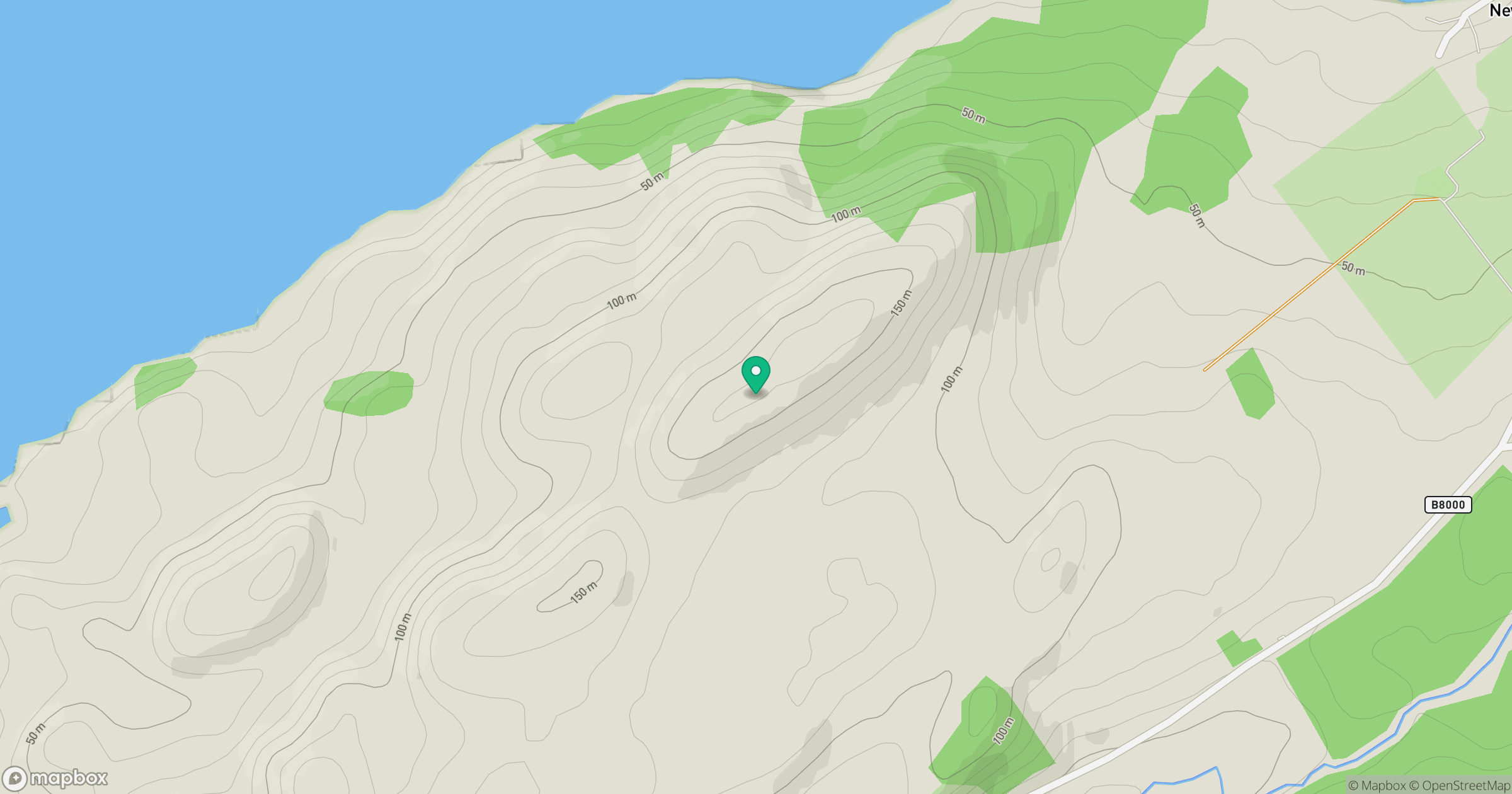
Grid reference: NS026975
View on OpenStreetMapOpens a map in a new tab, centred on the hill.
Hills within 30 km
Straight-line distance, not a walking route or confirmation of access.
Beinn Ghlas
420m
Beinn Ime
1,012m

The Cobbler [Ben Arthur]
887m
Beinn Narnain
927m
Dun Leacainn
360m
No comments yet. Be the first.