

Cruach Breacain
Good walks are even better shared.
Overview
Discovering Cruach Breacain
Nestled in the beautiful Scottish Highlands, Cruach Breacain is a Marilyn that beckons adventurers with its rugged charm and stunning vistas. Standing at 655 meters, this mountain offers a delightful hike for those looking to immerse themselves in nature's tranquillity.
Geology
Cruach Breacain is primarily composed of schist and quartzite, contributing to its unique and dramatic profile. Erosion has shaped the mountain over the years, presenting rock formations that invite exploration and admiration.
Routes
The most popular route begins at the parking area near Arnisdale, progressing along the South Ridge. This approximately 6.5 km route typically takes around three hours to complete, perfect for those seeking a moderate day out. Hikers will discover stunning landscapes and sweeping views as they ascend, with plenty of opportunities for photo stops (don't forget to capture that 'I conquered the hill' selfie!).
Summit Features
Upon reaching the summit, a small cairn awaits to greet you, alongside unparalleled views. On a clear day, you'll be treated to striking vistas of the Kintail range and the Isle of Skye, a sight that makes the effort worthwhile.
Terrain
The terrain is predominantly grassy with rocky outcrops, interspersed with patches of heathland. The combination offers both a challenge and a rewarding experience for hikers of varying skill levels.
Views
Highlights from the summit include not just the mountains but also the windswept beauty of the surrounding landscape. The best time to appreciate these stunning scenes is in spring or early autumn, although summer adds a dash of vivid colour with wildflowers blooming along the trails.
Hazards
As with any mountain hike, be mindful of loose rocks underfoot and prepare for rapidly changing weather conditions. A sturdy pair of boots will serve you well here!
Nearby Summits
For those seeking further adventures, nearby summits include the impressive Sgurr na bana-mhanaich at 932 meters and Beinn Sgritheall, topping out at 974 meters. A perfect excuse to bring a buddy along for a multi-peak day out!
Access
Access to Cruach Breacain is convenient, with a small parking area found at the end of a public road in Arnisdale. If you rely on public transport, consider planning your journey carefully as the last bus may not accommodate an impromptu climb. The nearest town is Kyle of Lochalsh, just a short drive away, where you can replenish your stores post-hike.
Facilities
While amenities in Arnisdale are limited, a small shop will cover your basic needs. For more extensive facilities, venture north to Kyle of Lochalsh.
History
The name 'Cruach Breacain' beautifully translates to 'speckled hill', evocative of its striking backdrop. This majestic mountain holds significance in both history and culture, drawing in hikers from around the globe, all eager to witness its beauty firsthand.
Embark on an adventure to Cruach Breacain and create your own unforgettable memories amidst the stunning landscapes of the Scottish Highlands. Happy hiking!
Explore routes near Cruach Breacain
Public walks starting within 80 km of this hill. Nearby does not mean a route reaches the summit; check its map and access before setting out.
Crinan Canal: Bellanoch and Dunardry towpath return
View route
Glen Kin group walk
View route
Bishop’s Glen group walk
View route
West Bay walk and talk
View route
Route planning notes
These notes describe possible approaches, not verified navigable routes or permission to cross land. Check current paths, local access rules and conditions before setting out.
South Ridge Route
Starting from the car park at the end of the public road, this route follows a grassy path leading up the southern ridge to the summit. The ascent is steady with breathtaking views along the way.
Make a day of it, together
Find someone to share the walk with, or organise a day out along a route you like.
Photo Gallery
View all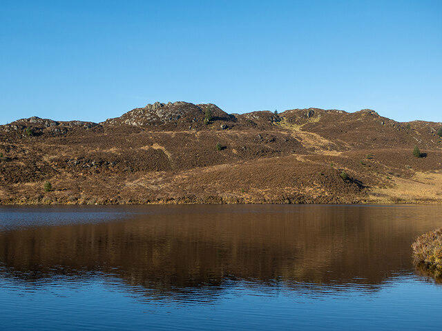 Photo could not load
NR8286 : Cruach Breacain
Patrick Mackie
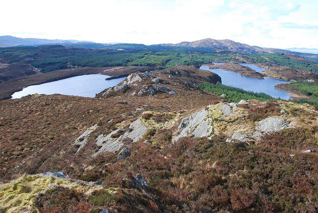 Photo could not load
NR8286 : Cruach Breacain
Patrick Mackie
Hill facts and local notes
Classifications
Elevation
360m
1,180 ft
Prominence
125m
Coordinates
56.0206, -5.4990
NR820863
OS Map
55
Explorer: 358S
At the Summit
At the summit, hikers will find a small cairn marking the highest point, along with spectacular panoramic views that will take your breath away—hopefully not literally!
Terrain & Geology
The mountain is primarily composed of schist and quartzite, giving it a rugged appearance. Weathering has resulted in striking rock formations and scattered boulders, creating a picturesque and interesting landscape.
Views & Scenery
From the summit, you can see the stunning peaks of the Kintail range, Loch Duich, and the picturesque Isle of Skye on a clear day. Keep an eye out for the elusive Golden Eagle soaring high above!
History & Heritage
Name Origin
The name 'Cruach Breacain' translates from Scottish Gaelic to 'speckled hill', a fitting name for its dotted landscape.
Historical Significance
Cruach Breacain has been a favourite among both local and visiting hikers, offering not only physical challenge but a connection to the untamed Scottish wilderness.
Getting There & Facilities
Check current local access restrictions, parking rules and transport timetables before travelling. These notes do not confirm public access to the summit.
Parking
There is a small parking area at the end of the public road near Arnisdale (NR 831 863). Space is limited, so arrive early to secure a spot.
Public Transport
Regular bus services connect nearby villages, but a car is recommended for ease of access.
Nearby Facilities
The nearest facilities are located in Arnisdale, where you can find a small shop. Further facilities can be found in Kyle of Lochalsh.
Safety Information
Known Hazards
- Loose rocks can give way underfoot, particularly in the upper reaches. Be cautious in bad weather as visibility can diminish rapidly.
General Safety Tips
- Check weather conditions before setting out
- Carry appropriate clothing and equipment
- Let someone know your planned route
- Take a map, compass, and GPS device
- Carry emergency supplies: food, water, first aid kit, torch
Hills
Some common questions about the hills answered
Are there group walks up Cruach Breacain?
Many walkers use Walkmates to join or organise walks with others. You can check for group walks around Cruach Breacain through the maps
Are there other walkers around Cruach Breacain?
Activity varies by location and time, but Walkmates lets you see whether others have shared walks or shown interest in this area. Find other people through the walking friends search walking friends for Cruach Breacain search or of course create your own walk for Cruach Breacain
Can I organise a walk to Cruach Breacain?
Yes. If there aren’t any walks listed already, you can create a walk and make it available for others to join.
If you're signed up to Walkmates, you can create a walk to Cruach Breacain.
How do I find a walk up this hill?
There are often multiple ways to walk this hill, depending on experience and route preference. Walkmates helps you explore walks and routes that others have shared.
Can I suggest a new route up Cruach Breacain?
Yes. You can suggest or create routes to share with others. Walkmates focuses on the social side of walking, so routes are used to help people organise walks and explore areas together, rather than as detailed navigation tools or route libraries.
Other uses really appreciate knowledgeable walkers sharing their routes. Share your favourite route to Cruach Breacain here
The is an error or something incorrect about this hill. How do I let you know?
We always strive to keep the information on Walkmates as accurate as possible. If you find an error, please let us know through the contact form and we'll aim to correct it as quickly as possible
Community Discussion
Comments
Location
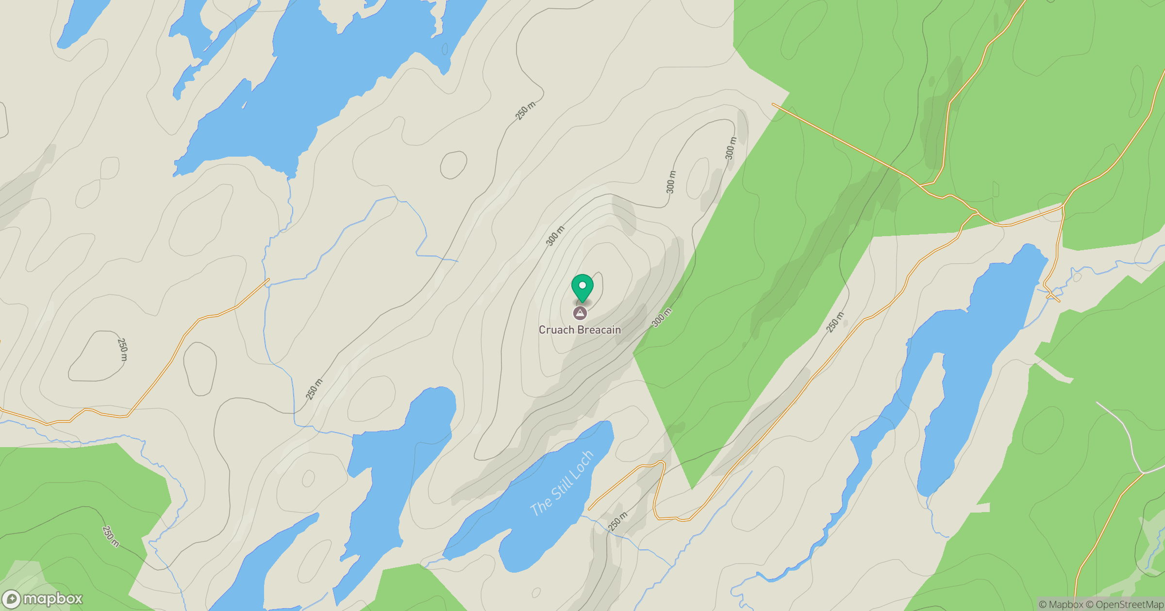
Grid reference: NR820863
View on OpenStreetMapOpens a map in a new tab, centred on the hill.
Hills within 30 km
Straight-line distance, not a walking route or confirmation of access.
Beinn Ghlas
420m
Stucan Dughaill [Meall Ruadh]
341m
Cruach Lusach
467m
Cruach a' Phubuill
477m
Cnoc Reamhar
266m
No comments yet. Be the first.