

Craig Murrail
Good walks are even better shared.
Overview
Craig Murrail
Nestled in the heart of the Scottish Highlands, Craig Murrail beckons adventurers with its rocky charm and stunning vistas. With an elevation of 588 meters, this Marilyn is not just a hill; it's a testament to nature's beauty and resilience.
Geology
The geology of Craig Murrail is quite fascinating. Composed mainly of metamorphic rocks, it tells the ancient tale of volcanic activity and geological transformations. It’s like walking on the earth’s ancient diary, full of stories waiting to be uncovered!
Route Information
Route: South Ridge
- Distance: 3.5 km
- Estimated Time: 2.5 hours
- Difficulty: Moderate
The South Ridge Route is a favourite among hikers. This picturesque path not only leads you gradually up but also treats you to beautiful views as you make your ascent. Be prepared for a bit of a scramble near the summit, but nothing too treacherous for a seasoned hiker!
Summit Features
Upon reaching the peak, you’ll be greeted by a small cairn, a traditional pile of stones erected by fellow hikers. It’s the perfect spot for a well-earned rest and a few thoughtful selfies. Just remember, the cairn isn’t a wishing well… or is it?
Views
From the summit, you’ll be rewarded with breathtaking views. Loch Snizort glimmers serenely in the distance, while the distant Isle of Skye adds an ethereal backdrop. And if you're lucky, you might spot the majestic deer that roam these hills. Just don't expect them to pose for the camera!
Hazards
As with most Highland hikes, be prepared for sudden shifts in weather. One moment it's sunny and bright, and the next, you're caught in a delightful Scottish drizzle. Also, watch your step on the rocky bits; you wouldn’t want to dance with the local wildlife accidentally!
Access
Getting to Craig Murrail is fairly straightforward. Park at the small area located just off the A87 near the trailhead—arrive early to snag a decent spot!
If you’re relying on public transport, regular buses to Portree will get you close. From there, it's a short taxi or a good stretch of leg to the trail.
Facilities
Before or after your trek, Portree offers various facilities, including quaint cafes and shops where you can refuel or pick up a souvenir. Just a heads-up: the scones are known to disappear quickly!
History
The name "Craig Murrail" means "rocky hill," which seems fitting considering the terrain. This mountain has seen its fair share of history, from clan gatherings to modern hikers, reminding us that the hills hold stories as rich as the landscapes themselves.
So, gear up, lace those boots, and head to Craig Murrail for a day of adventure. Whether you're here for the views or the thrill of the climb, you won't be disappointed! Enjoy and happy hiking!
Explore routes near Craig Murrail
Public walks starting within 80 km of this hill. Nearby does not mean a route reaches the summit; check its map and access before setting out.
Crinan Canal: Bellanoch and Dunardry towpath return
View route
Glen Kin group walk
View route
Bishop’s Glen group walk
View route
West Bay walk and talk
View route
Route planning notes
These notes describe possible approaches, not verified navigable routes or permission to cross land. Check current paths, local access rules and conditions before setting out.
South Ridge Route
A scenic path leading up the southern slopes, offering stunning views of the surrounding landscape.
Make a day of it, together
Find someone to share the walk with, or organise a day out along a route you like.
Photo Gallery
View all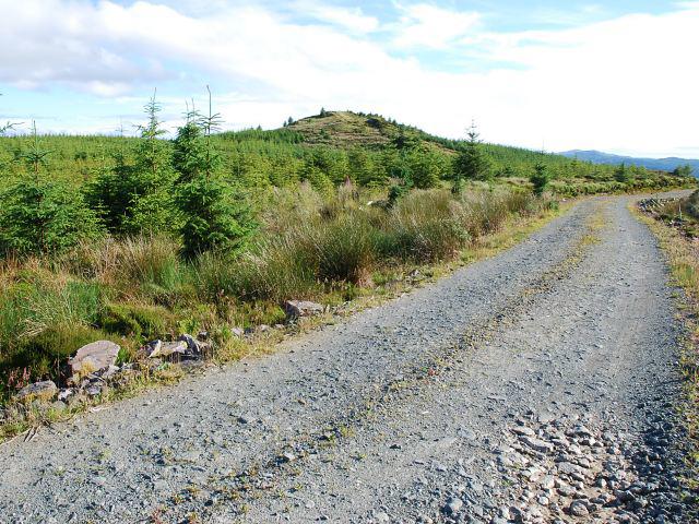 Photo could not load
NR8892 : Craig Murrail
Patrick Mackie
Hill facts and local notes
Classifications
Elevation
239m
784 ft
Prominence
122m
Coordinates
56.0736, -5.4076
NR880919
OS Map
55
Explorer: 358N
At the Summit
At the summit, you'll find a small cairn, a traditional marker that has stood the test of time, providing hikers with a place to rest or contemplate their life choices.
Terrain & Geology
The mountain predominantly consists of metamorphic rocks, typical of the Highlands, formed from ancient volcanic activity. You'll be treading on history as you hike!
Views & Scenery
On a clear day, expect sweeping vistas of Loch Snizort and the distant Isle of Skye. Spotting wildlife is a bonus - keep an eye out for those elusive stags!
History & Heritage
Name Origin
The name Craig Murrail translates to 'rocky hill', perfectly capturing the craggy character of the peak.
Historical Significance
This area is rich with history, having been frequented by both ancient clans and modern-day adventurers reminding us that everyone's journey counts!
Getting There & Facilities
Check current local access restrictions, parking rules and transport timetables before travelling. These notes do not confirm public access to the summit.
Parking
A small parking area is located just off the A87 near the foot of the trail. It's best to arrive early to secure a spot.
Public Transport
Regular bus services connect to Portree; check the timetables for the latest updates.
Nearby Facilities
The nearest facilities can be found in Portree, where you can indulge in a nice cup of tea or grab a bite to eat before or after your hike.
Safety Information
Known Hazards
- Be wary of sudden weather changes, typical in the Highlands. Some loose rocks may also add an unexpected twist to your adventure!
General Safety Tips
- Check weather conditions before setting out
- Carry appropriate clothing and equipment
- Let someone know your planned route
- Take a map, compass, and GPS device
- Carry emergency supplies: food, water, first aid kit, torch
Hills
Some common questions about the hills answered
Are there group walks up Craig Murrail?
Many walkers use Walkmates to join or organise walks with others. You can check for group walks around Craig Murrail through the maps
Are there other walkers around Craig Murrail?
Activity varies by location and time, but Walkmates lets you see whether others have shared walks or shown interest in this area. Find other people through the walking friends search walking friends for Craig Murrail search or of course create your own walk for Craig Murrail
Can I organise a walk to Craig Murrail?
Yes. If there aren’t any walks listed already, you can create a walk and make it available for others to join.
If you're signed up to Walkmates, you can create a walk to Craig Murrail.
How do I find a walk up this hill?
There are often multiple ways to walk this hill, depending on experience and route preference. Walkmates helps you explore walks and routes that others have shared.
Can I suggest a new route up Craig Murrail?
Yes. You can suggest or create routes to share with others. Walkmates focuses on the social side of walking, so routes are used to help people organise walks and explore areas together, rather than as detailed navigation tools or route libraries.
Other uses really appreciate knowledgeable walkers sharing their routes. Share your favourite route to Craig Murrail here
The is an error or something incorrect about this hill. How do I let you know?
We always strive to keep the information on Walkmates as accurate as possible. If you find an error, please let us know through the contact form and we'll aim to correct it as quickly as possible
Community Discussion
Comments
Location
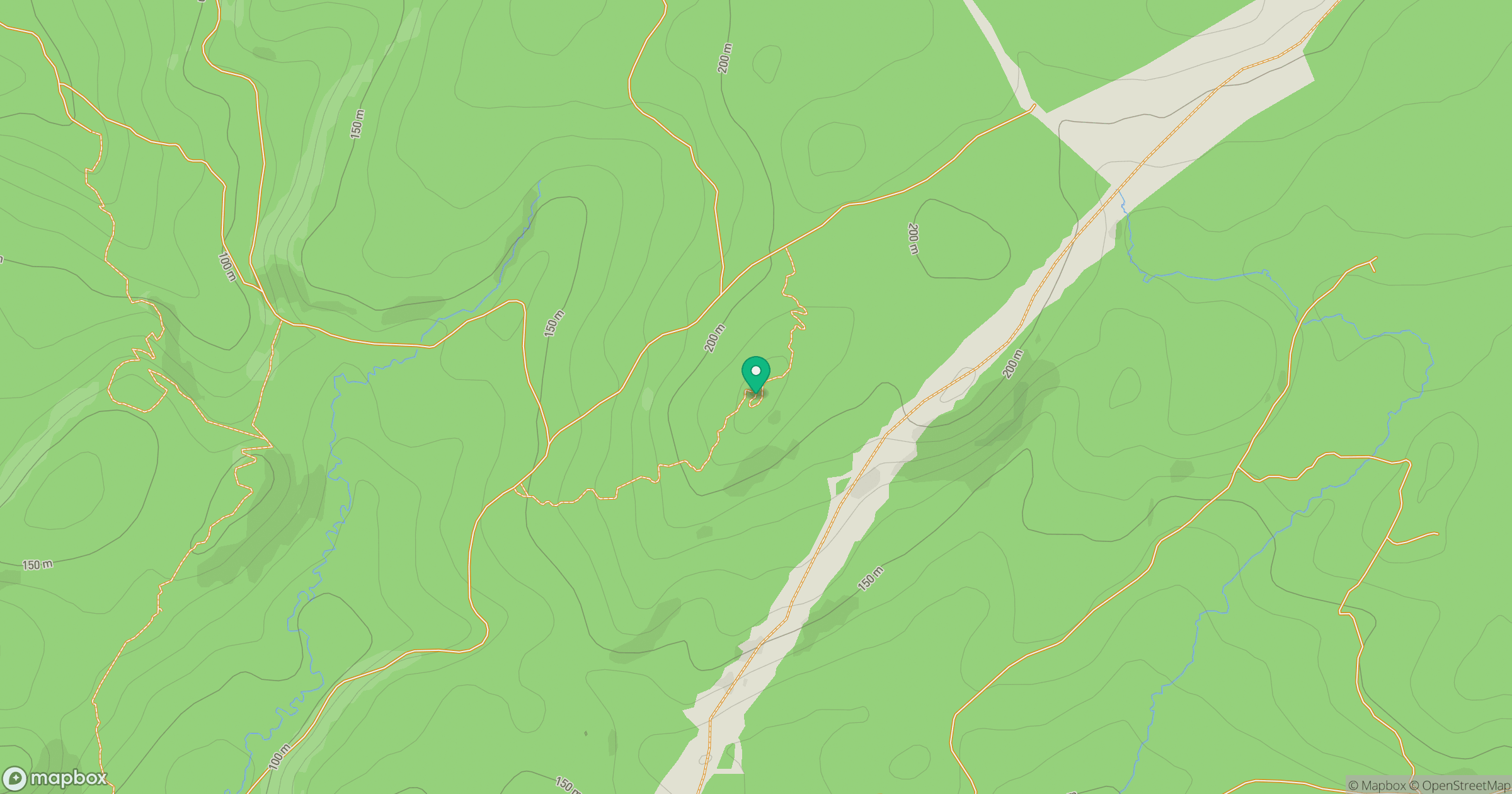
Grid reference: NR880919
View on OpenStreetMapOpens a map in a new tab, centred on the hill.
Hills within 30 km
Straight-line distance, not a walking route or confirmation of access.
No comments yet. Be the first.