
Dun Dubh
Good walks are even better shared.
Overview
Dun Dubh: The Dark Fortress
Dun Dubh, rising proudly at 559 meters, is a Marilyn located in the picturesque Southern Uplands of Scotland. Not only does this peak boast a charismatic name, which translates to 'Black Fortress', but it also offers a range of hiking experiences tailored for both casual walkers and seasoned adventurers.
Geology
Dun Dubh's unique composition of volcanic rock provides insight into the geological history of the region. The surrounding landscape is marked by ancient schist and granite formations, giving a nod to the immense forces that have shaped the earth over millennia. If rocks could talk, there'd be quite the Kettle of fish to hear here!
Routes
Two popular routes to explore the wonders of Dun Dubh include the Dun Dubh Circuit and the North Ridge Ascent. The former is an 8 km circular route that takes about 3.5 hours, making it ideal for a day out with friends or family. The North Ridge Ascent is a more straightforward option at just 4 km, taking approximately 1.5 hours and suitable for a relaxed hike amidst stunning views.
Summit Features
As you reach the summit, you'll be greeted by a prominent cairn and sweeping vistas that make you feel like the king (or queen) of the world! It's the perfect spot for a well-deserved break; don’t forget your sandwiches!
Terrain
Expect a mix of grassy fields and rocky outcrops, with the potential for some boggy patches, particularly after heavy rain. Good hiking boots are advisable – you don’t want to be left high and dry!
Views
Dun Dubh is known for its magnificent views. On clear days, not only can you gaze upon the picturesque Southern Uplands, but you might also catch a glimpse of the Borders in the distance. Spring and autumn, with their vivid colours and blooming landscapes, are particularly stunning times to visit.
Hazards
Be cautious; the weather can change in an instant. Slippery terrain after rain is also a consideration, so keep an eye on your step!
Access
Accessing Dun Dubh is straightforward, with a small layby for parking near Enoch, the nearest village. While public transport options are limited, local buses from Selkirk may offer weekend services.
Facilities
After your hike, treat yourself at the local café in Enoch for a well-earned cup of tea and perhaps a slice of delicious cake. A must for every hiker’s checklist!
History
The name 'Dun Dubh' alludes to its historical significance as a place of shelter for ancient folk. The remnants of earthworks play testament to the communities that once thrived here.
In conclusion, a hike up Dun Dubh is not just a walk in the park; it's an adventure rich in natural beauty, history, and geological wonder. So lace up those boots, grab your walking stick, and head out – you won't regret it!
Happy Hiking!
Explore routes near Dun Dubh
Public walks starting within 80 km of this hill. Nearby does not mean a route reaches the summit; check its map and access before setting out.
Crinan Canal: Bellanoch and Dunardry towpath return
View route
Glen Kin group walk
View route
Bishop’s Glen group walk
View route
West Bay walk and talk
View route
Route planning notes
These notes describe possible approaches, not verified navigable routes or permission to cross land. Check current paths, local access rules and conditions before setting out.
Dun Dubh Circuit
A pleasant circular walk starting from the small village of Enoch.
North Ridge Ascent
A straightforward ascent via the northern ridge, offering rewarding views.
Make a day of it, together
Find someone to share the walk with, or organise a day out along a route you like.
Hill facts and local notes
Classifications
Elevation
301m
988 ft
Prominence
123m
Coordinates
56.1848, -5.4474
NM861044
OS Map
55
Explorer: 358N 360S
At the Summit
The summit features a prominent cairn and expansive views of the surrounding hills. It's a perfect spot for a snack break and a cheeky photo opportunity.
Terrain & Geology
Dun Dubh is composed of volcanic rock, offering a fascinating glimpse into the geological processes that shaped this part of Scotland. The surrounding area features ancient schist and granite formations, testament to the powerful forces of erosion and tectonic activity.
Views & Scenery
From the summit, you can see the rolling hills of the Southern Uplands, as well as the distant outline of the Borders. On a clear day, the views stretch far and wide, making it a photographer's dream.
History & Heritage
Name Origin
The name 'Dun Dubh' translates to 'Black Fortress', possibly referring to the imposing cliffs that once provided shelter to ancient inhabitants.
Historical Significance
Historically, this area was significant for early Scottish communities, with remnants of ancient earthworks indicating past habitation.
Getting There & Facilities
Check current local access restrictions, parking rules and transport timetables before travelling. These notes do not confirm public access to the summit.
Parking
There is a small layby along the A708 just north of Enoch, suitable for parking.
Public Transport
Limited public transport options. It's advisable to travel by car; however, buses from nearby towns to Enoch may be available during weekdays.
Nearby Facilities
There's a quaint café in Enoch where you can recharge with a cup of tea and a slice of cake after your hike.
Safety Information
Known Hazards
- Sudden changes in weather can occur; be mindful of the forecast. The terrain can be slippery, particularly in wet conditions.
General Safety Tips
- Check weather conditions before setting out
- Carry appropriate clothing and equipment
- Let someone know your planned route
- Take a map, compass, and GPS device
- Carry emergency supplies: food, water, first aid kit, torch
Hills
Some common questions about the hills answered
Are there group walks up Dun Dubh?
Many walkers use Walkmates to join or organise walks with others. You can check for group walks around Dun Dubh through the maps
Are there other walkers around Dun Dubh?
Activity varies by location and time, but Walkmates lets you see whether others have shared walks or shown interest in this area. Find other people through the walking friends search walking friends for Dun Dubh search or of course create your own walk for Dun Dubh
Can I organise a walk to Dun Dubh?
Yes. If there aren’t any walks listed already, you can create a walk and make it available for others to join.
If you're signed up to Walkmates, you can create a walk to Dun Dubh.
How do I find a walk up this hill?
There are often multiple ways to walk this hill, depending on experience and route preference. Walkmates helps you explore walks and routes that others have shared.
Can I suggest a new route up Dun Dubh?
Yes. You can suggest or create routes to share with others. Walkmates focuses on the social side of walking, so routes are used to help people organise walks and explore areas together, rather than as detailed navigation tools or route libraries.
Other uses really appreciate knowledgeable walkers sharing their routes. Share your favourite route to Dun Dubh here
The is an error or something incorrect about this hill. How do I let you know?
We always strive to keep the information on Walkmates as accurate as possible. If you find an error, please let us know through the contact form and we'll aim to correct it as quickly as possible
Community Discussion
Comments
Location
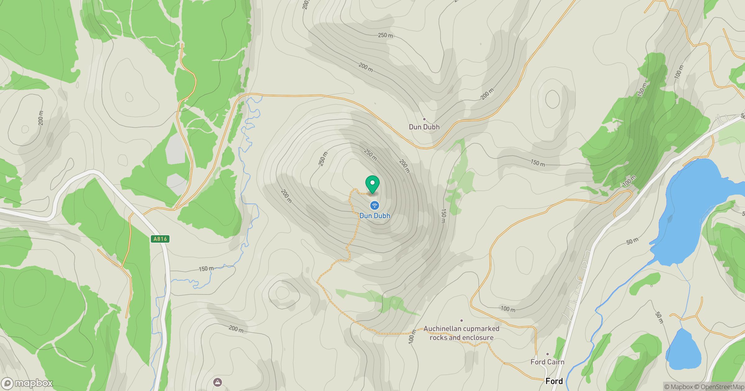
Grid reference: NM861044
View on OpenStreetMapOpens a map in a new tab, centred on the hill.
Hills within 30 km
Straight-line distance, not a walking route or confirmation of access.
No comments yet. Be the first.