

Cruach a' Phubuill
Good walks are even better shared.
Overview
Cruach a' Phubuill
Nestled within the scenic Argyle region, Cruach a' Phubuill stands proudly at 672 meters tall, showcasing both majesty and charm. Classified as a Marilyn, it offers ready access for those eager to explore the stunning Scottish Highlands.
Geology
This area, characterized by its Crystalline Schists and Gneisses, tells the story of ancient geological activity. These rocks are not just impressive to look at, but they also serve as a reminder of the powerful forces that shaped the landscape. One could almost imagine a dramatic fight between tectonic plates, complete with popcorn in hand!
Routes
The most popular route begins in Kilmun, taking you through enchanting woodlands before ascending to the summit. This 9.0 km trek generally takes around 3.5 hours, with some moderate inclines. Just enough to justify that extra scone at the café!
Summit Features
At the peak, hikers are greeted by a substantial cairn. Take a moment to revel in your achievements, snap a picture, and enjoy a snack (preferably not while trying to balance on one leg!).
Terrain Type
Expect a mix of rocky and grassy terrain, with some parts that might resemble a sponge if you've hit it after a rain. Prepare for the possibility of evolving into a mud monster if caught off guard!
Views
From the summit, the vista opens up, rewarding you with picturesque scenes of the Firth of Clyde and the illustrious Isle of Bute. If you’re lucky enough to get a clear day, this panoramic view will certainly make your heart sing.
Best Seasons: Spring and Autumn are generally the most rewarding. Milder temperatures mixed with vibrant colours will paint the perfect backdrop for your hikes. Bonus points if you can time it with a sunset; there’s nothing quite like it!
Hazards
Like all good outdoor ventures, there are hazards. Be wary of boggy patches during wet weather and keep an eye out for loose rocks; Mother Nature can be a cheeky one! Always pack a good pair of boots and ideally, leave nothing but footprints.
Nearby Summits
Don’t just stop at Cruach a' Phubuill; nearby peaks such as Beinn Mhor and Benmore await those who are hungry for more hills. Variety is the spice of life, after all!
Access
Nearest Parking: Kilmun has ample parking, but please be considerate of locals.
Public Transport: Check local bus schedules if you prefer to leave the car behind.
Nearest Town: Dunoon, vibrant with history and character.
Facilities
Before or after your climb, reward yourself with a visit to a café in Kilmun. A cup of tea and a bit of cake make for a fine end to any hike.
History
The name translates to 'the hill of the bubbling place', reflecting the charm of local spring water. This mountain is not only about breathtaking views, but also carries a rich tapestry of stories from the community.
So lace up those boots, pack your essentials, and set forth on an adventure to Cruach a' Phubuill. You might just find it’s more than just a hike – it’s a journey through the heart of Scotland!
Explore routes near Cruach a' Phubuill
Public walks starting within 80 km of this hill. Nearby does not mean a route reaches the summit; check its map and access before setting out.
Crinan Canal: Bellanoch and Dunardry towpath return
View route
Glen Kin group walk
View route
Bishop’s Glen group walk
View route
West Bay walk and talk
View route
Route planning notes
These notes describe possible approaches, not verified navigable routes or permission to cross land. Check current paths, local access rules and conditions before setting out.
From Dunoon
A scenic ascent starting from the village of Kilmun, taking you through delightful woodlands before a steady ascent to the summit, offering great views.
Make a day of it, together
Find someone to share the walk with, or organise a day out along a route you like.
Photo Gallery
View all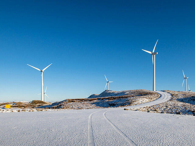 Photo could not load
NR8176 : Allt Dearg Community Wind Farm
Patrick Mackie
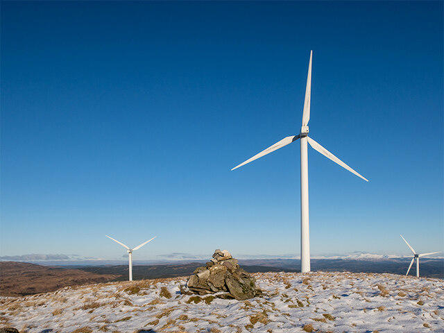 Photo could not load
NR8276 : Cairn on Cruach a' Phubuill
Patrick Mackie
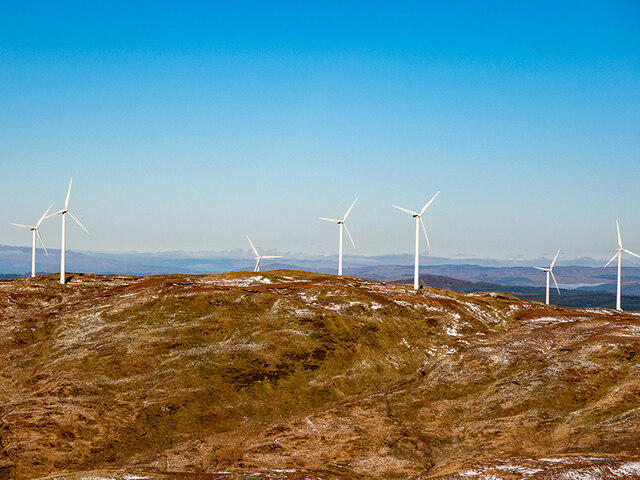 Photo could not load
NR8276 : Allt Dearg Wind Farm
Patrick Mackie
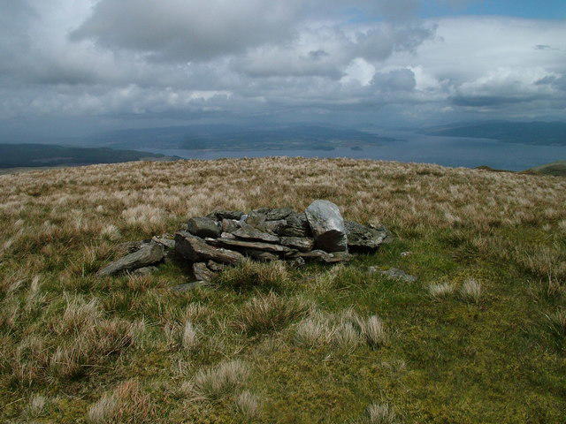 Photo could not load
NR8276 : Cairn on Cruach a'Phubuill
David Brown
Hill facts and local notes
Classifications
Elevation
477m
1,565 ft
Prominence
120m
Coordinates
55.9300, -5.4894
NR821762
OS Map
62
Explorer: 358S
At the Summit
The summit boasts a sizeable cairn with a few scattered rocks that create a mini labyrinth of nature’s building blocks. Ideal for a celebratory snack!
Terrain & Geology
Cruach a' Phubuill predominantly features Crystalline Schists and Gneisses, typical of the surrounding Scottish Highlands. These ancient rocks hint at the geological forces that have shaped this majestic landscape over millennia.
Views & Scenery
Admirable views of the Firth of Clyde, the Isle of Bute, and the surrounding mountains of the region, particularly the mighty Benmore.
History & Heritage
Name Origin
The name 'Cruach a' Phubuill' translates to 'the hill of the bubbling place'. It evokes images of quaint Scottish springs and perhaps the odd gurgling brook.
Historical Significance
This mountain is steeped in local folklore, often being a part of traditional stories, making it a revered spot among residents.
Getting There & Facilities
Check current local access restrictions, parking rules and transport timetables before travelling. These notes do not confirm public access to the summit.
Parking
Parking is available in Kilmun, where there’s enough space for a few cars. Make sure not to block driveways as residents might have a word or two!
Public Transport
Regular buses connect Dunoon and Kilmun but check schedules as services can be a bit sporadic, especially on weekends.
Nearby Facilities
Kilmun has a small café and public toilets near the village church. After trekking, grab a slice of cake – you've earned it!
Safety Information
Known Hazards
- Boggy patches during wet weather, potential for loose rocks on steeper sections, and sudden changes in weather typical of the Highlands.
General Safety Tips
- Check weather conditions before setting out
- Carry appropriate clothing and equipment
- Let someone know your planned route
- Take a map, compass, and GPS device
- Carry emergency supplies: food, water, first aid kit, torch
Hills
Some common questions about the hills answered
Are there group walks up Cruach a' Phubuill?
Many walkers use Walkmates to join or organise walks with others. You can check for group walks around Cruach a' Phubuill through the maps
Are there other walkers around Cruach a' Phubuill?
Activity varies by location and time, but Walkmates lets you see whether others have shared walks or shown interest in this area. Find other people through the walking friends search walking friends for Cruach a' Phubuill search or of course create your own walk for Cruach a' Phubuill
Can I organise a walk to Cruach a' Phubuill?
Yes. If there aren’t any walks listed already, you can create a walk and make it available for others to join.
If you're signed up to Walkmates, you can create a walk to Cruach a' Phubuill.
How do I find a walk up this hill?
There are often multiple ways to walk this hill, depending on experience and route preference. Walkmates helps you explore walks and routes that others have shared.
Can I suggest a new route up Cruach a' Phubuill?
Yes. You can suggest or create routes to share with others. Walkmates focuses on the social side of walking, so routes are used to help people organise walks and explore areas together, rather than as detailed navigation tools or route libraries.
Other uses really appreciate knowledgeable walkers sharing their routes. Share your favourite route to Cruach a' Phubuill here
The is an error or something incorrect about this hill. How do I let you know?
We always strive to keep the information on Walkmates as accurate as possible. If you find an error, please let us know through the contact form and we'll aim to correct it as quickly as possible
Community Discussion
Comments
Location
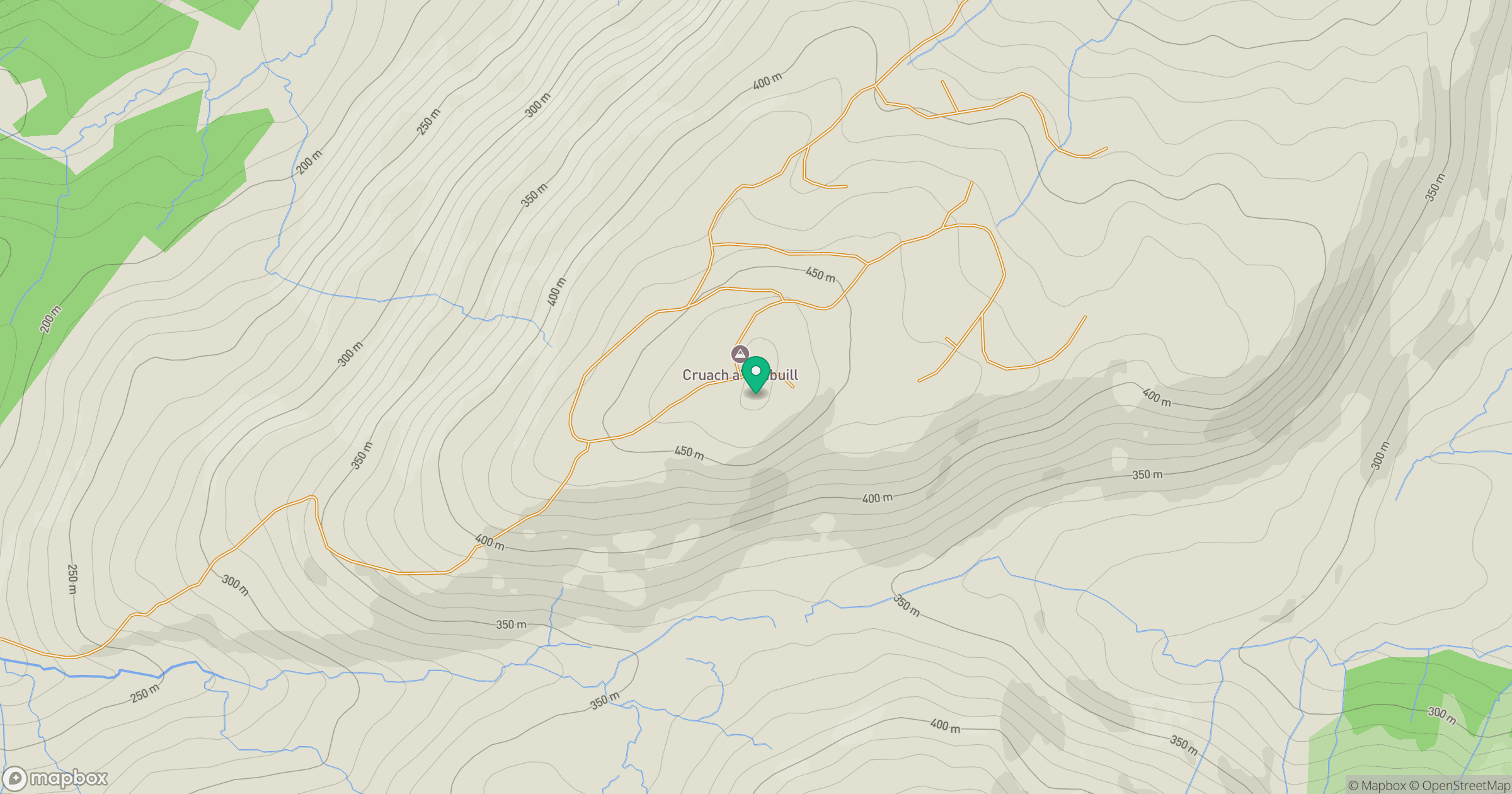
Grid reference: NR821762
View on OpenStreetMapOpens a map in a new tab, centred on the hill.
Hills within 30 km
Straight-line distance, not a walking route or confirmation of access.
Beinn Ghlas
420m
Stob Odhar
562m
Stucan Dughaill [Meall Ruadh]
341m
Cruach Lusach
467m
Cruach Breacain
360m
No comments yet. Be the first.