

Cross Craigs
Good walks are even better shared.
NN5352 : Summit of Cross Craigs
William Starkey Photo source
Overview
Cross Craigs: A Jewel in the Clyde Muirshiel
Nestled within the picturesque Clyde Muirshiel Regional Park, Cross Craigs stands at an elevation of 593 meters. While it may not be the highest peak in Scotland, it certainly packs a punch when it comes to spectacular views.
Geology
The rocks you tread upon are remnants of ancient volcanic activity, showcasing the diverse geology of the region. It’s a walk-through geological history, so keep a keen eye for interesting rock formations and fossils that tell stories of yore.
Routes
Cross Craigs boasts a variety of routes to cater to all levels of hikers. Whether you're after a leisurely stroll around the Clyde Muirshiel Loop or ready to tackle the steep ascent from Balmaha, there’s something for everyone.
Summit Features
Upon reaching the summit, hikers are greeted by a majestic cairn—your reward for the effort expended on the slopes below! Don’t forget to snap a photo with the cairn as your backdrop for bragging rights among your friends.
Terrain
Expect a terrain that mixes rocky paths with rolling grasslands. During your hike, there may be boggy patches that could challenge your footing, so sturdy boots are a recommended companion!
Views
As you reach the top, prepare to be blown away by the stunning vistas. Look out over Lochwinnoch and take in the breathtaking panorama that includes the distant hills of Ayrshire. The best time for these views? Spring and early autumn, when the weather cooperates and the scenery is at its finest.
Hazards
While not perilous, the terrain can be slippery post-rain, so watch your step. In summer months, the midges can be a nuisance, so bringing along bug spray might save your day!
Access
Enjoy easy access thanks to the Clyde Muirshiel Visitor Centre, where you can park your car and stock up on supplies. Public transport options are available, but be sure to check schedules in advance.
Facilities
Don’t fret if the hike spurs your appetite; the Visitor Centre café has a delicious selection of refreshments to rejuvenate you post-adventure!
History
The name 'Cross Craigs' evokes the rugged nature of the landscape. The mountain holds cultural significance, with connections to ancient settlements that hark back centuries, echoing with whispers of the past.
Grab your boots, pack your spirit of adventure, and set forth to explore Cross Craigs—a peak that promises not just a good workout, but also a feast for the eyes!
Explore routes near Cross Craigs
Walks starting near this hill. Open a route to check its map, distance and full itinerary.
Killin: Falls of Dochart, Finlarig and Moirlanich Longhouse
View route
Kenmore: Drummond Hill Black Rock Trail above Loch Tay
View route
Aberfeldy: Glassie Woodland and River Tay Circular
View route
Loch Lubnaig: West Shore Railway Path from Ben Ledi Car Park
View route
Route planning notes
These notes describe possible approaches. Check a route's map and access information when planning your walk.
Clyde Muirshiel Loop
A picturesque circuit starting from the visitor centre, wrapping around the park before ascending towards Cross Craigs.
Balmaha to Cross Craigs
A more challenging route that includes scenic views of Loch Lomond, giving a taste of the Scottish wilderness.
Make a day of it, together
Find someone to share the walk with, or organise a day out along a route you like.
Photo Gallery
View all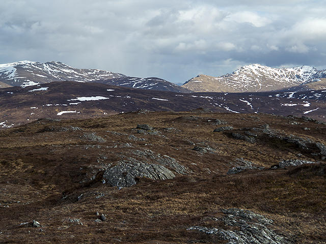 Photo could not load
NN5352 : Summit of Cross Craigs
William Starkey
Hill facts and local notes
Classifications
Elevation
747m
2,451 ft
Prominence
132m
Coordinates
56.6402, -4.3858
NN537523
OS Map
42 51
Explorer: 385E
At the Summit
The summit features a sizable cairn, offering an excellent vantage point for hikers to take in the stunning scenery.
Terrain & Geology
The geology of Cross Craigs predominantly features volcanic rock formations, including basalt and andesite. These ancient volcanic activities have contributed to the rugged landscape that defines the area.
Views & Scenery
From the summit, you can gaze over the expansive views of Lochwinnoch, as well as the rolling hills of Ayrshire in the distance.
History & Heritage
Name Origin
The name 'Cross Craigs' likely refers to the craggy outcrops that are characteristic of the area, with 'craig' being a Scots word for a rocky outcrop.
Historical Significance
The area is steeped in historical significance, with evidence of ancient settlements and a rich cultural heritage related to the indigenous wildlife and people.
Getting There & Facilities
Parking
There is a car park at the Clyde Muirshiel Visitor Centre, which is open all year round and is equipped with facilities.
Public Transport
Regular bus services run from Glasgow to the nearby town of Houston, followed by a short taxi ride to the park.
Nearby Facilities
The Clyde Muirshiel Visitor Centre offers toilets, picnic areas, and a café with a delightful selection of snacks.
Safety Information
Known Hazards
- The terrain can be slippery after rain, and visibility can diminish quickly in foggy or rainy conditions. Watch out for midge swarms in summer!
General Safety Tips
- Check weather conditions before setting out
- Carry appropriate clothing and equipment
- Let someone know your planned route
- Take a map, compass, and GPS device
- Carry emergency supplies: food, water, first aid kit, torch
Hills
Some common questions about the hills answered
Are there group walks up Cross Craigs?
Many walkers use Walkmates to join or organise walks with others. You can check for group walks around Cross Craigs through the maps
Are there other walkers around Cross Craigs?
Activity varies by location and time, but Walkmates lets you see whether others have shared walks or shown interest in this area. Find other people through the walking friends search walking friends for Cross Craigs search or of course create your own walk for Cross Craigs
Can I organise a walk to Cross Craigs?
Yes. If there aren’t any walks listed already, you can create a walk and make it available for others to join.
If you're signed up to Walkmates, you can create a walk to Cross Craigs.
How do I find a walk up this hill?
There are often multiple ways to walk this hill, depending on experience and route preference. Walkmates helps you explore walks and routes that others have shared.
Can I suggest a new route up Cross Craigs?
Yes. You can suggest or create routes to share with others. Walkmates focuses on the social side of walking, so routes are used to help people organise walks and explore areas together, rather than as detailed navigation tools or route libraries.
Other uses really appreciate knowledgeable walkers sharing their routes. Share your favourite route to Cross Craigs here
The is an error or something incorrect about this hill. How do I let you know?
We always strive to keep the information on Walkmates as accurate as possible. If you find an error, please let us know through the contact form and we'll aim to correct it as quickly as possible
Community Discussion
Comments
Location
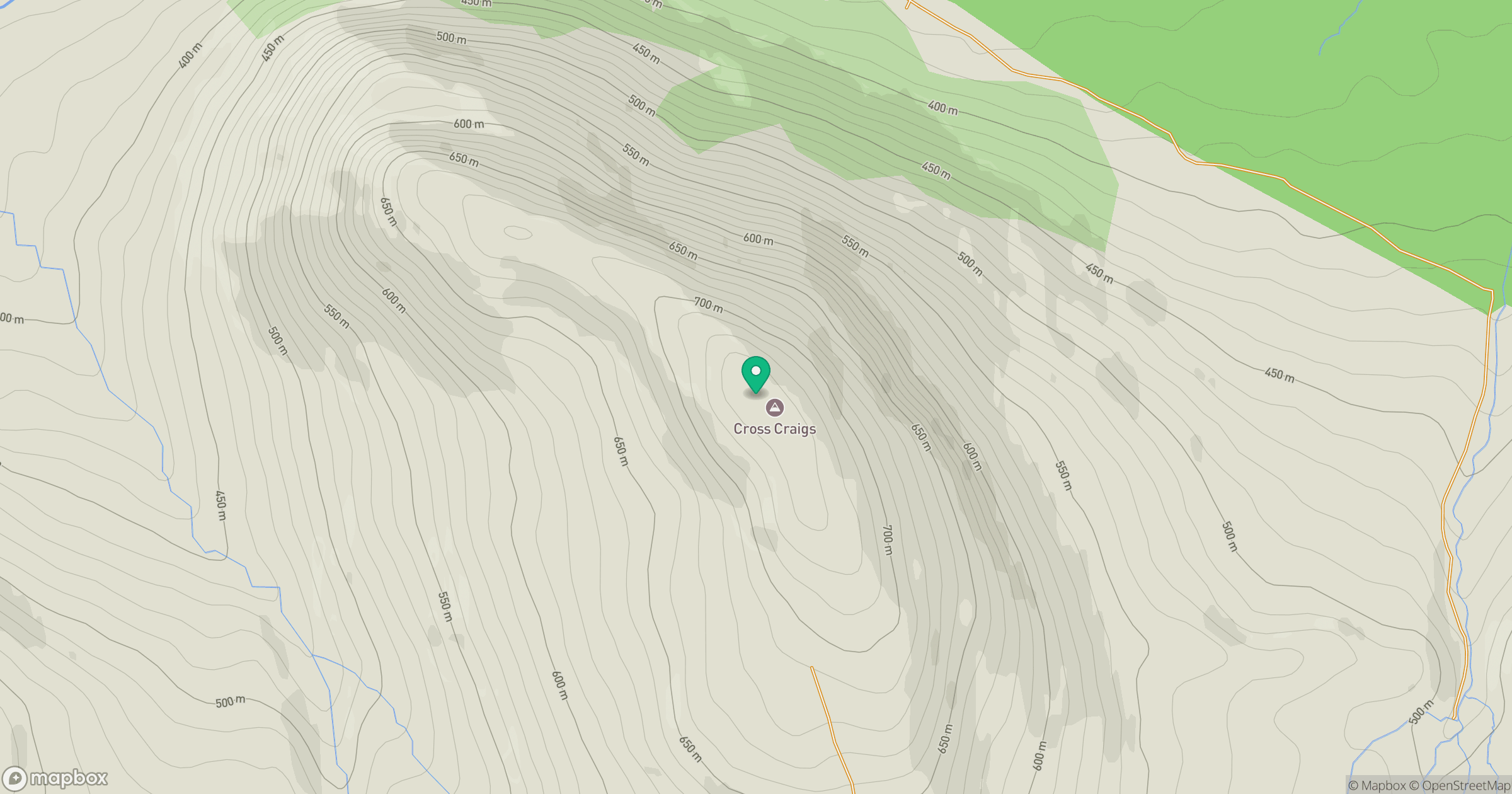
Grid reference: NN537523
View on OpenStreetMapOpens a map in a new tab, centred on the hill.
No comments yet. Be the first.