

Creag na h-Eanchainn
Good walks are even better shared.
Overview
Creag na h-Eanchainn: A Hiker's Delight
Nestled in the enchanting Scottish Highlands, Creag na h-Eanchainn stands proud at 683 meters, classified as a Corbett. With its rugged beauty and captivating vistas, it beckons outdoor enthusiasts and nature lovers alike.
Geology
Creag na h-Eanchainn is composed primarily of ancient gneiss, a rock that has withstood the test of time. This structure not only enhances the mountain's grandeur but also offers intriguing insights into the Earth’s geological past.
Routes
Two popular routes cater to varying skill levels:
- The Glen Tarbert Approach is a moderate trek, perfect for those seeking a picturesque walk without the fatigue of mountaineering. It offers a balance of ascent and comfortable terrain, making it a great introduction to the area.
- For those with a taste for adventure, the Kilchattan Approach delivers a challenging ascent that is well rewarded with spectacular views. Bring plenty of snacks; you’ll need the fuel!
Summit Features
Upon reaching the summit, hikers are greeted by a circular cairn that whispers tales of many past adventurers. The views from here? Simply breathtaking! But be aware—those winds can catch you off guard; it's not just the view that’ll take your breath away.
Terrain Type
Expect a mix of rocky paths interspersed with grassy stretches. Just remember, a bit of heather and some cheeky bogs will try to trip you up if you're not paying attention!
Views
The panorama from Creag na h-Eanchainn is nothing short of magical. To the north, the Jura Mountains stand watch over the Atlantic, while the Isles of Gigha and Arran provide a backdrop that postcard dreams are made of. The best seasons to enjoy these views are surely Spring and Autumn; those sunsets? Well, they deserve a standing ovation.
Hazards
As with any Highland adventure, be wary of the changing weather. The conditions can shift faster than a politician’s promises, so always be prepared! Also, keep an eye out for loose stones and muddy patches, particularly after the rain.
Access
Start your journey at the small car park by Glen Tarbert, but arrive early—good parking spots are as rare as hen’s teeth! While public transport options are sparse, a reliable bus service runs from Tarbert to surrounding villages, though it’s best to double-check schedules in advance.
Nearby Summits
Feel like extending your adventure? Nearby summits such as Beinn an Lochain (940 m) and Beinn Bhreac (698 m) are waiting to be explored.
Facilities
In the town of Tarbert, you’ll find cafes and toilets to replenish and refresh. Stock up on snacks; energy is essential!
History
The mountain's name, translating to 'Rock of the Horses', reflects the wonderful wildlife and stunning landscapes entrenched in local culture. Creag na h-Eanchainn not only offers fantastic hikes but a glimpse into the rich tapestry of Scottish history.
So lace up those boots, pack your rations, and head for Creag na h-Eanchainn: it’s sure to be a right old trek!
Explore routes near Creag na h-Eanchainn
Public walks starting within 80 km of this hill. Nearby does not mean a route reaches the summit; check its map and access before setting out.
Crinan Canal: Bellanoch and Dunardry towpath return
View route
Beinn Ime from Succoth
View route
The Cobbler from Succoth Carpark
View route
West Highland Way: Tyndrum to Bridge of Orchy
View route
Route planning notes
These notes describe possible approaches, not verified navigable routes or permission to cross land. Check current paths, local access rules and conditions before setting out.
Glen Tarbert Approach
This scenic route starts at Glen Tarbert, winding through lush landscapes before summiting Creag na h-Eanchainn. The initial ascent is gentle, but expect a steeper climb as you approach the summit.
Kilchattan Approach
Starting from Kilchattan, this route offers a more strenuous trek, suitable for seasoned hikers. The trail provides various viewpoints to catch your breath (and snack!) along the way.
Make a day of it, together
Find someone to share the walk with, or organise a day out along a route you like.
Photo Gallery
View all Photo could not load
NM9417 : Creag na h-eanchainn
Patrick Mackie
Hill facts and local notes
Classifications
Elevation
419m
1,375 ft
Prominence
105m
Coordinates
56.3072, -5.3233
NM945177
OS Map
55
Explorer: 360N
At the Summit
The summit boasts a modest cairn, complete with a stunning panoramic view, making it a popular spot for those Instagram-worthy shots. Watch out for the gusty winds; they can sneak up on you!
Terrain & Geology
Creag na h-Eanchainn is primarily composed of ancient gneiss, known for its resilience and durability. This type of rock, formed under extreme pressure and temperature, gives the mountain its rugged charm.
Views & Scenery
From the summit, you can gaze upon the majestic Jura Mountains, the shimmering waters of the Atlantic, and the picturesque Isle of Gigha. On a clear day, you might even spot the peaks of Arran in the distance.
History & Heritage
Name Origin
The name 'Creag na h-Eanchainn' translates to 'Rock of the Horses', evoking the strong sense of wildlife and natural beauty surrounding the area.
Historical Significance
This peak has long been a favourite among local hikers and is steeped in tales of the region’s heritage, making it a marker of Scottish culture.
Getting There & Facilities
Check current local access restrictions, parking rules and transport timetables before travelling. These notes do not confirm public access to the summit.
Parking
There is a small car park at the end of the road leading into Glen Tarbert. Parking can be limited, so arriving early is advisable.
Public Transport
Public transport options are limited; however, you may find bus services from Tarbert to nearby villages. Always check the latest schedules before heading out.
Nearby Facilities
While there are no facilities on the mountain itself, Tarbert offers cafes, eateries, and public toilets to prepare you for your adventure.
Safety Information
Known Hazards
- Watch for sudden weather changes, as the Highlands can be as unpredictable as a cat on a hot tin roof. Be mindful of loose rocks and boggy areas, especially after rain.
General Safety Tips
- Check weather conditions before setting out
- Carry appropriate clothing and equipment
- Let someone know your planned route
- Take a map, compass, and GPS device
- Carry emergency supplies: food, water, first aid kit, torch
Hills
Some common questions about the hills answered
Are there group walks up Creag na h-Eanchainn?
Many walkers use Walkmates to join or organise walks with others. You can check for group walks around Creag na h-Eanchainn through the maps
Are there other walkers around Creag na h-Eanchainn?
Activity varies by location and time, but Walkmates lets you see whether others have shared walks or shown interest in this area. Find other people through the walking friends search walking friends for Creag na h-Eanchainn search or of course create your own walk for Creag na h-Eanchainn
Can I organise a walk to Creag na h-Eanchainn?
Yes. If there aren’t any walks listed already, you can create a walk and make it available for others to join.
If you're signed up to Walkmates, you can create a walk to Creag na h-Eanchainn.
How do I find a walk up this hill?
There are often multiple ways to walk this hill, depending on experience and route preference. Walkmates helps you explore walks and routes that others have shared.
Can I suggest a new route up Creag na h-Eanchainn?
Yes. You can suggest or create routes to share with others. Walkmates focuses on the social side of walking, so routes are used to help people organise walks and explore areas together, rather than as detailed navigation tools or route libraries.
Other uses really appreciate knowledgeable walkers sharing their routes. Share your favourite route to Creag na h-Eanchainn here
The is an error or something incorrect about this hill. How do I let you know?
We always strive to keep the information on Walkmates as accurate as possible. If you find an error, please let us know through the contact form and we'll aim to correct it as quickly as possible
Community Discussion
Comments
Location
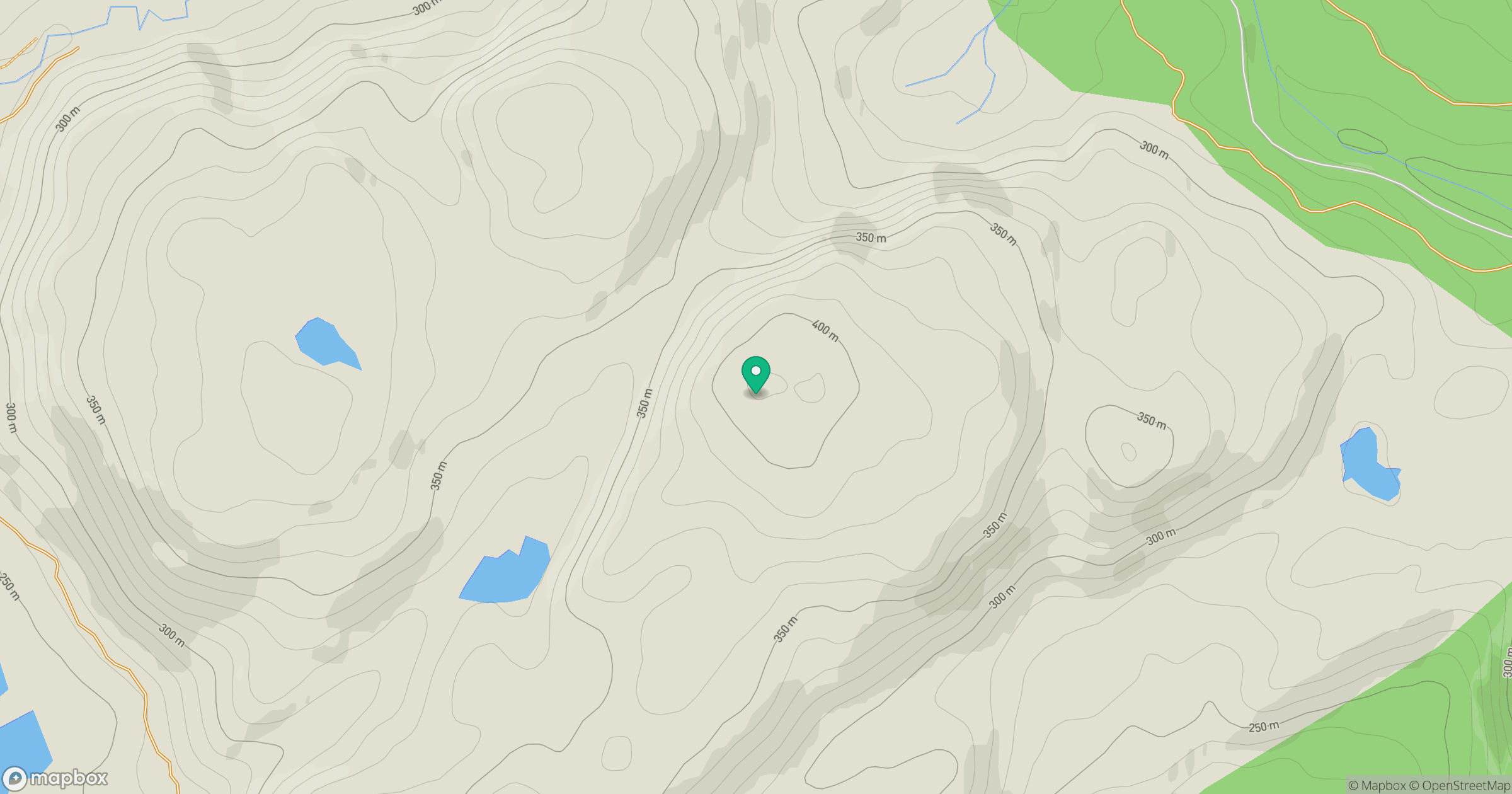
Grid reference: NM945177
View on OpenStreetMapOpens a map in a new tab, centred on the hill.
Hills within 30 km
Straight-line distance, not a walking route or confirmation of access.
Beinn Ghlas
420m
Ben Cruachan
1,127m
Beinn Chapull
515m
Tom an t-Saighdeir
303m
Cruach Narrachan
374m
No comments yet. Be the first.